
NexSat: NPOESS Preview - PowerPoint PPT Presentation
1 / 16
Title:
NexSat: NPOESS Preview
Description:
... near real time satellite value-added imagery products over the continental United States. ... of this data' -Dave Jones, CEO StormCenter Communications ... – PowerPoint PPT presentation
Number of Views:32
Avg rating:3.0/5.0
Title: NexSat: NPOESS Preview
1
NexSat NPOESS Preview
- Thomas F. Lee, Steven D. Miller, Jeffrey Hawkins,
F. Joseph Turk, Kim Richardson, Arunas
Kuciauskas, John Kent - Naval Research Laboratory
- Monterey, CA
- 25 October 2006
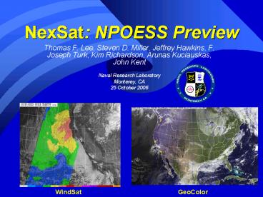
WindSat
GeoColor
2
Introducing NexSat
- NexSat is a public web site depicting near real
time satellite value-added imagery products over
the continental United States. Supported by IPO.
- NexSat demonstrates VIIRS using the current suite
of RD and operational sensors NASA-MODIS,
DMSP-OLS, and NOAA-AVHRR, supplemented by GOES. - Utilizes additional polar microwave data
WindSat, CloudSat, SSM/I, AMSU-B, etc. - Additional data from U.S. Navys numerical
weather prediction models (NOGAPS and COAMPS).
3
The Role of NexSat
- Current Scope
- Educational, but used by some operations
- Targeting the broadest audience (not just the
experts) - Simple and visually intuitive examples.
- Beyond NexSats Current Scope
- A formal operational resource (24/7 support)
4
The NexSat Interface
5
Low Cloud Detection at Night
Low Clouds
High Clouds
Nighttime Visible/Infrared YELLOW Low Blue
High
- Under adequate lunar illumination conditions, the
VIIRS DNB will provide quantitative information
on cloud reflectance, allowing for markedly
improved cloud characterization beyond IR-only
approaches.
Page 11 of 20
6
CONUS Dust Storms
While far less frequent than the Middle East, the
deserts of the southwestern U.S. produce an
occasional noteworthy dust storm. Above,
multispectral MODIS enhances a storm near Fallon
AFB.
7
WindSat overlayed on GOES
8
GeoColor
9
Multi-Layer Blends
10
Examples From NexSat Seasons
Summer
Fall
Late Fall
11
City Zooms
NexSat high spatial resolution (250 m pixels)
true color zooms over major U.S. cities provide
users with an NPOESS-quality snap shot of weather
conditions over their own backyard twice per
day.
12
NexSat Quick-Looks
- Calibrated
- Space/Time located
- NOGAPS temperature overlays
13
User Feedback
- This is great and thankyou (Mahalo)may I share
this with the Pacific Region Forecast offices?
Joel Cline, NWS Hawaii - This is cool stuff and I will share with the
rest of the EYW office Dennis Feltgen, NWS Key
West - This imagery is FANTASTICMy forecasters love
the imagery..this is Great Informationkeep it
coming! Tom Nizol, MIC, NWS Buffalo NY
(www.enh.noaa.gov/buf/lakeffect/lake0405/0128/modi
s.html) - I feel this is a critical effort and we should
partner and move out on showing the citizens of
the US the benefits of this data
-Dave Jones, CEO StormCenter Communications - Please keep us in tune with the current tech.
The stratus at SFO is a high visibility FAA
problem with the potential of saving millions
just by being able to forecast the clearing of
stratus and cancellation of a Ground Delay by 0.5
hrs Ken Venzke, MIC NWS San Francisco - California, Hawaii sector user requests filled
- and the list goes on
14
NPOESS VIIRS Trainingthrough the COMET Program
Next Generation Visible/Infrared Sensor
15
Online Training Modules
Online tutorials are designed to orient new users
with NexSat products using simple and
straight-forward illustrative examples, all the
while tying into the general theme of future
NPOESS/VIIRS capabilities.
16
NexSat
- http//www.nrlmry.navy.mil/NEXSAT.html
Recommended
CrystalGraphics Presentations


