
Human Impact and Adaptation in PERU PowerPoint PPT Presentation
1 / 69
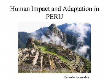
Title: Human Impact and Adaptation in PERU
1
Human Impact and Adaptation in PERU
- Ricardo Gonzalez
2
Human Impact and Adaptation in PERU
- The Natural Setting Affecting Human Adaptation
- The First Peruvians (12,000 BP 4,500 BP)
- Human Adaptation through Pre-Contact Times (4,500
BP to the Incas -1532 AD) - Spanish Conquest Colony (1532-1821)
- The Republic (1821 - Today)
- Case Studies
- -Amazon Destruction
- -Lima
- Today and the Future
3
PERU 0º - 18.5 º S 69 º - 83 º W
4
The Natural Setting Affecting Human Adaptation
- Geology Plate tectonics (Andes, Peru-Chile
Trench) - Climate A combination of latitude (Equator),
- Andes and coastal current
- Peruvian Current (Humboldt) and the Upwelling
Effect - El Niño Southern Oscillation (ENSO) and La Niña
- Ecological Regions Coast, Sierra Amazon
5
Geology Plate Tectonics (Andes, Peru-Chile
Trench)
6
Geomorphology Plate tectonics (Andes, Peru-Chile
Trench)
The World 200 Million Years Ago (Pangea
Panthalassa)
Subduction of the Nazca Plate into the South
American Plate creating the Andes
7
The Peru-Chile Trench
Deepest Point? 24,000 feet in Atacama, Chile
8
Examples of Present Tectonic Activity
The Andes grow 1 every 2.5 years
Active Volcanism Sabancaya Volcano
Frequent devastating earthquakes
9
Historical Geology
Coastal Cordillera (650 M.Y) Eastern
Cordillera (400 M.Y) Western Cordillera (65
M.Y) Central Cordillera (40 to 25
M.Y) Amazon Coastal Plains (1.65 M.Y
Present) Todays Growth? 1 2.5 years.
10
Historical Geology (II)
Coastal Cordillera (650 M.Y) Eastern
Cordillera (400 M.Y) Western Cordillera (65
M.Y) Central Cordillera (40 to 25
M.Y) Amazon Coastal Plains (1.65 M.Y
Present) Todays Growth? 1 2.5 years.
11
Peruvian Climate Tropical Subtropical
A combination of latitude (Equator), Andes and
coastal current
12
Seasonality
Located in the Southern Hemisphere, Perus Summer
runs from December through March Winter from
June through September
13
Climates of Peru
Coastal? Very Dry Temp. 12.5 º - 29 ºC Rain 0
100 mm Summer Dry Season (Dec.
Apr.) Winter Wet Season (Drizzles)
Andes? Variable Temp. -3 º - 21 ºC Rain 10
800 mm Summer Rainy Season (Nov. Apr.) Winter
Dry Season (Jun. Sept.)
Amazon? Variable Temp. 15 º - 41 ºC Rain 300
15000 mm Summer Rainy Season (Nov.
Apr.) Winter Dry Season (Jun. Sept.)
14
Wind Patterns
Predominant easterly winds. Climate is heavily
influenced by the presence of a high (H) pressure
area at 30 ºS.
15
The Peruvian Current
The Peruvian Current was formerly known as
Humboldt Current
16
El Niño Southern Oscillation (ENSO) and La Niña
Normal Conditions/ La Niña
La Niña is characterized by colder conditions in
the region
El Niño Southern Oscillation
17
Effects of El Niño
Normal Year? Cancas (North Coast) January 1991
Moderate El Niño? Cancas, January 1992
18
Effects of El Niño Floods
Avalanche Flood in Cusco March 1998
Sechura Desert, March 1998
19
Effects of El Niño Loss of Infrastructure
Pan American Highway El Niño 1997-98
Colan, North Coast El Niño 1997-98
20
Ecological Regions Coast, Sierra Amazon
21
Perus 8 Ecological Regions
Chala? 0 600 m Yunga? 600 2100 m Quechua?
2100- 3400 m Suni? 3400 4200 m Puna? 4200
5000 m Cordillera? 5000 6867
m Rupa-Rupa/Rainforest? 600 3200
m Omagua/Amazon Plain? 62 600 m
22
Perus 8 Ecological Regions
23
The Coast/Chala (0 600 m)
24
Yunga (600 2100 m)
25
Quechua (2100 3400 m)
26
Suni (3400 4200 m)
27
Puna (4200 5000 m)
28
Cordillera (5000 6768 m)
29
Rupa-Rupa (600 3200 m)
30
Omagua -Amazon Plain (62 600 m)
31
The First Peruvians
- a) Important Myths Legends
- b) Theories of Human Presence
- c) The First Peruvians
- d) The Pleistocene Overkill
- e) Primitive Habitat
32
Myths/Legends of Human Occupation
- I. Inca Myths of Creation
- II. Coastal Myths (Naylamp
- Tacaynamo)
- III. The Voyage of Tupac Inca
- Yupanqui to Oceania.
33
I. Inca Myth of Creation
- A couple, Manco Capac (1st Inca) Mama
- Ocllo, sent by their father, the Sun (Wiracocha),
- to teach the primitive people.
- They came out of the waters of
- Lake Titicaca to found the Inca
- empire based in Cusco.
- Manco Capac taught the men how
- to cultivate the land (potatoes
- corn), the art of war.
- Mama Ocllo showed the women
- to weave, the use of some plants for food
- medicinal purposes.
34
II. Coastal Myths Naylamp Tacaynamo
- Two heroes from ancient times who came on rafts
from the north. - They brought new agricultural
- technologies large armies.
- They established a new order
- in the world (kingdoms of
- Moche -3 to 7C- Chimu 12 to 15C)
35
III. The Voyage of Tupac Inca Yupanqui to Oceania
- A prince, son of Inca Pachacutec later to become
Inca-, - went on a trip to the West that lasted 2 years.
- When he came back he brought
- new plants, products some
- dark skin people from the East.
- It may proof that there was a long-
- distance connection with Oceania.
36
Theories of Human Presence in America (C. 1970s)
Asian
Immigration
Melanesian/Pacific
Indigenous
Australian
37
The First Peruvians
- Pacaicasa (22,000 BP)? Cave located in the
South-Central Andes. No human remains (skeleton )
found, only tools. Later found that radio-carbon
date was mistaken. - Paijan (11,200 BP)? Oldest Peruvian found at
present. Located on an oasis of the north coast.
Gatherer including sea products- hunter. - Lauricocha (10,500 BP)?
- Oldest human remains found
- in the high Andes. Hunter
- gatherer.
Man of Paijan
38
The Pleistocene Overkill
Pleistocene extinction reached South America
between 13,000 8,000 BP
39
The Pleistocene Overkill
Model of Pattern of Colonization of America
(11,500 10,500 BP)
40
The Pleistocene Overkill
80 of the South American Mega fauna extinct by
early hunters (47 of 59 species)
41
Primitive Habitat
Hunting Scene at Toquepala Cave (8,000 BC)
42
Human Adaptation After the Pleistocene Overkill
- After the overkill, the hunters gatherers
shifted to less - efficiently hunted animals more intensive use
of plant foods. - Hunted animals mainly camelids (llama, alpaca,
guanaco) deer. - Plants used as food (mainly tubers rhizomes)
clothing - (fibers).
- Foundation of the Andean
- agricultural pastoral
- system.
- Successful adaptation
- without destroying the natural
- world.
Guitarrero Cave (9,430 BP)
43
Human Adaptation After the Pleistocene Overkill
Spearheads from Guitarrero (9,430 BP)
Wild camelids (llamas alpacas) grazing in the
high Andes (4,000 m.)
44
Hunters Weaponry
45
Human Adaptation in the Coastal Area After the
Pleistocene Overkill
- Importance of the ocean resources for the
- subsistence of large populations.
- Moseleys theory (1975)? Andean
- culture developed prospered in its
- origins thanks to the extraordinary
- richness of ocean resources not due to
- agriculture.
- Gatherers hunters/fishermen started
- subsisting on mollusks, algae, fishing
- from shore in coastal lagoons.
- Agriculture was developed 5,000 years
- after arrival to the coast (approx. 5,000 BP)
Otumas scallop banks (4,000 BP)
46
Human Adaptation in the Coastal Area After the
Pleistocene Overkill
Early fishhooks made of bones
Remains of a coastal hut
Tools found in the hut
47
Coastal Adaptation in Early Times
Canastones, a site of early occupation in the
central Peruvian coast. The area thrives with
coastal resources scallops, mussels, fish, sea
lions.
Sea lions was easy prey and a favorite food for
coastal people
48
Human Adaptation through Pre-Contact Times
a) Gathering Hunting? Forests Lomas
wildlife. b) Fishing? Coastal, Ocean
Lagoons/Wetlands. c) Agriculture? Major land
transformation coastal oasis, Andean
terracing (andenes) lagoon agriculture.
49
Chronology of Pre-Contact Peru
- Pikimichay Cave (17,650 BP)
- Pre-Ceramic (until 1,800 BC)
- Horizon Empires
- -Chavin (900 - 200 BC)
- -Wari (800 1,100 AD)
- -Inca (1,400 1532 AD)
- Intermediate Regional Kingdoms
- -Paracas (200 BC 200 AD)
- -Moche (100 650 AD)
- -Nasca (100 650 AD)
- -Tiahuanaco (600 1,000 AD)
- -Chimu (1,000 1,400 AD)
50
The Inca Empire 1532
Conquests of the last Incas
The Inca Road System
51
Caral (5,000 BP) The First City of the New World?
Constructing cities on non-agricultural lands is
one of the most important characteristics of
Pre-Contact America
52
Growth of Administrative Hierarchies
Moche (100 650 AD) base representing the world
the underworld
53
a) Gathering Hunting? Forests Lomas Wildlife.
- In the periphery of the valleys there were
extensive forests with important hunting
resources. - These areas were maintained maybe excluded for
royal hunts. - Extensive fauna deer, bear, American lion,
turkey, dove, lizards, etc. - Wood was used for construction cooking but at
low rates. - Algarrobo (kiawe) seeds used to feed domestic
animals for human food medicinal purposes.
Moche deer hunting
Lizard a food delicacy- eating kiawe seeds
Chaku gathering of vicunas for trimming
54
b) Fishing? Coastal, Ocean Lagoons/Wetlands.
- Seafood was gathered only from the near coast in
early times. - At the beginning use of hooks only (mussel,
cactus spine, bones) later use of cotton to make
fishing nets (1,000 BC). - Development of fishing vessels allowed fishermen
to go beyond the near coast even long distance
travel.
55
b) Fishing? Coastal, Ocean Lagoons/Wetlands.
- Hunting in near islands for sea birds sea
lions to collect - guano (bird dropping -fertilizer).
56
b) Fishing? Coastal, Ocean Lagoons/Wetlands
Use of coastal lagoons wetlands to raise
mullets cultivate Totora (Scirpus sp.) reed for
boat building.
57
Chancay 1,300 AD
Caral 2002 AD
58
c) Agriculture Mayor Land Transformation in
Pre-Contact Times
The Hummingbird figure (180 ft long) was drew
among many others- by the Nascas (100 650
AD) to predict the agricultural seasons.
59
Coastal Agriculture I
The earliest agriculture was developed next to
the river deltas on the coastal plains, were
water was abundant easily accessible.
60
Coastal Agriculture II
In areas with shallow underground water, holes
were excavated to clear the sand from the
surface reach more fertile land.
61
Coastal Agriculture III
In coastal areas were moisture concentrated
during the winter (Lomas), temporal agriculture
in terraces was established.
62
Andean Agriculture I
Terraces constructed in irregular terrain for
better control of soil erosion.
63
Terraces in the Colca Valley Peruvian Southern
Andes.
64
Inca stone terraces at Macchu Picchu. They were
being used when it was discovered in the 1910s
65
Andean Agriculture II Raised Fields
66
Andean Agriculture II Raised Fields
67
Raised Fields
Raised fields during the Dry Season in Puno
Experimental Raised Field at Lakaya (1988)
68
Moray An Inca Agricultural Experimental Station
Moray, 300 ft deep and at 3,800 m, was used to
adapt food crops to different altitudes.
69
Andean Ranching
Camelids (llamas alpacas) ranching continues to
be a vary important activity. Their
environmental impact is very small.
Recommended
