
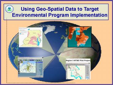
Using GeoSpatial Data to Target Environmental Program Implementation - PowerPoint PPT Presentation
1 / 20
Title:
Using GeoSpatial Data to Target Environmental Program Implementation
Description:
Use science-based analytical tools with best available data to assess, ... Non-wetland Hydric Soils - Presence or Absence of Buffers - Biological Information ... – PowerPoint PPT presentation
Number of Views:96
Avg rating:3.0/5.0
Title: Using GeoSpatial Data to Target Environmental Program Implementation
1
Using Geo-Spatial Data to Target Environmental
Program Implementation
2
- Goal Increasing Program Efficiency and
Measurable Environmental Results - Focus on measurable programmatic outcomes and
strategic implementation - Use science-based analytical tools with best
available data to assess, prioritize and target
areas for implementation - Focus on being proactive
- - Looking forward
- - Budget issues prevention is cheaper than
restoration
3
- Key Questions Where and What?
- Where and what are the greatest environmental
and public health risks? - Where and what are the most sensitive
populations? - Where are the areas with the highest ecological
value? - Where are the most vulnerable or threatened
areas? - What do we do once we get there?
- What programs or partners should be involved?
- What changes can we affect given the scope and
scale of the issues, programs and money
available, etc.
4
- Joint State/Regional Indicators and Outcomes
Initiative - Technical Objectives
- Develop indicators and measurable environmental
outcomes for tracking progress and guiding
program implementation - Develop geo-spatial assessment and targeting
methods and tools for use within and across
programs - Use best available data at multiple scales
(regional, state and local)
5
Outcomes Workgroup Pilots
Chesapeake Bay Water Quality
Ozone and PM2.5
Wetlands
Childrens Blood Lead
Watershed Management
Elizabeth RiverSediment
6
Example Pilot Wetland Restoration
Focusing Wetland Restoration to Improve Impaired
Streams
7
Overall Goal
Strategically restore wetlands to enable
the greatest improvements to wetland
resources, stream quality, and watershed health.
8
Examples of Expected Outcomes
- Reverse historic wetland loss with assistance
from NPS Program
- Remove Impaired Streams from 303(d) List
- Reduce Nutrient Loads via Wetlands Restoration
as a Water Quality BMP
- Other Habitat, Flood Control, Carbon
Sequestration, etc.
9
Restoration Targeting Factors
- Watershed-based Factors
- - Wetland Loss
- - Nutrient and Sediment Loads
- - Unbuffered Streams
- - Ag Runoff Potential
- - Land Cover Metrics
- Local Factors
- - Streams Impaired by Nutrients
- and Sediments
- - Non-wetland Hydric Soils
- - Presence or Absence of Buffers
- - Biological Information
10
Methods Agriculture Runoff
Data Estimated nitrogen and phosphorus loads
from Ag lands using ATtILA Source Mid-Atlantic
Integrated Assessment Ranking High runoff
(kg/ha/yr) gt 400 3 Moderate runoff 320
400 2 Low runoff lt 320 1
11
Initial Phase Targeting Results
Final Ranking High Restoration 11 14
Medium Restoration 8 10 Low Restoration
5 7
12
Example Focus Area Monacacy Watershed
13
Potential Wetland Restoration Site
14
Program-Specific Spatial Tools Elizabeth River
Targeting Tool
15
Program-Specific Spatial Tools MTBE Pilot
Project
Http//www.esri.com/events/uc/results/app_fair.htm
l
16
- Regional Application Spatial Tools
- Emergency Response Mapping Application (ERMA)
- User-friendly interface, built on ArcView
- Allows users to drill down from large geographic
areas to small areas - Pulls data from a large
- variety of sources to show
- a variety of areas or points
- (drinking water
- intakes, sensitive areas
- and populations
- hospitals, nursing care
- facilities, road
- intersections, etc.)
17
Other Regional Spatial Assessment Projects
- Watershed Strategy
- Comparative Risk and
- Future Vulnerability
- Assessment
18
Existing Geo-Spatial Data Infrastructure (AS IS
Processes)
Software - ESRI ArcGIS, ArcView
- Data Sources
- Region 3 spatial data library (sdl)
- Other Agencies states, CDC, HUD, Census
- Initiatives
- Index of Watershed Indicators
- Mid-Atlantic Integrated Assessment
- -State Reports (Indicators, Risk, Condition)
- -State of the Environment - type Reports
19
Future Geo-Spatial Data Infrastructure
Software be able to use web browser and web
services
- Data Sources
- Use up-to-date data streamed over internet thru
ArcGIS from partners
- Already Underway
- NEPA Assist
- Enviromapper
- DC Maps uses web services for graphical display
- Testing of National Hydrography dataset via a
web service
20
Future Geo-Spatial Data Infrastructure
- Benefits
- Better access to current data
- Access to more high quality data from more
sources - Avoid duplication of data management efforts
- Improved efficiency and synergy agencies can
focus on what they do best and determine who to
work with
Recommended
CrystalGraphics Presentations


