
Workshop Agenda PowerPoint PPT Presentation
Title: Workshop Agenda
1
Workshop Agenda
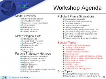
Model Overview Model history and features Computational method Trajectories versus concentration Code installation Model operation Example calculations Updating HYSPLIT Meteorological Data Data requirements Forecast data FTP access Analysis data FTP access Display grid domain Vertical profile Contour data Examples 1-5 Particle Trajectory Methods Trajectory computational method Trajectory example calculation trajectory model configuration Trajectory error Multiple trajectories Terrain height Meteorological analysis along a trajectory Vertical motion options Pollutant Plume Simulations Modeling particles or puffs Concentration prediction equations Turbulence equations Dispersion model configuration Defining multiple sources Simulations using an emissions matrix / file Concentration and particle display options Converting concentration data to text files Time of arrival graphic Example local scale dispersion calculation Special Topics Automated trajectory calculations Trajectory cluster analysis Concentration ensembles Chemistry conversion modules Pollutant deposition Source attribution using back trajectory analysis Source attribution using source-receptor matrices Source attribution functions GIS shapefile output KML/KMZ output Customizing map labels Scripting for automated operations Extra Topics Modeling PM10 emissions from dust storms Restarting the model from a particle dump file
2
Automated Trajectory Calculations
- Daily HYSPLIT trajectories can be calculated
between two dates within a given month with
Trajectory / Special Runs / Daily. - The Daily program can be repeated to obtain
trajectories for a season or longer. Trajectories
can then be further analyzed through the use of
trajectory cluster analysis (described in the
next section). - Example Compute 48-hour backward trajectories
daily beginning at 12 UTC on 01 January 1996 from
40N, 80W _at_ 500 m agl using the NGM archive data. - If trajectory cluster analysis will be done
later, it is recommended that you make an output
directory, and specify the Output path/file to
hold all the files such as C/hysplit4/working/end
pts/jan96/tdump - For a complete set of trajectories for the month
of January, NGM archive files ngm.dec95.002,
ngm.jan96.001, and ngm.jan96.002 must be
specified. - The first day's trajectory must be run manually
(upper right), explicitly setting the start
date/time, since this sets the model input
values. It is good practice to confirm the
trajectory looks correct (lower right) before
running many trajectories.
3
Automated Trajectory Calculations
- Below is how the Trajectory / Special Runs /
Daily form should be filled-out for this example.
- To compute the automated trajectories, the year,
month, and date must be set in the menu (below). - Setting the Delta-Hour to 12 will repeat this
trajectory every day beginning at 1200 UTC. Any
combination of hours can be specified (i.e., 00
06 12 18). - Click the Execute Script button. When the
calculation is finished, click Continue. - Each trajectory is treated as a separate
simulation and has its own associated trajectory
endpoints file (tdumpYYMMDDHH) in the output
directory.
4
Trajectory Cluster Analysis
- Trajectory Cluster Analysis is a process of
grouping similar trajectories together whereby
differences among individual trajectories in a
cluster are minimized and differences among
clusters are maximized. - Ideally, each cluster represents different
classes of synoptic regimes over the duration of
the trajectories. - Cluster analysis can be useful for matching air
quality measurements with pollutant source
regions. - The set of January 1996 trajectories created by
running Daily in the last section will be used to
illustrate this technique. - The cluster analysis routine requires that the
trajectory endpoints files to be used in the
calculation be located in the \hysplit4\cluster\en
dpts directory. - First, manually move or copy the 31 daily
trajectory endpoints files from \hysplit4\working
to \hysplit4\cluster\endpts. The files from Daily
were named tdump96010112 (tdumpYYMMDDHH) for the
01 January trajectory to tdump96013112 for 31
January trajectory.
5
Trajectory Cluster Analysis
- Select Trajectory / Special Runs / Clustering /
Standard. - Start by setting the parameters as in Step 1
Inputs (below). - The Run_ID (Jan96) is a label that will be used
on all plots. - With long trajectories and a large set of
trajectories, you may want to skip endpoints and
trajectories, respectively, to save computational
time. Clustering more than several years of daily
trajectories will take a while and may even
exceed the memory limits of your PC. - Note that ALL files with tdump in their name in
the endpoints folder (\hysplit4\cluster\endpts)
will be clustered, so make sure you remove old
ones before starting a new cluster simulation.
6
Trajectory Cluster Analysis
- In Step 2, click on Make INFILE and Run cluster
sequentially. - Make INFILE creates a text file (INFILE) in the
\cluster\working directory which lists the
trajectory endpoints files to be used in the
analysis. - Run cluster starts with N trajectories (clusters)
and keeps pairing similar clusters until all the
trajectories are in one cluster. - To determine the final number of clusters, you
need to decide when different clusters are
paired, and save the list of trajectories in each
cluster just before that happens. - A text listing (CLUSEND), produced by the Run
button, suggests the possibilities and Display
plot depicts them.
7
Trajectory Cluster Analysis
- In Step 3, enter the final Number of Clusters
(5), and click Text. This creates a file
CLUSLIST_N (N is the number of clusters), which
is the text file that lists the dates of the
trajectories that are in each cluster. One
possible application for using this file is that
if daily air quality measurements are available,
they can be assigned to the appropriate cluster. - Plots (next slide) showing the cluster-means (top
left) and trajectories in each cluster (1, 2, 3,
4, and 5) may be created using the optional
buttons. In the Trajectory Cluster Display
window, check "view" for the postscript window to
automatically open, and for the Vertical
Coordinate select "none" since the trajectory
vertical coordinate is not used. - Other final Number of Clusters may be specified
to observe the changes. - The Archive button moves all files to the
\hysplit4\cluster\archive folder.
8
Trajectory Cluster Analysis
9
Concentration Ensembles
- Instead of creating a single deterministic air
concentration simulation, several programs are
included with HYSPLIT that can be used to combine
multiple HYSPLIT simulations into a single
graphic that represents some variation of a
concentration probability. The simplest approach
is to run the model multiple times varying one
parameter. - In the next example, we will run the model with
several, albeit few, meteorological data sets,
thereby varying the meteorology. We will then
run the ensemble program and look at various
probabilities of exceeding concentration
thresholds in the results.
10
Concentration Ensembles
- Model configuration
- First, in the Advanced / Configuration Setup /
Concentration, click on Reset and then Save to
clear any old setups. - Concentration Source 28.5N, 80.7W _at_ 10 m
- Total run time 6 hrs
- Emission 1 unit/hr for 6 hrs beginning 1200 UTC
17 February 2009 - Output 6 hr average concentration between the
ground and 100 m - Concentration grid size 0.01 x 0.01 degrees
- Concentration grid span 20.0 x 20.0 degrees
- Run with each of the following meteorological
datasets and name the cdump files in the
Definition of Concentration Grid 1 menu as shown
below. The ensemble program requires the files
be named sequentially. - Be sure to Run using SETUP file
Meteorology cdump name
NAM 12 km SE tile cdump.001
NAM 12 km cdump.002
NAM 40 km cdump.003
RUC cdump.004
GFS cdump.005
11
Concentration Ensembles
NAM 12km
NAM 40 km
NAM 12km SE tile
RUC
GFS
12
Concentration Ensembles
- Now, before running the ensemble display program
the base name of the concentration files that
were just created (cdump.001 to cdump.005) MUST
be reset to the default in the Definition of
Concentration Grid 1 menu. Change the last one
selected, in this case cdump.005 to cdump (this
is automatically taken care of by the GUI if
running a one meteorological dataset internal
ensemble as will be shown later). - Save the setup, but do not rerun the model. This
creates a new CONTROL file with the proper base
name cdump to be created by the ensemble program.
- Now, select View Map from the Concentration /
Display / Ensemble menu (below).
13
Concentration Ensembles
- The Aggregation is set to 1 by default, meaning
that only the ensemble members from one time
period are aggregated together to produce the
probability display. If there is more than 1
time period, multiple probability plots will be
created. This number can be changed to the number
of output times to produce one output plot for
runs that have multiple concentration output
times. - The Ensemble Probability Display menu will call
conprob, which reads the concentration files with
the ensemble member 3-digit suffix (001 to 027)
and generate various probability files in the
\working directory.
14
Concentration Ensembles
- Output Selection Options
- 1 - Number of ensemble members at each grid point
with concentrations gt 0. - 2 - The Mean of all ensemble members.
- 3 Variance (mean square difference between
members and the mean). - 4 The Probability of Concentration produces
contours that give the probability of exceeding a
fixed concentration value at one of 3 levels 1
of maximum, 10 of maximum, maximum, or user
entered. The concentration level is displayed in
the pollutant identification label like C14,
where 14 is the concentration to the power of 10
(ie., 10-14) - 5 The Concentration at Percentile shows
contours of areas where concentrations will be
exceeded only at the given probability level (in
the GUI these are 50, 90 and 95). - Click the Help button for more details on each of
these settings.
15
Concentration Ensembles
- For this example, we will display the
concentrations at the 95th percentile level. - As can be seen in the display map, the plume
looks most similar to the NAM members, which is
expected since they contributed 3 members and
each was very similar. - This output can be useful to ascertain the
uncertainty due to differences in the
meteorological data used by the model.
16
Concentration Ensembles
- Another ensemble output option is to plot the
resulting concentrations at a specific location
as a box plot or series of box plots for multiple
time periods using the Concentration / Display /
Ensemble / Box Plot menu. - Shown at right is the box plot for the location
28.4N, 80.8W for this case.
17
Concentration Ensembles
- Another approach to concentration ensembles is to
generate an internal ensemble from a single
meteorological data set. This computation is part
of HYSPLIT and can be selected from the
Concentration / Special Runs / Ensemble /
Meteorology menu tab. - In these simulations the meteorological data are
perturbed to test the sensitivity of the
simulation to the flow field. - The meteorological grid is offset in either X, Y,
or Z for each member of the ensemble. The
calculation offset for each member of the
ensemble is determined by the grid factor and can
be adjusted in the Advanced / Configuration Setup
/ Concentration menu. The default offset is one
meteorological grid point in the horizontal and
0.01 sigma units in the vertical. The result is
twenty-seven ensemble members for all offsets. - Because the ensemble calculation offsets the
starting point, it is suggested that for
ground-level sources, the starting point height
should be at least 0.01 sigma (about 250 m) above
the ground.
18
Concentration Ensembles
- The 27-member ensemble using just the NAM 40 km
meteorology is shown at lower right (this may
take several minutes to display). - The output graphics are created in the same way
as the last example (i.e., Concentration /
Display / Ensemble / View Map ). Caution this
can take some time to generate depending on the
computing platform. - Beginning with version 4.9, two new ensembles are
available one based on the turbulence and one on
the physics methods. More details can be found
in the help section under the Special Runs menu.
19
Chemistry Conversion Modules
- Normally pollutants are treated independently
one pollutant per particle. However, multiple
pollutants per particle can be defined by
enabling the In-line chemical conversion modules
through the Advanced / Configuration Setup /
Concentration menu. - To demonstrate this capability first run the base
simulation (right) for one pollutant, configured
similarly to the previous example (see
underlined for changes) - - First, in the Advanced / Configuration Setup /
Concentration, click on Reset and then Save to
clear any old setups. - - Source 28.5N, 80.7W _at_ 100 m
- - Total run time 6 hrs
- - Meteorology NAMF40
- - Emission 1 unit/hr for 6 hrs beginning 1200
UTC 17 February 2009 - - Output 6 hr average concentration between the
ground and 100 m - - Conc. grid size 0.01 x 0.01 degrees
- - Conc. grid span 20.0 x 20.0 degrees
20
Chemistry Conversion Modules
- Next configure the model for two pollutants,
through the Pollutant, Deposition and Grids setup
menu (Num2, right). - Give each pollutant a unique name and configure
the 2nd pollutant for no emissions (below,
right). - Running the model with this configuration will
give the about the same result as before since no
new emissions are being released.
21
Chemistry Conversion Modules
- Enable the 10/hour chemical conversion module
through the Advanced / Configuration Setup /
Concentration / In-line chemical CONVERSION
MODULES (10) menu (right). - Rerunning the model will now produce
concentrations for the second pollutant as the
first pollutant is converted to the second at 10
per hour. - Multiple pollutants can be selected individually
from the Concentration Display menu (lower
right). The All option sums pollutants onto one
map.
22
Chemistry Conversion Modules
- Using the default 10/hr conversion produces the
graphic (right) for the 2nd pollutant. The
conversion rate can be modified by creating a
chemrate.txt file to define the species index
and, for this example, a 50 conversion rate. - If the file is placed in the model startup
directory, the conversion module will use these
values and produce the results below for the two
pollutants. (The contour intervals were fixed to
be the same in each plot.)
23
Pollutant Deposition
- The deposition (D) from a particle is expressed
as a fraction of the mass (m) computed from the
sum of different time constants (ß), - Dwetdry m (1 - exp?t (ßdry ßgas ßinc
ßbel ) ) - When the dry deposition is entered directly as a
velocity (Vd), then ßdry Vd ?Zp-1.
- The radio-buttons along the top of the Pollutant
Deposition menu can be used to set default
deposition parameters, which can then be edited
as required in the text entry section. - The second line of radio-buttons define the
deposition values for some preconfigured species
Cesium (C137), Iodine (I131), and Tritium (HTO). - The reset button sets all deposition parameters
back to zero. - Note that turning on deposition will result in
the removal of mass and a corresponding reduction
in air concentration. The deposition will not be
available in any output unless height "0" is
defined as one of the concentration grid output
levels.
24
Pollutant Deposition
- Dry Deposition
- Dry deposition calculations are performed in the
lowest model layer (75m) based upon the relation
that the deposition flux equals the velocity
times the ground-level air concentration. This
calculation is available for gases and particles.
When dry deposition is entered directly as a
velocity (Vd), then ßdry Vd ?Zp-1.
- Example
- - First, click Reset and Save in the Advanced /
Configuration Setup / Concentration menu to clear
any old setups. - - Source 28.5N, 80.7W _at_ 10 m
- - Total run time 12 hrs
- - Meteorology NAM 40 km
- - Emission 1 unit/hr for 1 hr beginning 1200
UTC 17 February 2009 - - Output 12 hr deposition (level 0) 100 m
conc. - - 5000 3D particles
- - Conc. grid size 0.05 x 0.05 degrees
- - Conc. grid span 20.0 x 20.0 degrees
- - Turn on dry deposition in the Deposition menu
from the Pollutant, Deposition Grids Setup menu
(right). This automatically sets Vd to 0.006 m/s
for a gas.
25
Pollutant Deposition
- The results (upper right) show the dry deposition
pattern left by the particles as they moved
across central Florida. - The dry deposition of particles due to
gravitational settling (Vg) can also be computed
from the particle diameter and density Vg
dp2 g(?g - ?) (18 µ)-1 - Enter a density of 5 g/cc and a diameter of 6 µm,
which should result in a settling velocity close
to the previous Vd of 0.006 m/s and rerun the
model. - The result (lower right) from this configuration
confirms that the plots are almost identical .
26
Pollutant Deposition
- The normal deposition mode is for particles to
loose mass to deposition when those particles are
within the deposition layer. An additional option
was added to deposit the entire particle's mass
at the surface, that is the particle itself, when
subjected to deposition. To insure the same mass
removal rates between the two methods, a
probability of deposition is computed, so that
only a fraction of the particles within the
deposition layer are deposited in any one time
step. The probability of deposition is a function
of the deposition velocity, time step, and depth
of the layer. One limitation of this method is
that only one mass species may be assigned to a
particle. To enable this feature, check the
Deposit particles rather than reducing the mass
of each particle option in the Advanced /
Configuration Setup / Concentration / In-line
chemical CONVERSION MODULES menu. The model must
be configured for 3D particles to use this
option. If a sufficient number of particles are
released the results will be similar to the other
deposition options. In this case, more than
15,000 particles are needed to produce a similar
deposition pattern (bottom right).
27
Pollutant Deposition
- Finally, the dry deposition velocity can also be
calculated by the model using the resistance
method, which requires setting the four
parameters molecular weight, surface reactivity
ratio, diffusivity ratio, and the effective
Henry's constant. (See the table in the Help for
suggested numbers for some common pollutants.) - Radioactive decay can be specified by entering a
value in days for the decay rate. A non-zero
value in this field initiates the decay process
of both airborne and deposited pollutants. - A non-zero value for the re-suspension factor
causes deposited pollutants to be re-emitted
based upon soil conditions, wind velocity, and
particle type. Pollutant re-suspension requires
the definition of a deposition grid, as the
pollutant is re-emitted from previously deposited
material. Under most circumstances, the
deposition should be accumulated on the grid for
the entire duration of the simulation. Note that
the air concentration and deposition grids may be
defined at different temporal and spatial scales.
28
Pollutant Deposition
- Wet Deposition
- Henry's constant defines the wet removal process
for soluble gases. It is defined only as a
first-order process by a non-zero value in the
field. - Wet removal of particles is defined by non-zero
values for the In-cloud and Below-cloud
scavenging parameters. - In-cloud removal is defined as a ratio of the
pollutant in air (g/liter of air in the cloud
layer) to that in rain (g/liter) measured at the
ground. - Below-cloud removal is defined through a removal
time constant (s-1). - See the table in the Help for suggested numbers
for some common pollutants.
29
Source Attribution using Back Trajectory Analysis
- Frequently it is necessary to attribute a
pollutant measurement to a specific source
location. One approach is to compute a backward
trajectory to determine the airs origin. - Although it is not uncommon to see sources
identified by a single trajectory, the
uncertainties inherent in a single-trajectory can
preempt its utility. One way to reduce those
uncertainties would be to compute multiple
trajectories, in height, time, and space.
Case Study High ozone event in Atlanta, Georgia
on August 15, 2007. Daily Maximum 1-hour ozone
values of 139 ppb.
30
Source Attribution using Back Trajectory Analysis
- First, Reset HYSPLIT from the main menu. Then run
72-hr backward trajectories from Atlanta, GA
(33.65N, 84.42W) at 10, 500, 1000, 1500, and 2000
m-agl beginning (arriving) at 1200 UTC the
morning of August 15, 2007 to see where the air
was coming from prior to the high ozone event. - Use the edas.aug07.001 extract file.
31
Source Attribution using Back Trajectory Analysis
- The resulting map (right) using a zoom of 95 and
a vertical coordinate of Meters AGL, shows that
all the trajectories eventually moved through the
Ohio River valley, a large source of precursor
emissions from coal-fired power plants. - The lower 2 trajectories (10 and 500 meters)
travelled further east than the upper-level
trajectories.
32
Source Attribution using Back Trajectory Analysis
- Quickly changing meteorological conditions can
also contribute to uncertainty, especially if a
pollutant sample represents an average rather
than a snapshot concentration. - Next, set the starting height to only 500 m-agl
and from the Advanced / Configuration Setup /
Trajectory / Multiple trajectories in time (3)
menu set the restart interval to 6 hours. - Run Model using SETUP file
- Now you can see that during the 3 days prior to
this event, the air originated over the same
source regions, contributing to a build-up of
pollutants.
33
Source Attribution using Back Trajectory Analysis
- The third variation in trajectory source
attribution is to examine the spatial
sensitivity. - In this simulation, we could run a trajectory
ensemble, however instead, set four additional
starting points (right) offset by 1 degree from
Atlanta (Delete file then Run without the SETUP). - The results (lower right) show that there is very
little spatial sensitivity around the Atlanta
area, with all five trajectories passing through
the Ohio River Valley.
34
Source Attribution using Source-Receptor Matrices
- The term matrix has two connotations with
respect to HYSPLIT. In the earlier application, a
matrix of sources was created, the results of
which were summed to a single concentration
grid. In this application, defining a
concentration grid for each source creates a
matrix of sources and receptors. - For this simulation, we are interested in knowing
what fraction of the 6-hourly average air
concentration at Atlanta was contributed by a
grid of source locations within the Ohio Valley
region, assuming that there are no other
contributions from other sources. - First we will lay out a grid of source locations
over the Ohio Valley between 35N, 90W and 45N,
75W at 1 degree intervals. - Then we will release 500 3D particles from each
source location over the 72 hour simulation at 50
m-agl and determine the contribution to Atlanta
from these sources.
35
Source Attribution using Source-Receptor Matrices
- Model Setup
- Choose three concentration run starting locations
to define the source region and grid interval of
1 degree (35N,90W 45N,75W and 36N, 89W) all at
50 m-agl in the Concentration Setup menu. - Total run time 72 hrs beginning at 1200 UTC on
12 August using the edas.aug07.001 extract.
36
Source Attribution using Source-Receptor Matrices
- Model Setup continued
- Set the emission rate to 1 unit/hr for 72 hours.
- Set the Grid Center lat/lon to 38N,85W.
- Reduce the resolution of the concentration grid
to 0.75 in lat and lon to reduce the memory
requirements and run time. - Set the Grid Span to (30.0 40.0) degrees lat /lon
- Set the output level to 100 m.
- Set the averaging period to 6 hours.
37
Source Attribution using Source-Receptor Matrices
- Model Setup continued
- In the Advanced / Configuration Setup /
Concentration menu, first click Reset and then
set the model to run with 500 3D-particles . - Set the maximum number of particles to at least
100,000 since there will be many particles
released. - Prior to executing the model, it is necessary to
check the Restructure the concentration grid to
the source-receptor format button in the In-line
chemical CONVERSION MODULES (10) menu. This
causes the concentration grid to be reconfigured
so that every source location within the matrix
(176 in this example) will have its own
concentration grid. - Run the model through the Concentration / Special
Runs / Matrix menu using the SETUP file. This run
will take a few minutes to complete.
38
Source Attribution using Source-Receptor Matrices
- Results
- Running Matrix will result in a special
concentration output file that may be called a
source-receptor matrix, such that each column may
be considered a receptor location and each row a
pollutant source location. The display program
under this menu tab permits the contouring of any
row or column. - To display the source-receptor matrix results,
choose Concentration / Display / Source-Receptor
/ View.
39
Source Attribution using Source-Receptor Matrices
- Results
- When a location is selected in the menu (right),
a special program is called to extract that
location from the concentration output file and
then write a standard concentration file for that
location so that the concentration display
program can plot the results. - The source-receptor matrix extraction file name
will consist of SRM_original file name. - Selection of the source extraction method means
that the location entered is considered to be the
source location and the resulting output contour
map is just a conventional air concentration
simulation showing concentrations from that
source. - The receptor extraction method means that the
location entered is considered to be the receptor
location and the output is a map of how much air
concentration each source contributes to the
selected receptor. - Note that turning on the normalization flag
divides all concentrations by the sum of all
concentrations at each grid point, resulting in a
map that represents a fractional contribution.
40
Source Attribution using Source-Receptor Matrices
- Results
- Choosing a Receptor at Atlanta (33.65N, 84.42W)
and plotting the normalized concentrations for
the last two 6-hr time periods (1200 and 1800 UTC
15 August 2007 below left and right,
respectively) indicates that, from the sources
we defined, those with the highest contribution
(gt10) were from southern Ohio, eastern Kentucky,
southwestern West Virginia and western Virginia.
41
Source Attribution Functions
- Running the air concentration prediction model
backwards is comparable to a back trajectory
calculation but it includes the dispersion
component of the calculation. - The result, although it looks like an air
concentration field, is more comparable to a
source attribution function. - If the atmospheric turbulence were stationary and
homogeneous then this attribution function would
yield the same result from receptor-to-source as
a forward calculation from source-to-receptor.
42
Source Attribution Functions
- Model Setup
- Enter the receptor location (33.65N, 84.42W) at
10 m-agl in the Concentration Setup menu. - Set the total run time to 72 hrs Back beginning
at 1800 UTC on 15 August using the edas.aug07.001
extract. - Set the emission to 1 unit/hr over 1 hour and
produce 6-hr average concentrations between the
ground and 100 m-agl. - Set the concentration grid resolution to 0.5 deg.
and a span of 30 deg.
43
Source Attribution Functions
- Model Setup Results
- In the Advanced / Configuration Setup /
Concentration, Reset and Save before running the
standard Model using SETUP file. This will cause
the model to run with the default 3D particle
method. - Display the results with the normal concentration
display program (80 zoom). - The last 6-hr average output map (right) can be
interpreted to mean that the emissions in the
yellow and blue regions between 1800 UTC on
12 August and 0000 UTC on 13 August were most
likely to have contributed to the measurements on
the 15th at 10 m AGL at Atlanta, Georgia.
44
GIS Shapefile Output
- Graphical output from most GUI programs can be
converted into an ESRI GIS shapefile format for
use in GIS programs such as ArcExplorer, ArcGIS
Explorer, and Google Earth. - To convert the graphic generated in the last
example, check the Frames and ESRI Generate boxes
in the Concentration Display menu (below). - This will result in a unique Postscript file and
2 text files for each time period (ignore the
concplot.ps not found message and click
Continue). - The Generate format text output file in the
\working directory (GIS_00100_ps_HH.txt, where HH
is the sequence number) contains the latitude and
longitude pairs that make up each contour.
45
GIS Shapefile Output
- From Concentration / Utilities, use the GIS to
Shapefile menu (below) to select text files,
which are named by level and time sequence. - Select the last file (GIS_00100_ps_12.txt) and
rename the output file to reflect the same number
(Con_sh12). - Make sure the Conversion method is set to
polygons, since we are outputting concentration
contours. - If you would like Enhanced attributes from the
.att files to be added to the dbf file, select
the appropriate button. - When finished there will be a series of Con_sh12
files with the suffix shp, shx, and dbf in
the working directory.
46
GIS Shapefile Output
- Open ArcExplorer and click on the "" button to
add the Con_sh12.shp theme. - Also add the country map background theme
(CNTRY94.SHP) from the C\ProgramFiles\ESRI\ArcExp
lorer2.0\AETutor\ directory and then select both
themes. (The example includes the States
shapefile also.) - To change the color of the fill and other
attributes, double click on the theme name. In
this case we made the map background transparent.
To have each contour level a different color,
choose Unique Symbols from the Classification
Options menu and then choose "id" from the Field
pull down menu then change the colors as
appropriate.
47
kml/kmz Output
- Graphical output from the trajectory and
concentrtion GUI programs can be exported into a
compressed .kml file (.kmz) for use in Google
Earth or ESRIs ArcGIS Explorer. - You must have the Info-Zip file compression
software installed to compress the kml file and
its associated graphics. Info-Zip (zip.exe) is
included as part of the HYSPLIT distribution and
can be found in the \exec directory. - Trajectory Example
- Before starting, click Reset from the main
HYSPLIT menu to remove old setups. - Source 3 trajectories 10, 1000, and 3000 m AGL
from 28.5N, 80.7W. - Total run time 24 hrs Forward
- Meteorology NAM 12 km SE Tile
- Starting time beginning of dataset (00 00 00 00)
48
kml/kmz Output
- To create the kmz file, check the Google Earth
box in the Trajectory Display menu and make sure
the Vertical Coordinate is set to Meters-agl
(otherwise the labeling will be incorrect in
Google Earth). This will result in the normal
Postscript file and a file called
HYSPLITtraj.kmz. - Locate the kmz file in the working directory and,
assuming Google Earth (or ArcGIS) has been
downloaded and installed, double click on the
Google Earth file. - Google Earth will open automatically (ArcGIS may
require you to open the file from the program)
and zoom in to the source location. Users can
turn on/off the trajectories, endpoints, terrain,
and other features within Google Earth. - Clicking once on any of the trajectory endpoints,
when displayed, will cause an information box to
appear giving the height and lat/lon location of
the endpoint. - Double clicking on an endpoint or any other
feature will cause the program to zoom to that
location. - Expanding the menu along the left side of the
display (right) will reveal the different layers
associated with the trajectory display.
49
kml/kmz Output
- The jpg image below was created by doing a File /
Save Image within Google Earth.
50
kmz/kml Output
- Concentration Example
- Source 28.5N, 80.7W at 10 meters
- Emission 1 unit/hr over 6 hours beginning at
data initial time (00 00 00 00) - Total run time 6 hrs
- Meteorology NAM 12 km SE Tile
- Concentration Grid 0.01 deg.
- Concentration Span 20.0 deg.
- Output 3-hour average concentration between the
ground and 500 m-agl - In the Advanced / Configuration Setup /
Concentration menu, first click Reset and then
set the model to run with 8000 3D particles. - Run the Model using SETUP file.
- This will create two 3-hr average surface to 500
m-agl output maps from the same Florida location
(turn off Frames if still checked from the last
example).
51
kmz/kml Output
- Concentration Example
- To create the Google Earth formatted file check
the Google Earth box in the Concentration Display
menu. - This will result in the normal Postscript file
and a file called HYSPLITconc.kmz. - Opening the Google Earth file results in 2 plumes
to display (0-3h and 3-6h averages). Animate the
image by using the VCR buttons at the top of the
display - The image below shows the 3-6h average between
the ground and 500m AGL. - Using the controls in Google Earth allows the
user to rotate, pan, and zoom the plume.
52
kmz/kml Output
- Finally, as an example to show the 3-dimensional
terrain (NOTE the Google Earth terrain is
different from the meteorological model terrain
so that the model contours and trajectories may
be below or above the shown terrain), a
trajectory and a concentration run was produced
from a location in the Grand Canyon. - The concentration CONTROL and SETUP.CFG files can
be used to reproduce the concentration Google
Earth file, and the trajectory CONTROL and
SETUP.CFG files can be used to reproduce the
trajectory Google Earth file.
53
Customizing Map Labels
- The Concentration Display menu only contains one
option that can be used to customize map labels
a concentration Label entry. This changes the
text on the second line of the graphic for the
mass units of concentration. This usually used in
conjunction with the Concentration Multiplier if,
for instance, emission units were grams but
display units of micro-grams were desired. - However, additional label information can be
changed if the Concentration Display program
finds a file called LABELS.CFG in the working
directory, as shown in the graphic below taken
from a previous example.
54
Customizing Map Labels
- Supplemental text information can be added at the
bottom of each plot by entering information on
the Extra Labeling menu (lower left) called from
the Advanced / Configuration Setup menu tab. This
creates a file called MAPTEXT.CFG which is read
by both the trajectory and concentration plotting
programs and plotted at the bottom of the graphic
(lower right).
55
Scripting for Automated Operations
- The \guicode and \examples\scripts directories
contains example scripts that can be used to
automate computations (Auto_traj.tcl,
Auto_ftp.tcl, etc). - Familiarity with the command line options is
essential in modifying and writing new scripts in
a text editor. Script syntax is very similar to
the C language. - All scripts work in the same manner by writing a
new CONTROL file for each simulation, running the
model, and then renaming the output. - In this EXAMPLE SCRIPT, trajectories are computed
at four locations and each is run separately for
24 hours using the NAM 40 km meteorological data.
- Place this script in the /working directory and
double click on it to run it. Close the window
when it appears and the trajectory Postscript
files should be in the /working directory.
Recommended
