
Gis Data Types Processing And Application PowerPoint PPT Presentations
All Time
Recommended

Title: The Virtual Domain Application Data Center (VDADC): Access to Data in Multiple Formats and Data Visualization Author: HEATHER WEIR Last modified by
| PowerPoint PPT presentation | free to view

Chapter 1: Introduction to Spatial Databases 1.1 Overview 1.2 Application domains 1.3 Compare a SDBMS with a GIS 1.4 Categories of Users 1.5 An example of an SDBMS ...
| PowerPoint PPT presentation | free to download

Chapter 1: Introduction to Spatial Databases 1.1 Overview 1.2 Application domains 1.3 Compare a SDBMS with a GIS 1.4 Categories of Users 1.5 An example of an SDBMS ...
| PowerPoint PPT presentation | free to download

1.6 A Stroll though a spatial database ... Exercise: List two ways you have used spatial data. ... rules to identify identifiable objects and properties of space ...
| PowerPoint PPT presentation | free to download

Using GIS in Watershed Management GIS Applications Douglas M. Schleifer, Director The GIS Center at Upper Raritan doug@urwa.org Process Define the issues Generate ...
| PowerPoint PPT presentation | free to view

Spatial data analysis tasks and techniques. Applying region growing approaches to segmentation of area data ... Tessellation of space. For example using grids ...
| PowerPoint PPT presentation | free to view

Ship's speed through the water. 17) smg. ' Speed made good' over the ground. ... Cruise Survey. Time duration effort data (Fall 1999) ...
| PowerPoint PPT presentation | free to download

Looking forward, the geographic information system (GIS) market value is projected to reach a strong growth during the forecast period (2021-2026). More info:- https://www.imarcgroup.com/geographic-information-system-market
| PowerPoint PPT presentation | free to download

... Ocean ... Indices, fish landings for California, tagged animals ... inputted, a list and a map of the data that are available will be returned. In ...
| PowerPoint PPT presentation | free to view

data model = limited representation of reality. a discretization or partitioning of space ... Data Model. Representation of information about a form or a process ...
| PowerPoint PPT presentation | free to download

Urban Planning Applications of GIS GIS can be applied to many types of problem. Among these are representatives of both raster and vector data base structures, both ...
| PowerPoint PPT presentation | free to download

Data Storage and Processing GIS Topics and Applications ...
| PowerPoint PPT presentation | free to download

GIS Data Models GEOG 370 Christine Erlien, Instructor
| PowerPoint PPT presentation | free to view
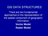
GIS DATA STRUCTURES There are two fundamental approaches to the representation of the spatial component of geographic information: Vector Model
| PowerPoint PPT presentation | free to download

Through the analysis of data collected by a device that is not in direct contact with the thing, region, or phenomenon being studied, remote sensing is the process of learning more about an object, phenomenon, or location
| PowerPoint PPT presentation | free to download

GIS Applications in
| PowerPoint PPT presentation | free to view

Applications of GIS to Water Resources Engineering
| PowerPoint PPT presentation | free to view
PRE-PROCESSING IN IMAGE ANALYSIS OF SATELLITE DATA
| PowerPoint PPT presentation | free to download

Characteristics of GIS Data. Map scale, spatial detail, and extent. Coordinate systems ... Meridians of longitude. 0 Greenwich England. 0-180 Western ...
| PowerPoint PPT presentation | free to view

Applications of the GIS in
| PowerPoint PPT presentation | free to view
Acquisition and Applications of LIDAR for GIS
| PowerPoint PPT presentation | free to download
Data capture and data storage . . -
| PowerPoint PPT presentation | free to download

From the 2-D Map to 1-D Computer Files. 2 * Dr. Stuart Murchison, UTDallas GISC ... 'raster is faster but vector is corrector' Joseph Berry. Raster data model ...
| PowerPoint PPT presentation | free to view

Sensors, Data, Analyses and Applications
| PowerPoint PPT presentation | free to view

GIS and Spatial Data Management Explained Corey Tucker Tamarack Geographic Technologies Data Standards Is everyone working together? Who ultimately decides what ...
| PowerPoint PPT presentation | free to view

Government applications, such as voting districts. Planning applications, such as parcel mapping ... identification numbers, zip codes and telephone numbers. ...
| PowerPoint PPT presentation | free to view
Applications of GIS in National e-Governance Plan Presented by: Shankar Aggarwal, Joint Secretary, DIT * * * Creation of physical infrastructure in remote and ...
| PowerPoint PPT presentation | free to download

... enterprise consists of all the people, processes and systems within an organization ... School Finder Website. Point-In-Polygon. Service. Increases System Agility ...
| PowerPoint PPT presentation | free to download

Start your GIS analysis by figuring out what information you need. ... on a map is kept very clean, very simple, and uncluttered with graphic symbology ...
| PowerPoint PPT presentation | free to view

Having defined how the geography can be modeled within a GIS, we now need to ... FID = Primary Key = Index. Relational DBMS (2) Most popular type of DBMS ...
| PowerPoint PPT presentation | free to view

Each student independently designs and conducts a GIS-based project ... Normally approached by. advancing hypotheses derived from the literature of existing research, ...
| PowerPoint PPT presentation | free to download

Data-Driven Digital Library Applications -- The UC Berkeley Environmental Digital Library University of California, Berkeley School of Information Management and Systems
| PowerPoint PPT presentation | free to download
Feeding the GIS. Discussion here focuses more on projects than organization-wide implementation. Like a teenager, a GIS can consume more than data you ever imagined!
| PowerPoint PPT presentation | free to download

Continuous fields in GIS only spatially discretized (TIN, raster) ... Types of raster maps. Nominal data like land use (forest, grassland, farmland, ...
| PowerPoint PPT presentation | free to view

... questions, as, for example, using models to evaluate health risk and the ... in this selection process it may become easier to develop a preliminary coverage ...
| PowerPoint PPT presentation | free to view

GIS Demonstration Sources: Alsahhar, Belew, Getachew, McElroy - GIS in Public Health University of Dallas, Oct 2005 Boulos, Kamel MN ...
| PowerPoint PPT presentation | free to view

GIS TECHNOLOGY SDI THE INTELLIGENT GEOSPATIAL DATA MANAGEMENT
| PowerPoint PPT presentation | free to view

Sure!Maps Raster: seamless, projection of choice ... Data acquired for roughly half of state. Directory of county map servers very popular ...
| PowerPoint PPT presentation | free to view

Fisheries and Aquaculture Statistics with emphasis on GIS tools for Data collection the African Wate
| PowerPoint PPT presentation | free to download

Title: GIS for EMS and Fire Author: William E. Ott Last modified by: William E. Ott Created Date: 9/11/2000 4:25:34 PM Category: NCEMS Document presentation format
| PowerPoint PPT presentation | free to view

The GEON LiDAR Workflow: CyberinfrastructureBased Data Distribution and Processing
| PowerPoint PPT presentation | free to view

Geographical Information Systems (GIS) for Public Safety Applications NC EMToday 2000 Pressley Lorbacher William E. Ott Scott Roberts Mike Smith Joseph Zalkin
| PowerPoint PPT presentation | free to view

Introduction to attribute data handling in a GIS environment. Outline. Definitions ... Table (attribute) join concept has been extended to geographic case. SQL ...
| PowerPoint PPT presentation | free to view

... a single application for example Police CAD system which has a map data and address data that must be very accurate for dispatching police In almost all of our ...
| PowerPoint PPT presentation | free to view

... GIS data collection and update,' Photogrammetric Week '99. Fritsch and R. ... from scanned thematic maps ,' Photogrammetric Engineering and Remote Sensing. ...
| PowerPoint PPT presentation | free to view

Data Mining, Data Warehousing and Knowledge Discovery ... which contain j as a sequence Sequence data: transaction logs, DNA sequences, patient ailment history, ...
| PowerPoint PPT presentation | free to view

... (interfaces) are used for different types of data (objects) inheritance ... Object is typically an opaque scalar, which can be used to invoke the methods ...
| PowerPoint PPT presentation | free to view

GIS Modeling Week 2 Maps as Data GEOG 3110 University of Denver Presented by Joseph K. Berry W. M. Keck Scholar, Department of Geography, University of Denver
| PowerPoint PPT presentation | free to download

... communication among designers, developers, and users ... in a completely rigorous and unambiguous fashion on which both user and GIS analyst agree ...
| PowerPoint PPT presentation | free to download

This presentation will probably involve audience discussion, which will ... GIS in Public Safety is a 'No Brainer' Computer Aided Dispatch. Crash Data Analysis ...
| PowerPoint PPT presentation | free to view

Challenges and Solutions for Digital Geospatial Data Preservation Jeff Essic Geospatial Data Service
| PowerPoint PPT presentation | free to download

Global GIS software market is projecting a rise in estimated value to an estimated value of USD 13.95 billion by 2026, registering a healthy CAGR of 10.1% in the forecast period of 2019-2026 due to Rising investment in GIS solutions, Projects related to development of smart cities and Adoption of GIS solutions in various sectors
| PowerPoint PPT presentation | free to download

The Application of Remote Sensing and Geographic Information Systems (GIS) to Prehistoric Site Location Predictive Models Exploitation of remote sensing and GIS for ...
| PowerPoint PPT presentation | free to view

Water Quality in the Lake Tahoe Basin: Applications of GIS. Christian Raumann ... Basin: City of South Lake Tahoe. Many agencies (TRPA, USFS), private ...
| PowerPoint PPT presentation | free to view

... definitions which is represented completely rigorous and unambiguous fashion. ... Trade Magazines: GIS World; Books with vendor information: ESRI Inc. ...
| PowerPoint PPT presentation | free to view

Note: Percentages based on the actual number of respondents to ... Also, archiving data does not guarantee ' ... to PREMIS, MODS? Metadata wrapper ...
| PowerPoint PPT presentation | free to download