
GIS in Weather and Society - PowerPoint PPT Presentation
1 / 26
Title:
GIS in Weather and Society
Description:
GIS Radar images and warning polygons are displayed, time looped and can be downloaded to a GIS ... GIS and Climate Data Online (CDO) Rich Baldwin, NCDC ... – PowerPoint PPT presentation
Number of Views:71
Avg rating:3.0/5.0
Title: GIS in Weather and Society
1
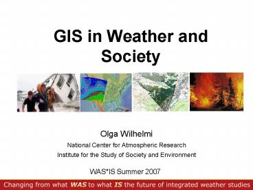
GIS in Weather and Society
- Olga Wilhelmi
- National Center for Atmospheric Research
- Institute for the Study of Society and
Environment
WASIS Summer 2007
2
Geographic Information Systems
- A science and a technology that includes elements
of computer visualization, database management
and spatial analysis of geographically referenced
data. - A GIS stores information as a collection of
thematic layers that can be linked together by
geography. - In many disciplines and sectors GIS is used for
data integration, analysis and decision making
(common tool for many stakeholders, i.e., local
and state governments).
3
Georeferenced Data
- Coordinates (X, Y) or geographic identifier
(place name) that can be linked to GIS data - Vast collection of geographically referenced data
already exists in digital format - Google for your keyword GIS data download
- Remotely sensed data important source of
georeferenced data - Paper maps can be scanned
- Data acquisition is usually the most time
consuming task - Data quality
- Appropriate use of data (completeness, scale,
content, etc.)
4
What can a GIS do?
- Geographic information links a place (and often a
time), with some property of that place - The temperature at 40 N, 105 W at noon local
time on 07/16/07 was 25 Celsius.
- GIS can store a vast number of these properties
- The GIS term is attributes.
- Attributes are nonspatial information about a
geographic feature in a GIS, usually stored in a
table and linked to the feature by a unique
identifier. - They can be physical, social, economic,
demographic, environmental, etc.
5
GIS Applications
- Visualization of information
- Spatial analysis
- Location (Where is it...)
- Condition (What is it...)
- Trend (What has changed...)
- Pattern (What is the pattern...)
- Routing (Which is the best way ...)
- Modeling (What if...)
- Integration of information (interdisciplinary
research quantitative and qualitative) - Data distribution
6
Traditional use of GIS
7
Source of data EM-DAT The OFDA/CRED
International Disaster Database.
http//www.em-dat.net, UCL - Brussels, Belgium
8
GIS Analysis and Integration
Tropical Storm Allison
Research studies on and emergency management of
hurricane-induced flooding involve integrating
data from atmospheric sciences, oceanography,
hydrology, geology, geography, and social
sciences.
9
Weather and Society Data in a GIS
10
Weather and Climate Data Model
- Working dialog between ESRI and weather and
climate community - Four workshops in 2004-2007
- The goal is seamless integration of atmospheric
and oceanographic data - Observations
- Products
- Infrastructure
Participants NCAR, Unidata/UCAR, NWS. NOAA NCDC,
University of Oklahoma, Pacific Marine
Environment Lab, National Marine Fisheries
Service, NASA Jet Propulsion Laboratory, ESRI,
George Mason University
http//www.gis.ucar.edu/sig
11
Weather and Climate Data Model Data classified
by usability in GIS
- GIS Friendly
- some effort to make GIS-Ready
- GIS Ready
- fully described, point and click -----------?
- GIS Alien
- cannot be fully described -----?
Summary by Scott Shipley, GMU in
http//www.esri.com/library/newsletters/atmospheri
cfront/atmospheric-front-fall06.pdf
12
NetCDF Tools in ArcGIS 9.2
- Toolbox Multidimension Tools
- Make NetCDF Raster Layer
- Make NetCDF Feature Layer
- Make NetCDF Table View
- Raster to NetCDF
- Feature to NetCDF
- Table to NetCDF
- Select by Dimension
13
Weather Models in a GIS
- Mesoscale weather predictions
- Impacts of extreme weather events
- Verification of model outputs
- Decision support and management
- Integration of weather forecast with
socio-economic data
Total precipitation NAM CONUS 40km conduit
2007-02-05
14
NWS GIS Radar Webpages
- GIS Radar images and warning polygons are
displayed, time looped and can be downloaded to a
GIS - 1 Minute Polygon Warning updates
http//radar.weather.gov
Keith Stellman, NWS
15
Watches Warnings
Ken Waters, NWS
Atmospheric Front
http//www.weather.gov/regsci/gis/
16
- GIS and Climate Data Online (CDO)
Simple access to NCDC data archives while
integrating new and informative products
US Drought Indices
Rich Baldwin, NCDC
http//gis.ncdc.noaa.gov, http//www.ncdc.noaa.gov
http//cdo.ncdc.noaa.gov
17
Climate Change in a GIS
- NCAR GIS Initiative distributes CCSM IPCC
projections (monthly averages) in a GIS format
http//www.gisclimatechange.org
18
Users of NCAR GIS Portal
Biomass potential
Salmon conservation
Resource management
Climate change education
Vegetation ecology
Water resources
Agriculture
Vulnerability of population and ecosystems
Human health
Energy
2000 registered users from 108 countries
30K CCSM files downloaded
Types of users Research Education Government
GIS Environmental Military and defense
Industry Regional planning and economic
development Native American Tribes, Other
19
Weather and Society Data in a GIS
20
Social Sciences and GIS
- Spatial turn in social sciences, a new interest
in location, and a new "spatial social science"
that crosses the traditional boundaries between
disciplines. - Social processes can be examined in their
geographic settings. - Resources
- Center for Spatially Integrated Social Sciences
(http//www.csiss.org/) - "Geographic Information Systems for the Social
Sciences Investigating Space and Place" by S.
Steinberg and S. Steinberg, 2006 - Goodchild (2004) http//www.esri.com/news/arcnews
/spring04articles/social-sciences.html
21
GIS-based Risk Assessments Spatial Integration
and analysis
Population 1,5 M Population density 11,233/mi2
Wilhelmi, Uejio, Samenow (2007)
22
Qualitative Data in a GIS Conceptual Integration
- Content-specific snap shots in time.
- Visualization of information
- Geographical referencing (XY, place name,
geographic identifier) allows for mapping data
together to reach a common interpretation - Methodological differences (concepts and study
objects) may create challenges
Perceptions of climate change From S. McNeeley
23
In Summary
- GIS is a useful tool to study and solve problems
when location matters. - GIS provides tools and methods for integrative,
interdisciplinary research and decision-making. - Ongoing research in Atmo-GIS and spatial social
sciences offer many new potentials. - Research challenges provide great topics for
students!
24
Contact
- E-mail olgaw_at_ucar.edu
- GIS Initiative webpage http//www.gis.ucar.edu
25
ArcGIS Exercise
- Exploring societal risk to flash flooding
- Flash flood in Fort Collins, Colorado
- 5 people died
- US 250 M in damage
- Extreme precipitation event
26
Group Projects
- Group discussion
- Vulnerability mapping (what characteristics did
you select for vulnerability mapping and why?) - Presentation of the results
- Does your map convey what you are trying to
present? - Discuss and critic selection of scale, legend,
color schemes, other map elements - Discuss the role of GIS in your work. If not used
already, imagine the potential use of GIS in your
weather and society applications. Discuss
challenges and opportunities.
Recommended
CrystalGraphics Presentations


