
Topography PowerPoint PPT Presentations
All Time
Recommended

Dynamic topography, phase boundary topography and latentheat release
| PowerPoint PPT presentation | free to view

Discrepancy Between Scheimpflug and Placido-Based Topographies and Correlation with Astigmatism After Scheimpflug Topography-Guided LASIK Mohamed Abou Shousha, MD,1,2 ...
| PowerPoint PPT presentation | free to download

Topography Key Vocabulary Vocabulary Quiz Friday 1-17; Write words and definitions only ISN page 57; use webpage to complete as homework
| PowerPoint PPT presentation | free to download
Topography Understanding How to Use Topographic Maps to Map Watersheds. Can topography affect watershed contaminations? Get the Gist Name the most important who ...
| PowerPoint PPT presentation | free to download

... or region especially in a way to show their relative positions and elevations ... an unique perspective revealing the intimate boundaries of public and private ...
| PowerPoint PPT presentation | free to download

Zero elevation' Topography- creating a map based on elevation points that ... Contour Line- A line created by connecting points of equal of elevation on a map. ...
| PowerPoint PPT presentation | free to view

Ocean Topography Main Features Topography Is the study of Earth's surface shape and features. Ocean topography is the study of the ocean floor and the features of it.
| PowerPoint PPT presentation | free to download

Ocean Topography What is Ocean Topography? The shapes, patterns and physical configuration of the ocean surface. Side-scan sonar is used to create an image of large ...
| PowerPoint PPT presentation | free to view

Faults & Topography What s a Fault? A fault is a break in the rock that makes up the Earth s crust. The surfaces on either side of the break move past each other ...
| PowerPoint PPT presentation | free to view

Chest topography. Landmarks used to position the lung fields with in the image. LUNGS WIDEST AT BASE. INSPIRATION VS EXPIRATION. expiration ...
| PowerPoint PPT presentation | free to view

II. An analysis of mean wind roses during warm- dry months and cool-wet ... WIND ROSE FOR DOUGLAS, AZ. July-August (1973-2002) 27.3 C / 47mm. 25.3 C / 113mm ...
| PowerPoint PPT presentation | free to download

Orography, topography. At the site of. interest. orography is. smooth. ?????af?a, t?p???af?a ... S1 wind in the x direction. S2 wind in the y direction ...
| PowerPoint PPT presentation | free to view
Which of majority, centroid, or weighted are most similar to the others? ... Download, unzip, import, and display a quad that you are familiar with ...
| PowerPoint PPT presentation | free to download

Topography Project. Sixth Grade Science. Waterloo Junior High School. Karen Duvall. November 2003 ... 'It was fun, you got to see it in 3-D' Robert ' ...
| PowerPoint PPT presentation | free to view
Title: PowerPoint Presentation Last modified by: jean-baptiste Created Date: 1/1/1601 12:00:00 AM Document presentation format: Affichage l' cran
| PowerPoint PPT presentation | free to download

In this guide, we'll look at what bathymetric lidar drones are, how they work, and their importance in unearthing the secrets of the underwater environment.
| PowerPoint PPT presentation | free to download

Topography and Landforms In 1804 Meriwether Lewis and William Clark set out on an expedition to explore the land between the Mississippi River and the Pacific Ocean ...
| PowerPoint PPT presentation | free to view

Jody Culham Brain and Mind Institute Department of Psychology University of Western Ontario http://www.fmri4newbies.com/ Brain Areas and Topography
| PowerPoint PPT presentation | free to view

Title: Topography of the Earth Author: ssciglibaglio Last modified by: ssciglibaglio Created Date: 2/7/2005 1:35:07 PM Document presentation format
| PowerPoint PPT presentation | free to view

Groundwater and Karst Topography Chapter 9, Section 2 Groundwater mixes with carbon dioxide to form carbonic acid. Limestone is a rock that is easily dissolved by ...
| PowerPoint PPT presentation | free to download

1855 - Fontaine Maury identified 'shallow middle ground' ... Early Cretaceous - Global spreading rates uniformly high. Marine sediments. Seafloor Dating ...
| PowerPoint PPT presentation | free to download

Dorsally = latissimus dorsi, teres major, subscapularis. Medially = serratus anterior ... M. opponens pollicis, m. flexor pollicis brevis (caput superfic. ...
| PowerPoint PPT presentation | free to view

TOPOGRAPHY AND MAPS. By Lorin Somerlot, 2006. Latitude/Longitude. The earth's surface is arbitrarily divided into a system of coordinates called...
| PowerPoint PPT presentation | free to view

TOPOGRAPHY OF SKYWAY. MARGOT & JOCIE. AERIAL. STREET MAP. ROUTE FROM FREEWAY. STREET MAP. LAND USE. 100' CONTOURS ...
| PowerPoint PPT presentation | free to view

Groundwater and karst topography #1 factor in geoenvironmental problems of the Nittany Valley Nittany Valley karst features Small-scale cavity formation in the Salona ...
| PowerPoint PPT presentation | free to view

Surface topography of Hungary
| PowerPoint PPT presentation | free to view

... features deposited by melt water streams ... during high discharge often ... A and B., with sediment concentration, C = 18 per cent and depth of ...
| PowerPoint PPT presentation | free to view

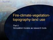
Fire-climate-vegetation-topography-land use What drives and determines fire patterns across time and space? What are the implications of global climate change?
| PowerPoint PPT presentation | free to download

The Challenges of Photographing Cuneiform Tablets ... Topography of Cuneiform Tablet. Before ... Cuneiform Tablets are remains of historic cultural values. ...
| PowerPoint PPT presentation | free to download

Some gaps and problems in high slopes and lakes. ... High resolution offshore CA bathymetry.http://wrgis.wr.usgs.gov/dds/dds-55/pacmaps/site.htm ...
| PowerPoint PPT presentation | free to view

India, China, Japan China has a varied climate also. It ranges from a subarctic climate in the north, to a tropical climate in the south. Most of China s population ...
| PowerPoint PPT presentation | free to download
Linear Wind Model. Rotate wind vectors according to complex ... Uwcor (x,y,t) = slope(x,y)*Uwind (t) U (x,y,t) = Uwcor (x,y,t) U (x,y,t) Linear Wind Model ...
| PowerPoint PPT presentation | free to download

The High Resolution Topography model provides more detail about local variation in elevation. ... ATLSS High Resolution Hydrology ...
| PowerPoint PPT presentation | free to download

Climatology (pg 1 only) Downslope winds: Concepts Factors Interactions Uniform flow Complex flow Exercise Rotors (pgs 1-2) Flow Interaction with Topography Notes ...
| PowerPoint PPT presentation | free to download
Title: Mapping Fire Regimes Across Time and Space: Author: Penny Morgan Last modified by: Penny Morgan Created Date: 5/17/1999 4:50:57 PM Document presentation format
| PowerPoint PPT presentation | free to download

The ATLSS High Resolution Topography/Hydrology Model. Scott M. Duke-Sylvester ... High Resolution Hydrology. Created as part of the ATLSS SESI package. Sun ...
| PowerPoint PPT presentation | free to download

Douleurs et Topographie Mid-tarsienne et arri re-pied Andr Perreault md Chirurgien Orthop diste-plasticien Zone III Fasciite Plantaire Tendinite d insertion T ...
| PowerPoint PPT presentation | free to download

Topography and Bathymetry in Alaska
| PowerPoint PPT presentation | free to view

Less stable, higher wind speed case = winds uniform with height and ... More stable, lower wind speed case = wind shear in the lowest layers and ...
| PowerPoint PPT presentation | free to download

Ocean Surface Topography Science Team Meeting. Venice, Italy: March 16 - 18, 2006 ... Editing thresholds and engineering flags. Sea surface height, SWH, Wind ...
| PowerPoint PPT presentation | free to view

Husky data set Topography. 10x Surface Topography Exaggeration ... Kim Wilmott. Husky Oil. Talisman Oil. Friday Lunch Folks. John Sumner. No doubt many others ...
| PowerPoint PPT presentation | free to download

Religious: temples, altars, funeral mound ... Altar of Zeus (long predates his temple) Temple of Hera. Philipeion (honors Philip of Macedon) ...
| PowerPoint PPT presentation | free to view

Attracted to negatively charged soil particles/organic matter. Binding of Cations = cation exchange capacity index of soil fertility. impacted by ...
| PowerPoint PPT presentation | free to view

Spline Topography Maps (New Repeated, 50 ms epochs) Supplementary Figure. ... Spherical spline topographical maps (in color, center) illustrate the N400 ...
| PowerPoint PPT presentation | free to download

The Role of Canyons, Promontories and Topography in DOES Susan Allen, Department of Earth & Ocean Science University of British Columbia Vancouver, Canada
| PowerPoint PPT presentation | free to download

Observations of Arctic sea ice thickness and topography
| PowerPoint PPT presentation | free to view
... Eagle 388 seismic acquisition system Unix-based Acquisition control software Spectrum analyzer A/C window unit is surprisingly small because of the energy ...
| PowerPoint PPT presentation | free to download

Les problmes frquents aux pieds Topographie comme aide diagnostic
| PowerPoint PPT presentation | free to view

... Aberrations Measures Accommodation Multifocal Acrylic IOL Alcon ReStor Lens Monofocal Acrylic IOL Alcon SA-60 Normal Eye +0.5 D Hyperope iTrace Summary ...
| PowerPoint PPT presentation | free to download

February 11, 2000, the Space Shuttle gathered topographic data over ... radiation to detect, locate, and (or) track objects, to measure altitude and to ...
| PowerPoint PPT presentation | free to view

Geospatial Analysis of Coastal Topography and its Dynamics
| PowerPoint PPT presentation | free to view

Based on an Ensemble Prediction System (EPS) DMO. Statistical interpretation. Rescaling ... Critical eye of the forecaster is still requested, mostly for ...
| PowerPoint PPT presentation | free to view

Research objectives - explore the possibilities to gain new insights into ... new LIDAR survey - modeling (SBEACH, DELFT3D) Future. H. Mitasova. Cape Fear ...
| PowerPoint PPT presentation | free to view

National Weather Service Fire Weather Program Manager. Fire Weather How are forecasts made? ... National Fire Danger Rating Forecasts from local NWS Offices. ...
| PowerPoint PPT presentation | free to download

Time Organized Maps. Learning cortical topography from spatiotemporal stimuli ' ... F. Spengler, F. Joublin, P. Stagge, S. Wacquant, Biological Cybernetics, 2000 ' ...
| PowerPoint PPT presentation | free to download

... and even marine biogeochemistry. The increased diapycnal mixing weakens stratification and strengthens the deep overturning cell and equatorial upwelling.
| PowerPoint PPT presentation | free to download