
Topography - PowerPoint PPT Presentation
1 / 14
Title:
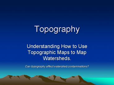
Topography
Description:
Topography Understanding How to Use Topographic Maps to Map Watersheds. Can topography affect watershed contaminations? Get the Gist Name the most important who ... – PowerPoint PPT presentation
Number of Views:92
Avg rating:3.0/5.0
Title: Topography
1
Topography
- Understanding How to Use Topographic Maps to Map
Watersheds. - Can topography affect watershed contaminations?
2
Get the Gist
- Name the most important who or what
- Identify the most important information about the
who or what - Rephrase the main idea into own words
- Limit responses to 10 words or less
3
Get the Gist of Reading
- Reader pauses after every paragraph to shrink it
into a main idea statement - Each partner reads for 5 minutes
- Listening partner is the coach
4
Gist Coaching
- If readers statement does not tell most
important who, what or thing Coach says Thats
not quite right. Try again. - If reader says too many whos or whats
- Coach says Choose the most important
- If readers main idea is more than 10 words .
- Coach says Shrink it.
- Remember you want your partner to figure out the
answer for him or herself.
5
Cant Get the Gist?
- If neither reader or coach knows the answer, the
Coach raises his or her hand and asks the teacher
for help.
Sea Level O feet
6
YOUR MISSION!
- You and your gist partners need to get the gist
of the following slides on journal page 13. - Divide the page into 6 boxes.
- Record the gist of each slide in 10 words and
answer any questions from the slides in your
journal. - Check your answers with a click
7
Get the Gist of Topography
- A contour line is defined as a line of equal
elevation on the map. If you were to walk on a
contour line painted on the ground around the
side of a hill you would neither go up nor down,
but remain level throughout. The difference
between contours, known as the contour interval,
is selected by the mapmaker. For any given
topographic map, the contour interval remains the
same. On topographic maps, every fifth contour
line, or index contour, regardless of map scale,
is shown in bold, and has an elevation value of
even hundreds.
- One continuous contour line represents a specific
elevation. - A contour interval is the distance between two
lines. - Index contours are bold every fifth line valued
in even hundreds.
Get the Gist And Record Answers in Your Journal
on Pg 13 in first of six boxes
(800 - 700) is 100 foot index contour intervals
100 feet divided by 5 intervals 20 feet per
intervals
8
Reading Elevations
- Using the map to estimate the elevation of the
points marked with letters - Point A An easy one. Just follow along the
index contour from point A until you find a
marked elevation. On real maps this may not be
this easy. you may have to follow the index
contour a long distance to find a label. - Point B This contour line is not labeled. But
we can see it is between the 700 and 800 contour
line. From above we know the contour interval is
20 so if we count up two contour lines. - Point C is not directly on a contour line. But
by counting up from 700 we can see it lies
between the 760 and 780 contour lines. Because
it is in the middle of the two we can estimate
its elevation as - Point D is outside the interval between the two
measured contours. While it may seem obvious
that it is 20 above the 800 contour, how do we
know the slope hasn't changed and the elevation
has started to back down? We can tell because if
the slope stated back down we would need to
repeat the 800 contour. Because the contour
under point
Point A 700
Point B 740
Get the Gist And Record Answers in Your on
Journal Pg 13
Point C 770
D is not an index contour it can not be the 800
contour, so must be 820.
9
Map Reading Activity Topography Test Your Skills
Get the Gist And Record Answers in Your on
Journal Pg 13 Click to Begin
1 2 3 4 5 2 3 45 65 4 3 2
1
Predict the color of the elevations on the topographic map as follows. Red 50m and higher, Orange 40-50m, Yellow 30-40m, Light green 20-30m, Dark green 10-20m, Purple 0-10m. 1. 2. 3. 4. 5. 6.
red
orange
yellow
light green
dark green
purple
Get the Gist And Record Answers in Your on
Journal Pg 13
2. Approximately how tall is Able Hill? _____________________
About 42m
More questions. Keep recording answers
3. Approximately how tall is Baker Hill? ___________________________
About 51m
4. Which mountain is taller, and by about how much? ___________________________
Baker by about 9m
5. How many meters of elevation are there between contour lines on the topographic map? __________________
10m
6. Which mountain has steeper slopes? ___________________________
Baker
Baker
7. Are the contour lines closer together on Able Hill or Baker Hill? _____________________
10
Topography Water Movement
- Use Gist to summarize each of these 3 paragraphs
in 3 separate sentences. - Water flows
- Water merges into
- A watershed
- How do contours relate to water flow? A general
rule - of thumb is that water flow is perpendicular to
- contour lines. In the case of the isolated hill,
water - flows down on all sides of the hill. Water flows
from - the top of the saddle or ridge, down each side in
the - same way water flows down each side of a garden
- Wall.
- As the water continues downhill it flows into
- progressively larger watercourses and ultimately
into - the ocean. Any point on a watercourse can be used
- to define a watershed. That is, the entire
drainage - area of a major river like the Merrimack can be
- considered a watershed, but the drainage areas of
- each of its tributaries are also watersheds.
- Each tributary in turn has tributaries, and each
one of - these tributaries has a watershed. This process
of - subdivision can continue until very small, local
Get the Gist And Record Answers in Your Journal
on Pg 13
On this slide, it is up to you to decide if you
get the gist.
11
Topography in Landscapes
- Sometimes topography maps look like
this - But sometimes topography maps or diagrams look
like this
Give me the Gist of the differences in these
maps. How do different map views change use?
12
The Gist of Topography Diagrams
- Photos and diagrams can also be described by
using the Get the Gist method. Look at the
diagram at the left and list ten words of your
own to describe the features of this landscape
which may affect water movement. - 1.
- 2.
- 3.
- 4.
- 5.
- 6.
- 7.
- 8.
- 9.
- 10.
slope stream development watershed wetland infiltr
ation wells lakes karst divide drainage tile
Record list on journal page 13
13
Your Mission is Complete!
- You just use the Gist to summarize learning.
- Now you
- can find contour elevations on topography maps
- calculate contour intervals
- locate and recognize index intervals
- describe water movement according to topographic
landscape
Next Mission Can topography affect watershed
contaminations?
14
Bibliography Credits
- http//www.enchantedlearning.com/geography/mapread
ing/ - http//edeninitiative.com/watersheds.htm
- http//raider.muc.edu/mcnaugma/Topographic20Maps
/contour.htm - http//raider.muc.edu/mcnaugma/Topographic20Maps
/topomapindexpage.htmMenu - http//www.epa.gov/owow/watershed/
- http//water.usgs.gov/wsc/
Recommended
CrystalGraphics Presentations


