
Boundaries and Disputes PowerPoint PPT Presentation
1 / 50
Title: Boundaries and Disputes
1
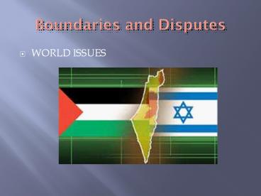
Boundaries and Disputes
- WORLD ISSUES
2
Five Basic Shapes of States
- Compact
- Prorupted
- Elongated
- Fragmented
- Perforted
3
Compact
- Distance from center to boundary does not vary
- Beneficial to small states easy to set up
communication systems if capital is in center - Efficient to govern
- Examples Rwanda and Uganda
4
Prorupted
- Compact state with a large projecting extension
- Can provide access to a resource
- Separate two states that would share a boundary
- Example Caprivi strip in Namibia
5
Elongated
- State with large distance from one end to another
but smaller distance side to side. - Regions can be separated from capital
- Country may have poor communications
- Ex. include Chile and Norway
6
Fragmented
- State that has several discontinuous pieces of
territory. - 2 types
- Separated by water and separated by another state.
7
Tin Bigha corridor (Fragment)
8
Perforated
- A state that completely surrounds another state.
- Lesotho is surrounded by S. Africa
9
Landlocked states
- Lacks a direct outlet to the sea.
- Ocean access is critical, international trade.
- Landlocked states must work with neighboring
states to transport goods to the ocean. - Most common in Africa, 14 states are landlocked
10
Types of boundaries
- Physical
- Geometric
- Anthropographic (Cultural)
11
(No Transcript)
12
Geometric Borders
- Almost always appear as straight lines
- Usually follow lines of latitude or longitude
- Completely created by humans
- Examples
- Border between MN and IA
- Northwest Angle
13
(No Transcript)
14
Physical Borders
- Use a physical feature of the landscape
- Rivers easy but problematic
- The darn things move!
- People tend to live along them, so population
centers get divided - Mountain ridges awesome, they stay still and
people dont live along the tops of mountains.
15
(No Transcript)
16
(No Transcript)
17
(No Transcript)
18
Anthropographic Borders
- Borders that separate cultural features
- Language groups
- Religion
- Ethnicity
- Huge advantage makes political units
(countries) that have consistent cultural
features. Much easier to govern. - Not as easy to create.
19
Cultural Boundaries
- Religious boundaries
- Used in dividing Ireland and Pakistan/India
- Language Boundaries
- European countries set main boundaries based on
language. Ex. France, Germany, and Italy.
20
Cultural Boundaries
- Religious boundaries
- Used in dividing Ireland and Pakistan/India
- Language Boundaries
- European countries set main boundaries based on
language. Ex. France, Germany, and Italy.
21
May also classify boundary when boundary was made.
- Antecedent boundarydrawn before an area becomes
populated. - Subsequent boundarydrawn after the cultural
landscape has been developed. - Consequent boundary is a type of subsequent
boundary that is drawn to accommodate differences
within a state. - Subsequent superimposed boundariesboundaries
forced on a country by a conquering or colonizing
power.
22
Boundary Disputes
- 1. Positional disputes When states disagree
about the interpretations of documents that
define a boundary. Usually arise when the
boundary is antecedent. - 2. Territorial dispute These arise when a
boundary has been superimposed and divides a
ethnic population.
23
Boundary Disputes (Cont.)
- 3. Resource disputes Disagree to the resources
and their use in boundary areas. - 4. Functional disputes arise when neighboring
states disagree over policies applied to
boundaries. Usually over the issue of land use
or immigration.
24
Two types of states.
- 1. Unitary Highly centralized governments,
few internal cultural contrasts, strong sense of
national identity, borders are cultural as well
as political. - 2. Federal Associations with provinces or
states and the states have strong regional govt.
responsibilities. Capital city was created to
serve as an administration center. - The trend is for countries to have a federal
government.
25
What are the government responsibilities inside a
state?
- establishes the legal code
- what kind of currency will be used
- may have to join army
- speak a common language
- kind of religion that is taught in school
26
GEOPOLITICS
- Geopolitics is the study of economic, political,
and military value of space to help predict and
direct international relations.
27
Friedrich Ratzel (1844-1904)
- State resembles a biological organism.
- To prolong its existence, a state needs
nourishment. - Nourishment is provided by acquisition of
territories. - If a state is confined with static boundaries,
the state will die. - Territory is the states essential life-giving
force.
28
Halford Mackinders Heartland Theory
29
Halford Mackinder
- 1861-1947
- Founded the London School of Economics in 1895
- In 1904 wrote The Geographic Pivot of History
- Within this paper he discussed the Heartland
theory.
30
Heartland Theory
- The Earth is divided into two sections
- One section is called the World Island made up
of Europe and AsiaEurasia. - The other section is the periphery, comprised of
the Americas and Oceania. - The Heartland was Ukraine, W. Russia, and
Eastern Europe.
31
Heartland Theory
- The World Island had more resources and a larger
population. - For the Periphery to conquer the W.I. the
periphery would have to transport long distances
by sea. - W.I. could locate industries deep inside for
protection form invasion.
32
Heartland Theory
- Who controls E. Europe rules the Heartland.
- Who rules the Heartland rules the World Island.
- Who rules the World Island rules the World.
33
(No Transcript)
34
Rimland Theory
- Near the end of WW II the theory was modified by
Nicholas Spykman. - He argues that the coastal areas of the
heartland or the Rimland were more important.
35
Why did this theory worry the U.S. at the end of
WWII?
- U.S. Foreign Policy decisions.
- Containment and Domino Theory
- Containment meant to contain the spread of
Communism - The Domino Theory was that if one country fell to
communism, soon after, the neighboring country
would fall like a row of dominoes.
36
Valid Theory?
- Many analysts believe these theories no longer
apply to the current world situation because of
the following. - breakup of the USSR/end of the cold war
- development of nuclear power
- rise of Japan/China/W. Europe
- decline of power of the U.S.
37
Future Conflict
- Many political geographers believe it is not
military power that will cause conflict and shape
the world in the future but two other forms
competition.
- 1. Economic rivalryeconomic competition between
the north (developed countries) and the south
(undeveloped countries). - 2. Competition between different civilizations.
More importantly many believe the world will be
shaped by eight major civilizations and the
conflicts between them.
38
INTERNATIONAL POLITICAL SYSTEMS
39
UNITED NATIONS
- Organization that brings together countries to
promote world peace - Provides a forum where countries can discuss
international and regional concerns.
40
UNITED NATIONS PROGRAMS
- World Health Organization (WHO)
- Food and Agriculture Organization (FAO)
- United Nations Educational, Scientific, and
Cultural Organization (UNESCO)
41
UNITED NATIONS
- Much of the UN budget is committed to assisting
states with economic growth and development. - UN has NO authority of any countries military.
- Most recently has taken a different approach to
world affairs.
42
International Law of the Sea(1982)
43
International Law of the Sea(1982)
- Territorial Sea, 12nm (19km). Coastal states
have sovereignty. Most vessels have the rights
to innocent passage. - Contiguous zone, to 24nm (38km). Coastal states
do not have complete sovereignty, but can enforce
some laws and pursue out of territorial waters.
44
International Law of the Sea(1982)
- Exclusive Economic zone (EEZ), up to 200nm
(370km). State has rights to explore and exploit
natural resources. Has rights to continental
shelf up to 350nm beyond their coasts. - High Seas. Outside any one states jurisdiction.
All minerals are the property of humankind.
45
World Trade Organization (WTO)
- Located in Geneva, Switzerland
- WTO is the only global international organization
dealing with the rules of trade between nations. - Handles trade disputes between states
- Goal of WTO is to cut tariffs and dismantle all
barriers to trade.
46
European Union (EU)
- Also referred to as the common market.
- The EU has rid Europe of trade barriers and
allowed free movement of capital, goods, and
people throughout member nations. - The EU has created a single European Market.
47
(No Transcript)
48
North Atlantic Treaty Organization (NATO)
- NATO is an alliance of 26 countries from North
America and Europe. - NATO treaty was signed on April 4, 1949.
- NATO is a mutual defense agreement.
49
Warsaw Pact
- The Warsaw Pact was a military organization of
Central Eastern European Communist countries. - It was established in 1955 in response to the
formation of NATO. - The Warsaw Pact dissolved in 1991.
50
NATO vs. WARSAW PACT
Recommended
