
The View from the COOL Room: PowerPoint PPT Presentation
Title: The View from the COOL Room:
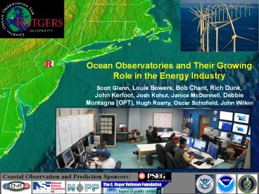
1
Ocean Observatories and Their Growing Role in the
Energy Industry Scott Glenn, Louis Bowers, Bob
Chant, Rich Dunk, John Kerfoot, Josh Kohut,
Janice McDonnell, Debbie Montagna (OPT), Hugh
Roarty, Oscar Schofield, John Wilkin
Coastal Observation and Prediction Sponsors
2
Growing World Population
World Population 2008 - Over 6.65 Billion 2050
Over 9 Billion
Earth at Night
3
THE WORLD IS CHANGING!!
2090
Our grand children
Polar Amplification of Global Warming
2005
1979
2060
Our children
2030
Us
1980
2000
YEAR
4
Where Will The Melting Water Go? Will It Change
Our Ecosystem?
- The Mid-Atlantic Bight is getting
- Fresher Warmer
- Experiences Some of the Largest
- Temperature Differences in the World
- Summer to Winter
- Top to Bottom
- Some of the Most Migratory
- Fish Species have Evolved
- Most Urbanized Coast
- in the U.S.
5
A Framework for Research Investments in Ocean
Science for the coming Decade
- Theme 1 Stewardship of Natural and
- Cultural Resources
- Theme 2 Increasing Resilience to Natural
- Hazards
- Theme 3 Enabling Marine Operations
- Theme 4 The Oceans Role in Climate
- Change
- Theme 5 Improving Ecosystem Health
- Theme 6 Enhancing Human Health
- Three Central Elements
- Ocean Observing System
- Forecast Models for Key Ocean and
Ocean-Influenced Processes - Scientific Support for Ecosystem Based Management
http//ocean.ceq.gov/about/sup_jsost_prioritiespla
n.html
Deploying an ocean-observation system will
revolutionize the access to and view of the ocean
and increase the pace, efficiency, and scope of
ocean research.
6
The NSF Ocean Observatories Initiative (OOI)
OOI will provide scientists an enduring in situ
infrastructure to study episodic events in
extreme ocean environments.
- Ocean-Atmosphere Exchange
- Climate Variability, Ocean Circulation, and
Ecosystems - Turbulent Mixing and Biophysical Interactions
- Costal Ocean Dynamics and Ecosystems
- Fluid-Rock Interaction and the Subseafloor
Biosphere - Plate-scale and Ocean Geodynamics
7
Rutgers University Coastal Ocean Observation Lab
Mission Planning
Operations Communications Station
Glider Fleet
A Stommel View of the Ocean WWW Interactive
3-D
L-Band X-Band Satellite Systems
CODAR Network
8
Satellite Data Acquisition Systems
China FY1-D
1992
2003
US MODIS
India Oceansat
9
5 MHz
CODAR System Antennas
Receive Antenna
Transmit Antenna
25 MHz and 13 MHz
10
Rutgers Interfaces to the Mid Atlantic CODAR Data
11
Success
Stories Making a Difference Optimizing HF
Radar for SAR using USCG Surface Drifters
Art Allen U.S. Coast Guard Scott Glenn Rutgers
University and the Mid-Atlantic Regional Coastal
Ocean Observing System
12
Slocum Coastal Glider
Glider Specs. Length 1.5 m Hull Diameter 21.3
cm Weight 52 kg
Science Bay Specs. Length 30 cm Diameter 21.3
cm Max. Payload Weight 4 kg
13
Rutgers Slocum Glider Fleet
- 129 deployments worldwide (2003 present)
gt 39,000 km flown (Earths circ. 40,000 km) gt
1900 days in water 300,000 profiles
Liverpool Bay Coastal Observatory
Mediterranean Sea
Perth, Australia
West Florida Shelf
Mid-Atlantic Shelf
14
Coastal Observatories Enable Student Involvement
- Ocean Sciences Abstracts used Coastal
Observatory - 35 with Student or Post-doc First Authorship
15
Composite Data Forecast Products
Remote Sensing
Gliders
3-D Nowcasts
Data Assimilation
Nested Models
4-D Forecasts
16
Rutgers PSEG Weather Forecasting Partnership
- RU-WRF model operation
- Operational weather forecast tailored to PSEG
delivered daily via protected website by 7 AM.
Highly detailed forecast for days 1 and 2.
General overall synopsis for forecast days 3
through 7.
- Issuance of Severe Weather Alerts during
inclement weather conditions transmitted to PSEG
personnel via email and protected website. - Experimental plant damage forecast transmitted to
PSEG personnel via email at the initiation
of severe weather alerts.
17
Tropical Storm Ernesto Labor Day Weekend, 2006
RU-WRF is Orange
6 am Friday Morning Where do we send the ships?
18
- RU-WRF Forecast of
- Tropical Storm Ernesto
- improved model physics,
- more input data (ocean atmosphere),
- higher resolution model grids
Note WRF forecasts The transition of
Ernesto From tropical to extra-tropical after
landfall!
19
Tropical Storm Ernesto Feedback to the State
Accumulated Rainfall
Predicted Observed
20
Observed Track is Yellow RU-WRF is Orange
21
Tropical Storm Ernesto Track Sensitivity
INCREASING RESOLUTION
-INCREASE IN MODEL SKILL IS GREATEST WITH
IMPROVED UNDERSTANDING Ocean-Atmosphere-Land
Interactions!!!!!!!
Operational Model Physics
INCREASING RESOLUTION
Observed Track is Yellow
Bowers et al.,
Research Model Physics
22
Verification
- Severe weather forecasts are verified using
strict criteria determined crucial by PSEG. - Plant Damage forecasts are verified using actual
plant damage data. - Model performance used to adjust model in future
upgrades.
Alert Justified Unjustified Total Accuracy
Southern 120 27 147 81.60
Central 128 21 149 85.90
Metropolitan 126 27 153 82.40
Palisades 125 28 153 81.60
Total 499 103 602 82.90
Severe Weather Alert Verification Statistics Oct
2004-Dec 2006
23
New Jersey Governors Energy Plan
24
Test Region For Offshore Wind Energy Pilot Study
25
New Jersey Population and Typical Energy Usage
Patterns
Ocean City, NJ Year-round 15,000 Summer
150,000 Long Beach Isl., NJ Year-round
9,000 Summer 110,000 Wildwood, NJ Year-round
5,500 Summer 250,000
26
Sea Breeze Observations and Modeling
Radar Reflectivity from Doppler Radar
1830 UTC
2035 UTC
2230 UTC
RU WRF 6 KM
NWS NAM 22 KM
27
Sea breeze circulation cell initially forms 10
AM-12PM Typical sea breeze cell depth 600-1,200
meters Typical inland propagation speed 1-10
km/hour depending on geostrophic wind
flow Offshore winds greater than 20 knots
disrupts Sea Breeze development Does not always
take the coastline shape
28
Monitoring Plan for Southern New Jersey
29
Ocean Power Technologies
- Ocean-tested, proprietary technology
- 35 patents issued
- Commenced active operations in 1994
- Headquarters - 21,000 sq. ft. facility in
Pennington, NJ - Focus on electrical power generation from ocean
waves - Utility grid-connected systems
- Remote, autonomous applications
- Experienced and motivated personnel
- 48 employees, primarily engineers and scientists
- More than 10 years experience in producing
electrical power from ocean waves using its
PowerBuoy
Autonomous PowerBuoy deployed off Washington
State, 2004
PowerBuoy deployed off Marine Corp Base Hawaii
2005-2006
PowerBuoy deployed off Marine Corp Base
Hawaii June 2007
PowerBuoy deployed off Tuckerton, New Jersey,
2005-2006 2007-present
30
PowerBuoys for Wave Power
- Initial products rated at 150 kW 500 kW
products available in 2010-11 - Wave park ratings in 100s of MWs attained by
grouping into arrays - Operating wave range of 1.5 to 7m
- Automatically locks up for storm and hurricane
wave conditions above 7m - Designed to survive 100 year storm wave
conditions - 24m - Orkney Islands, Scotland
- 20m - Bay of Biscay, Spain
- 18m US West Coast
- Demonstrated survivability in two separate
hurricanes
31
OPTs PowerBuoy - Enabling Technology
- OPT Rutgers have been developing technologies
for persistent maritime security solutions - Leverages work previously accomplished through
ONR, DoD CounterNarco Terrorism DHS - Existing Components
- OPT PowerBuoy wave energy conversion buoy
- Rutgers Coastal Ocean Observation Lab advanced
vessel detection tracking software - CODAR Ocean Sensors HF Radar
City and/or Naval Facility
Friendly Navy ship
PowerBuoy with integrated HF Radar transmitter
High-speed waterborne threats
HF Radar System provides detection and tracking
of high-speed vessels approaching from currently
unprotected 10 50 mile range. System helps
protect naval assets and civilian populations
from high-speed waterborne threats.
Land-based HF Radar Receiver(s)
OPTs PowerBuoy replaces solar powered buoys
having insufficient power for Radar transmitters
31
32
Compact Wave Energy Harvesting Buoy
- Wave energy harvesting contained in hermetically
sealed Buoy - Wave action forces Buoy up and down
- Tuned internal oscillator maximizes wave energy
capture - Scalable up from 3-inch diameter
- Free floating or moored
- Available as buoy or embedded in other device
Compact Wave Energy Harvesting can be embedded in
other devices such as undersea gliders
33
OPT Point of Contact
Ocean Power Technologies, Inc. (OPT) 1590 Reed
Road, Pennington, NJ 08534 Website
www.oceanpowertechnologies.com Point of
Contact Deborah A. Montagna dmontagna_at_oceanpowert
ech.com Phone (609) 730-0400 x221
Recommended
