
Marine Magnetotellurics for Geothermal Exploration under the Salton Sea - PowerPoint PPT Presentation
1 / 21
Title:
Marine Magnetotellurics for Geothermal Exploration under the Salton Sea
Description:
Edward Nichols, Jiuping Chen, (Schlumberger - EMI) Tiziano Labruzzo (AGO) ... EM fields attenuate with depth. H0. e. H0. z. ra. Frequency. high. high. low ... – PowerPoint PPT presentation
Number of Views:399
Avg rating:3.0/5.0
Title: Marine Magnetotellurics for Geothermal Exploration under the Salton Sea
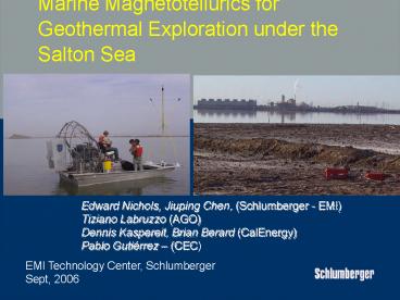
1
Marine Magnetotellurics for Geothermal
Exploration under the Salton Sea
Edward Nichols, Jiuping Chen, (Schlumberger -
EMI) Tiziano Labruzzo (AGO) Dennis Kaspereit,
Brian Berard (CalEnergy) Pablo Gutiérrez (CEC)
EMI Technology Center, Schlumberger Sept, 2006
2
Salton Sea Survey Plan Target Identify high
conductivity zones related to hot brines in the
reservoir. 4 Profiles (72 km) 93 sites
proposed 30 land owners
(3-D map by Dave Miller http//www.stanford.edu/d
miller/dem1.html )
3
Objective Evaluate offshore extension of
geothermal field with marine MT Tasks Modify
Deep Marine MT for operations in Salton Sea (lt15
m depth) Collect 50 marine and 30 land MT
stations along profiles Perform interpretation
using 2-d models on profiles
4
Geothermal Exploration under the Salton Sea using
Marine Magnetotellurics
- Stage 1 - Planning
- Design Initial Survey Layout
- Preliminary deployment
- Develop survey plan
- Stage 2 - Conduct Full Survey
- 80 MT stationsarranged in 4 profiles
- Deployment (marine stations)
- Deployment (land stations)
- Stage 3 - Reduce and Interpret data
- Reduce data
- Preliminary Interpretation
- 2D Computer inversion on profiles
- Construct geological/reservoir model
5
MMT24
Stray Line Flotation Ball
Flotation package
BFM Marine Sensors
Anchor Release Mechanism
ANCHOR
Electrode Arms
Electrode
EMI MMT24 System Jamestec 2001 Deployment -
Water Depth 5.6 km - Sea of Japan
6
MMT24 Shallow Water MT System
Test Survey Site 6 Water Depth 6
7
The MT Method
8
Challenges of Marine Magnetotellurics in the
Salton Sea
- Data quality - EM Noise from very large power
generation facilities and transmission
lines - Shallow sea small boats, difficult access, wave
noise, river currents, caution for
interference to boaters - High salinity corrosion of equipment,
electrical contacts
9
Hx
Ex1
Good signal
Ex2
Ey1
Hy
10
Survey - December 2003 RS3 5 channel MT.
12 miles away RS4 4 channel MT. 22 miles
away Survey - March 2004 RR6 4 channel MT.
43 miles away RR8 4 channel MT. 57
miles away
REMOTE REFERENCE LAYOUT
11
L2-08S EMI, Mar. 2004
L2-12S EMI, Mar. 2004
Comparison With Existing MT Data
WC-5 Woodward-Clyde, May. 1979
12
Marine Operations
Marine Sites SSX17 and 45
13
Line 2 Inverted 2D resistivity profile
With fix zone
14
The data fitting for the old, inverted model
15
Line2 -- 2D MT inversions
16
Salton Sea
17
(No Transcript)
18
(No Transcript)
19
Conclusions
- Shallow water marine MT is possible
- Data matches old surveys
- Correlation with well log
- Patience to work with weather conditions
- Interpretation needs geologic integration and
fill in data - Energy climate is ready for more marine MT
exploration - Other shallow marine target areas may be
- Clear Lake, Surprise Valley
- International Gulf of California, Indonesia,
Iceland, Japan
20
Geothermal Exploration under the Salton Sea using
Marine Magnetotellurics
- Acknowledgements
- CalEnergy
- Geological Information - Dennis Kaspereit, Fred
Pulka - Land Owners - Vince Signoritti
- Sonny Bono Wildlife Refuge
- Sylvia Pelizza - Land and special use advice
- Daniel Gomez - CDFG
- Wister Game Reserve
- Jack Crayon - Game Warden - air boat logistics
- Rob Schrag - air boat operator
- Contractors
- John Greenman
- Rays Fishing Guide Service
- GeoInvest
- Schlumberger
- Nestor Cuevas
- Kevin Eyl
- Rebecca Harvey
21
- EMI Survey equipment, s/w
- Cal Energy Reservoir information
- CEC Funding, Project review
Recommended
CrystalGraphics Presentations


