
Coastal and Ocean Engineering at Texas A - PowerPoint PPT Presentation
Title:
Coastal and Ocean Engineering at Texas A
Description:
Coastal and Ocean Engineering at Texas A – PowerPoint PPT presentation
Number of Views:892
Avg rating:3.0/5.0
Title: Coastal and Ocean Engineering at Texas A
1
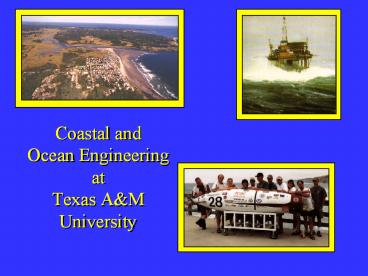
Coastal and Ocean EngineeringatTexas AM
University
2
- Fields Related to Ocean Waves
- Ocean Engineering Ship, water borne
transport, - offshore
structures (fixed and - floating
platforms), Pipe lines, Wave
energy, Underwater robots, ROV - Navy Military activity, amphibious
operation, - WW II Allies landing, Mobil sea base,
Sonar-underwater acoustics - Coastal Engineering Harbor and ports,
dredging, coastal - structures, Tsunami, Storm surge,
- beach erosion, sediment
transport.
3
- Oceanography Ocean environment,
atmosphere, - fishing,
oil spilling, mixing, pollutant - transport.
- Environmental Eng. Capping contaminated dredged
- material,
Waste water disposal - Diffusion
and dispersion of toxic - material
in ocean and costal water.
4
After December 26 Tsunami
Before December 26 Tsunami
5
Hurricane Ivans Path (2004)
Picture courtesy of Weather Underground
(wunderground.com)
6
(No Transcript)
7
(No Transcript)
8
Gravity Platform
9
Gravity Platform Arctic area
10
Spar
- Deepest Structure
- Hoover/Diana
- 4800 ft
11
Future Sub-sea Completion?
- Limitations
- New technology
- Multi-phase flow
- Expensive
- Depth to 6000 ft
12
System of Production Platforms
13
(No Transcript)
14
- Horizontal Turbine
15
Offshore Airport
16
Mobile Offshore Base
17
Mobile Offshore Base
18
Floating Harbor in Alaska
19
Floating Type
20
RIB Rapidly Installed Breakwater(US Army)
21
- Floating Breakwater System RIB
22
Floating Bridge (Norway)
23
Floating Bridge (Seattle)
24
Lightering Operation in Open Sea
25
Demands of LNG
- Larger LNG Carrier
- LNG-FPSO
- LNG Offloading Terminal
26
Side-by-Side Offloading
27
Tandem Offloading
28
ISSUES ON LNG SLOSHING
LNG-FPSO
LNG Carrier
SMB
- Partial Loading
- Sloshing Concerns for Membrane System
- Impact Loading Strength of Membrane System
- Ship Motion Coupling
29
Offshore Technology Research Center (OTRC)
30
OTRC FPSO Model Testing
31
Well Blowouts, Oil Spills, and Environmental
Safety
32
Materials and Corrosion
33
Rigs-to-Reefs
34
COASTAL ENGINEERING
- Coastal Protection
- Beach Restoration
- Port and Harbors
- Inlet Control
- Waterway Navigation
- Dredging
- Military Operations
35
Option 1 Do Nothing
36
Option 2 Retreat
Cape Hatteras Lighthouse, Outer Banks, North
Carolina
37
Option 3 Beach Nourishment
38
Option 4 Coastal Armoring
39
Dredging Technology
40
Testing of Armor Unit Stability _at_ TAMU
41
TsunamiAttack
42
(No Transcript)
43
(No Transcript)
44
After December 26 Tsunami
Before December 26 Tsunami
45
What Do I Do!?!?
A strong earthquake in your area is a natural
tsunami warning. Do not stay in low-lying coastal
areas!
If unusual sea conditions like extreme lowering
of sea level are observed, move towards high
grounds!
During the retreat of sea level, interesting
sights are often revealed. Fishes may be stranded
on dry land thereby attracting people to collect
them. Also, sandbars and coral flats may be
exposed. These scenes tempt people to flock to
the shoreline thereby increasing the numbers of
people at risk when the on rushing waves of
tsunami hit the area.
46
It is Impossible to Predict Tsunamis
- However, Tsunamis can be forecasted after a
seismic event is detected. - Current Technology
- Computer simulations are used in order to create
evacuation plans in the event that a tsunami
occurs. - Seismographs measure the intensity of earthquakes
and tide gages measure wave height. - Developing Technology
- Deep ocean buoys that can detect tsunamis after a
seismic event
47
DART Buoys
- Deep-ocean Assessment and Reporting of Tsunami
- Normal Operation
- Surface Height is measured every 15 minutes.
- Operation After a Seismic Event
- 15 second values are transmitted during the first
few minutes - Followed by 1 minute averages
- If another event is not detected after 4 hours,
they return to normal operation.
48
- The NOAA will deploy 32 DART Buoys
- Fully operational by mid-2007
- Projected to cost 37.5 million over the next 2
years
49
The drag coefficients of swimming fishes are one
order of magnitude smaller than most underwater
vehicles
50
(No Transcript)
51
Submarines
- Diving and Life Support
- Thrust and Propulsion
- Energy Systems
52
Remotely Operated Vehicles (ROVs)
53
ROV Inspection of Offshore Structure
54
Specialized ROV Trench Digger
Recommended
CrystalGraphics Presentations


