
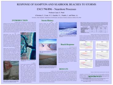
RESPONSE OF HAMPTON AND SEABROOK BEACHES TO STORMS - PowerPoint PPT Presentation
1 / 1
Title:
RESPONSE OF HAMPTON AND SEABROOK BEACHES TO STORMS
Description:
Results of these beach profiles were analyzed and periods of erosion or ... Leo, M.E. 2000. ... 14, 2001, when the first profiles were recorded, all of the ... – PowerPoint PPT presentation
Number of Views:57
Avg rating:3.0/5.0
Title: RESPONSE OF HAMPTON AND SEABROOK BEACHES TO STORMS
1
RESPONSE OF HAMPTON AND SEABROOK BEACHES TO
STORMS ESCI 796/896 Nearshore
Processes Professor Larry G. Ward (Christian, E.,
Evans, N.T., Gaeckle, J.L., Paradis, J., and
Watts, A.) University of New Hampshire,
Department of Earth Sciences and Jackson
Estuarine Laboratory, Durham, NH, 03824
INTRODUCTION
Storm History
The primary objective of this project was to
document the changes in beach morphology at five
sites at Hampton Beach and the northern 1.5 km of
Seabrook Beach in response to seasonal storms.
These objectives were carried out with nine beach
profiling surveys between 14 March - 24 July,
2001, and analysis of storm records. Results of
these beach profiles were analyzed and periods of
erosion or accretion were identified along with
the morphological features that developed on the
beaches over the course of the study. Wind and
wave climate and storm tracks (duration, tidal
phase, intensity, track, and wind speed and
direction) acquired from the National
Oceanographic and Atmospheric Administration
(NOAA) were investigated and compared to the
erosion and deposition cycles at the five sites.
In addition, the erosive activity created by the
March 2001 storms were compared to the climate
conditions and beach profiles of Hurricane Bob
and the Halloween Storm of 1991.
Coastal storm characteristics including course,
duration, intensity, maximum sustained winds,
wave height, frequency and steepness, and tidal
stage are important to understanding how a beach
will respond to various climatic conditions
(Figure 3). Wind and wave conditions were
monitored by the NOAA National Data Buoy Center
at an offshore buoy (Station 44007) located 12
nautical miles southeast of Portland, ME (and
approximately 50 nautical miles northeast of the
study area). In addition, meteorological
conditions were monitored by NOAA at the Isle of
Shoals (Station IOSN3). These stations were used
for wind and wave information. Data were
downloaded from the website (www.ndbc.noaa.gov)
and analyzed to determined storm characteristics
(course, intensity and duration), wind strength,
and wave height that contributed to the erosion
of Hampton and Seabrook beaches throughout the
study period.
Table 1. This table shows a comparison of two
major storms in 1991 and two major storms in
March 2001. Hurricane Bob had little impact on
the Hampton shoreline because it was a fast
moving storm and the beaches were well developed
by late August. The Halloween Storm of 1991
created significant erosion from Hampton Beach
because it was a long and intense storm impacting
an already eroded beach. The two March 2001
storms created significant erosion on Hampton and
Seabrook beaches. Most of the sediment on the
beaches probably had been moved offshore to the
nearshore bar prior to these events due to
earlier winter storms. Consequently, the March
2001 storms severely impacted the beaches that
were already in an eroded state.
The Hampton/Seabrook barrier island system
developed approximately 4,000 years before
present (ybp), when sea level rise slowed,
increasing sediments deposition south of Great
Boars Head and ultimately creating a barrier
island. The barrier island system extends from
Great Boars Head to Castle Neck, Massachusetts
(Leo 2000). The sediments on Hampton and Seabrook
beaches probably originated from 1) the
Merrimack River to the south, 2) erosion of Great
Boars Head, and 3) the inner continental shelf.
These sediments (0.1 to 2.1 phi) are susceptible
to erosion from wave energy causing Hampton and
Seabrook beaches to change on a seasonal basis
(Leo 2000). The combination of longshore
currents, and tidal and wave energy created an
unstable barrier island system and migrating
inlet. This was observed and documented from
historical charts of Hampton Harbor Inlet from
1867 1917. Between 1867 1907, the sand spit
on the north side of the inlet was smaller and
landward of the southern spit resulting in
drainage towards the north. Some time between
1907 and 1917, the sand spit on the south side of
the inlet eroded away and sediment accreted on
the sand spit north of the inlet changing the
flow towards the south. In 1934-1935 jetties were
constructed to stabilize the inlet (Figure 1,
Army 1962).
Hampton and Seabrook beaches were flat and
featureless following the March 6-7, 2001 storm
(see March 14, 2001 profile in Figure 6). As
climatic conditions improved, wind and wave
energy transported sediments landward rebuilding
the morphological features on these beaches. This
was observed at Hampton and Seabrook in May (see
May 1, 2001 profile in Figure 6). Later in the
season, after prolonged accretion, a large berm
was formed and the beach face became steeper as
documented by the 24 July 2001 profiles (Figure
6).
Beach Response
BERM
BEACH FACE
Five study sites were established along the
coast of New Hampshire on Hampton and Seabrook
beaches NHC 21a (N 42º 54.79, W 070º 48.59), NHC
22 (N 42º 54.41, W 070º 48.67), NHC 23a (N 42º
54.30, W 070º 48.70), SEA 24a (N 42º 54.18, W
070º 48.86), and SEA 25a (N 42º 54.82, W 070º
48.96) (Figure 1). Measuring the changes in
elevation and morphological features of the
beaches were accomplished by the stake and
horizon or Emery method (Emery 1961) (Figure
4). Beach profiling provided a simple and quick
method to monitor changes in shoreline
development over time and identify features such
as berms, the beach face, and ridges and runnels
on the low tide terrace (Figure 5). Each of the
five sites were profiled eight times over a six
week period between 14 March 1 May, 2001.
Additional profiling occurred on 24 July 2001.
LOW TIDE TERRACE
EDGE of DUNE
Figure 6. Profiles for the five sites along
Hampton (NHC 21a, 22, and 23a) and Seabrook (SEA
24 and 25a). March profiles (blue line) show
erosional beaches, whereas May and July profiles
(green and pink lines) show accretional beaches.
July profiles (pink line) show a large berm and
steep beach face, typical of a fully recovered,
well developed accretional shoreline. The
landward edges of profiles NHC 21a, 22, and SEA
24 were restricted by a seawall that inhibited
dune development. However, in the NHC 23a and SEA
25a profiles dunes were observed.
DUNE AREA
In addition to the jetties, humans have impacted
the Hampton/Seabrook system through numerous
activities. A seawall approximately 1.0 m high
extends 1.5 km from the northern section of the
Hampton Beach south towards Hampton Harbor Inlet
(Figure 2). The remaining 0.3 km of beach
consists of a human-made dune system (Army 1962).
Both the seawall and the dunes were constructed
to protect the commercial and residential
community from overwash during storms and to
interrupt the aeolian transport of sediments
landward. However, during the study period
sediment had accumulated equal to the height of
the seawall reducing its effect (Figure 2).
Sediments were transported over the wall and into
the parking lot during storms. Other
anthropogenic activities include the periodic
dredging of Hampton Harbor and subsequent beach
nourishment from the dredge spoils.
RESULTS On March 14, 2001, when the first
profiles were recorded, all of the beaches had
recently undergone erosion from the strong
northeast winds generated by the winter storms
(Figure 6 and Table 1). The largest storm event
during this study that had a significant impact
on the beaches occurred on March 6 and 7 (Table
1). This storm occurred two days before a full
moon creating higher than normal tides, and had
winds that reached 45 - 56 mph from the north
northeast. Waves were in excess of 2.0 m.
Calculated wave steepness (wave height/wavelength
ratio) during this storm was on the order of
0.034. Wave steepness greater than 0.016 tends to
cause offshore sediment transport and erode
beaches. On March 23, a second storm event
occurred with wave steepness in excess of 0.044
and caused major erosion at Hampton and Seabrook.
This storm generated waves greater than 2.0 m in
height and had sustained winds of 40-50 mph over
3 days. Following these storms, low energy
conditions prevailed for the next several months
rebuilding the beaches. All sites profiled during
July 2001 showed a well-developed berm, a steep
beach face and a flat, featureless low tide
terrace characteristics indicative of a fully
recovered, accretional beach (Figure 6).
Hampton and Seabrook beaches experienced periods
of erosion that corresponded to Noreaster storm
events. The effect of the storms on the beaches
depended on several factors including the
orientation of the beach, volume of sediment on
the beach, structures landward of the beach, and
storm and wave conditions. Although late winter
storms further eroded Hampton and Seabrook
beaches, by mid-summer these beaches have fully
recovered.
REFERENCES Leo, M.E. 2000. The geomorphology,
sedimentology, and storm response of beaches
along the glaciated coast of the western Gulf of
Maine (New Hampshire and southwestern Maine).
Masters Thesis. University of New Hampshire. 125
pp. Emery, K.O. 1961. A simple method of
measuring beach profiles. Limnology and
Oceanography. 690-93. Army, 1962. Shore of the
state of New Hampshire, beach erosion and control
study. Report of the chief of engineers,
Department of the Army. Washington, D.C. 156 pp.
Figure 2. Seawall that is 1.0 m high and extends
south along Hampton Beach to within 0.3 km of the
Hampton Inlet. The buildup of sediments from
aoelian forces reduces the effectiveness of the
seawall.
Recommended
CrystalGraphics Presentations


