
Geodetical PowerPoint PPT Presentations
All Time
Recommended

Exploring the Relationship Between Geothermal Resources and Geodetically Inferred Fault Slip Rates i
| PowerPoint PPT presentation | free to view

This presentation shows data and results acquired in the framework of EPICA, ... Trhough integrated geodetical, geophysical. and glaciological surveys ...
| PowerPoint PPT presentation | free to download

Basic Geodesy and Geographic Coordinate Systems What is Geodetic Leveling ? Vertical surveying is the process of determining elevations above mean sea-level.
| PowerPoint PPT presentation | free to download

International Symposium on Geodetic Deformation Monitoring: From Geophysical to Engineering Roles 17 19 March 2005, Ja n (SPAIN) Estimating crustal deformation ...
| PowerPoint PPT presentation | free to download

... a G G G p S S S S Ss s s s s ss t t t tt F F F F F F FFFFFFFFT T T T ... TTO O O O O O O'O OOOOOOd d ddddddddd 'f f f'fffffe e e'e ee'eee ...
| PowerPoint PPT presentation | free to download

Projection carves out land-parcels (geodetic projection) Properties Transparent: projection and location are functions Exhaustive ... reservoir. tarn. loch. water. of .
| PowerPoint PPT presentation | free to view

The Communication Network The GPS Data Flow 5 sec sampling rate Data ... It is based on epoch-by-epoch technology, ... //212.179.112.235 Until recently, ...
| PowerPoint PPT presentation | free to view
Gravity and the Geoid at NGS Dru A. Smith National Geodetic Survey Presented at the 2000 Geodetic Advisor Convocation Silver Spring, MD April 11, 2000
| PowerPoint PPT presentation | free to download

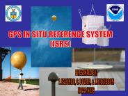
... into the National Spatial Reference System ... order horizontal and 2nd order vertical Data standards and ... vertical angle between two stations ...
| PowerPoint PPT presentation | free to download

Images: depict completed flight lines/coverage areas; Topo-bathy LiDAR point cloud images Blurb: On October 28, the National Geodetic Survey (NGS) ...
| PowerPoint PPT presentation | free to view

Experimental Results from BigAnt , a Large Format Antenna for High Quality Geodetic Ground Stations Gerald Mader National Geodetic Survey (NGS)
| PowerPoint PPT presentation | free to view

... Geomorphic constraints Geodetic estimate on upper bound strain rate Ask the ... How much strain per earthquake cycle? Seismic Moment Rates: Ask the Experts?
| PowerPoint PPT presentation | free to view

Recent insitu absolute phase center calibrations match most of the previous anechoic chamber results Absolute calibration Hannover System: ...
| PowerPoint PPT presentation | free to download

SOILS: The Forgotten Framework Layer Bruce Nielsen GIS Specialist USDA-Natural Resources Conservation Service Why Was Soils Data Forgotten? Geodetic Control ...
| PowerPoint PPT presentation | free to download
Title: PowerPoint Presentation - 12.201/12.501 Essentials of Geophysics Author: Thomas Herring Last modified by: Thomas Herring Created Date: 10/31/2003 2:25:20 AM
| PowerPoint PPT presentation | free to download

Data fusion for geoid computation numerical tests in Texas area (preliminary results) Yan Ming Wang & Xiaopeng Li National Geodetic Survey, NOAA, USA
| PowerPoint PPT presentation | free to download

Numerical aspects of the omission errors due to limited grid size in geoid computations Yan Ming Wang National Geodetic Survey, USA VII Hotine-Marussi Symposium
| PowerPoint PPT presentation | free to download
Designing the configuration of the Geodetic-Geodynamic Network in Israel Gilad Even-Tzur Department of Mapping and Geo-Information Engineering Faculty of Civil and ...
| PowerPoint PPT presentation | free to download


Barcelona, Spain Joint work with: Carmen Hernando, Merc Mora, Carlos Seara Jose C ceres, M. Luz Puertas CHORDAL GRAPH No induced cycles of length greater than 3 ...
| PowerPoint PPT presentation | free to view

Control Surveying
| PowerPoint PPT presentation | free to view

Earth Science Applications of Space Based Geodesy DES-7355 Tu-Th 9:40-11:05 Seminar Room in 3892 Central Ave. (Long building) Bob Smalley
| PowerPoint PPT presentation | free to download

Geomatics is the science and technology ... Geomatics encompasses a broad range of disciplines that can be brought together ... Geodetic Survey. Remote Sensing ...
| PowerPoint PPT presentation | free to view

Investigation of the Topographic Effect by Using High Degree Spherical Harmonic Expansion Yan Ming Wang National Geodetic Survey, USA IAG Scientific Meeting
| PowerPoint PPT presentation | free to download

U.S. Coast & Geodetic Survey/NOAA Steps to Creating a Nautical Chart Historic types of surveys required Astronomical Observations Land survey (triangulation)
| PowerPoint PPT presentation | free to download

Mount Hood, Oregon Photo by Daryl Moistner www.nevadasurveyor.com Considerations for Testing GLONASS Ken Bays, PLS Lead Geodetic Surveyor, Oregon DOT
| PowerPoint PPT presentation | free to download

On the relation between Geodetic strain, Seismicity and fault frictional properties Nepal Sumatra Taiwan Sumatra Variability of interseismic coupling (using PCAIM on ...
| PowerPoint PPT presentation | free to download

Workshops for Establishing a Stable North American Reference Frame (SNARF) to Enable Geophysical and Geodetic Studies with EarthScope: Annual Report 2004-2005
| PowerPoint PPT presentation | free to download

... D. Roman. National Geodetic Survey. NOAA. Montreal, Canada, May 17-21, 2004. Recent geoid ... in Banff, Alberta, Canada from July 31 - August ...
| PowerPoint PPT presentation | free to view

7th international Workshop on the
| PowerPoint PPT presentation | free to download

Title: High-precision numerical analysis of the rigid Earth rotation problem using a high performance computer Author: APEX Last modified by: Wolodia
| PowerPoint PPT presentation | free to view

Map Projections (1/2) Francisco Olivera, Ph.D., P.E. Center for Research in Water Resources University of Texas at Austin Overview Geodetic Datum Map Projections ...
| PowerPoint PPT presentation | free to view
... September 1986 National Water Level Observation Network ... MLLW of a 19 yr series diffs are due to shallow waters and ... to where the acoustic sensor ...
| PowerPoint PPT presentation | free to download

Title: SPCS Computations and Use Subject: SPCS Author: Donald M. Mulcare Last modified by: Donald M. Mulcare Created Date: 11/10/1997 9:52:36 PM Category
| PowerPoint PPT presentation | free to download

Height Mod Overview
| PowerPoint PPT presentation | free to download

Development of Advanced Precise Positioning System (APPS) for Automated Geodetic GPS Processing ICHIKAWA Ryuichi and KOYAMA Yasuhiro Kashima Space Research Center, NICT
| PowerPoint PPT presentation | free to view

National Readjustment of NAD 83
| PowerPoint PPT presentation | free to download

... and ground-based navigation aids to a common geodetic reference datum; ... ensure that all FMS software is referenced to a common geodetic datum. BASIC RNAV ...
| PowerPoint PPT presentation | free to download

3. 'Geodesy for the Layman', National Imagery and Mapping Agency, ... 4. Richard H. Rapp, 'Geometric Geodesy Part I & II', The Ohio State ...
| PowerPoint PPT presentation | free to download

difference of geodetic precession GP - deSicy] ... long-term nutation coefficients, precession. Relativity ... periodic nutation, precession (VLBI, GPS, SLR) ...
| PowerPoint PPT presentation | free to download

photogr 'mm try n. Process of making surveys. or geodetic measurements by photography. ... a three-dimensional digital model of the site using digital images and the ...
| PowerPoint PPT presentation | free to download

Development of cabled seafloor seismogeodetic network and seafloor borehole observatories in the Nan
| PowerPoint PPT presentation | free to download

Improved Access to an Accurate Geodetic Reference Frame for the Caribbean
| PowerPoint PPT presentation | free to download

Geodetic Metrology and Engineering Geodesy Prof. Dr. Hilmar Ingensand Institute for Geodesy and Photogrammetry http://www.geometh.ethz.ch Geodetic Metrology and ...
| PowerPoint PPT presentation | free to download

Hydrogeodesy applies geodetic techniques to study and monitor the (terrestrial) hydrology. Geodesy is the science of determining the geometry, gravity field, ...
| PowerPoint PPT presentation | free to download
OPUS. DUAL CORS. National Geodetic. Survey. Benchmark. Future CORS Site ... OPUS. DUAL CORS. LAUNCH POINT CORRECTION. 11. Reference Flight Path and Smoothed Wind Speed ...
| PowerPoint PPT presentation | free to download
For Flood Insurance Maps (FIRM) modernization. Determining High Water marks ... GPS could be immediately used to meet some of California's requirements ...
| PowerPoint PPT presentation | free to download
... Liquefaction & lateral spreading hazard maps (USGS) O-HELP: ... prone to errors GPS has revolutionized the surveying of geodetic networks Does not require ...
| PowerPoint PPT presentation | free to download

Arizona Height Modernization Program - AZHMP Dave Minkel NGS Geodetic Advisor to Arizona Geospatial Professional Member, APLS Presentation Outline Why Did ...
| PowerPoint PPT presentation | free to download

Global Positioning System (GPS) III Requirements Process 27 Mar 08 Lt Col Martin HQ AFSPC/A5P Example: Geodetic Requirement Notional GPS III CDD Timeline for KDP-C ...
| PowerPoint PPT presentation | free to download
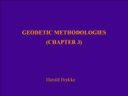
GEODETIC METHODOLOGIES (CHAPTER 3) Harald Brekke Definitions The CLCS follows the IHO (1990) standard abbreviation for a nautical mile, M The CLCS follows the IHB ...
| PowerPoint PPT presentation | free to download

Volcano Deformation Constraints on continued episodic inflation at Long Valley Caldera, based on seismic and geodetic observations (Feng et al.)
| PowerPoint PPT presentation | free to download

Geodesy. Geology. Geodetic datums define size and shape and the origin and ... Through a long history, the 'figure of the Earth' was ...
| PowerPoint PPT presentation | free to view

NOAA/National Geodetic Survey ... quasar structure models (VLBI) ? new subdaily EOP tide model ? better handling of parameter constraints ? modern ...
| PowerPoint PPT presentation | free to download
A computer-based data storage and analysis tool that combines ... Geodetic Control. Boundaries. Surface Waters. Transportation. Land Ownership. Thematic Data ...
| PowerPoint PPT presentation | free to download

Demonstrate the general process of 7 parameter datum transformations ... The Geoid (Mean Sea Level) Local Datum. AGD84 (best fits Australia) Geocentric Datum ...
| PowerPoint PPT presentation | free to view