
Aspects of Severe Weather Forecasting - PowerPoint PPT Presentation
1 / 15
Title:
Aspects of Severe Weather Forecasting
Description:
Idealized setup of synoptic-scale features associated with a classic tornado outbreak ... PROBABILITY OF AN F2 OR STRONGER TORNADO WITHIN 25 MILES OF A POINT ... – PowerPoint PPT presentation
Number of Views:60
Avg rating:3.0/5.0
Title: Aspects of Severe Weather Forecasting
1
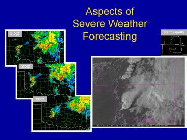
Aspects of Severe Weather Forecasting
Storm reports
2100Z
2200Z
2300Z
2
Convective Storm Forecasting Techniques
- Useful to separate by time range
- 0 to 3 hours in advance (observational trends,
model-based diagnostics, diagnostic imagery,
observed and model soundings)? - 3 hours through 3 days (high res/operational
models, ensembles, model soundings)? - Beyond 3 days (global models, ensembles,
climatology) - Note Forecaster Pattern Recognition can apply at
various time/space scales (synoptic-scale to
storm-scale)?
(CHARLES A. DOSWELL III and DONALD W. BURGESS,
1993)
Idealized setup of synoptic-scale features
associated with a classic tornado outbreak (After
Barnes and Newton, 1983)?
3
T-STORMS REQUIRE SOME COMBINATION OF THESE THREE
INGREDIENTS
- INSTABILITY
- LIFT
- MOISTURE
Instability Tendency for air parcels to move
up or down when displaced from rest
determined by rate of temperature change with
height Lift Mechanism(s) to
initiate, maintain or augment vertical air
motions (updrafts) Moisture Fuel in
the form of the latent heat of condensation (2.5
x 106 J/kg)
- Note Organized severe storms additionally
require sufficient vertical wind shear. - Two-step process (1) potential for
thunderstorms, (2) will they become severe?
(McNulty, 1978)?
4
THE FORECAST PROCESS
- FORECAST DIAGNOSIS TREND (focused on
ingredients based evaluation)? - DIAGNOSIS REQUIRES GOOD ANALYSIS (More on
this later)? - TREND DETERMINED VIA
- 1. Extrapolation
- 2. Spotter Reports (Ground Truthwhat is
actually occurring)? - 3. Climatology
- 4. Forecaster Knowledge
- a. Pattern recognition ( gt Conceptual models,
storm-scale to synoptic-scale)? - b. Ingredient evaluation ( gt Composite
charts) - 5. NWP guidance (both synoptic and mesoscale,
and statistical applications used to enhance
model output, such as MOS and ensemble
techniques)?
THE HUMAN is good at synthesis of information
from many disparate sources, adding value over
strictly objective (model) approaches.
5
CLIMATOLOGY PROVIDES A START
- Most useful when responsible physical
processes are understood - Can provide a useful first guess when
small-scale forcing mechanisms are not known or
are unresolvable
4 MARCH
8 APRIL
PROBABILITY OF AN F2 OR STRONGER TORNADO WITHIN
25 MILES OF A POINT
6 MAY
(From NSSL http//www.nssl.noaa.gov/hazard/)?
6
Numerical Model Guidance
- MODEL OUTPUT INDISPENSIBLE TO FORECASTING
- MODELS ARE AN UNDER-APPRECIATED ACHIEVEMENT OF
MODERN SCIENCE - SUCCESSFUL USE REQUIRES BASIC KNOWLEDGE OF MODEL
- - Finite differencing methods (numerical
approximations - to the real world)
- - Data assimilation techniques (what data go
in how are - they treated - - - more is not necessarily
better!)? - - Parameterization of physical processes
(especially boundary - layer, convective and radiation effects)?
- NUMERICAL MODELS REMAIN IMPERFECT
- - Effects of convection / convective outflow
(cold pools)? - - Boundary layer processes (e.g.,
evapotranspiration - turbulent transfer of moisture / heat /
momentum)? - - Data irregularities in space and time (e.g.,
surface obs - every few minutes raobs only twice daily)?
- - Most hazardous weather features NOT
explicitly forecast
7
Traditional use of NWP GuidanceCOMPOSITE SVR
CHARTS Combine information derived from
observations and numerical guidance with
conceptual models
Emphasis is on juxtaposition of storm
ingredients (indices as proxies), storm limiting
factors (e.g., caps), and their 4-D evolution
L
Storm reports 24-hr period 4-5 May 2003
24-hr composite prog valid 0000Z 5 May 2003
8
Another Traditional Forecast ApproachSevere
Weather Checklists
- Early recognition by Miller and others that a
collection of elements leads to severe weather
episodes - Usually based on convective indices another form
of the composite chart but for a point. - This Cookbook approach may not be applicable to
all events (e.g., low CAPE/high shear)?
9
VERY HIGH RESOLUTION MODELS
- High resolution non-hydrostatic explicit
handling of convection and microphysics (5km or
less horizontal grid spacing)? - These model simulations can tell you something
about the storm type, initiation, and storm
evolution - Caveat see lots of detail, but model may Not
have the details correct.
(Example 31 May 2007)?
10
Ensemble Approach
- Lower-resolution, but allows for many members
and statistical analysis of output, to help
quantify degree of uncertainty - Vary initial conditions (computationally identify
initial uncertainties that result in rapidly
diverging solutions, use as perturbation)? - Vary physics packages
- Model core (grid point versus spectral)
- Cloud Microphysics
- Convective parameterization schemes
- Land surface models / surface fluxes
Drawback Can get buried in the statistics.
Balance high-res and ensemble approach
11
NCEP Short-Range Ensemble (SREF)?
- Used extensively for convective outlooks at SPC
since 2003 - Run 4 times per day (03, 09, 15, 21z) forecasts
out to 87 hrs - 21 members (10 NAM, 5 RSM, 6 WRF)?
- Horizontal resolution varies 32-45 km
- Output mean spread, probability, spaghetti
- Also produced calibrated output based on
verification in recent weeks.
(Weiss et al. 2006)?
12
NUMERICAL GUIDANCE Calibrated ensemble
forecasts
Ensemble forecasts are a set of forecasts all
valid at the same time and made using either (1)
different models and / or (2) the same model with
different initial conditions, parameter settings,
etc.
Ensemble probability of 3-hr precip gt .01 15 hr
fcst, valid period 2100Z 31 Aug to 0000Z 1 Sept
2004
Ensemble mean precip 0.01 (thick dashed)?
13
NUMERICAL GUIDANCE Calibrated ensemble
forecasts
Cloud Physics Thunder Parameter (CPTP) was
developed to refine thunderstorm forecasts based
on more traditional model-generated parameter
fields such as CAPE
Ensemble probability of CPTP gt 1 15 hr fcst,
valid period 2100Z 31 Aug to 0000Z 1 Sept 2004
- Sufficient CAPE in the 0o to -20o C layer -
Lifting condensation level gt -10o C -
Equilibrium level temperature lt -20o C
Ensemble probability of CPTP gt 1 (thick dashed)?
14
NUMERICAL GUIDANCE Calibrated ensemble
forecasts
A composite ensemble forecast of thunderstorm
potential it is the product of the two previous
ensemble forecasts
Ens Prob (Precip gt .01) x Ens Prob (CPTP gt
1)? 15 hr fcst, valid period 2100Z 31 Aug to
0000Z 1 Sept 2004
15
NUMERICAL GUIDANCE Calibrated ensemble
forecasts
Composite model forecast of the previous slide
has been calibrated (i.e., modified)? by
performance of that same parameter in recent
weeks (see Bright et al. 2004)
Calibrated ensemble tstm parameter 15 hr fcst,
valid period 2100Z 31 Aug to 0000Z 1 Sept 2004
Observed lightning strikes (yellow crosses)
Recommended
CrystalGraphics Presentations


