
Free Aerial Imagery PowerPoint PPT Presentations
All Time
Recommended

How Aerial Imagery Can Track Agricultural Change
| PowerPoint PPT presentation | free to view

Industry Insights by Type (Vertical, Low Oblique and High Oblique), by Application (Surveillance and Monitoring, Geospatial, Conservation and Research, Construction and Development, Disaster Management, Exhibition and Entertainment, and Energy and Resource Management), by End User (Government, Civil Engineering and Archaeology, Defense, Energy and Mining, Media and Entertainment, Agriculture and Forestry, and Others)
| PowerPoint PPT presentation | free to download

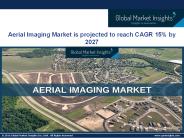
Aerial imagery provides enriched point of vision that further provides amplified vision of larger areas from distant angles that enables witnessing of surface of the earth in an authenticated manner. The global aerial imagery market is anticipated to reach USD 5.2 billion by 2024, at a CAGR of 14.5% during 2018-2024. The capability of aerial imagery in order to provide improved and sudden view of any surface specifically in construction activities for instance for the development of water based and thermal project is expected to bolster the demand for aerial imagery market across the globe. Ability of this technology to enable the business organizations in monitoring and recording surface of the earth that ultimately helps in freezing time and advancing imaging resolutions is ultimately creating huge momentum for the growth of the market.
| PowerPoint PPT presentation | free to download

If you looking for drone aerial surveys in the UK. Check out our drone aerial surveys! We provide high-quality drone surveys for photography, promotional videography, house surveys, etc. Get in touch for a free consultation and contact us today at 01283 542257
| PowerPoint PPT presentation | free to download

Use free MrSID Software Development Toolkit (SDK) to enable existing ... Aerial/Satellite Imagery. Geographic Information Systems. Document Management Systems ...
| PowerPoint PPT presentation | free to download

Available as scanned topographical maps, aerial imagery or site photographs ... External Service Provider: 0839001212 toll free from 083 no.'s ...
| PowerPoint PPT presentation | free to view

Adopting the Principle of Free Exchange of Key Spatial Data Sets within the ... Aerial photographs and satellite Imagery; Department of Land and Surveys ...
| PowerPoint PPT presentation | free to view

Unmanned Aerial Vehicles New Frontiers
| PowerPoint PPT presentation | free to view

Mapping Olive Plantations Using Sentinel-2 MSI Imagery Case Study: Bashiqa City, Iraq
| PowerPoint PPT presentation | free to download

Repeat cycles of 1 to 5 years depending on location and resolution ... Use for farmstead activities (e.g. routing driveways, and locating new feedlots and buildings) ...
| PowerPoint PPT presentation | free to view

Operational fully automated preliminary classification of multispectral satellite imagery
| PowerPoint PPT presentation | free to view

The adoption of aerial imaging has increased in various sectors such as agriculture & forestry, energy & resource management, tourism, research, and media & entertainment among others. In addition, adoption of location-based services (LBS) for navigation & remote monitoring is expected to drive the growth of the aerial imaging market.
| PowerPoint PPT presentation | free to download

Aerial imaging market size is estimated to reach over USD 2.5 billion by 2022. Escalating demand from numerous application sectors such as commercial and forestry & agriculture is anticipated to drive the industry growth over the next few years.
| PowerPoint PPT presentation | free to download

Growing demand in emerging application areas including natural resources management, energy, and disaster prevention is expected to drive the market over the next six years.
| PowerPoint PPT presentation | free to download

Driving New Business Models With Next Generation Satellite and Aerial Information Solutions
| PowerPoint PPT presentation | free to view

... Parks medium resolution data also released as free downloads) Medium-resolution ... Declass imagery are retained as a 7 micron source for future free downloads ...
| PowerPoint PPT presentation | free to view

Get more customers with stunning images of your business on Google Maps with 360 Virtual Business Tours company. Here we create your own immersive Virtual Tours or get Street View-compatible gear to capture imagery yourself. Visit https://360virtualbusinesstours.com/ today and get a free quote.
| PowerPoint PPT presentation | free to download

... were saved as images in PowerPointtm to reduce file size and prevent alterations ... Most Popular Responses to 'Other' for Buy-Up Options ...
| PowerPoint PPT presentation | free to view

Remote sensing of natural hazards Remote sensing = satellite imagery and aerial photography They range from low resolution (weather satellites) to very high res ..
| PowerPoint PPT presentation | free to view

GIS In Maryland Ken Miller ... Howard & Montgomery Use FEMA specification Aerial Imagery Elevation Geodetic Control Boundaries Surface Waters Transportation Land ...
| PowerPoint PPT presentation | free to download

Everything from park boundaries to digital elevation models to crime statistics ... State Highways 1966 Fayetteville Photography. County Roads 1999 Land Cover ...
| PowerPoint PPT presentation | free to view

IKONOS World Imagery Updates Project Scope 50 million sq. km. of imagery Select Best Of 2 million IKONOS scene archive Select - Ortho - Color Balance ...
| PowerPoint PPT presentation | free to download

What is Photogrammetry Photogrammetry is the art and science of making accurate measurements by means of aerial ... (digital images) Aerial photographs were the ...
| PowerPoint PPT presentation | free to download

... News & E-Newsletter (Free publications) Clearinghouse (WALIS agency free data transfer facility) WA Atlas (Online map viewer: 400 datasets, ability to print maps) ...
| PowerPoint PPT presentation | free to download
With the rapid increase in town planning, building infrastructure, energy & mining exploration, the aerial imaging market is predicted to witness notable traction in the coming years. Get sample copy of this research report @ https://www.gminsights.com/request-sample/detail/105
| PowerPoint PPT presentation | free to download

satellite image (digital) MultiSpec software. reference data, maps, aerial photos, etc. ... two images , several years apart (digital) ...
| PowerPoint PPT presentation | free to view

... high quality imagery from a minimum altitude of 3000 feet AGL @ 45 slant-angle Assuming a clear ... Proposed ISR Acquisition Strategy Full and ...
| PowerPoint PPT presentation | free to view

U.S. Census data and maps. Online aerial photography of Northwest Arkansas. GIS software ... 8. Online maps, atlases, and gazetteers: ... Go to: Online maps ...
| PowerPoint PPT presentation | free to view

Aerial Photographs (oblique and vertical) taken with a camera/film/filter ... from photographs including heighting/contouring) 2D plane. 3D world. Height ...
| PowerPoint PPT presentation | free to view

WETLAND EDUCATION WORKSHOP WETMAAP Wetland Education through Maps and Aerial Photography Focusing on the Foster City Redwood City area of San Francisco Bay
| PowerPoint PPT presentation | free to download

Pilot studies for carbon stock determination in shifting cultivation areas ... Forest inventory started long ago, 1950s, with aerial photography in northern Vietnam ...
| PowerPoint PPT presentation | free to view

The formation of a stereo model to simulate the perspectives of the aerial ... orientation, select relative points, removes parallax, and digitize each point ...
| PowerPoint PPT presentation | free to view

The French design has captured the perfect combination of art and functional seating to showcase the spirit and philosophy of a machine-made man. Further enhancing the futuristic ambiance is the clean gloss and metallic finishes available for the different choices.
| PowerPoint PPT presentation | free to download

Environmental Characterization Lake St. Clair Habitat Restoration and Conservation Project ... Based on photo-interpretation of color aerial photography. 54 ...
| PowerPoint PPT presentation | free to view

Air/Ship Integration. Aircraft Launch & Recovery Technology ... Air-to-Ground. Airframe. Cruise Missiles. Energetics. Free Fall Bombs. Guidance & Control ...
| PowerPoint PPT presentation | free to view

To find quality websites to support student and staff needs ... White pages. Can email articles. Bartleby.com. Fun site. Free. Good Site for English Teachers ...
| PowerPoint PPT presentation | free to view

... Educator's Supplement, a Resource Guide, study site ... WETLAND EDUCATION WORKSHOP. WETMAAP. Wetland Education through Maps and Aerial Photography ...
| PowerPoint PPT presentation | free to download

As part of the code of practice for aerial application, NZCPA was contracted by ... GALILEO is Europe's answer to the American and Russian systems and is set to ...
| PowerPoint PPT presentation | free to view
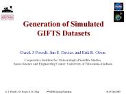
2 x 3 GIFTS cubes aerial coverage. Highly complex wind and moisture fields ... 3 by 3 array of cubes. 850 1/cm (window region) D. J. Posselt, J. E. Davies, E. R. Olson ...
| PowerPoint PPT presentation | free to download

ids System Requirements ... ids is designed for desktop and laptop PCs ... 32 megabytes of physical RAM. 10 megabytes of free hard disk space. 4x CD-ROM drive ...
| PowerPoint PPT presentation | free to view

The Digital Chart of the World (DCW) was completed in 1992 ... The province was digitally mapped at 1:20,000 from aerial photos taken in 1980s; completed 1996 ...
| PowerPoint PPT presentation | free to view

Heavy investment in R&D activities related to drone technology have fueled the use of innovative tools for the development of commercial drones. In addition, increase in demand for GIS (geographic information system), LiDAR (Light Detection and Ranging), aerial & mapping services across various industries is expected to boost the adoption of commercial drones. In addition, increased demand for aerial imaging market in developing economies and rapid penetration of high definition cameras present lucrative opportunities to the commercial drone market. The global Commercial Drones market was valued at $2,145 million in 2015, and is projected to reach $10,738 million by 2022, growing at a CAGR of 26.2% from 2016 to 2022. Download Sample PDF Copy@ https://www.alliedmarketresearch.com/request-sample/974
| PowerPoint PPT presentation | free to download

The evolution of aerial imaging has resulted in the development of optical and ... UMBC instrument was flown on a Twin Otter to collect test data over a variety of ...
| PowerPoint PPT presentation | free to view
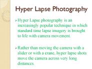
Hyper lapse photography is a technique for time lapse photography in which the location of the camera is changed along with its zoom levels. This results in smooth moving time lapse photography. But the process is very careful and time consuming effect in photography. Brandsten Media in Melbourne offers exciting packages for hyper lapse photography along with having loads of experience. Also their work is mostly done in Ultra HD 4k video which is 4x resolution of HD along with 12 megapixels of photography quality and giving you the most risk free and fastest turnaround.
| PowerPoint PPT presentation | free to download

'We' may change, suspend or discontinue all or any aspect of the Service, ... We have the largest, highest resolution, seamless, off-the-shelf coverage of ...
| PowerPoint PPT presentation | free to view

Geospatial Data for Puerto Rico, Alaska, Hawaii and the Pacific Basin
| PowerPoint PPT presentation | free to download

The World On Our Desktops
| PowerPoint PPT presentation | free to view

Advanced Mapping with Digital Sensors
| PowerPoint PPT presentation | free to view
CENTENNIAL COLLEGE SCHOOL OF ENGINEERING & APPLIED SCIENCE VS 361 Introduction to GIS DATA CAPTURE/COLLECTION METHODS COURSE NOTES Getting the Map into the Computer
| PowerPoint PPT presentation | free to download

Title: No Slide Title Author: jws Last modified by: Kevin Howald Created Date: 7/8/1998 4:12:15 PM Document presentation format: On-screen Show Other titles
| PowerPoint PPT presentation | free to download

Introduction to Geographic Information Systems GIS for UCCE
| PowerPoint PPT presentation | free to view
Remote Sensing Applications
| PowerPoint PPT presentation | free to download

Remote Sensing Platforms
| PowerPoint PPT presentation | free to download

Medium Format Digital Cameras: Standards and Specifications for Calibration and Stability Analysis A. F. Habib Digital Photogrammetry Research Group
| PowerPoint PPT presentation | free to download

... remote locations for NASA s Earth sciences research, Goddard Space Flight Center contributed to the development of microservers (wireless sensor network ...
| PowerPoint PPT presentation | free to download

Market Size – USD 52.87 Billion in 2021, Market Growth – at a CAGR of 5.1%, Market Trends – Increasing integration of Geographic Information System software in agriculture
| PowerPoint PPT presentation | free to download