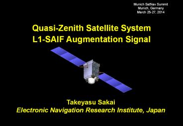
Quasi-Zenith Satellite System L1-SAIF Augmentation Signal PowerPoint PPT Presentation
1 / 16
Title: Quasi-Zenith Satellite System L1-SAIF Augmentation Signal
1
Munich SatNav Summit Munich, Germany March 25-27,
2014
Quasi-Zenith Satellite System L1-SAIF
Augmentation Signal
Takeyasu Sakai Electronic Navigation Research
Institute, Japan
2
Introduction
- QZSS (Quasi-Zenith Satellite System) program
- Regional navigation service broadcast from
high-elevation angle by three or more satellites
on the inclined geosynchronous (quasi-zenith)
orbit and GEO - Broadcast GPS-like supplemental signals on three
frequencies and two augmentation signals, L1-SAIF
and LEX - The first QZS satellite successfully launched on
Sept. 11, 2010. - L1-SAIF (Submeter-class Augmentation with
Integrity Function) signal offers - Sub-meter accuracy wide-area differential
correction service - Integrity function for safety of mobile users
and - Ranging function for position availability all
on L1 single frequency. - ENRI has developed L1-SAIF signal and
experimental facility - Signal design SBAS-like signal and message on L1
frequency - Implemented L1-SAIF Master Station (L1SMS) which
generates augmentation message stream in realtime
and transmits it to the QZSS MCS - Conducted experiments of L1-SAIF successfully.
3
QZSS Concept
- Broadcast signal from high elevation angle
- Applicable to navigation services for mountain
area and urban canyon - Augmentation signal from the zenith could help
users to acquire other GPS satellites at any time.
- Footprint of QZSS orbit
- Centered at 135E
- Eccentricity 0.075, Inclination 43deg.
4
Space Segment QZS-1
Mass 4,020kg (wet) 1,802kg (dry) (NAV Payload320kg)
Power Approx. 5.3 kW (EOL) (NAV Payload Approx. 1.9kW)
Design Life 10 years
5
Broadcast Ranging Signals
Supplemental Signals
- Supplemental Signals by JAXA
- GPS-like L1C/A, L2C, L5, and L1C signals (PRN
193) working with GPS - Improves availability of navigation
- Minimum modifications from GPS signals.
QZS satellites
- L1-SAIF by ENRI
- SBAS-like C/A code (PRN 183) signal on L1 freq.
Reasonable performance for mobile users - Augmentation to GPS Potentially plus GLONASS and
Galileo.
- LEX by JAXA
- For carrier-based experimental purposes
- Original CPSK signal on E6 frequency
- Member organizations may use LEX as 2kbps
experimental data channel.
Augmentation Signals
6
L1-SAIF Signal
L1-SAIF Signal
- SBAS-like augmentation signal Differences are
PRN code (183 for L1-SAIF) and Doppler only - Three functions by a single signal ranging,
error correction (Target accuracy 1m), and
integrity - User receivers can receive both GPS and L1-SAIF
signals with a single antenna and RF front-end - See IS-QZSS for detail (Available at JAXA HP).
User GPS Receivers
SAIF Submeter-class Augmentation with Integrity
Function
7
ENRI L1-SAIF Master Station
- L1-SAIF Master Station (L1SMS)
- Generates L1-SAIF message stream in realtime and
transmits it to QZSS MCS developed by and
installed at JAXA - Installed at ENRI, Tokyo 90km from JAXA Tsukuba
Space Center - Dual frequency GPS measurements at some locations
in Japan necessary to generate L1-SAIF messages
are sent from GEONET in realtime.
8
L1-SAIF Performance
GPS Only Result
6 reference stations
User location for this test
L1-SAIF expe- rimental area
- Example of user position error at Site 940058
(Takayama) - Realtime operation with MSAS-like 6 reference
stations in Japan - Period 19-23 Jan. 2008 (5 days).
Note Results shown here were obtained with
geodetic-grade antenna and receivers at open sky
condition.
9
Experiment by Car
- L1-SAIF experiment
- L1-SAIF is originally planned as an augmentation
to mobile users with a certain velocity - Experiment with a car
- Location urban/suburban environment, freeway
- Experiment period Dec. 2010 to March 2011.
- Experiment setup
- Reference GPSIMU sensor
- Post-processing with GEONET stations (20- 30 km
separation) for accurate reference - GPS/L1-SAIF receiver and PC in cabin
- Receives L1-SAIF signal on PRN 183
- Applies L1-SAIF corrections in realtime and
outputs position fix.
GPSIMU
GPS/L1-SAIF Rx
10
On the Freeway
Plan View of the Route
Typical Situation
- On Dec. 14, 2010 QZS near the Zenith
- About 10 km drive at the Kofu Basin on Chuo
Freeway going westward from Tokyo - Plain ground with less bridges across the Freeway.
11
Freeway GPS No Augmentation
Chuo Freeway GPS without Augmentation
Horizontal Position Error, m
1.2m
UTC Time 12208 to 13708
15min
12
Freeway L1-SAIF Augmented
Chuo Freeway L1-SAIF Augmentation
Horizontal Position Error, m
0.5m
UTC Time 12208 to 13708
15min
13
In Tsukuba City
Plan View of the Route
Typical Situation
- On Dec. 16, 2010 QZS near the Zenith
- About 6 km drive in West part of Tsukuba City in
Ibaraki Pref. - Road on the ground level with less tall buildings
around.
14
Tsukuba GPS No Augmentation
Tsukuba GPS without Augmentation
Horizontal Position Error, m
2.0m
UTC Time 53001 to 54501
15min
15
Tsukuba L1-SAIF Augmented
Tsukuba L1-SAIF Augmentation
Horizontal Position Error, m
0.6m
UTC Time 53001 to 54501
15min
16
Conclusion
- ENRI has developed QZSS L1-SAIF signal
- Signal design SBAS-like C/A code signal (PRN
183) on L1 frequency - Planned as an augmentation to mobile users
- Implemented L1-SAIF Master Station (L1SMS) which
generates augmentation message stream in realtime
and transmit it to QZSS MCS. - QZSS satellite Michibiki
- The first satellite for QZSS, Michibiki, was
successfully launched in 2010 - Continuously broadcasting navigation signals just
as planned. - L1-SAIF Experiments
- ENRI has conducted L1-SAIF experiments
successfully and confirmed submeter-class
accuracy as originally planned - Currently investigations are in progress on usage
of Multi-GNSS with GLONASS, dual frequency
augmentation, and application in short message
service - Information is available at http//www.enri.go.jp
/sat/qzss_e.htm

