
Remote Sensing PowerPoint PPT Presentation
Title: Remote Sensing
1
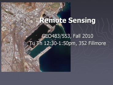
- Remote Sensing
- GEO483/553, Fall 2010
- Tu Th 1230-150pm, 352 Fillmore
2
- Instructor
- Ling Bian, 120 Wilkeson
- Office Hours
- Tu Th 2-3pm or by appts
3
- TA Steve Tulowiecki
- Labs
- Tu 630-750pm Wilkeson 145
- Th 500-620am Wilkeson 145
- No lab in the first week
- No lab in the first week
- No lab in the first week
4
- Access to
- Wilkeson
- GIAL
- computer account
- printing account
- See Joe if there are still problems
5
Purpose
- This course is designed to introduce principles
and applications of remote sensing, and basic
techniques of digital image processing. Remote
sensing technology is essential for modern
spatial analysis in order to identify features
and phenomena at the surface of the Earth. Remote
sensing has been used for research and
applications in a wide range of disciplines such
as geography, archaeology, engineering, geology,
urban studies, forestry, agriculture, and
homeland security. The course should benefit
students who are interested in pursuing a career
in any of these disciplines.
6
- This course has a lecture component and a lab
component. Both components are presented at an
introductory level. The lecture will cover basic
principles and applications of remote sensing.
These include the basic laws of energy, the
interaction between the energy and Earth surface,
remotely sensed data and the major sensor
systems, basic techniques for image enhancement
and image classification, classification accuracy
assessment, and applications of remote sensing.
7
Labs
- A series of laboratory exercises will help
students understand the lecture materials and
gain hands-on experience in digital image
processing. ENVI will be used as the primary
software. Digital images of various spatial,
spectral, and geographic characteristics will be
used for the lab exercises. These images include
Thematic Mapper (TM), Multispectral Scanner
(MSS), SPOT, MODIS, IKNOS, and digital aerial
photographs. The labs are designed to familiarize
students with the following techniques basic
understanding of ENVI, remotely sensed imageries
and satellite systems, data access through web
sites, image rectification, image enhancement,
image classification, and accuracy assessment.
8
Annotated Bibliography
- Each graduate student is expected to review 10
remote sensing application articles and to
develop an annotated bibliography for each
article. The 10 articles should be from refereed
journals. At the end of the semester, each
graduate student is expected to present a summary
of the bibliography to the class, and submit a
written summary.
9
Annotated Bibliography ..
- The 10 articles should cover one topic of
student's interest. The bibliography should
briefly describe (1) the reference of the
article, (2) the purpose of the study, (3) the
data used for the study, and (4) the image
process methods used for the study. The weekly
bibliography is due on Thursdays.
10
Annotated Bibliography ..
- The weekly bibliography should be typed in less
than one double-spaced page. Each bibliography
will be given a maximum of 10 points. The
bibliographies account for 10 of the total grade
for graduate students. The written summary counts
another 10.
11
A Sample Reference
- Cowen, D.J., 1988. GIS versus CAD versus DBMS
What are the differences? Photogrammetric
Engineering and Remote Sensing, 54(11)
1551-1555.
12
Recommended Journals
- Photogrammetric Engineering and Remote Sensing
- Remote Sensing of Environment
- International Journal of Remote Sensing
- ISPRS Journal of Photogrammetry and Remote
Sensing - GeoCarto International
- ASPRS/ACSM Annual Meeting and Convention
13
Prerequisite
- The course is open to graduate students or
senior undergraduate students. Basic algebra is
required to help understand the principles of
remote sensing. Basic statistics are preferred.
14
Text
- Lillesand T.M. and R.W. Kiefer, 2008, 6th ed.
Remote Sensing and Image Interpretation. John
Wiley Sons, Inc., New York. - Additional Readings
- Jensen, J.R., 2005. 3rd ed. Introductory Digital
Image Processing, A Remote Sensing Perspective.
Prentice Hall, New Jersey. - Campbell, J.B., 2007. 4th ed. Introduction to
Remote Sensing. The Guilford Press, New York.
15
Grading System
-
Undergraduate Graduate - Mid-term exam 30 25
- Final exam 30 25
- Lab exercises 40 30
- Bibliography 10
- Summery 10
- Total 100 100
- You will earn two identical grades for the
lecture and the lab - The exams will be mostly based on lectures
16
Grad cut-off
- A 93.33-100.0
- A- 90.00-93.32
- B 86.67-89.99
- B 83.33-86.66
- B- 80.00-83.32
- C 76.67-79.99
- C 73.33-76.66
- C- 70.00-73.32
- D 66.67-69.99
- D 60.00-66.66
- F lt60
17
Tentative Schedule
- I. Principles of remote sensing
- 8/30 Introduction
- 9/ 1 Energy sources, radiation
principles - 9/ 6 Energy interactions with earth
systems - 9/ 8 Aerial photo interpretation (1st
bibliography due) - 9/13 Satellite remote sensing
- 9/15 Lansat systems
- 9/20 Spot and other moderate resolution
systems - 9/22 Image rectification
18
Tentative Schedule (2)
- II. Image Processing
- 9/27 High resolution and Met satellite
system - 10/ 4 Image enhancement
- 10/ 6 Image enhancement
- 10/11 Supervised classification
- 10/13 Un-supervised classification
- 10/18 Image classification systems
- 10/20 Mid-Term Exam
- 10/ 25 Accuracy assessment
19
Tentative Schedule (3)
- III. Other Sensor Systems
- 10/27 Aerialphoto geometry
- 11/ 1 Thermal remote sensing
- 11/ 3 Microwave remote sensing
- 11/ 8 Microwave remote sensing
- 11/10 Guest speaker
- 11/15 Advanced topics
- 11/17 Advanced topics
- 11/22,29, 12/1,6 Presentations (last bibli
due) - 12/ 8 Conclusions (graduate students summary
due) - Final Exam Dec 15 Thur, 1145am-245pm, 352
Fillmore
20
Plagiarism
- What is plagiarism and how to avoid
ithttp//ublib.buffalo.edu/libraries/asl/guides/
plagiarism.htmlhttp//www.guardian.co.uk/world/20
11/mar/01/german-defence-minister-resigns-plagiari
sm
21
Expectations
- Job oriented
- Research oriented
Recommended
