
The Geography of Africa PowerPoint PPT Presentation
1 / 33
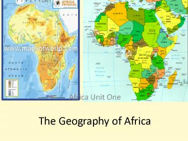
Title: The Geography of Africa
1
The Geography of Africa
- Africa Unit One
2
Section 1-African Geography
- Geography is the study of the earths
surface, land, bodies of water, climate,
peoples, and natural resources. - Africa is the worlds second largest
continent. - It is home to 52 countries, 1,000 different
languages, and 800 million people. - The one thing that all African nations have in
common is their reliance on the lands physical
characteristics, which affect where people live
and the type of work they do. - The continent can be broken into many different
regions the Sahara, the Sahel, the savannahs,
the rainforests, the Ethiopian Highlands, and
Southern Africa.
3
(No Transcript)
4
Africas Size
4 6 0 0 M I L E S
5000 MILES
- Second largest continent ? 11,700,000 sq. mi.
- 10 of the worlds population.
- 2 ½ times the size of the U. S.
5
- The Sahara
- The Sahara is the worlds largest desert.
- Deserts are areas that typically get only fewer
than 10 inches of rain a year. - The Sahara Desert is covered with sand dunes,
rolling rocky hills, and wide stretches of gravel
that go on for - miles and miles
- The Sahara divides the
- continent into two regions
- North Africa and
- sub-Saharan Africa
6
- The Sahara covers an area the size of the United
States. - Very few people are able to live there.
- In the few places where there is water, an oasis
(a small place where trees are able to grow and
where people can live with grazing animals and a
few crops) can be found. - Such places are rare in the Sahara Desert.
- Many consider the Sahara
- one of the most difficult
- places to live on earth.
- The Atlas Mountains act as a
- barrier between the desert, the
Mediterranean Sea, and the
Atlantic Ocean.
7
People of the Sahara
- Most of the people who live in the Sahara
today are nomads. - They move from place to place, usually traveling
by camel, looking for water or food. - Nomadic tribes often trade with each other as
they try to fill the needs of their group. - These desert nomads were the ones who led the
caravan trade across the Sahara in the years
before airplanes and desert vehicles were
available. - Hundreds of years ago, gold and salt came across
the Sahara on the backs of camels from central
Africa to markets along the Mediterranean coast.
8
- Trade goods from the coast then made the return
journey. - Even today, there are parts of the Sahara that
are virtually impossible to get across without a
camel. - Some of the nomadic tribes who live in the Sahara
have been there for centuries. - Today many of these tribes are finding it
difficult to make a living in traditional ways,
and many have settled down to live in small
villages - and towns where they
- can find steady work.
9
What can grow in the Sahara?
- Despite its harsh environment, the Sahara is home
to a number of plants that can tolerate desert
conditions. - Those areas that do get a little rainfall or that
have access to underground water often have
grasses and shrubs as well as
palm trees, olive trees, and cypress.
10
The Sahel
- The Sahel is a strip of dry grassland south of
the Sahara. - The Sahels climate is semiarid, meaning
that it gets more rainfall than the - desert but still receives very little.
- At one time, enough rain fell in the Sahel to
raise crops. - Because it depends on farming, the Sahel region
can be devastated by bad weather. - In the 1970s, the area suffered a drought.
- Almost 200,000 people died from starvation.
- The famine prompted many people to give up
farming and move to the cities.
11
- However, the regions cities are too poor to
accommodate the population increase. - Many people continue to live without electricity,
running water, or proper sewers.
- The desert gradually took over the farmland the
people left behind. - Desertification is the process of once fertile
farmland turning into desert. - Desertification reduces the amount of crops that
can be grown, increases starvation, and maintains
poverty.
12
In the Sahel, Overgrazing Desertification
13
- The word Sahel means border or margin, and
this is the region that borders the Sahara. - It is a region between the desert to the north
and the grasslands and rainforest to the south. - The Sahel is relatively flat with few mountains
and hills. - While there is more rain than in the Sahara
desert, rainfall in the Sahel varies from year to
year, ranging from 6-20 inches. - Vegetation is sparse in the
- Sahel, and grasses and
- shrubs are unevenly
- distributed.
14
People in the Sahel
- A majority of the people living in the
- Sahel follow traditional ways of making
- a living, herding animals and
- living semi-nomadic lives.
- They move when water and grass run out for their
animals. - Others practice subsistence farming, meaning they
grow just enough food for their families. - Some grown peanuts and millet to sell in the
market places, but undependable rain makes
farming difficult. - Many of the countries in the Sahel have rapidly
growing populations. - This is a problem since food and water are often
scarce.
15
The Savanna
- Closer to the equator, the climate becomes
hot and features both rainy and dry
seasons. - Savannas cover the regions just
- north and south of the
rainforests that lie along the
equator. - Savannas are hot, dry grasslands.
- In a savanna, the grass it tall and thick.
- Trees are short and scattered.
16
- The most famous savanna is the Serengeti, a
migration areas for 1.5 million animals like
buffalo, gazelles, and zebras. - The Serengeti includes parts of Kenya, where
people rely on the land for their livelihood. - About one-third of the country is grazing land
for cattle, goats, and sheep.
- Many Kenyans make a living growing coffee and
tea, which are the countrys major exports. - Many of the wild animals associated with Africa
live in the savannas. - Although the soil is rich, farming is the
savannas is limited because of disease carrying
insects.
17
- Usually there is not enough water to sustain
trees and forests. - Grasses and grains like wheat, oats and sorghum
grow in the region, too. - The African savanna is the largest in the world.
- It covers almost half of Africa.
- When the summer rains come, the savanna is green
and the grass is thick. - During the winter dry season, the grasses turns
brown and grass fires occur. - These fires are part of the natural cycle of life
in the savanna.
18
People in the savanna
- The biggest threat to the African savanna is the
increasing number of people. - The increasing population in Africa has put
pressure on people to open more land for farming
and ranching. - Every year, more savanna grassland is fenced in
and plowed for crops. - Expanding farmlands mean less land for the
animals. - Some countries, like Kenya and Tanzania, are
working to set aside large areas of the savanna
as national parks and game preserves. - The savanna regions of Africa have faced pressure
from the growth of towns and cities and the need
for highways to connect urban areas. - As roads are built through isolated savanna
wilderness, natural animal habitats disappear.
19
African Rain Forest
- Annual rainfall of up to 17 ft.
- Rapid decomposition (very humid).
- Covers 37 countries.
- 15 of the land surface of Africa.
20
Rainforest
- Along the equator lies the Congo Basin, home to
the worlds second largest tropical rainforest
(the Amazon is the largest).
- A rainforest, is a dense evergreen forest with an
annual rainfall of at least 60 inches. - In the Congo, trees are so thick and tall that
sunlight never reaches the forest floor. - Unfortunately, the rainforest has shrunk
substantially because of deforestation and
destructive farming practices.
21
- Rainforests are found in parts of the world that
are warm and humid and usually in an area near
the earths equator. - Part of the rainforest is in Ghana, an
agricultural and mining nation. - Ghanas most profitable crop is cocoa.
- It also has a long history as a gold and diamond
exporter. - Poorly maintained roads make
- transportation difficult in Ghana,
- which has slowed the growth of the
timber industry.
22
The people of the rainforest
- For most of Africas history, the rainforests
have been home to small groups of people who
lived by gathering food from the forest or living
on small subsistence farms. - They lived simple lives that had little impact
on their environments. - In the 1800s, that changed when European nations
discovered the riches in the rainforests. - Land was cleared for great plantations, including
those that harvested rubber for Europes
industrial revolution. - Thousands of the people who had lived in
- the rainforests were forced to work on
- these plantations and their traditional
ways of life began to disappear.
23
Rainforest today
- Today, the rainforests continue to be destroyed,
but now the cause is commercial logging. - This destruction of the rainforest is called
deforestation. - Timber cutting businesses also need roads and
heavy equipment to get the trees they cut to
cities. - These roads destroy more of the natural
environment. - Deforestation leads to the extinction of species
of both plants and animals. - Extinction means that those species no longer
exist anywhere in the world. - Destruction of the forests contributes to soil
erosion and desertification.
24
The African Plateau
25
Great Rift Valley
- In East Africa, Earths
- crust is slowly being
- pulled apart. This
- causes hills, long lakes,
- and wide rift valleys
- to form.
- The area where it is
- being pulled apart in
- Africa is called the
- Great Rift Valley
26
Great Rift Valley
- The Great Rift Valley
- starts in the Middle East
- (Syria) and continues
- south all the way to
- Mozambique.
- In some places along the
- rift valley, there are cliffs
- that are several
- thousand feet high.
27
ESCARPMENTS
A long steep slope or cliff at the edge of a
plateau or ridge
28
Along the Great Rift Valley
- Due to the earth pulling apart at the Rift
Valley, there are lots of long, narrow lakes and
rivers that have formed in this area.
29
- Lake Victoria (bordered by Uganda, Kenya, and
Tanzania) is the largest. - Lake Tanganyika (located between the DR Congo and
Tanzania) is the deepest. - The Congo River is the second longest river in
Africa.
30
Atlas Mountains
- This mountain range separates the temperate
coastal areas of Morocco, Algeria, Tunisia from
the harsh Sahara Desert.
31
Lake Victoria
- It is the largest lake in Africa and the
second largest freshwater lake in the
world (only Lake Superior is bigger). - It extends into three countries Tanzania,
Uganda, and Kenya. - Lake Victoria is very important to Tanzania.
- It provides a living for many fishermen and
attracts millions of tourists each year.
32
- The Drakensberg Mountains stretch across
Southern Africa. - They are home to many game reserves and
national parks. - Another notable feature of the region is the
Kalahari Desert. - Thanks to underground water supplies, grass,
shrubs, and a number of wild animals manage to
live in the Kalahari Desert
33
Egypt
- Egypt is connected to Asia by the
Sinai Peninsula, which makes - it an important trade center.
- One of the most populous areas of
- the Sahara region is Cairo, Egypt.
- The Suez Canal allows transport
- through the peninsula.
- The Nile River, which is the worlds
- longest river, provides another
- important waterway for transporting
people and goods, - It also provides a source of irrigation
for agriculture.
Recommended
