
Presented by Joseph K. Berry PowerPoint PPT Presentation
Title: Presented by Joseph K. Berry
1
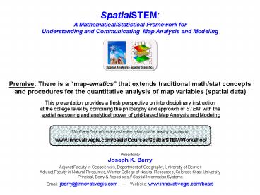
Premise There is a map-ematics that extends
traditional math/stat concepts and procedures
for the quantitative analysis of map variables
(spatial data)
Premise There is a map-ematics that extends
traditional math/stat concepts and procedures
for the quantitative analysis of map variables
(spatial data)
This presentation provides a fresh perspective on
interdisciplinary instruction at the college
level by combining the philosophy and approach of
STEM with the spatial reasoning and analytical
power of grid-based Map Analysis and Modeling
This PowerPoint with notes and online links to
further reading is posted at
www.innovativegis.com/basis/Courses/SpatialSTEM/Wo
rkshop/
Presented byJoseph K. Berry Adjunct Faculty in
Geosciences, Department of Geography, University
of Denver Adjunct Faculty in Natural Resources,
Warner College of Natural Resources, Colorado
State UniversityPrincipal, Berry Associates //
Spatial Information Systems Email
jberry_at_innovativegis.com Website
www.innovativegis.com/basis
2
(Nanotechnology) Geotechnology
(Biotechnology)
Geotechnology is one of the three "mega
technologies" for the 21st century and promises
to forever change how we conceptualize, utilize
and visualize spatial relationships in
scientific research and commercial applications
(U.S. Department of Labor)
Computer Mapping (70s) Spatial Database
Management (80s)
Map Analysis (90s) Multimedia Mapping (00s)
is Where What
Why So What and What If
(Berry)
3
A Mathematical Structure for Map Analysis/Modeling
Geotechnology ? RS GIS GPS
Geo-registered Analysis Frame
? Matrix of Numbers
4
Spatial Analysis Operations (Geographic Context)
Spatial Analysis extends the basic set of
discrete map features (points, lines and
polygons) to map surfaces that represent
continuous geographic space as a set of
contiguous grid cells (matrix), thereby providing
a Mathematical Framework for map analysis and
modeling of the Contextual Spatial
Relationships within and among grid map layers
(Berry)
5
Spatial Analysis Operations (Math Examples)
Dzxy Elevation
? Districts_Average Elevation
S_area cellsize / cos(Dzxy Elevation)
(Berry)
6
Spatial Analysis Operations (Distance Examples)
Truck 18.8 min ATV 14.8 min
Hiking 62.4 min
(Berry)
7
Spatial Statistics Operations (Numeric Context)
Spatial Statistics seeks to map the variation in
a data set instead of focusing on a single
typical response (central tendency), thereby
providing a Statistical Framework for map
analysis and modeling of the Numerical Spatial
Relationships within and among grid map layers
(Berry)
8
Spatial Statistics (Linking Data Space with
Geographic Space)
(Berry)
9
Spatial Statistics Operations (Data Mining
Examples)
Advanced Classification (Clustering)
Advanced Classification (Clustering)
Map Comparison (Statistical Tests)
T-statistic Map
Predictive Statistics (Correlation)
Predictive Statistics (Correlation)
(Berry)
10
PowerPoint and Online Book Chapter on SpatialSTEM
Part 3) Spatial Statistics (numerical
relationships)
Further Reading Making a Case for SpatialSTEM
a 15-page white paper describing a framework for
grid-based map analysis and modeling concepts
and procedures http//www.innovativegis.com/basi
s/Papers/Other/SpatialSTEM/SpatialSTEM_case.pdf S
patialSTEM Extending Traditional Mathematics and
Statistics to Grid-based Map Analysis and
Modeling white paper describing an innovative
approach for teaching map analysis and modeling
fundamentals within a mathematical/statistical
context http//www.innovativegis.com/basis/Paper
s/Other/SpatialSTEM/SpatialSTEM_extendedcase.pdf
Further SpatialSTEM Readings a comprehensive
appendix to the SpatialSTEM extended readings
with URL links to over 125 additional readings on
the grid-based map analysis/modeling concepts,
terminology, considerations and procedures
described in the papers on SpatialSTEM
http//www.innovativegis.com/Basis/Courses/Spatial
STEM/sSTEMreading.pdf
Part 4) Future Directions
Recommended
