
GIS for Health PowerPoint PPT Presentation
1 / 19
Title: GIS for Health
1
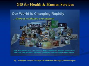
GIS for Health Human Services
By, Sandipan Das ( GIS Analyst )
Sushant Khursange (GIS Developer)
2
What is GIS
- GIS is a computer system capable of assembling,
storing, manipulating, and displaying data
referenced by geographic coordinates - Global positioning systems (GPS) and
geostatistics, are available to use in connection
with GIS
3
GIS Related Technologies Remote Sensing
- Remote Sensing is the science of acquiring
information about the Earths surface without
actually being in contact with it.
4
GIS Related TechnologiesGlobal Positioning
System(GPS)
- GPS receivers determine location and are among
the most important tools for spatially
referencing data.
5
Public Health
- GIS is becoming a vital tool for scientists and
public health officials investigating the cause
and spread of deadly diseases around the world - Outbreaks of infectious diseases can be quickly
analyzed using GIS tools
6
GIS Integrates Data
- The data below can integrate with other data
you provide to help better understand the
geographic landscape and address your challenges.
- Market Data Births, Death, Disease, Population
Demographics - Infrastructure Buildings, Roads, Floor Plans,
Nursing Units - Facilities Hospitals, Physician Offices, Retail
Health Outlets, Employer Locations - Administrative Boundaries Service Regions,
Referral Areas, Planning Areas, Zip, Census - Environmental Topographic, Bio-Hazards, Toxic
Sites, Infectious Disease, Air and Water Quality
Testing Sites
7
Role of GIS
- Monitor, display, and analyze situations.
- Develop early warning systems
- Plan and monitor response programs
- Communicate to decision makers and the public
- Improve response times and lead to better
decisions.
8
GIS Applications in Epidemiology
- Distribution of diseases across States,
Districts, Cities Villages - Vaccine Trials results
- Identifying Health care resources,
- Monitoring Immunization Schedule.
- Monitoring data Collection at surveillance sites.
- Monitoring Cases Deaths
- Monitoring Male/Female affected
- Monitoring child/adult affected.
- Monitoring the distribution of serotypes of any
virus. - Monitoring the distribution of vectors of any
virus.
9
Distribution Of Diseases
- GIS and RS is used to evaluate and model the
Geographical distribution and pattern of disease
10
Monitoring Cases Deaths
- Display geographical prevalence and incidence.
- Identifying High-risk areas using GIS and remote
sensing technologies that would otherwise be
difficult to detect using traditional methods
11
Monitoring data Collection at surveillance sites
- Disease surveillance and tracking systems help in
early detection of health threats - Disease surveillance and reporting in a Web-based
environment
12
Monitoring Immunization Schedule
- Identify gaps in immunizations
- Evaluating Immunization Efficiency
13
Monitoring the distribution of vectors of any
virus
- Many Diseases are transmitted by various vectors
like Mosquito etc. - By tracking the Vectors of diseases and the
movement of contagions, the populations at risk
can be identified.
14
Monitoring the distribution of serotypes of any
virus.
- Identifying the distribution of different
Serotypes occurring in a region.
15
Monitoring child affected
- Thematic maps can be generated to denote the
intensity of disease.
16
Monitoring Vaccine development
- Evaluate performance of immunization services
- Vaccine wise performance
- Vaccination Coverage
17
How it will be useful?
- Monitor the epidemiology of any disease.
- Develop control strategies
- Vaccine development Trials
- Develop monitor effective surveillance sites.
- Planning and implementation of Control Programme
- Tracking epidemic in the country
- Effective management of cases.
18
Technology Used
- Web Programming
- 1. ASP .Net2. C .Net3. Mysql4. AJAX
- GIS software
- 1. ArcGIS 9.1
19
Conclusion
- If there is online GIS service for mapping
sharing Disease Information it can support public
education, disease surveillance, health care
planning, emergency coordination, spatial
epidemiology, vaccine distribution, and policy
initiatives at different administrative levels. - It's important to develop disease Information
systems that can be monitored and assessed
rapidly, enabling the implementation of effective
prevention and control measures.
Recommended
