
The Grand Canyon PowerPoint PPT Presentation
1 / 20
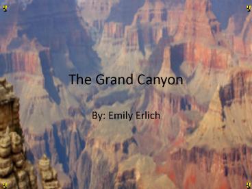
Title: The Grand Canyon
1
The Grand Canyon
- By Emily Erlich
2
Research Topics! (Home)
Resources page
When and why was it created?
What environmental issues are affecting your park?
US map
How is the land in the park currently changing?
Special Features
What type of rocks can be found?
Or just click through the slides
Click a button, any button!
How was it formed?
Bibliography
Topographic Map
How is technology used?
3
Resources page
http//www.nps.gov/grca/photosmultimedia/rangermin
ute.htm
This page has ALL of the resources on it!
http//www.bobspixels.com/kaibab.org//geology/gc_l
ayer.htmkl
http//www.ohranger.com/grand-canyon/preserving-pa
rk
4
How was it formed?
The Grand Canyon was formed by erosion. Over
millions of years, the Grand Canyon was formed.
With the help of rain and a few other sources,
the Colorado River eroded the land to form the
Grand Canyon.
MUCH more info.
Thats so cool!!!
5
More info on how it was formed
- It began when, large rocks were compressed and
broken down under a lot of heat and pressure.
Then, hot magma got in the cracks and cooled.
Over time, things like limestone, sandstone,
ancient oceans, and ancient desserts piled on top
of those rocks. Then, the North American plate
and the Pacific plate collided, pushing the land
up 7,000 feet high, to form the Colorado plateau.
Finally, the Colorado River streams through the
land, weathering and eroding the walls to form
the Grand Canyon.
6
Special Features
- Some special landforms in the Grand Canyon are
the Colorado River and the Colorado Plateau.
Look! The Colorado River
Look! The Colorado Plateau!
7
The Colorado River
The Colorado River is constantly running around
242,000 square miles of land. It runs in the
states of Wyoming, Colorado, Utah, New Mexico,
Arizona, Nevada and California. The headwaters of
the Colorado River are in Rocky Mountain National
Park in Colorado. There, the altitude is 9,010
feet.
8
The Colorado Plateau
The Colorado Plateau is 130,000 square miles
large. The range in elevation from 5,000 to
11,000 feet high. Animals and plants have adapted
to the rock and harsh climatic conditions.
9
When and why was it created?
When did it become a national park?
- It was created about 5-6 million years ago, which
is very young. Even though some rocks found
date back to around 250 million years ago.
It was created because the Colorado River eroded
a large amount of rock that is now the Grand
Canyon. If we didnt have the Colorado River, we
wouldnt have this great national park, called
the Grand Canyon.
10
When did it become a national park? (and why)
- The Grand Canyon became a national park in 1919.
The park boundaries were set in 1975. The Grand
Canyon was named a World Heritage Site in 1979 in
recognition of the world wide value of its
exceptional natural resources.
The Grand Canyon became a national park because
of the thick amount of many kinds of ancient
rocks that are preserved and exposed in the most
beautiful way inside the walls of the Grand
Canyon.
11
What type of rocks can be found?
There are seven different large layers of rock in
the Grand Canyon. The first layer is a layer
with Kaibab Limestone. This layer is around 250
million years old. It's made of sandy
limestone. The second layer is called the
Toroweap Formation. It is around 255 million
years old and is yellow and gray. The next layer
is made with Coconino Sandstone. It is about 260
million years old and has quartz sand, or sand
dunes. Next, is the Hermit Shale layer. It's
about 265 million years old and is made of soft
rock. The level after that is the Supai
Formation. It's average is about 285 million
years old. Next is Redwall Limestone. Then
Temple Butte Limestone, and lastly, the Tonto
Group. These are sedimentary rocks.
Rock Pictures
Lots of layers!
12
Rock Pictures
Sandstone
Limestone
Toroweap Formation
Redwall Limestone
Supai Formation
Hermit Shale
Temple Butte Limestone
Tonto Group
13
How Is Technology Used?
- Industries are putting in better pollution
control because there is so much pollution in the
air coming from southern California, southern
Arizona and northern Mexico. The reason this is
important is because the pollution is getting
into the Grand Canyon. That is bad for the
animals who live there. It also could harm the
tourists. Also, The Grand Canyon has pathways
for people to walk on.
Sweet technology!!
14
How is the land in the park currently changing?
The rocks are still slowly eroding and
weathering. The process of weathering is when
rocks get broken down into smaller particles.
Erosion is the process of the weathered pieces
being carried away. If it rains, that water
helps the Colorado River erode. The Colorado
River is the largest source of erosion the Grand
Canyon, though. eroding, though.
Eroding rocks
15
What environmental issues are affecting your
park?
- The Grand Canyon is facing floods. Also,
factories in southern California, southern
Arizona, and northern Mexico are putting out so
much pollution. This is an issue because the
pollution is getting into the Grand Canyon. That
is bad for the animals who live there. It also
could harm the tourists.
16
Topographic Map of the Grand Canyon.
This is just part of the Grand Canyon.
17
Map of the Grand Canyon in the U.S.
The Grand Canyon!
18
Bibliography
Book Cone, Patrick. Grand Canyon. Minneapolis
Carolrhoda, 1994. Print. Websites Preserving the
Park Grand Canyon Oh, Ranger!" Your Complete
Guide to the Parks Oh, Ranger! Web. 01 June
2010. lthttp//www.ohranger. com/grand-canyon/prese
rving-parkgt. "The Geology of the Grand Canyon."
Bob Ribokas - On-Line Photography Portfolio
(BobsPixels.com). Web. 01 June 2010.
lthttp//www.bobspixels.com/kaibab.org/geology/gc_g
eol.htmgt. "Grand Canyon USGS Grand Canyon Quad,
Arizona, Topographic Map." Topographic Maps
Aerial Photos for United States Canada. Web. 01
June 2010. lthttp//www.topozone.com/map.asp?lat36
.05444lon-112.13861gt. Picture Colorado
Plateau. Photograph "Grand Canyon USGS Grand
Canyon Quad, Arizona, Topographic Map."
Topographic Maps Aerial Photos for United
States Canada. Web. 01 June 2010.
lthttp//www.topozone.com/map.asp?lat36.05444lon
-112.13861gt. Also, information from the Grand
Canyon itself.
19
Pictures Websites!
http//www.ohranger.com/grand-canyon/preserving-pa
rk
http//stephenleonardo.com/gallery/images/waves.jp
g
http//www.topozone.com/map.asp?lat36.05444lon
-112.13861
20
Pictures!!!!!!!!
Recommended
