
Alaska ShoreZone PowerPoint PPT Presentation
1 / 43
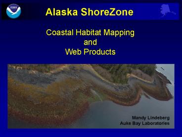
Title: Alaska ShoreZone
1
Alaska ShoreZone
Coastal Habitat Mapping and Web Products
Mandy LindebergAuke Bay Laboratories
2
What is ShoreZone? Standardized Coastal
Mapping System
ShoreZone characterizes physical and biological
attributes both along-shore and across-shore
sediment texture
geomorphology
wave exposure
man-made features
supratidal biota
intertidal/subtidal biota
3
What is ShoreZone? Coastal Imagery
Mapping is based on video and still imagery -
Low-altitude - Oblique- Spatially-referenced
- Collected during low tides
4
What is ShoreZone? Digital Shoreline
Navigation trackline and imagery are used to
segment digital shoreline into along-shore units
GPS flight trackline recorded at1-second
intervals
?
Perry Island
5
What is ShoreZone? Biophysical Mapping
Physical and biological features of across-shore
zones are mapped with respect to relative tidal
position
Physical (geomorphic) attributes
Biotic communities (biobands)
6
What is ShoreZone? Unique Biological Mapping
- Biobands
Species assemblages having a characteristic color
and across-shore elevation
- Bedrock Wall- Simple habitat
- Glacial fjords
7
What is ShoreZone? Unique Biological Mapping
- Biobands
Species assemblages having a characteristic color
and across-shore elevation
- Bedrock Wall- Complex habitat
- Biologically rich
8
What is ShoreZone? Unique Biological Mapping
- Biobands
- Bedrock Wall- Complex habitat
- Biologically rich
9
ShoreZone Protocols online
10
ShoreZone Protocols Shore Types
11
ShoreZone Protocols Habitat Class
12
ShoreZone Protocols Biobands
13
ShoreZone Shore Stations and Verification
Verification Surveys
Shore Station Surveys
14
ShoreZone A Rigorous Geospatial Database
15
ShoreZone Attribute Maps Wave Exposure
16
ShoreZone Attribute Maps Substrate Type
17
ShoreZone Attribute Maps Estuary
502 km
18
ShoreZone Attribute Maps Eelgrass
19
ShoreZone Attribute Maps Oil Residency Index
20
ShoreZone Attribute Maps Shore Modifications
21
Alaska ShoreZone Progress (2008)
22
ShoreZone Priorities Arctic and Aleutians
Global warming
Oil and gas
23
Alaska ShoreZone Partners (2001-08)
NOAA Fisheries Alaska Dept. of Natural
Resources The Nature Conservancy Regional
Citizens Advisory Council Exxon Valdez Oil Spill
Trustee Council U.S. Fish and Wildlife
Service Alaska Dept. of Fish Game University of
Alaska Fairbanks US Forest Service National Park
Service
Contractors Coastal Ocean Resources,
Inc. Archipelago Marine Research Ltd.
Endorsed by Coastal America, Alaska Region
24
Alaska ShoreZone Web Products
www.alaskafisheries.noaa.gov/maps/szintro
- A collaboration between SZ partners and NOAA
Fisheries AK Regional Office(Steve Lewis - data
manager) - Website is constantly being updated
- New features are being added
- Terabytes of information 3 million images
25
Interactive Geospatial Database Online
26
New Upgrade for ShoreZone
27
www.alaskafisheries.noaa.gov/habitat/fishatlas
28
Nearshore Fish Altas Online
29
Applications Resource Management
Southeastern Alaska eelgrass monitoring program
Auke Bay Laboratories Pat Harris
30
Monitoring Crab Bays Eelgrass Bed
2005
2003
- - Declining eelgrass density
- Declining eelgrass biomass
- Declinging forage fish
2008
31
Applications Resource Management
Auke Nu Cove
August 2004
32
Applications Resource Management
Bay Creek
Bay Creek
Auke Bay Harbor Bay Creek
33
Resource Management
Should Lynn Canal Herring be placed on the
Endangered Species List?
Kelps
Seagrasses
Historical Herring Spawn
Berners Bay
ShoreZone
ADFG
ShoreZone
34
Applications Invasive Species
Habitat Capability Modeling
- Invasive species high risk areas for Green
crab migration into SEAK waters. Baseline for
establishing a monitoring program.
- Sargassum distribution increasing with climate
change.
35
Applications First Responders
Grounding of the ferry Lituya Metlakatla Jan.
30, 2009
ShoreZone web photo
It worked as advertised and gave us an exact
picture of the shoreline around Scrub Island and
due to weather and darkness, ShoreZone provided
valuable information prior to any response assets
could arrive on scene. It was extremely helpful
and we'll use it again next time. LT Chris
Williammee, USGC Incident Management Sector
Juneau
36
Applications Coastal Archaeology
Fish Traps
Wood stave fish trapSalmon Bay, SEAK
Stone wall fish trap Prince of Wales , SEAK
37
Applications Coastal Archaeology
Clam Gardens
Intertidal rock wallSea Otter Sound, Craig
38
Applications Regional Comparisons
Bioareas in Alaska
Note All of Washington State and British
Columbia complete
39
Benefits of ShoreZone
- Scientists
- Site selection
- Habitat utilization
- Habitat capability modeling
- Invasive species monitoring
- Archeological documentation
Forage Fish
Fish traps
40
Benefits of ShoreZone
- Managers
- Coastal development
- Natural resource planning
- Permit reviews
- First responders
- Climate change and litigation
Logging
Oil Spills
41
Benefits of ShoreZone Accessibility Integration
Databases
ShoreZone
Nearshore Fish Atlas
Shore Stations
Archival /Future Data
42
In summary
- Alaska ShoreZone Coastal Mapping
- Half of state done
- Online Products
- - Alaska ShoreZone
- Nearshore Fish Atlas
- New Products Alaska Mapper stand alone
43
Thank You
Recommended
