
REALTIME LOSS ESTIMATES AFTER EARTHQUAKES Max Wyss WAPMERR Geneva - PowerPoint PPT Presentation
1 / 19
Title:
REALTIME LOSS ESTIMATES AFTER EARTHQUAKES Max Wyss WAPMERR Geneva
Description:
Rescue Agency: mobilizing (yes/no) offer of help (yes/no) Disaster Manager: ... Much needed information on building stock in fast growing megacities can be ... – PowerPoint PPT presentation
Number of Views:36
Avg rating:3.0/5.0
Title: REALTIME LOSS ESTIMATES AFTER EARTHQUAKES Max Wyss WAPMERR Geneva
1
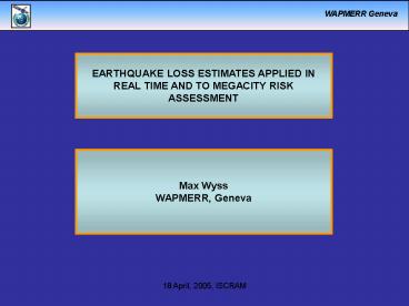
EARTHQUAKE LOSS ESTIMATES APPLIED IN REAL TIME
AND TO MEGACITY RISK ASSESSMENT
Max Wyss WAPMERR, Geneva
2
- OUR BUSINESS
- Estimate losses after an earthquake as fast as
possible - (number of fatalities, injured and map of degree
of damage)
3
- OUR BUSINESS
- Estimate losses after an earthquake as fast as
possible - (number of fatalities, injured and map of degree
of damage) - Construct loss scenarios for likely future
earthquakes
4
- OUR BUSINESS
- Estimate losses after an earthquake as fast as
possible - (number of fatalities, injured and map of degree
of damage) - Construct loss scenarios for likely future
earthquakes - Improve the necessary data bases
5
- OUR BUSINESS
- Estimate losses after an earthquake as fast as
possible - (number of fatalities, injured and map of degree
of damage) - Construct loss scenarios for likely future
earthquakes - Improve the necessary data bases
- Improve the mode of using our alarms
internationally
6
Example of Real-Time loss Estimate
Within 30 minutes of this second M8 earthquake
in Sumatra, we warned that more than 1000
fatalities may have to be expected. Instead of
deploying rescue teams to the islands we marked
as the trouble spots (settlements colored red),
some rescue teams reported that they were in
Banda Aceh and that they were just fine. This
last statement is about as relevant as saying
that nothing happened in New York city.
7
DISTRIBUTION AND PERFORMANCE OF QUAKELOSS TESTS
8
WAPMERR Geneva
Example of Loss Estimate in Scenario Mode
A repeat of the M8.3, 1897 Assam earthquake
might cause as many as 90,000 fatalities
200,000 injured and affect about 4,000
settlements according to QUAKELOSS. (Depth and
magnitude are poorly known, but important)
9
MEGACITIES Casualties increase with time 5 to
10 fold 1950 to 2015
M7 at 30 km distance
- Increase of casualties directly proportional to
population increase. - Trend similar, also for smaller capitals.
10
Scenario Assumtion Major problem earthquake is
shallow and 6.5M7
Seismogenic crust
Rupture area
W13 km
L30 km
Rupture of an M 6 3/4 earthquake (A400 km2)
W13 km, L30 km can hide in the seismogenic
crust without reaching the surface.
11
Decrease of casualties as a function of distance
(normalized to 10 km)
12
Decrease of casualties as a function of distance
(poor building stock)
Casualties include fatalities to lightly
injured. 1/4 should be assumed to be heavily
injured.
13
DATA ON PROPERTIES OF BUILDING STOCK NEED
IMPROVEMENT
- Distribution of percent of buildings into
fragility classes. - Fragility curve for each building class.
- Tool 3D modeling from satellite images.
14
N
Satellite image of the peninsula of the United
Arab Emirates.
By courtesy of Informap.
15
N
Zooming in on Dubai.
By courtesy of Informap.
16
N
The height of each building can be estimated to
within 1 to 5 m. Thus the distribution into
fragility classes can be facilitated
By courtesy of Informap.
17
THE BIGGEST PROBLEM
- Inexperienced local disaster managers.
- Problem They underestimate extent of disaster.
- Reason Information they receive originates from
the edge of the affected area where
communications remained intact.
18
wait
Earthquake
Accurate parameters X, Y, Z, M
Damage to buildings
Building fragility data base
Earth transmission properties
Earth transmission properties ground motion
- Estimates
- Building damage
- Number of fatalities
- Number of injured
Population data base
- Rescue Agency
- mobilizing (yes/no)
- offer of help (yes/no)
- Disaster Manager
- accept help (yes/no)
Help injured
19
- CONCLUSIONS (megacities in developing countries)
- Increase of casualties in megacities from 1950
to 2015 is 5 to 10 fold. - Casualties for M7 6 at 20 km, 3 at 30 km,
0.5 at 50 km ( of population). - As function of building stock M7, dist.30km,
variation between 1 and 5. - As function of M at dist.30 km casualties for
M6.5 10 times less than M7. - Much needed information on building stock in
fast growing megacities can be derived from 3D
models, based on satellite images.