
Vital Signs Program Coastal and Barrier Network PowerPoint PPT Presentation
1 / 26
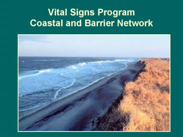
Title: Vital Signs Program Coastal and Barrier Network
1
Vital Signs ProgramCoastal and Barrier Network
2
Coastal and Barrier Network8 Parks Covering
141,000 Acres Across 5 StatesAnnual Visitation
18 Million
- Cape Cod National Seashore, MA prototype park
- Assateague Island National Seashore, MD
- Fire Island National Seashore, NY
- Gateway National Recreation Area, NY/NJ
- Sagamore Hill National Historic Site, NY
- Colonial National Historical Park, VA
- George Washington Birthplace NM, VA
- Thomas Stone National Historic Site, MD
3
Recommended Approach forDeveloping a Monitoring
Strategy
- 1. Form a Board of Directors and Technical
Steering Committee - 2. Summarize existing data and understanding
- 3. Hold Network scoping workshop
- 4. Write workshop report and have it widely
reviewed - 5. Decide on priorities and implementation
approaches - 6. Draft the monitoring strategy
- 7. Review and approval of monitoring strategy
4
Recommended Approach forDeveloping a Monitoring
Strategy
- 1. Form a Board of Directors and Technical
Steering Committee - Feb. 2000
- Establishment of a Coastal and Barrier Network
Technical Steering Committee - Includes
- April 2001
- Board of Directors meet to sign Network charter
USGS-BRD, EPA, Park Resource Managers and Coastal
CESU Cooperators
5
Recommended Approach forDeveloping a Monitoring
Strategy
- 2. Summarize existing data and understanding
- Nov 99-Feb 2000
- Parks submit info on existing monitoring
programs, management issues, and monitoring
needs - Feb 2000
- Steering Committee sets
- up straw dog
Ecosystem Models
Monitoring Issues
Vital signs
6
Network Ecosystems Based on Cape Cod Prototype
- 1. Estuaries and near shore environments
- 2. Freshwater wetlands, ponds and streams
- 3. Uplands (forests, grasslands and thickets)
- 4. Beaches, dunes, spits and shoreline systems
7
High Priority Management Issues
- 1. Shoreline change
- 2. Water quality
- 3. Species and habitats of concern
- 4. Resource extraction
- 5. Recreation and visitor use
8
Recommended Approach forDeveloping a Monitoring
Strategy
- 3. Hold Network scoping workshop
- April 13-14, 2000
- Coastal and Barrier Network scoping workshop,
held at Gateway NRA - 50 people attend from
- parks, region, WASO
- state and federal agencies,
- universities
- private sector
9
Coastal and Barrier Network Scoping Workshop
- Materials provided to participants
- Workshop agenda and format
- Park/Network management issues, resources and
settings. - Patuxent Wildlife Research Center coastal issues
workshop summary. - Framework for the development of long-term
monitoring protocols at Cape Cod National
Seashore. - Available GIS layers for each park.
- Draft list of monitoring questions and vital
signs.
10
Scoping Workgroups
- Based on Network management issues
- Shoreline change, water quality, species and
habitats of concern, resource extraction and
recreation and visitor use - Tasks
- Evaluate background materials
- Review example monitoring questions
- Develop monitoring questions
- Identify and prioritize vital signs
- Submit workgroup reports
11
Scoping Workshop
- Successful in
- Network parks meeting and learning about similar
issues. - Outsiders learning about the IM Program and park
issues. - Brainstorming about the issues identified
- Unsuccessful in
- Large workgroups defining Network monitoring
questions and needs
12
Recommended Approach forDeveloping a Monitoring
Strategy
- 4. Write workshop report and have it widely
reviewed - Nov 2000
- Scoping workshop report completed and sent out
for review
13
Scoping Workshop Report
- Successful as a
- Written record of workshop events and planning
- Written description of Network and monitoring
issues - Unsuccessful
- Sent out for Review- received comments from one
person
14
Recommended Approach forDeveloping a Monitoring
Strategy
- 5. Decide on priorities and implementation
approaches - Sept. 2000
- Technical Steering Committee meeting
- Discussed
Scoping Workshop Report
Hiring a Network Coordinator
Small workgroups to review issues and identify
cooperators
15
Small Workgroups Meet
- Dec 13, 2000 Vegetation Mapping (Chris Lea, ASIS,
lead) - Jan 9, 2001 Shoreline Change (Brendan Cain, CACO,
lead) - Jan 25, 2001 Freshwater Quality (nutrients) (John
Portnoy, CACO, lead) - Feb 7-8, 2001 Data Management (Charles Roman,
USGS, lead - Feb 12, 2001 Estuarine Eutrophication (Hillary
Neckles, USGS, lead) - Water Quality (contaminants) (John Tanacredi,
GATE, Nancy Finley CACO, leads) - Visitor Use and Recreation (Jeff Marion, lead)
- Species and Habitats of Special Concern (lead not
determined) - Aerial Photography (Carl Zimmerman, ASIS, lead)
16
Workgroup Tasks
- Review existing CACO protocols
- Review Gateway workgroup reports
- Prioritize monitoring questions
- Review candidate indicators
- Evaluate existing monitoring programs
- Develop scope of work to fill data gaps
- List potential cooperators
- Estimate costs for 2001-2002
- Report to Network
17
Where does the Program Stand Now?
18
Shoreline Change Monitoring
- Coordinator-Mark Duffy (ASIS)
- Program development in conjunction with USGS,
NASA, VIMS, Rutgers, NC State - Work will include
- Network Parks needs assessment
- Data mining
- Existing data development and analysis (USGS)
- Development of a Network strategy
19
Species and Habitats of Concern
- URI Research Assistant
- Data Mining
- Species and habitats of concern and their threats
- Existing monitoring programs (inside and outside)
- Keystone species
- Similar issues between parks
- Potential cooperators
20
Contaminants Assessment Rutgers University
- Review existing data from all sources
- Evaluate sources and threats at each park
- Develop a park specific baseline inventory and
monitoring plan (spill response vs. long-term
monitoring) - Establish need/guidelines for doing a NRDA
21
Water Quality USGS/URI
- Identification of wetland types and area
statistics for each park - Description and discussion of threats
- Description of existing inventory and monitoring
programs - Review of state 305(b) reports and USEPA 303(d)
lists - Recommendations on restoration, monitoring,
management and research
22
Vegetation Mapping
- HOW ASIS, CACO, NCR and NER Staff, NCState,
VA/NY Natural Heritage, ABI, CACO staff, UMASS,
URI - Coastal Network, Veg Mapping Program, Fee
Demo, Regional Science, Park Staff - COLO, GEWA, THST 2001
- ASIS, GATE, SAHI 2002
- CACO 2001
- FIIS accuracy assessment 2001
23
Estuarine Nutrients
- Phase I
- Identify candidate monitoring variables by
analyzing information from various sources - Find common threads and synthesize relevant
components in a regional context. - Write a report identifying and justifying
potential monitoring variables and a work plan
and budget for testing the variables on a
regional scale. - Phase II
- Test variables to determine their suitability for
regional application and the appropriate sampling
designs. - Develop an operational monitoring plan.
24
Visitor Use Impacts
- Cooperators-VA Tech and NC State
- Designing and testing of sampling protocol for
monitoring visitor use and resource impacts at
CACO - Apply to Network?
25
2001 Funding706,500
- Workgroups
- Shoreline Chg. 99.5K
- Water quality 46K
- Contaminants 105.5K
- Species 23K
- Travel 30.5K
- Veg Map 97K
- Coord/Data 180K
- NET Meeting 5K
- Equipment 30K
- Miscellaneous 90K
26
CACO Protocol Development
Proposal to draft Protocol
- Estuaries and Salt Marshes
- Estuarine Nekton Feb 1998 Jan 2001
- Nutrient Enrichment July 1998 July 2001
- Salt Marsh Vegetation May 1999 May 2001
- Waterbirds Aug 1999 Sept 2001
- Barrier Island, Spits, Dunes
- Shoreline Change April 1997 May 2001
- Ponds, Freshwater Wetlands, Groundwater
- Amphibians Sept 2000 Feb 2002
- Freshwater Fish July 1998 Aug 2001
- Coastal Uplands
- MAPS (birds) June 1999 Apr 2001
- Landbirds July 2000 July 2003
- Small Mammals July 2000 July 2003
- Heathland Veg. May 1999 Dec 2002
Recommended
