
Chapter 4 Traverse Computations PowerPoint PPT Presentation
1 / 42
Title: Chapter 4 Traverse Computations
1
Chapter (4) Traverse Computations
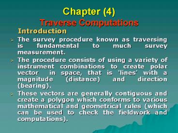
- Introduction
- The survey procedure known as traversing is
fundamental to much survey measurement. - The procedure consists of using a variety of
instrument combinations to create polar vector
in space, that is 'lines' with a magnitude
(distance) and direction (bearing). - These vectors are generally contiguous and create
a polygon which conforms to various mathematical
and geometrical rules (which can be used to check
the fieldwork and computations).
2
- The equipment used generally consists of
something to determine direction like a compass
or theodolite, and something to determine
distance like a tape or Electromagnetic Distance
Meter (EDM). - There are orderly field methods and standardized
booking procedures to minimize the likelihood of
mistakes, and routine methods of data reduction
again to reduce the possible occurrence of
errors. - The most fundamental of these checks is to
perform a closed traverse that is a traverse that
starts and finishes on either the same point or
known points, (similar in concept to a level run).
3
- The Function of Traverses
- Traverses are normally performed around a parcel
of land so that features on the surface or the
boundary dimensions can be determined. - Often the traverse stations will be revisited so
that perhaps three-dimensional topographic data
can be obtained, so that construction data can be
established on the ground. - A traverse provides a simple network of 'known'
points that can be used to derive other
information.
4
(No Transcript)
5
- Types of traverse
- There are two types of traverse used in survey.
- These are open traverse, and closed traverse.
6
- Open Traverse
- An open traverse begins at a point of known
control and ends at a station whose relative
position is known only by computations. - The open traverse is considered to be the least
desirable type of traverse, because it provides
no check on the accuracy of the starting control
or the accuracy of the fieldwork. - For this reason, traverse is never deliberately
left open. - Open traverse is used only open projects like
roads, cannels, railway lines, shoreline
protection.
7
- Closed Traverse
- This traverse starts and ends at stations of
known control. - There are two types of closed traverseclosed on
the starting point and closed on a second known
point. - Closed loop traverse
- This type of closed traverse begins at a point of
known control, moves through the various required
unknown points, and returns to the same point. - This type of closed traverse is considered to be
the second best and is used when both time for
survey and limited survey control are
considerations. - It provides checks on fieldwork and computations
and provides a basis for comparison to determine
the accuracy of the work performed.
8
- The first step in checking a closed traverse is
the addition of all angles. - Interior angles are added and compared to
(n-2)180o. - Exterior angles are added and compared to
(n2)180o. - Deflection angle traverses are algebraically
added and compared to 360o. - The allowable misclosure depends on the
instrument, the number of traverse stations, and
the intention for the control survey. - c K n 0.5
9
- where
- c allowable misclosure.
- K fraction of the least count of the
instrument, dependent on the number of
repetitions and accuracy desired (typically 30"
for third-order and 60" for fourth-order) - n number of angles.
- Exceeding this value, given the parameters, may
indicate some other errors are present, of
angular type, in addition to the random error. - The angular error is distributed in a manner
suited to the party chief before adjustment of
latitude and departures. Adjustment of latitudes
and departures is the accepted method. - The relative point closure is obtained by
dividing the error of closure (EC ) by the line
lengths. - Relative point closure EC / S of the distances
10
- Closed traverse between two known control points
- This type of closed traverse begins from a point
of known control, moves through the various
required unknown points, and then ends at a
second point of known control. - The point on which the survey is closed must be a
point established to an equal or higher order of
accuracy than that of the starting point. This is
the preferred type of traverse. - It provides checks on fieldwork, computations,
and starting control. It also provides a basis
for comparison to determine the accuracy of the
work performed.
11
- The procedure for adjusting this type of traverse
begins with angular error just as in a loop
traverse. - To determine the angular error a formula is used
to generalized the conversion of angles into
azimuth. - The formula takes out the reciprocal azimuth used
in the back sight as (n-1) stations used the
back-azimuth as a back sight in recording the
angles. - A1 a1 a2 a3 ... an -(n-1)(180o )A2
12
- If the misclosure is exceeded, the angular error
may have been exceeded or the beginning and
ending azimuths are in error or oriented in
different meridian alignments. - If beginning and ending azimuths were taken from
two traverses, and the angle repetitions were
found to be at least an order of magnitude better
than the tabulated angular error, the ending
azimuths may contain a constant error which may
be removed to improve the allowable error. - GPS or astronomic observations may be used to
find the discrepancy if the benefit of this.
13
- Traverse fieldwork
- The easiest way of visualizing the traversing
process is to consider it to be the formation of
a polygon on the ground using standard survey
procedures. - If the traverse is being measured using a
theodolite (which is the normal case) then angles
are observed to survey stations on both faces for
a given number of rounds, and booked and reduced
accordingly. - The stations being observed are pre marked and
targeted with range poles or traversing targets,
or simply by a plumb-bob string for the duration
of the angle measurement.
14
- If bearings are being observed with a magnetic
compass then care must be taken to reduce the
effect of variation in declination over the
period of the survey, and especially to avoid the
effects of local attraction. - This is done by avoiding nearby metallic objects,
and by observing both forward and reverse
bearings for each traverse line. - Whatever method is used for the measurement of
distance then all appropriate corrections should
be made, and the distances reduced to horizontal.
15
- Choice of points
- Planning - establish requirements for accuracy,
density and location of control points. - Reconnaissance - nature of terrain, access,
location of points. - Station marking
- Station marking - type of mark, reference.
- Protection.
- Description Card.
- Observations
- Angular and Distance Measurements.
- Angular Measurement Targets, Reading and
booking procedure. - Linear Distance - Standard, slope, temp.
- Booking procedure.
16
- Traverse Computations
- 1 Angular Closure of Closed loop traverse
- Using a theodolite we can measure all the
internal angles. - The sum of the internal angles of a polygon
(traverse) is given by the rule - S ? (n -2) 180O
- Where n is the number of sides of the traverse,
and each internal angle. - Any variation from this sum is known as the
misclosure and must be accounted for, either
through compensation (if it is an acceptable
amount) or elimination by repetition of the
observations. - An angular closure is computed for traverses
performed with either Theodolites or magnetic
compasses.
17
- A larger misclosure could be expected when using
a magnetic compass, but in any case it must be
calculated and removed. - The Angular Misclosure
S Measured Angles - S Internal Angles - Maximum Angular Misclosure 2Accuracy of
Theodolite v (No. of Angles)
- Calculation of Whole Circle Bearing
- When the angles is adjusted, then a bearing is
adopted for one of the lines (or a known bearing
is used) and bearings for all the lines are
computed. - The bearing of a line is computed by adding 180
to the bearing of the line before, and then
subtracting the included angle (a).
18
Example Observations, using a 6" Theodolite,
were taken in the field for an anti - clockwise
polygon traverse, A, B, C, D. The bearing of line
AB is to be assumed to be 0o and the co-ordinates
of station A are (3000.00 m E 4000.00 m N).
N
C
B
A
D
19
(No Transcript)
20
Solution Calculation of Angular misclosure S
(Internal Angles) 360º 00? 12" S (Internal
Angles should be (N-2)180º
360º 00? 00" The Angular
Misclosure(?) S Measured Angles - S Internal
Angles 360º 00? 12" - 360º
00? 00" 12" Allowable 2 6" v4
24" OK Therefore distribute
error The correction / angle -12/4 3"
21
(No Transcript)
22
Calculation of Whole circle Bearing
23
- Linear closure
- The method of checking the distance component of
the closed traverse is known as performing a
linear closure. - In its simplest form this consists of converting
the corrected angles into bearing and then
computing the partial Easting and Northing for
each line. - ? Easting D . Sin ?
- ? Northing D . Cos ?
- These values are then summed, and any deviation
from the expected value is assessed. - In a traverse that starts and finishes on the
same point the total change in position should be
zero, and in a traverse that starts and finishes
on points that have a known position the sum
should equal the known displacement.
24
- An angular closure must be performed first, as
these formulae contain two measured variables
(direction and distance) the bearings must have
their error eliminated so we can attribute the
remaining error to the distances.
- If the linear misclosure is acceptable, then this
can be adjusted out of the network, but if the
misclosure is too large then the fieldwork should
be repeated (unless the source of the problem can
be isolated).
25
linear misclosure In above example can be
calculated as follow
26
- e v (? E2 ? N2 )
- v (0.0942 0.6542) 0.661m
- e is the LINEAR MISCLOSURE
- Fractional Linear Misclosure (FLM) 1 in (S D
/ e ) - 1 in (9172.59 / 0.661) 1 in
13900 - Acceptable FLM values -
- 1 in 5000 for most engineering surveys
- 1 in 10000 for control for large projects
- 1 in 20000 for major works and monitoring
for structural deformation etc.
27
Example Consider the following traverse and
traverse table
28
(No Transcript)
29
Solution Calculation of Angular misclosure S
(Internal Angles) 539º 59? 10" S
(Internal Angles) should be (n -2)180
(5-2)180 540º 00? 00" The Angular
Misclosure(?) S Measured Angles
- S Internal Angles 539º
59? 10" - 540º 00? 00" - 50" Allowable 2
20" v5 89.44" OK Therefore distribute
error. The correction/angle 50"/5 10 The
angles area adjusted for this misclosure amount,
this case 10 seconds would be added to each angle
to distribute the misclosure evenly throughout
the traverse.
30
(No Transcript)
31
Linear closure
32
- From the table, S ?E -0.029, and S ?N -0.026
This is then converted to a vector, expressing
the misclosure in terms of a bearing and
distance. - Distance ( S ?E 2 S ?N2 )1/2 0.039 meters,
- Bearing tan-1 (S ?E/ S ?N) 227 30
- Then the work is repeated. Conventionally the
misclosure is expressed as a ratio of the total
perimeter of the traverse and referred to as the
'accuracy'. - In this case this is 113,795 which satisfies
requirements under the Survey Coordination Act. - If the misclosure was found to be large then it
is likely that a mistake had occurred during the
field process. - The bearing of the misclosure vector can be used
as an indication of the line in which the mistake
occurred, however this is a guide only. - Naturally if the misclosure was close to one
physical length of the measuring device (say 50m)
then it is likely that a chain length was omitted
somewhere. If the source of the mistake cannot be
isolated,
33
If the coordinates of point A ( 2000,5000 ) Now
we will go to correct the coordinates of the
points of the traverse
34
Final corrected coordinates
35
- Traverses - Missing Data
- As a rule traverses are always closed, either
onto them selves or between known points so that
an estimate of accuracy and precision can be
obtained, as well as a check on our fieldwork. - There are rare occasions where traverses cannot
be closed, and more commonly there are situations
where open traverses run off a rigorous network
are used to determine the dimensions of features
that are not readily accessible. - The use of traversing procedures and calculation
to determine these dimensions is based on the
mathematics of a closed traverse. - That is, the data that is missing from the
traverse is presumed to be that which would close
the traverse. - If we adopt this procedure, then an additional
condition applying to our measurements is known
36
- The missing elements of a traverse polygon that
can be solved for are as follows - Bearing and Distance of One Line .
- Bearing of One Line, Distance of Another.
- Distance of two Lines.
- Bearing of two Lines.
37
Example In a theodolite survey the following
details were noted and some of the observations
were found to be missing.
Calculate the missing data ?
38
Solution
39
In Departure 415.69 1069.44 0.826 L 1205 Sin
(?) 00.00 1205 Sin (?) 0.826 L
1485.13 1452025Sin2(?)0.682L22453.43L2205611.12
(1) In Latitude 240 498.69 0.564 L 1205
Cos (?) 00.00 1205 Cos (?) 0.564 L
258.69 1452025Cos2(?)0.318 L2291.8 L 6692 0.52
(2) For length CD Add Eq.(1) and
Eq.(2) 1452025 Sin2(?)Cos2(?)L22161.63 L
2272531.64 L2 2161.63 L 820506.64 00.00
(3) Solving Eq. (3)
L 491.455 m. For Bearing of line
CD Substitute in Eq.(1) 1205 Sin (?) 0.826 x
491.455 1485.13 Sin (?)
-0.8955
R.B. of CD N 63º 34?22"
W W.C.B. of CD 296º 25? 38"
40
Example (Mansoura 4/1/2006) C and D are two
stations whose coordinates are given below
From station C is run a line CB of 220 m length
with a bearing of 130º. From B is run a line BA
of length 640 m and parallel to CD . Find the
length and bearing of AD?
41
Solution
N
D (-680,1350.50)
130º
C (380,835)
220 m
A
B
640 m
o
42
DC (1060)2 (515.5)2 0.5 1178.703 m W.C.B
of DC tan-11060/515.5 115º 56? 05? W.C.B of
BA 295º 56' 05?
L sin ? - 652.983 m , L cos ? 377.011 m ? (
W.C.B of AD ) 325º 59' 57? , Length of AD
754.005 m
Recommended
