
Welcome to the Howard University, Beltsville Research Campus - PowerPoint PPT Presentation
1 / 17
Title:
Welcome to the Howard University, Beltsville Research Campus
Description:
Welcome to the Howard University, Beltsville Research Campus – PowerPoint PPT presentation
Number of Views:54
Avg rating:3.0/5.0
Title: Welcome to the Howard University, Beltsville Research Campus
1
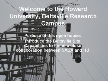
Welcome to the Howard University, Beltsville
Research Campus
- Purpose of this open house
- Introduce the Beltsville Site Capabilities to
foster a close collaboration between NASA and HU
2
NASA/GSFC-Howard Research Collaborations at
Beltsville
- Enhance the capacity of HU to conduct research in
atmospheric observations for the improvement of
weather, climate, and air quality prediction - Facility for hands-on student training in
instrumentation and atmospheric observation - Contribute to national and international climate
and environmental monitoring (SURFRAD, CEOP,
BSRN, etc)
3
Capabilities and Ongoing Research
4
Passive Radiation Measurement
- Instruments
- Research Objectives
- Radiative Forcing
- Monitoring cloud and aerosol optical properties
- Indirect effect of aerosols on clouds
- Validation of satellite algorithms and radiative
transfer schemes in models
MFRSR 6 bands 415, 500, 610, 665, 862, and
940nm. Direct, diffuse, and total solar
irradiances
RSS-1024 350 to 1075 nm. Direct, diffuse, and
total solar irradiances 0.3 nm FWHM at 360-3 nm
at 1100 nm OOB 10-5
Microwave Radiometer Cloud liquid water and
total column water vapor
Broadband Radiometers Up/Down SW and LW for
surface energy budget
5
Atmosphere-Surface Measurements
- Measurements
- 31 m Flux tower
- Subsurface ground heat flux soil temperature
and moisture - Wind profiler (MDE)
- Raman Lidar
- Radiosonds
- Objectives
- Investigate atmosphere-surface interaction/boundar
y layer processes over heterogeneous environment - Validation of model/WRF physics and other
modeling studies - Monitoring
6
Air Quality (MDE, UMCP, NASA, HU)
- Upper Air
- Upper Air Profiler and RASS (wind speed
direction 0-4km and temperature 0-1.5km) - Surface
- O3, NOx, CO
- 56 VOCs via canister samplers and Gas
Chromatograph / Flame Ionization Detection - 7 Carbonyls via tube samplers and Liquid
Chromatograph - 42 Toxic Compounds via canister samplers and Gas
Chromatograph / Mass Selective Detector - Surface Particles
- PM2.5 from FRM (Daily), TEOM (Hourly), BAM
(Hourly) PM2.5 Speciation (filters analyzed in
laboratory) - Ozonesondes (profile up to 30 km 3/day on code
red days) - University of Maryland RAMMPP Aircraft
- HU research instrument
- QCM (impactor) Mass fractionated sampling
- Climet (laser particle counter)
Size-fractionated number densities from 0.3 to 25
mm in seven size bins
7
Raman Lidar Profiling of Aerosol and Water
Vapor
- Completed Raman Lidar. The system has met or
exceeded all initial design criteria - Three-channel
- Measure water vapor mixing ratios, aerosol
backscatter coefficients, and cirrus clouds
thicknesses. - Preliminary results show good qualitative
agreement with data obtained from radiosonde
measurements for water vapor
8
Research Examples
9
Water Vapor Lidar Intercomparison within the
context of NDSC and AURA Validation
GSFC/Scanning Raman Lidar
- Purposes
- AURA water vapor profile validation
- Cal/Val of Raman lidar water vapor profiles
- NASA/GSFC Scanning Raman Lidar (Whiteman) and
Aerosol/Temperature Lidar (McGee) - Howard University Raman Lidar (Venable)
- Radiosonde intercomparison study
- Experiment Design
- Time Sept December, 2005
- Location HU Beltsville Research Site
- Instruments Raman Lidars, Vaisala RS92,
Intermet, Microwave Radiometer, GPS
Howard Raman Lidar
10
Cloud Optical Properties
Cloud optical depth and effective radius from
diffuse solar irradiance MWR using Min and
Harrison, 1996 Min et al, 2003
algorithms. Lookup table for cloud optical
depth cloud Re LWP/CLD-Tau Comparison with in
situ observations from the Citation during ARESE
II Millimeter-wave cloud radar
reflectivity Inferred cloud optical
depth Inferred cloud re Re from in situ
11
Inferred Cirrus and Aerosol Optical Depth On
20000313
Min et al, 2004a Min et al, 2004b
12
2004 Regional Air Quality Pilot Study GSFC,
UMCP, and MDE
- Ozone Profiles for MD and Washington DC Area
- Profiling of tropospheric ozone during code red
events - IONS/INTEX Site
- Summer campaign to study intercontinental ozone
transport - INTEX NASA component of summer 2004 ITCT/ICARTT
experiments. - Intercomparisons
- TOMS Satellite
- University of Maryland RAMMPP Aircraft
13
Instrumentation Workshops(24 26 June 2003, and
21 30 June 2004)
- The principal goals of the workshops were
- Introduce students to and facilitate
student-interaction with leading atmospheric
scientist - Develop both horizontal and vertical mentoring
strategies with graduate students and
participating faculty members - Employ experiential methods of learning as a
means to motivate students to pursue research and
careers in atmospheric sciences - Hand-on application of theories leaned in the
classroom
14
Workshop Participants
31 Participants
15
Challenges
- An overall strategy of multi-institutional
leveraging is being pursued to support Beltsville
research - Instrument operation expendables, QA, etc
- Student mentors collaborative research,
workshops etc - Onsite technicians
16
Beltsville/HU
Summary
UMCP Aircraft sampling Ozone
Challenges Infrastructure cost/improvements
NOAA/NCAS Instrumentation Summer Workshops
NOAA DC-Net
MDE Instrumentations Operations
UMBC REALM
GSFC Raman lidar Precip.
17
THE END
Recommended
CrystalGraphics Presentations


![Maharishi University of Management and Technology - [MUMT], Bilaspur PowerPoint PPT Presentation](https://s3.amazonaws.com/images.powershow.com/9657642.th0.jpg?_=20210907048)


