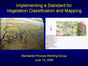
Implementing a Standard for Vegetation Classification and Mapping PowerPoint PPT Presentation
1 / 36
Title: Implementing a Standard for Vegetation Classification and Mapping
1
Implementing a Standard for Vegetation
Classification and Mapping
- Standards Process Working Group
- June 15, 2005
2
Why a Standard for Community Classification
- Identify diversity of ecological units within
any jurisdiction - Understand distribution and its environmental
requirements for each type - Characterize status and trends for each type
- Identify reference conditions and quality
indicators for each type and their occurrences - Provide basis for the development of
standardized maps - Develop site plans and management prescriptions
- Provide baseline to monitor community condition
and change - Develop spatial and temporal models
3
Physiognomic-Floristic Hierarchy for Terrestrial
Vegetation
4
US-NVC Taxonomic Hierarchy
(Grossman et al. 1998 UNESCO 1973)
5
NVC CLASSES
Forest Woodland Shrubland
Dwarf-
shrubland
Herbaceous Nonvascular
Sparse Vegetation
6
Formation
Profiles of the four principal cloud forest
types, according to J.S. Beard (1944, 1955)
7
Alliance Pseudotsuga menziesii Tsuga
heterophylla Forest Alliance
- CANOPY SPECIES
- Pseudotsuga menziesii 25-37.5,
- Abies grandis 25-37.5,
- Tsuga heterophylla 25-37.5,
- Thuja plicata 12.5-25
Olympic National Park, Mt. Olympus
8
Completing the Community Element List Diversity
of U.S. Vegetation
Natural/Semi-Natural Subgroup only. Data as of
June 1999.
9
Dichotomous Keys to Types
10
Data Development Association Description
Quercus marilandica - Juniperus virginiana var.
virginiana / Schizachyrium scoparium - Hypericum
gentianoides Wooded Herbaceous Vegetation
SYNONYM Shawnee Sandstone Glade RANGE This
association occurs on the upper slopes and
ridgetops of south facing bluffs and escarpments
in the Shawnee Hills of southern Illinois,
western Kentucky, and southern Indiana. The
present range of this community is probably very
close to pre-European settlement range.
VEGETATION DESCRIPTION This community is
dominated by graminoid species. Quercus
marilandica (blackjack oak), Quercus stellata
(post oak) and Juniperus virginiana (eastern red
cedar) are the dominant trees they are found
scattered or in patches throughout the
occurrence. These trees are generally small,
stunted, and limby. The overstory cover seldom
exceeds 50. The subcanopy is conspicuously thin
or absent. Scattered individual and patches of
shrubs occur here, with Vaccinium arboreum
(farkleberry) and Ulmus alata (winged elm) the
most commonly encountered. Schizachyrium
scoparium (little bluestem), Danthonia spicata
(poverty oat-grass), Andropogon virginicus
(broom-sedge), and Dichanthelium spp. dominate
the herbaceous layer, along with a diverse
mixture of forbs. The patchiness and uneven
distribution of trees, shrubs, and herbaceous
vegetation is a response to thin infertile soils
and droughty conditions. Lichens and mosses are
common on exposed bedrock surfaces and on soils
not covered with organic debris (leaf litter,
wood). MOST ABUNDANT SPECIES Quercus stellata
(post oak), Quercus marilandica (blackjack oak),
Juniperus virginiana (eastern red cedar), Ulmus
alata (winged elm), Vaccinium arboreum
(farkleberry), Smilax bona-nox (saw greenbrier),
Danthonia spicata (poverty oat-grass),
Schizachyrium scoparium (little bluestem),
Parmelia spp., Polytrichum spp. DIAGNOSTIC
SPECIES Quercus marilandica (blackjack
oak),Vaccinium arboreum (farkleberry), Smilax
bona-nox (saw greenbrier), Schizachyrium
scoparium (little bluestem), Hypericum
gentianoides (orange-grass St. Johns-wort). ENVIR
ONMENTAL DESCRIPTION etc.
11
Web Access to Data NatureServe Explorer
12
Web Access to Data NatureServe Explorer
13
Web Access to Data NatureServe Explorer
14
Web Access to Data NatureServe Explorer
15
- FGDC 1997. Establishing the U.S. National
Vegetation Classification Standard
16
(No Transcript)
17
Current Number of Associations by State
gt 300
201-300
100-200
lt 100
Data as of June 1999
18
Percentage of Associations in Each Ecoregion
(Province Level) that are Imperiled (G1, G2)
gt 30
20-30
10-20
lt 10
Data as of June 1999
19
PROGRESS ON USGS/BRD VEGETATION MAPPING PROJECT
20
FROM FIELD SURVEYS TO VEGETATION MAPS
21
(No Transcript)
22
(No Transcript)
23
(No Transcript)
24
WORKING WITH PARTNERS ON
DATA STANDARDS
APPLICATIONS OF CONSERVATION DATA
NCEAS VEGETATION PLOTS DATABASE
HEINZ CENTER REPORTS
25
AGENCY APPLICATIONS
U.S. FOREST SERVICE Old Growth definition South,
East and Midwest Southeast Region (R8)
classification and community descriptions Characte
rization of vegetation for ECS provinces,
sections, and subsections National ranking of
imperilment status of USNVC associations RNA and
SIA priority-setting based on classification ECODA
TA and successors - data management and
analysis Ecosystem management - Columbia River
Basin U.S. GEOLOGICAL SURVEY -- BIOLOGICAL
RESOURCES DIVISION National GAP Analysis Program
-- alliance standards and descriptions Southwester
n, Southeastern, and Midwestern regional
technical assistance projects U.S. NATIONAL PARK
SERVICE and U.S.G.S. Vegetation Mapping
Project ECOLOGICAL SOCIETY OF AMERICA Panel for
Vegetation Classification Standards and Database
Development LANDFIRE
26
Mapping the NVC Difficulties
- Mixed Physiognomy e.g.,
wetland/riparian mosaics
- Mixed leaf type (broadleaf evergreen vs.
deciduous, etc.) - Hydrologic Modifiers distinguishing wetland
formations - Many Floristic Distinctions esp. w/herbaceous
vegetation
27
Hierarchy Revision Goals
- Develop an integrated physiognomic-floristic
classification that organizes regional /
continental floristic patterns. - Emphasize vegetation criteria in the
classification, while ensuring ecological
meaningfulness of the units. - Provide physiognomy and structural modifiers to
support stand descriptions and vegetation
mapping. - Provide mapping guidelines.
28
CURRENT NVC CLASSES
Forest
Woodland Shrubland
Dwarf-
shrubland
Herbaceous Nonvascular
Sparse Vegetation
29
Forest Woodland (Mesomorphic Vegetation)
Shrubland Grassland
Semi-Desert Vegetation (Xeromorphic Vegetation)
Polar High Montane Vegetation (Cryomorphic
Vegetation)
Loiseleuria procumbens
Nonvasc. and Sparse Vasc.Veg. (Lithomorphic
Vegetation)
Aquatic Vegetation (Hydromorphic Vegetation)
30
Revised Hierarchy Levels
31
Ecological Systems integrate communities with
ecological processes and environmental gradients
at broader scales
32
(No Transcript)
33
(No Transcript)
34
Proposed Map Zone Clusters for Keys (25)
35
Ecological Classification Approaches
- Ecological Communities NVC
- US National Vegetation Classification
- Canadian National Vegetation Classification
- Latin America and the Caribbean
- Ecological Systems
- US Classification of Ecological Systems
- Latin America and the Caribbean Classification
of Ecological Systems
36
Standard Classification Units for National
Mapping (natural land cover)

