
Floyds Fork Greenway PowerPoint PPT Presentation
1 / 77
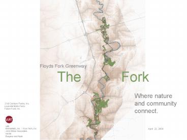
Title: Floyds Fork Greenway
1
Floyds Fork Greenway
The
Fork
Where nature and community connect.
21st Century Parks, Inc. Louisville Metro
Parks Future Fund, Inc.
with Biohabitats,
Inc. / Eco-Tech, Inc.
John Milner Associates HNTB Burgess and Niple
April 22, 2008
2
Process
Phase 1 Project Initiation
Phase 2 Inventory Analysis
Phase 3 Conceptual Alternatives
Phase 4 Master Plan Dev.
Phase 5 Draft Final Plan
NEPA / CE Process
Schematic Design Process
4
Land Ownership Analysis
Land Acquisition Concepts
Park Components
Stakeholder Interviews
Park and Open Space Needs Analysis
Park System Recommenda-tions
Activity and Facility Programming
Concept Alternat- ives Select Preferred
Draft Master Plan
Final Master Plan Documents
Inventory and Analysis Summary
Data Collection and Review
Natural Resources Analysis
Water Quality/Habitat Concepts
Implementation Program
Tour of Floyds Fork Basin
Cultural and Scenic Resources Analysis
Interpretive Framework Concepts
Design Guidelines
Public Forum
Public Forum
Public Forum
Public Forum
JUNE 07
FALL
WINTER
OCTOBER 06
FEBRUARY 07
3
Process
4
Process
Community Feedback
I like Access to trails and the variety of user
groups accommodated Community parks and
accessibility to neighboring residents Access to
natural areas (creek, wooded areas,
etc) Wetlands and buffers to enhance water
quality
think about Designing trails to ensure that
user groups interact safely How design
distinguishes between parkland and private
residences Light pollution How my ____ group
can be included in the master plan (e.g., equine,
fishing, various sport leagues, balloons, etc.)
5
Guiding Concepts
- Sustainability
- The Fork will embrace the 21st Centurys
principles of sustainability. - Connectivity
- The Forks disparate lands will come together as
a unified place accessible to all and linked to
the Metro community. - Theater
- The experience of The Forks natural, cultural
and designed landscapes will be meaningful and
memorable.
6
Sustainability A Park for the 21st Century
Community
Energy
Resource Conservation
Habitat
Water Quality
- Diverse Activities
- Gathering places
- Local economic benefits
- Cultural heritage
- Agricultural services
- Conservation
- Bus service
- Shuttles
- Hybrid Fleets
- Reduced Mowing
- Protection
- Solar Panels
- Geothermal
- Biofuel
- Natural
- Natural resource preservation
- Cultural
- Adaptive re-use
- Material
- Recycling center
- Compost facility
- Nursery
- Use local materials
- Enhancement
- Reforestation
- Meadows
- Wetlands
- Corridors
- Patches
- Protection
- Threatened Species Preservation
- Riparian Buffers
- Bioswales
- Rain
- Gardens
- Upland Reforesta-tion
- Ground Water Recharge
- Porous Pavement
- Rainwater harvesting
7
Sustainability A Park for the 21st Century
Riparian Buffer
Forest
Stream Restoration
Wetland
Meadow
Sustainable Agriculture
20 miles _at_ 50-150 width
44 acres
318 acres managed differently
7 miles (tbd)
273 acres converted from grasslands
508 additional acres
Approximate calculation - final figures are in
still in progress
8
The Fork
Connectivity Making the Region One
9
Connectivity
10
The Fork
Making The Fork one
Floyds Fork
Existing Park Road
New Park Road within Park Properties
Park Road as Existing Road (Outside Park Property)
11
The Fork
Making The Fork one
Floyds Fork (Water Trail)
Loop Trail/Hiking Trail
12
Theater making the landscape memorable
13
Theater highlighting special features
14
Recreation A Park for the 21st Century
Vista Points
Future Park Development Pods
Canoeing
Community Parks
Park Drive
Bridges
Trails
Cultural Resources
13 historic sites in the Fork 100 Special
Places Project
9
Up to 15
8 Launches 11 Landings
9 Parks
20 miles on existing park roads, new park
drives and on existing county roads
10 Floyds Fork bridges 6 Tributary bridges
13 miles Louisville Loop 41 miles ExcursionTrails
17 miles Hiking 46 miles total
Approximate calculation - final figures are in
still in progress
15
The Fork
Park Organization
Framework Sustainability Habitat and Agriculture
16
The Fork
Park Organization
Framework Sustainability Habitat and
Agriculture Connectivity Water Trail, Louisville
Loop, Hiking Trail, Park Drive
17
The Fork
Park Organization
Framework Sustainability Habitat and
Agriculture Connectivity Water Trail,
Louisville Loop, Hiking Trail, Park
Drive Pods Landscape Theaters Future
Recreational Activity Areas
18
The Fork
Park Organization
Framework Sustainability Habitat and
Agriculture Connectivity Water Trail,
Louisville Loop, Hiking Trail, Park
Drive Pods Landscape Theaters Future
Recreational Activity Areas
North Park Connecting Framework South
Park
19
Park Tour
pond meadows filter terraces egg lawn
sport walk mill bottom ridge meadow
cedar maze arc meadow
North Park
20
Park Tour
I-64
pond meadows
Blue Heron Road
Pond Meadows Curve - Gateway
21
Park Tour
pond meadows
Pond Meadows Curve - Gateway
22
Park Tour
pond meadows
Pond Meadows Curve - Gateway
23
Park Tour
pond meadows
24
Park Tour
I-64
Blue Heron Road
filter terraces
I-64
Filter Terraces Oxbow Echoes - Clean Water
25
Park Tour
I-64
filter terraces
I-64
Filter Terraces Oxbow Echoes - Clean Water
26
Park Tour
I-64
filter terraces
I-64
Filter Terraces Oxbow Echoes - Clean Water
27
The Fork
Park Tour
I-64
sport walk
Sport Walk Axis - Sports
28
The Fork
Park Tour
egg lawn
I-64
Egg Lawn Oval - Before and After View
29
The Fork
Park Tour
I-64
sport walk
Sport Walk Axis Before and After View
30
The Fork
Park Tour
canoe launch distillery mill race agriculture
fields mill canoe launch
mill bottom
Mill Bottom Mills and Stills
31
The Fork
Park Tour
mill bottom
Mill Bottom Mills and Stills
32
Park Tour
Old Routt Road
S English Station Road
ridge meadow
Taylorsville Road
Ridge Meadow Serpentine- View/Grove
33
Park Tour
Pope Lick Road
Old Routt Road
Taylorsville Lake Road
S English Station Road
ridge meadow
Taylorsville Road
Ridge Meadow Serpentine- View/Grove
34
Park Tour
cedar maze arc meadow
Cedar Maze Spiral - Livestock
Arc Meadow Arc Open Field
35
Park Tour
cedar maze arc meadow
Cedar Maze Spiral - Livestock
Arc Meadow Arc Open Field
36
Park Tour
Deer Trace Estates
bottoms oxbow bend
Old Heady Road
Thurman Road
connecting framework
Echo Trail
37
Park Tour
Deer Trace Estates
connecting framework
38
Park Tour
canoe landing canoe launch with vehicular
access community park trail head
Oxbow Bend
Oxbow Bend Oxbow Bend Heritage Farm
39
Park Tour
Oxbow Bend
Oxbow Bend Oxbow Bend Heritage Farm
40
Park Tour
Echo Trail
connecting framework
41
Park Tour
island valley star meadows garden
walk meander meadow
South Park
South Park
42
island valley
Clem Valley and Marys Island Field
43
Park Tour
canoe landing
canoe launch with vehicular access
trail head
community park
island valley
recreational development pod
Island Valley Island Valley - Heritage Use
44
Park Tour
star meadows
Star Meadows Radials Camping / Views
45
Park Tour
sledding hill sky camping trail
center tower
star meadows
Star Meadows Radials Camping / Views
46
Park Tour
park nursery stout house heritage farm garden
walk biopond
garden walk
Garden Walk Transect Farm
47
Park Tour
garden walk
Garden Walk Transect Farm
48
Park Tour
garden walk
Garden Walk Transect Farm
49
Park Tour
garden walk
Bio Pond Before and After Views
50
Park Tour
canoe landing
community park canoe launch with vehicular
access trailhead
meander meadow
Meander Meadow Swoop Gateway
51
Park Tour
meander meadow
Meander Meadow Swoop Gateway
52
The Fork
Recreational Benefits Canoe Access
Canoe Access 19 miles
Shelbyville Road
gateway canoe landing canoe launch
I-64
Taylorsville Road
I-265 South
Bardstown Road
Final figures in progress
53
The Fork
Recreational Benefits Multi-Purpose Trail System
Shelbyville Road
gateway trail heads louisville loop trail and
approximate route of hiking trail excursion loop
trail
I-64
Taylorsville Road
I-265 South
Bardstown Road
54
The Fork
Recreational Benefits Community Parks
gateway
picnic
parking
restroom
louisville loop trail
trail head
mile loop
bark park
recreational lawn
play ground
Typical Community Park (may include all or some
of the features shown)
55
The Fork
Recreational Benefits Cultural Resources
Cultural Resources
themes transportation agriculture architecture co
mmunity
56
Recreational Benefits Vista Points
Vista Points Total 9
Shelbyville Road
I-64
Taylorsville Road
I-265 South
Bardstown Road
57
The Fork
Ecosystem Benefits
49 coverage
forest
grassland
wetlands
agriculture
66 coverage
buffers
stream restoration
stream filtration
habitat
coverage increase of
508 additional acres
figures for illustrative purposes only and will
be revised upon final calculations
58
The Fork
Ecosystem Benefits
forest
grassland
proposed grassland
wetlands
684 acres
agriculture
buffers
stream restoration
stream filtration
meadow
recreational landscape
273 acres
410 acres
habitat
figures for illustrative purposes only and will
be revised upon final calculations
59
Ecosystem Benefits
existing wetlands
10 acres
.3 coverage
forest
grassland
proposed wetlands
wetlands
54 acres
agriculture
2 coverage
buffers
stream restoration
stream filtration
habitat
coverage increase of
44 acres
figures for illustrative purposes only and will
be revised upon final calculations
60
Ecosystem Benefits
12 coverage
forest
grassland
wetlands
agriculture
buffers
stream restoration
stream filtration
habitat
figures for illustrative purposes only and will
be revised upon final calculations
61
Ecosystem Benefits
Shelbyville Road
forest
grassland
I-64
wetlands
agriculture
buffers
stream restoration
Taylorsville Road
stream filtration
habitat
I-265 South
Bardstown Road
62
Ecosystem Benefits
Habitat
patches
defined by 10 acres or more of forest and 25
acres or more of meadow
figures for illustrative purposes only and will
be revised upon final calculations
63
Phase 1 Actions
Site Framework
park drive louisville loop trail
64
Phase 1 Actions
Site Framework North Park
park drive louisville loop trail excursion trail
65
Phase 1 Actions
Site Framework South Park
park drive louisville loop trail excursion trail
66
Phase 1 Actions
Site Features
major gateway minor gateway trail head community
park canoe launch canoe landing vista
point operations facility
67
Phase 1 Actions
Site Features North Park
major gateway minor gateway trail head community
park canoe launch canoe landing vista
point operations facility
68
Phase 1 Actions
Site Features South Park
major gateway minor gateway trail head community
park canoe launch canoe landing vista
point operations facility
69
Phase 1 Actions
Riparian Buffer
70
Phase 1 Actions
Riparian Buffer North Park
71
Phase 1 Actions
Riparian Buffer South Park
72
Floyds Fork
Photo Chris Atkinson
73
The Fork
74
The Fork
75
The Fork
76
Floyds Fork
Photo Chris Atkinson
The
Fork
77
www.21cparks.org
Recommended
