
A Geothermal GIS for Nevada''' PowerPoint PPT Presentation
1 / 32
Title: A Geothermal GIS for Nevada'''
1
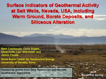
Surface Indicators of Geothermal Activity at Salt
Wells, Nevada, USA, Including Warm Ground, Borate
Deposits, and Siliceous Alteration
Mark Coolbaugh, Chris Sladek, Chris Kratt, Lisa
Shevenell, and James Faulds
Great Basin Center for Geothermal
Energy University of Nevada, Reno
Funded by grants from Amp Resources and Nevada
Geothermal Specialists
Borax Hot Spring
2
Newberry Crater
Geothermal Systems in Nevada Great Basin, USA
Big Southern Butte
China Hat
Borax Lake
Medicine Lake
Roosevelt/ Cove Fort
Salt Wells
Mammoth
Current GB Geothermal Power Plant Capacity is
600 MWe
Coso
Boundary of Great Basin
3
Broad diffuse zone of extension characterizes the
interior of GB Extension direction changes From
SW to NW as one moves from east to west Possible
sources of extension - back-arc spreading
- gravitational collapse - mantle
upwelling Deformation becomes trans-tensional
in western Great Basin - appears to correlate
well with increased geothermal activity
Salt Wells
Map from Faulds et al. (2005)
4
Salt Wells has been considered a blind geothermal
system because of a lack of known hot springs and
fumaroles
A large, 12-km-long, thermal anomaly is present
at Salt Wells
Map from GeothermEx Pier Report Dec./2003
5
At regional scale, Salt Wells is a blind
geothermal system At detailed scale, it is not a
blind geothermal system Surface
geothermal-related features 1) Opalized
sediments, bedrock, and sinter 2) Warm
ground 3) Hot springs and hot seeps 4)
Quaternary borate deposits 5) Quaternary fault
scarps 6) Advanced argillic alteration
These features can be used to map thermal
structures
6
Field Equipment 1) Thermocouple at the end of
12 long probe 2) GPS unit and Pocket PC 3)
Field spectroradiometer 4) Hand lens, acid
bottle
7
K-type thermocouple connected to Data Logger
(with digital storage capability)
Advantages cheap and rugged Disadvantage poor
calibration
8
Playa (shallow groundwatershallow temperature
measurements)
Piedmont (deeper groundwater) (alteration mapping)
Very shallow temperature measurements (30 cm
depth) can be effective in areas like playas
where groundwater is upwelling to the surface
Salt Wells, NV
9
Daily temperature variations at the surface damp
out quickly with depth.
surface
1-meter-depth
10
At a 30 cm (1 ft) depth, the 24- hour solar cycle
is almost completely damped out
Anomaly threshhold temperature used for this
mapping (12C)
midnight
Salt Wells, NV, Feb. 26, 2006, after an
unseasonably sunny, warm day
11
BASIC HAND-HELD GPS UNIT Hardware
200-300 for WAAS capability - accuracy as
good as 2-3 meters - very portable, AA
batteries - serial cable Software -
freeware available to facilitate data
downloads as ASCII-format files - point,
line, polygon data formats - limited data
attributing (name) - data storage 500 to
1000 points
WAAS wide area augmentation system
12
GPS Unit
POCKET PC iPAQ with ArcPAD Hardware -
1300 includes GPS, batteries - accuracy as
good as 2-3 meters - 400 MHz, 128 Mb RAM
- storage cards 128 Mb ArcPAD Software
- ArcGIS-compatible shapefiles - point,
line, polygon data formats - display of GIS
maps, images - customized display
symbols (strike/dips, drill-holes, temps) -
rapid data entry (attributes) with keypad, pick
lists Other Software Options - Discover
Mobile/MapInfo - TerraSync/Pathfinder
HP iPAQ 5550
13
Where am I?
14
Many evaporites minerals, including borates and
sulfates, have distinctive reflectance spectra in
the short wave infrared
mirabalite thenardite
Field spectroradiometer
gypsum (sulfate)
halite
mirabalite (sulfate)
tincalconite (borate)
thenardite (sulfate)
tincalconite
halite
15
In low-flow rate springs and seeps, siliceous
sinter may not always form, but other types of
surface and near-surface silicified materials may
be diagnostic of high-temperature geothermal
activity
Silicified surface/near-surface materials are
extensive at Salt Wells, NV, although true sinter
is rare
16
Salt Wells, NV
17
Silicified gravels with opal veins
Salt Wells, NV
18
Silicified shoreline sands
Salt Wells, NV
19
(No Transcript)
20
unsilicified colluvium
tufa
Lake Lahontan age Silica old high-temp Geothermo
meters current high-temp
Salt Wells, NV
21
Seven groups of hot springs over a distance of 5
km geothermometers average 180C
Unnamed, 57C
Borax Hot Spring, 81C
Unnamed, 58-66C
Unnamed, 48-55C
22
Playa fed by geothermal groundwaters -
temperature as high as 67C at 12 in. below
surface - no thermal springs or vents are present
Shallow sub-surface temperature measurements can
be a valuable exploration tool
85C at 1 meter depth
23
- Borate mining surface crusts raked into piles
to expose underlying ulexite - Residual piles
contain some tincalconite borax ulexite
NaCaB5O9.8H2O borax Na2B4O7.10H2O
This is a geothermally fed playa with no hot
springs temperatures at 12 depth are strongly
anomalous
24
Borate evaporite minerals can form proximal to
surface fluxes of geothermal fluids, with or
without actual hot springs
Borate mine near Salt Wells, NV active in 1870s.
No springs are present, but temperatures are as
high as 73C within 1 meter of the surface
25
Specimen of fairly pure surface borate crust from
locality of previous slide. Specimen has been
turned upside down, revealing fibers of borax
underneath fine-grained tincalconite.
Tincalconite forms at the surface from the
dehydration of borax.
26
Salt Wells, Nevada
Salt Wells, NV has been considered a blind
geothermal system, but detailed mapping reveals
evidence of geothermal activity
27
Salt Wells, NV
A hand lens and acid bottle (HCl) are useful for
identification of opal-cemented sands
28
Temperature anomalies
Over 1,000 shallow temperature measurements were
digitally recorded
Boundary of playa and shallow groundwater
Siliceous alteration
1 km
29
Detailed mapping of surface geothermal features
at Salt Wells has 1) identified faults that
control geothermal fluid flow over a
distance of 9 kms 2) increased awareness of a
possible second upwelling zone on the north
end 3) identified surface and near- surface
hot waters on the north end that can be
sampled for geochemical analysis
North End
South End (power plant under construction)
1 km
30
Multiple faults with different strikes appear to
intersect at the northern end of the Salt Wells
geothermal system
Hot Springs
N
1 km
31
Hot Springs and groundwater, north end, Salt
Wells, NV. geothermometers average 180C
57C
Borax Hot Spring, 81C
66C
85C at 1 meter depth
32
CONCLUSION
Surface mapping of geothermal features can
provide valuable information on the location and
structural controls of geothermal systems
Successful production well, south end Salt Wells,
April 2005
Photo Brad Platt
Recommended
