
Vital Signs Monitoring PowerPoint PPT Presentation
1 / 19
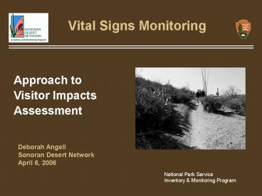
Title: Vital Signs Monitoring
1
Vital Signs Monitoring
Approach to Visitor Impacts Assessment
Deborah Angell Sonoran Desert Network April 6,
2006
National Park Service Inventory Monitoring
Program
2
Project Overview
- Saguaro National Park (SAGU) identified the need
to develop a Trail Management Plan as part of the
GMP - Need quantitative information on potential
impacts on park resources surrounding the trails - Visitor impacts is one of 25 SODN vital signs
- All SODN park managers are interested in
understanding potential visitor impacts to park
resources, such as trampling effects on soils and
vegetation. - Lack of information in existing literature on
impacts adjacent to desert trails
3
Project Overview
- Pilot study initiated
- Assist in development of network protocol
- Obtain information needed by SAGU
- Objective Document some of the impacts near
travel routes and destinations - Soils in arid and semi-arid environments are more
vulnerable to disturbance because they tend to
degrade more quickly and develop more slowly. - Soil Quality vital signs used to address Visitor
Impacts vital sign through the sampling design. - Comparing soil quality indicators across a
perceived gradient in visitor use
4
Study Area Saguaro NP Rincon District
- Cactus Forest Network
- Dense network of trails popular with hikers and
horseback riders - Most intensive concentration of trails within the
park - These trails bear highest level of visitor use
5
Sample Design
- Trail segments preselected using random point
generator in ArcView - Stratified based on soil type and hillslope with
proportional allocation of sites - X-Y coordinates in .dbf file exported to Excel
copied and pasted into the GPS Locations database
table
6
Transect Layout
7
Measures of Trail Impact
Soil/Vegetation Cover
Trail Profile
Soil Compaction
Soil Stability
Saguaro Recruitment Vandalism
8
Complementary Data
- Visitation and individual trail usage
- Historic land use
Automated counter pad technology
Trail tracking plots
Historic maps
9
Data Collection Paper Data Sheets
- 4 data sheets per trail segment
- Species/cover values preprinted on data sheets
- Data entry and QC required 150 hours
- lt 0.5 data entry error rate
- More errors in recording data in the field but
still a small percent
10
Data Collection Pocket Excel
- Copied and pasted Excel data into Access tables
- Added 10 minutes to recording time per transect
- Reduced data entry and QA/QC time to 30 hours
- Decreased both error rates
- Drawback to Pocket Excel no pick lists
- Used laminated species list cards
- Will investigate freeware that enables use of
pick lists
11
Data Collection Intercue Mobility Suite
- Intercue software allows data to be downloaded
directly into an Access database - Least satisfactory method too time-intensive
- 2-3 seconds to update after each of the 400
vegetation data points per transect - Completed only 5 m of 20-m transect in 30-45
minutes - Completed entire transect with Pocket Excel in
same amount of time
12
NRDT Database
- Mandatory Tables Locations, Events, 5 Field Data
- Mandatory if Applicable Tables Sites, Event
Groups, Data Locations - IM Recommended Naming Standards
- Lookup tables to populate pick lists soil
texture and cover types, saguaro height classes
13
Table Relationships
Worked well to model our project data
14
User Interface
15
User Interface
16
Quality Control
- Data Verification
- Paper data sheets two people compared 100 of
values on data sheets to database printouts - Pocket Excel Checked Access tables for correct
number of transects, etc. - Data Validation
- Plotted data and looked for outliers
- Looked at values to be sure they made sense
17
Lessons Learned
- Revise sampling design
- Did not find expected gradient of impacts
- Use 2 quadrats one next to and one 10 m away
from trail - Important to know multiple points not needed
- Better protocol for taking repeat photographs
- Dont let vegetation block view of trail
18
Lessons Learned
- Data flow worked well overall
- Data entry should be ongoing dont wait until
all data have been collected - Methods of measuring soil parameters worked well
and will probably be adopted by Network - SAGU is already using the trail profile data
For more information, contact Cheryl
McIntyre (520) 290-0828 cmcintyre_at_sonoran.org
19
Close Encounters
Desert tortoise crossing trail
Diamondback rattlesnake at trail edge
Recommended
