
2006 GIS User Group Meeting PowerPoint PPT Presentation
1 / 148
Title: 2006 GIS User Group Meeting
1
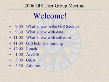
2006 GIS User Group Meeting
- Welcome!
- 900 Whats new in the GIS Section
- 930 Whats new with data
- 1100 Whats new with software
- 1130 GIS help and training
- 1200 Lunch
- 100 ArcGIS
- 300 QA
- 330 Adjourn
2
2006 GIS User Group Meeting GIS Section
Whats New in the GIS Section
3
2006 GIS User Group Meeting GIS Section
- MIS Professional Services
- The DNR has developed a funding model for
Management Information Services that features a
structural budget shortfall
4
2006 GIS User Group Meeting GIS Section
- MIS Professional Services
- MIS is responding by offering additional
project-based services following a service-bureau
type model. (Contact Robert Maki or Tim Loesch
for details)
5
2006 GIS User Group Meeting GIS Section
- MIS Professional Services
- GIS support services are not fee-based services
6
2006 GIS User Group Meeting GIS Section
- MIS Professional Services
- Our intent is to maintain our current open-door
policy to GIS technical support and to limit
for-fee services to large and medium-sized
projects (approximately 20 hours or greater in
duration)
7
2006 GIS User Group Meeting GIS Section
Whats new with data
8
2006 GIS User Group Meeting New Data
NRCS Web Soil Survey
- More than 2/3 of MN counties now have digital
soil surveys (SSURGO2) available
9
2006 GIS User Group Meeting New Data
NRCS Web Soil Survey
- SSURGO data served from the NRCS Soil Data Mart
by county (a shapefile and dozens of linked
tables) - DRS has a SSURGO layer, but
- NRCS data changes, processing required, so lag
time for DRS data to be updated - for this reason, the layer includes only the
most basic of attributes
10
2006 GIS User Group Meeting New Data
NRCS Web Soil Survey
- NRCS ArcView 3.x Soil Data Viewer extension
phased out - doesnt work with Windows XP - Interactive Web Soil Survey site is replacement
- http//websoilsurvey.nrcs.usda.gov
11
2006 GIS User Group Meeting New Data
NRCS Web Soil Survey
12
2006 GIS User Group Meeting New Data
NRCS Web Soil Survey-Define an AOI
13
2006 GIS User Group Meeting New Data
NRCS Web Soil Survey-Define an AOI
14
2006 GIS User Group Meeting New Data
NRCS Web Soil Survey-Soil Map
15
2006 GIS User Group Meeting New Data
NRCS Web Soil Survey-Data Explorer
16
2006 GIS User Group Meeting New Data
NRCS Web Soil Survey Summary
- Gives full access to all tabular data and its
complexities (nearly impossible to do by
downloading and linking tables) - Does not allow queries
- Does not allow users to download soils data used
in the session to their computers-can only be
used interactively
17
2006 GIS User Group Meeting New Data
- Public Recreation Information Maps (PRIM)
- DNR Forestry color infrared orthophotos
- DNR 24K Perennial Streams
- Trout Stream Special Regs Winter Regs
- Wild and Scenic Recreational Rivers
- DNR 100K Lakes - Muskie Lakes
- Priority Landscapes for Wetland Conservation
- DNR Forestry SRM sites
- State Forest Boundaries
- Municipal Boundaries
- Exploration and Engineering Boring Hole Locations
- 2004 Minnesota Deer Harvest
- New WMS Data
- MLCCS
18
2006 GIS User Group Meeting New Data
- Public Recreation Information Maps (PRIM)
- 16 maps were updated 8/2005
- Tim, Ken Boss
See QUICK THEMES SCANNED MAPS DNR PRIM Maps
19
2006 GIS User Group Meeting New Data
DNR Forestry Color Infrared Photos
- As of April 2006 the photos will be
password-restricted to DNR Forestry, Wildlife,
and other units that financially support the
orthorectification program - Contact Steve.Gallay_at_dnr.state.mn.us
- 218-327-4449 x228
- for password, access, and purchase information
20
2006 GIS User Group Meeting New Data
DNR 24k Perennial Streams
- A subset of the original DNR 24k Streams layer
-only streams where STREAM_TYPE 20 are
presented - Useful in maps and applications where
intermittent streams and other linear water
features are not desired - See QUICK THEMES HYDROGRAPHY DNR 24K Perennial
Streams
21
2006 GIS User Group Meeting New Data
Trout Stream Special Regulations
- Southeast Minnesota trout streams that have a
special regulation as described in the 2005
Minnesota Fishing Regulations
Trout Stream Winter Regulations
- Southeast Minnesota trout streams that have a
winter regulation as described in the 2005
Minnesota Fishing Regulations
See QUICK THEMES HYDROGRAPHY
22
2006 GIS User Group Meeting New Data
Wild and Scenic Recreational Rivers
- Contains designated Wild, Scenic Recreational
Rivers in Minnesota as specified in 1997 MN Rules
6105 - Intended to support cartographic applications
only
See QUICK THEMES HYDROGRAPHY
23
2006 GIS User Group Meeting New Data
DNR 100K Lakes Muskie Lakes
- Intended to support planning, fisheries
management, research and other resource-related
activities with impact on muskie lakes
See QUICK THEMES HYDROGRAPHY
24
2006 GIS User Group Meeting New Data
Priority Landscapes for Wetland Conservation
- Modeled information - each 40-acre unit has been
classified to define the relative potential to
provide benefits for a suite of wetland dependant
wildlife species - Index scales from 1 - 100, with 100 indicating
the best habitat, and the highest priority for
conservation - See QUICK THEMES ENVIRONMENTAL QUALITY
25
2006 GIS User Group Meeting New Data
DNR Forestry SRM sites
- Designed to generate feedback from those who are
seeking read only access to DNR Forestry
Silviculture/Roads Module (SRM) data via the
departments GIS data resource sites - Collected by DNR Forestry Administrative Areas
and are updated on a continuous basis, as needed
See QUICK THEMES LAND COVER
26
2006 GIS User Group Meeting New Data
State Forest Boundaries
- Updated to reflect changes discovered/ rectified
during SFRMP and State Forest Access Inventories
See QUICK THEMES ADMINISTRATIVE FEATURES
27
2006 GIS User Group Meeting New Data
Municipal Boundaries
- Maintained by the Minnesota Dept. of
Transportation, this data was updated to reflect
conditions as of December, 2004
See QUICK THEMES ADMINISTRATIVE FEATURES
28
2006 GIS User Group Meeting New Data
Exploration/Engineering Boring Hole Locations
- Location data for drill cores stored at the DNR
Lands and Minerals facility in Hibbing were taken
from the accompanying mineral exploration
assessment files - Locational data presented in this ArcView
shapefile are in DRAFT form . . . since the maps
in the files have many different scales,
locations have varying degrees of accuracy
See QUICK THEMES GEOLOGY AND SOILS
29
2006 GIS User Group Meeting New Data
2004 Minnesota Deer Harvest
- Annual Minnesota Whitetail deer harvest,
summarized by deer permit areas, broken down by
weapon used and buck/antlerless deer
See QUICK THEMES EVENTS AND SIGHTINGS
30
2006 GIS User Group Meeting New Data
WMS layers
- Under QuickThemes - Scanned Maps
- Iowa 100k USGS Topo Quads
- Iowa 24k USGS Topo Quads
- Under QuickThemes - Land Imagery
- 2000 Iowa USGS Black and White DOQ
- 2002 Iowa FSA Color DOQs
- 2002 USGS Color DOQ of Twin Cities
- 2003-2004 FSA Color DOQ
- 2004 DNR Wildlife Color Infrared DOQs
- DNR Forestry Color Infrared DOQs - Current Series
31
2006 GIS User Group Meeting New Data
MLCCS (MN Land Cover Classification System
- Popular land cover inventory for city and
counties - use in comprehensive planning - Standardized inventory procedures ensure
compatible data across jurisdictions
32
2006 GIS User Group Meeting New Data
MLCCS
- Endorsed by the Metropolitan Council's MetroGIS
as a "Best Practice" for conducting land cover
inventories - Capable of creating highly detailed inventories
of both natural communities and built-up areas - http//www.dnr.state.mn.us/mlccs/index.html
33
2006 GIS User Group Meeting GIS Section
Whats new with Software
34
2006 GIS User Group Meeting LandView
- LandView Current version 4.0.10 (1/05/06)
- Changes from previous versions include
- WMS imagery can be added as background maps
- Historic air photos work again
- When restoring original settings, a scheme is
created as backup - Background layers are refreshed when panning
- Measure tool point is now green (to not confuse
red Current Location point) - Can delete selected Measure Tool points
- Can load Measure Tool points into a Garmin GPS
- Tiled overlay data is updated when zoom or pan is
used - Wizard functions fixed
- CTRL-I zoom in, CTRL-O zoom out, CTRL-R
real-time GPS - Default symbology used when creating shapefiles
- Base Point and Move unit properties can be
changed - DRS/Local Menu option added
35
2006 GIS User Group Meeting LandView
36
2006 GIS User Group Meeting LandView
37
2006 GIS User Group Meeting LandView
38
2006 GIS User Group Meeting LandView
39
2006 GIS User Group Meeting LandView
40
2006 GIS User Group Meeting DNRGarmin
- DNR Garmin Current Version 5.1.1 (10/06/05)
- PRJ File Creation when saving to a shapefile
41
2006 GIS User Group Meeting DNRGarmin
- NMEA Enhancements
- Depth from Transducer
- PDOP, HDOP, VDOP
- Speed, Direction
42
2006 GIS User Group Meeting DNRGarmin
- ArcGIS 8.x/9.x Compliant
- Save to Shapefile, Personal Geodatabase, Graphic
- Load from Layer, Graphic
- Real-Time Tracking
- Calculate Circular Error of Probability
43
2006 GIS User Group Meeting DNRGarmin
- Calculate Circular Error of Probability
44
2006 GIS User Group Meeting DNRGarmin
- Use DNR GIS data to create background maps for
your Garmin Map GPS
45
2006 GIS User Group Meeting DNRGarmin
- MapSource background maps can be purchased/used,
but dont provide the detail that DNR data can - A set of shareware programs from the internet
allow you to create background maps yourself - GPSMapEdit
- GPSSendMap
46
2006 GIS User Group Meeting DNRGarmin
- GPSMapEdit program creates Garmin background maps
from ArcView shapefiles - Background maps have several advantages over GIS
data that is uploaded as waypoint or tracks - Store larger, more detailed GIS data sets (i.e.
FIM Inventory) as rather than generalizing
(smoothing) track data - Load as many background layers as you wish up to
GPS storage limits - Turn display of map layers on and off in GPS
- Use different point, line or polygon symbology
for background maps and create labels that can be
turned on and off in GPS - Still cant load raster data into GPS (i.e. FSA
photos and PRIM maps)
47
2006 GIS User Group Meeting DNRGarmin
- Compatible GPSs (also the GPSIII Plus, GPS 12
map)
48
2006 GIS User Group Meeting DNRGarmin
- Training
- There will be training classes available in the
spring (see training website) - Installation
- v\drs\apps\gps\gpssendmapsetup.exe
- Help/Training Files
- http//thoreau.dnr.state.mn.us/mis/gis/tools/arcvi
ew/Training/WebHelp/Training.html
49
2006 GIS User Group Meeting GIS Section
GIS Help and Training
50
2006 GIS User Group Meeting Intranet Pages
- Intranet GIS/GPS resources can be found at
- http//dnr.state.mn.us/mis/gis
51
2006 GIS User Group Meeting Training
- Other non-DNR GIS events listed
- Some DNR courses still have seats available
- Waiting lists developed for spring/summer courses
- contact your Regional GIS Coordinator
52
2006 GIS User Group Meeting Training
- 2005 GIS/GPS training stats
- GIS 17 classes, 203 students
- GPS 11 classes, 101 students
A DNR employee???
53
2006 GIS User Group Meeting DNR GIS WIKI
- WIKI What I know is . . ..
- Online collaboration tool allowing any registered
user to edit web page contents through a browser.
- Functions like a chalkboard.
- Goal WIKI is where DNR GIS users go to share
knowledge and expertise with one another. - Anyone can edit (most of) the WIKI. GIS staff
occasionally review pages to consolidate and
organize the site as needed. - http//dnrnet.state.mn.us/cgi-bin/giswiki.pl?
DNR_Intranet_GIS_Wiki
54
2006 GIS User Group Meeting DNR GIS WIKI
55
2006 GIS User Group Meeting DNR GIS WIKI
56
2006 GIS User Group Meeting DNR GIS WIKI
57
2006 GIS User Group Meeting GIS Section
ArcGIS ArcMap ArcView 9
58
2006 GIS User Group Meeting ArcGIS
- What is ArcGIS?
- A family of software products produced by ESRI
- Software upgrade to ArcView 3.x which tightly
integrates all software that ESRI markets - Arc/Info power GIS
- ArcView desktop GIS
- MapObjects programmable GIS
- Previously each ESRI software program had its own
code
59
2006 GIS User Group Meeting ArcGIS
- What is ArcGIS?
- Licensed at different levels of capabilities
- ArcView
- Least expensive, least capable software. Edit
shapefiles and Personal GeoDatabases. All the
functionality of ArcView 3 is here and more! - ArcEditor
- Mid-range pricing, increased functionality.
Supports multi-user Database editing - ArcInfo
- Expensive, full geoprocessing capabilities,
Designing and build multi-user databases,
establish topologic relationships
60
2006 GIS User Group Meeting ArcGIS
Licensing Levels
Arc/Info Edit SDE GeoDB Define Topology
Full Geoprocessing
Software Products
Capability
ArcMap ArcCatalog ArcToolBox Extensions
Spatial Analyst Network Analyst 3D
Analyst Geospatial Analyst All License
Levels can use Extensions
ArcEditor Edit Corporate GeoDB Increased
Geoprocessing capability
ArcView Edit Personal GDB Limited
Geoprocessing Run Models Rectify Air
Photos Use Extensions Map Topology
Create and edit Models Command Line Entry
Expense
61
2006 GIS User Group Meeting ArcGIS
- Hardware Requirements
- CPU speed 1 GHz or higher
- Memory (RAM) 512mb, 1 Gb recommended
- Swap space 300mb, 800mb recommended
- Disk space
- 50mb in Windows directory
- Program is 870mb installed
62
2006 GIS User Group Meeting ArcGIS
- Whats different about ArcGIS?
- Consolidated interface for all desktop products
- For ArcView 3.x users its a different look and
feel than what youre used to - Nomenclature and terminology is a little
different between ArcView 3 and ArcGIS - but not a big issue, really
- New Data types
- GeoDatabases, GeoWebServers, etc.
- New Program Modules
- ArcCatalog, ArcMap and ArcToolBox
63
2006 GIS User Group Meeting ArcGIS
- Whats different about ArcGIS?
- Like ArcView 3.x, ArcGIS has Extensions that
extend the core functionality of the program - Spatial Analyst grid processing
- 3D Analyst 3d modelling
- Geostatistical Analyst Interpolations and
hard-core spatial statistics - But . . . these are the same no matter what level
of software licensing you use - Can build extensions for ArcGIS with custom
functionality for specialized purposes
64
2006 GIS User Group Meeting GIS Section
- ArcGIS Licensing Policy
- The DNR Policy and Planning Committee has
recommended that access to ArcGIS software be
managed at the division/bureau level - The division/bureau coordinator is the
appropriate contact for assuring access to the
software resource - Anyone can install the software on their desktop.
However, ability to run the software may be
limited by network license availability
65
2006 GIS User Group Meeting GIS Section
- ArcGIS Licensing Costs (per person)
- Single use upgrade from ArcView 3 to ArcView 9.1
- 600.00 (conversion 1 yr maintenance) - Single use upgrade from ArcView 3 to Arceditor
9.1 - 5700.00 (conversion 1 yr maintenance) - Single use upgrade from Arcview 3 to Arc/Info 9.1
- 6400 (conversion 1 yr maintenance) - Annual maintenance after one year 400.00/
ArcView license (more for ArcEditor and ArcInfo)
66
2006 GIS User Group Meeting GIS Section
- ArcGIS Licensing Costs (per person)
- Opportunities to reduce deployment costs are
being explored
67
2006 GIS User Group Meeting ArcGIS
- How does this affect me?
- ArcGIS is licensed on a yearly basis
- Pay a yearly fee to use (ArcView 3 was a one-time
purchase and subsequent upgrade purchases) - License purchasing/administration coordinated by
the GIS Section - Two types of licenses
- Stand-Alone licenses
- Shared license
- Licenses are centrally managed
- Users must be on a network
68
2006 GIS User Group Meeting ArcGIS
- How does this affect me?
- Currently there are 31 shared ArcView - ArcGIS
licenses - 90 are reserved for designated users
- 10 are available for anyone to use
- To be a Designated User talk to your unit GIS/IT
lead - Requires a commitment for yearly license payments
69
2006 GIS User Group Meeting ArcGIS
- Unit GIS Contacts
- EcoServices Tom Glancy
- Fisheries Lyn Bergquist
- Forestry Dave Martodam
- Lands and Minerals Renee Johnson
- MR Robert Maki
- State Parks Ron Danielson
- Trails and Waterways Dave Lonetti
- Waters Joe Gibson
- Wildlife Steve Benson
70
2006 GIS User Group Meeting ArcGIS
ArcGIS FAQs
- What level of licensing is right for me?
- If you used ArcView 3.x, then ArcView is still
good for you - How Do I get ArcGIS Installed on my Computer?
- Contact your Regional GIS Coordinator
- Can I have ArcGIS and ArcView 3.x both on my PC?
- You bet! We all do
- Does ArcMap work with DNR Garmin?
- Without a doubt!
- Does ArcMap work with LandView?
- Absolutely!
- Is there a QuickThemes for ArcMap?
- Of course!
71
2006 GIS User Group Meeting ArcGIS
ArcCatalog
- Browse your data
- View the map and the table
- Create, define and manage data and projects
- Create
- and view
- metadata
72
2006 GIS User Group Meeting ArcGIS
ArcToolbox
- Geoprocessing commands are organized and accessed
in ArcToolBox - Equivalent to the DNR ToolBox for ArcView 3.x
- Build custom tools and Analysis models using
ModelBuilder - Share models and analysis commands
73
2006 GIS User Group Meeting ArcGIS
ArcMap
- Equivalent to ArcView 3.x interactive Map-based
tasks such as - Mapping
- Editing
- Queries
- Analysis
- Graphing
- Reporting
74
2006 GIS User Group Meeting ArcGIS
- ArcMap is the Software you use to visually
interact with data and make maps - This is the component most like ArcView 3.x
- Many of the tools and options are familiar
- Basic navigation, identify, zoom, etc.
- Some have changed names
- Most things have improved
- Labeling and text, printing, pan, and zoom tools
- A few things have not
- Not capable of multiple layouts!? Coming summer
2006 . . . - Some things are missing!
- Where are all the document folders?
75
2006 GIS User Group Meeting GIS Section
LUNCH
76
2006 GIS User Group Meeting ArcGIS
ArcView 3.x
ArcMap
Whats missing? Whats new?
77
2006 GIS User Group Meeting ArcGIS
- The ArcMap interface is composed of
- Table of Contents Shows legends, selection, and
source information for layers - Display Area This is where the map is displayed
- Data View displays data (View)
- Map View displays map layout (Layout)
- Status bar At the bottom of the display showing
status, coordinate information, etc. - Toolbars Organized sets of commands and tools
78
2006 GIS User Group Meeting ArcGIS
Toolbars
Display Area
Table of contents
Status Bar
79
2006 GIS User Group Meeting ArcGIS
- Commands and buttons for ArcGIS are organized
into Toolbars - Toolbars can be docked
- or floating, can be turned
- on/off
- Lots of toolbars exist
- Use VIEW Toolbars
- menu option to see the
- toolbars and their status
- If you lose a toolbar, look to see if it is
viewable or not
80
2006 GIS User Group Meeting ArcGIS
Floating Toolbar
Docked Toolbar
81
2006 GIS User Group Meeting ArcGIS
Standard Toolbar
Layout Toolbar
Tools Toolbar
82
2006 GIS User Group Meeting ArcGIS
- Context Menus organize options and commands
- Accessed by clicking the right mouse-button
- Shows those options that are valid within the
context of the item the mouse pointer is over - When you right-click on a Layer, only those
options valid for layers are displayed - Almost every item in ArcGIS has a Context Menu
- Get into the habit of right-clicking on things
you see, youll be surprised at what you can find!
83
2006 GIS User Group Meeting ArcGIS
- For instance, the Context Menu for a Data Frame
in ArcMap has only those options that relate to
what you can do on a data frame
84
2006 GIS User Group Meeting ArcGIS
- Data Frames
- Within the Table of Contents data layers are
organized into Data Frames (a View in ArcView 3) - Data Frames can be renamed, copied, pasted, and
deleted - Can have multiple frames, but only one can be
active - Alt-Click to activate a data frame
- Data Frames have their own property sheet
85
2006 GIS User Group Meeting ArcGIS
- Grids
- Drawn around Map Frames on a Layout for
referencing purposes - Three types of grids
- Graticules (Lat/Long)
- Measured (Map Units)
- Reference (Indexing)
86
2006 GIS User Group Meeting ArcGIS
- Frames
- Put borders around Map Frames on a Layout
- Border Styles
- Background fills
- Drop Shadows
87
2006 GIS User Group Meeting ArcGIS
- Extent Rectangles
- Allow you to point out where other Data Frames
are - Normally used in Locator maps
- Shows project areas in context within larger
geographic areas
88
2006 GIS User Group Meeting ArcGIS
- Grouped Layers
- Layers can be merged into groups of layers
89
2006 GIS User Group Meeting ArcGIS
- The Layer Context Menu
- Copy and remove layers
- Open a layers attribute table
- Join and Link (relate) tables
- Zoom to the active layer
- Set the visible scale range
- Use Symbol Levels
- Work with Feature Selections
- Label features
- Convert Labels to Annotation
- Convert Features to Graphics
- Export and manage Data (Convert to Shapefile)
- Save as a layer file
- Make a temporary file permanent
- Set layer Properties
90
2006 GIS User Group Meeting ArcGIS
- Defining Symbology
- Easy to create custom symbols
- Symbol Manager is quite extensive
- In ArcMap there are tons of predefined symbology
- Select one or create your own
- Change the fill color
- Outline color
- Use the Properties button to get into the guts of
a symbol - More Symbols are available
- The Symbol Selector is used for all symbol
operations
91
2006 GIS User Group Meeting ArcGIS
- Lots of Style Sets available
- Fiddle-Factor is quite high here but it is fun!
92
2006 GIS User Group Meeting ArcGIS
- Legends
- Single Symbol
- Categories
- Unique Values
- Quantities
- Used primarily on numeric fields
93
2006 GIS User Group Meeting ArcGIS
- Category Legends
- Select the Value field
- Use Add All Values button to add all unique
values to the legend - Use Add Values button to add selected values to
the legend - Select a color scheme, or
- Select each color patch to define symbols
- Aelect multiple symbols using Shift or Ctrl
keyboard buttons
94
2006 GIS User Group Meeting ArcGIS
- You can spend a lot of time defining layer
properties - Labels, symbols, definitions etc.
- These characteristics can be saved and shared
with others - Layer properties are saved in a Layer File .lyr
- Contains all of the instructions to reconstitute
this layer - Does not store data only the definitions
95
2006 GIS User Group Meeting ArcGIS
- ArcMap has a number of data exploration tools
- Some are familiar
- Identity
- Find (binoculars!)
- Select by Attributes (query) wheres the
Hammer? - Some are not
- Bookmarks
- Overview window
- Magnifier
- All are useful and powerful tools
96
2006 GIS User Group Meeting ArcGIS
- In ArcView 3 Active Themes were used to define
which layers are used for data retrieval - Information Tool
- Find Tool
- Feature Selection Tool
- In ArcGIS you dont have Active Themes
- Tool result windows control what info shows
- Selections are controlled via Selectable Themes
- You can have many themes selectable at one time
97
2006 GIS User Group Meeting ArcGIS
- Using the Identify Tool
- The Identify tool is used to list the attributes
of features you select by clicking on the mouse. - Its just like in ArcView 3.x
- Except
98
2006 GIS User Group Meeting ArcGIS
- You specify which layers you want to review in
the Info window - Top-most layer
- Selectable Layers
- All Layers
- Individual layers are listed below
- Selecting the entry in the ID window flashes the
shape
99
2006 GIS User Group Meeting ArcGIS
- Dont forget about Context menus!
- Set Bookmark
- Add Hyperlink
- Manage Hyperlinks
100
2006 GIS User Group Meeting ArcGIS
- Selectable Layers
- Defined in TOC, or
- Selection Set Selectable Layers
101
2006 GIS User Group Meeting ArcGIS
- ArcMap has new tools for exploring data
- Spatial Bookmarks a bookmark that is tied to
coordinates rather than a URL - Overview Window a window that allows you to
view where you are zoomed to (locator map) - Magnifier a window that magnifies the area
under the cursor without having to actually zoom
in
102
2006 GIS User Group Meeting ArcGIS
- Spatial Bookmarks allow you to keep track of
where youve been and want to go back to - Create, Name, Edit and Zoom-To bookmarks
- Like a web bookmark, only location in nature
- Zoom to a place of interest and then use the VIEW
Bookmarks option to create a bookmark
103
2006 GIS User Group Meeting ArcGIS
- Bookmarks When you create a bookmark you give
it a name - To return to a bookmark use the VIEW Bookmarks
option - Bookmarks show up below the Manage option
- Selecting a bookmark will pan and zoom to that
location
104
2006 GIS User Group Meeting ArcGIS
The Overview Window is turned on using WINDOW
Overview - Red outline indicates where
you are zoomed to
105
2006 GIS User Group Meeting ArcGIS
The Magnifier Window is turned on using WINDOW
Magnify - You can change the amount of
magnification (right-click the
magnifier banner)
106
2006 GIS User Group Meeting ArcGIS
- All Feature datasets have tables
- Open a table by right-clicking on the layer of
interest and selecting the Open Attribute Table
option - Tables not stored in a separate Table folder
107
2006 GIS User Group Meeting ArcGIS
The Table view
Fields and field names
Name of table
Records selected
Show all or selected records
108
2006 GIS User Group Meeting ArcGIS
- Select records with the mouse pointer along the
left edge.
109
2006 GIS User Group Meeting ArcGIS
- Field Tools Field Context menu
- To hide a column, drag the right edge of the
column to the left - To make it visible again, double-click on the
column edge
110
2006 GIS User Group Meeting ArcGIS
Options allow you to modify a table - click the
Options button
111
2006 GIS User Group Meeting ArcGIS
- ANNOTATION
- Static
- Managed individually
- Stored in map document or geodatabase
- May or may not be linked to feature
- Use to create high quality map output
- LABELS
- Dynamically placed
- Managed as a Group
- Created for features in View
- Linked to feature
- Use for general on-screen viewing or creating map
books
112
2006 GIS User Group Meeting ArcGIS
- Converting Labels to Annotation
- Automatic Placement doesnt always work
- Annotation is choice for high quality maps where
label placement is critical - Human intervention is required for fine-tuning
- Let ArcMap automatically place the labels,
convert them to Annotation, then adjust them
manually
113
2006 GIS User Group Meeting ArcGIS
- ArcMap has two ways to present data
- Data View (for ad-hoc data exploration)
- Equivalent to a View document in ArcView 3
- Can simulate multiple Views using Data Frames
- Layout View (for map creation)
- Equivalent to a Layout document in ArcView 3
- Unlike ArcView 3, cannot have multiple Layouts
- Switch Views using the buttons on the lower part
of the view window
114
2006 GIS User Group Meeting ArcGIS
- Layout View
- A piece of paper with all Data Frames added
Three Data Frames
Data Frame View
Layout View
115
2006 GIS User Group Meeting ArcGIS
- Legends have lots of properties - can make very
nice presentations
116
2006 GIS User Group Meeting ArcGIS
- Map Templates
- A way to set up predefined layout elements and
then load them into your Map Document
117
2006 GIS User Group Meeting ArcGIS
- Editing spatial data
- ArcMap provides a rich set of editing tools
- Can edit many layers simultaneously
- good or bad, you decide
- Lots of new tools and some new terminology
- More powerful editing means more complicated
processes . . .
118
2006 GIS User Group Meeting ArcGIS
- The Edit Toolbar
- Contains all of the necessary tools for basic
editing - If you dont see the Edit Toolbar youll need to
turn it on - Use the Edit Toolbar Button
- Using the VIEW Toolbars menu
119
2006 GIS User Group Meeting ArcGIS
- To Start an edit session Press the Edit button
and then select Start Editing
120
2006 GIS User Group Meeting ArcGIS
- Once you start and edit session you must tell
ArcMap what data to edit - This is not a shapefile but a folder or database
where one or many shapefiles are stored - All shapefiles in your document that are in that
folder are now editable
121
2006 GIS User Group Meeting ArcGIS
- Editing has many options
- Target defines the file that is being edited
- Tasks define what it is you are going to be doing
122
2006 GIS User Group Meeting ArcGIS
123
2006 GIS User Group Meeting ArcGIS
- Can copy features from one file to another works
just like copying text in a word processor - Use the Select Feature tool to select
- Copy the feature to the Clipboard
- CTRL-C
- EDIT Menu Copy option
- Copy button
- Paste the feature to the Target
- CRTL-V
- Edit Menu, Paste Option
- Paste Button
124
2006 GIS User Group Meeting ArcGIS
- Editing shared boundaries is called topologic
editing in ArcGIS - Must have the Topology Toolbar visible
- View Toolbars Topology
- Contains tools that are specific to editing
shared boundaries - Works in conjunction with Topology tasks
- Modify Edge
- Reshape Edge
- Auto-complete Polygon
125
2006 GIS User Group Meeting ArcGIS
- Topology establishes which features share
boundaries - Once topology is established you can select and
edit shared boundaries - Use the same general technique as a non-topologic
boundary edit - Task must be set to Topology Tasks
126
2006 GIS User Group Meeting ArcGIS
- QuickLayers A Jumpstart to ArcMap
127
2006 GIS User Group Meeting ArcGIS
- QuickLayers
- The DNRs GIS data is stored in structure called
a Data Resource Site (DRS) - Users mainly access this information in ArcView
3.x using a tool called QuickThemes - QuickThemes has been ported to ArcMap (now called
QuickLayers) and improved - Goal is the same a single portal to DNR GIS
data - Basic concepts are the same
- Organize content by thematic class
- Provide metadata and status maps
128
2006 GIS User Group Meeting ArcGIS
- QuickLayers for ArcMap is accessible from the
FILE MNDNR Extensions - Turn on the extension using the checkbox, then
click OK
129
2006 GIS User Group Meeting ArcGIS
- DNR QuickLayers button will appear dock or keep
floating
130
2006 GIS User Group Meeting ArcGIS
- If you close QuickLayers use View Toolbars
131
2006 GIS User Group Meeting ArcGIS
- Four tabs
- DRS Themes organized by thematic class
- Unit Themes used to publish themes specific to
Units or projects - Custom Themes these are your own themes you
want to save - Search Search for data based on keywords
132
2006 GIS User Group Meeting ArcGIS
A number of tools
Roll up/down Add Theme Status Map Open LandView
Copy Theme Paste Theme Delete Theme Create New
Category Edit Category Copy Category Paste
Category Show Metadata
For Custom Themes
133
2006 GIS User Group Meeting ArcGIS
- Thematic Categories are represented as folders
- Each folder contains a number of Layers
- Layers are represented
- with a blue icon
- Layers with multiple representations have their
own folders - Non-colored Icons mean
- no template is built yet
134
2006 GIS User Group Meeting ArcGIS
- View Metadata for layers by expanding the
QuickLayers window - Links to the full metadata record on DNR server
135
2006 GIS User Group Meeting ArcGIS
- Adding Layers
- To add layers double-click on a layer, or
- Highlight a layer and press the Add Layer button
- Can only add one layer at a time
136
2006 GIS User Group Meeting ArcGIS
- Accessing Landview
- Users can open LandView to do searches
- Can then Zoom to place in ArcGIS
137
2006 GIS User Group Meeting ArcGIS
- Searching for Data
- Use to find layers of interest
- Searches are conducted on the metadata
- Can specify which section of metadata you wish to
search - Layers are displayed as they are found
- Add layers like you normally would
138
2006 GIS User Group Meeting ArcGIS
- Managing Layers
- Unit Layers
- Centrally managed layers
- Distributed via DRS
- Units or Projects OK
- Can be organized in any way
- Coordinated through Central office GIS staff
- Built from Layer files
139
2006 GIS User Group Meeting ArcGIS
- Managing Layers
- Custom Layers
- Organize Layers your way!
- Can copy and paste from DRS and Unit Layers
- Can create as many categories as you like
- Add themes from Layer Files
- Custom Layer information stored in
TEMP\user.layers
140
2006 GIS User Group Meeting ArcGIS
- To Create a Category
- File Insert Category, or Create new Category
button
141
2006 GIS User Group Meeting ArcGIS
- To add a new layer
- Custom Insert New Theme, or
- Create New Theme button
142
2006 GIS User Group Meeting ArcGIS
- Copy and/or paste from Unit or DRS Themes
- Use the Copy and Paste Themes tool or Context menu
143
2006 GIS User Group Meeting ArcGIS
- DNR ArcView Tools gt ArcToolbox
144
2006 GIS User Group Meeting ArcGIS
- ArcToolbox
- Nearly all functions found in the DNR Toolbox
are now standard in ArcToolbox (plus many more!) - Toolbox functions listed will depend on your
level of ArcGIS software (ArcView, ArcEditor,
ArcInfo) - Toolbox functions will also depend on if you have
extensions turned on or not
145
2006 GIS User Group Meeting ArcGIS
- Toolbox functions have interactive popup windows
with help dialogs
146
2006 GIS User Group Meeting ArcGIS
- Toolbox functions will all be listed regardless
of which Layer(s) you have active - Use the Index and/or Search tabs to find
appropriate tools - Customize your Toolbox by adding/eliminating/group
ing functions - Create new tools from scripts, string tools
together to form models
147
2006 GIS User Group Meeting GIS Section
Questions Answers??? Round Table
148
2006 GIS User Group Meeting
- Thanks for attending!
- See the online training file at
- http//thoreau.dnr.state.mn.us/mis/gis/
tools/arcview/Training/WebHelp/ Training.html - to access this slideshow
Recommended
