
Monitoring and assessment of nonpoint source pollution from agricultural dominated catchments - PowerPoint PPT Presentation
1 / 19
Title:
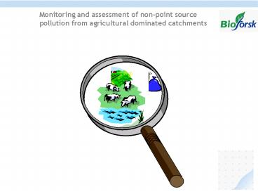
Monitoring and assessment of nonpoint source pollution from agricultural dominated catchments
Description:
Arable land. 272. Forest area. 129. Urban/other. 38. Total area ... Arable land, grain, South-eastern Norway. Phosphorus dynamics. Pastures. South-west Norway ... – PowerPoint PPT presentation
Number of Views:29
Avg rating:3.0/5.0
Title: Monitoring and assessment of nonpoint source pollution from agricultural dominated catchments
1
Monitoring and assessment of non-point source
pollution from agricultural dominated catchments
2
The Norwegian Agricultural Monitoring Programme
(JOVA)
- The programme has been in operation since 1992
- 10 agricultural catchments varying in size from
1- 20 km2. - catchments represent
- different geo-hydrological settings,
- agricultural practices and
- climatological conditions
3
Catchment description
4
Monitoring and assessment of nutrient loads
measuring discharge, water sampling
Discharge measurement using Crump weir,
V-notch Water sampling and analysis(TDS, Ntot,
Ptot)
runoff(mm) N,P,SS loss (kg.ha-1)
5
Catchment characteristics
Topography of the Skuterud catchment and
surrounding areas ranging from approximately 85
(green) to 150 (grey) meters above sea level. The
Skuterud stream in blue.
Total area 450 ha
6
Soil type, landuse
7
Jordbrukspraksis
- 11 farms
- 51 farmer fields
- many combinations of
- crops
- sowing/harvisting dates
- farming practices
8
The monitoring station
- What is it
- To measure discharge, to take water samples or
both - Equipment
- Logger and water sampler types, in situ water
parameters (EC, pH, NO3, etc), reliability - Operation
- Be in operation 24 hrs/day when no currency,
winter climate, automatic transfer of data - Heating monitoring station needed,
(kerosene/gas?), how initiated - Locations
- Remote areas, how automatic transfer of data
9
(No Transcript)
10
What about the flashiness index What is
flashiness in runoff?
11
Short-term variability/flashiness in Norwegian
catchments
Nitrate concentrations Arable land,
grain, South-eastern Norway
Phosphorus dynamics Pastures South-west Norway
(Vagstad, Deelstra and Eggestad)
12
Winter runoff (Øygarden, 2000)
Short-term variability/flashiness in Norwegian
catchments
January 30 Runoff 25 mm Soil loss 2 kg ha-1
January 31 Runoff 77 mm Soil loss 3 050 kg ha-1
13
Results showing the variability in losses between
catchment
14
Monitoring and assessment in Baltic Sea countries
- Baltic Sea under severe stress
- Loads from agriculture one of main reasons
15
Programmes to monitoring and assess nutrient loss
from agriculture in Baltic countries
Cooperation with Norway, Sweden since 1993
resulted in several monitoring projects, based on
same principles. Baltic Sea Regional Project
(BSRP, since 2000)
- Main results of those programmes
- Similar reporting routines(national/international)
in Nordic/Baltic countries on nutrient loads
from agriculture to Baltic Sea. - Collected data used in research and education,
calibrate and validate simulation models - Training and capacitiy building
(national/international)
16
Training, capacity building in monitoring and
assessment of nutrient losses from agricultural
catchments (Extension to farmers, Latvia)
Mellupite catchment, Latvia Large catchment
drainage field 16 small plots (different
fertiliser appl.)
17
Training, capacity building in monitoring and
assessment of nutrient losses from agricultural
catchments
18
First monitoring station in Leningrad Oblast
(through cooperation between Sweden/Norway with
St Petersburg)
Crump weir, Suida catchment
Planned monitoring station
19
Various uses of dataChallengesUse of
collected data in modeling?Simulation
models? SOILNDB/HBV? SWAT? Drainmod? SWAP/Ani
mo?How to deal with in-day variation and/or
freezing/thawing?Subsurface drainage
Recommended
CrystalGraphics Presentations


