
Remote Sensing PowerPoint PPT Presentation
1 / 16
Title: Remote Sensing
1
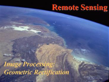
Remote Sensing
Image Processing Geometric Rectification
2
Remote Sensing
- What is geometric rectification?
- The conversion of satellite image coordinate
system to a standard map projection - Why is it necessary?
- Accurate location within an image
- Importing remote sensing data to GIS
3
Remote Sensing
- Satellite Imaging Systems
- Scan mirror
4
Remote Sensing
- Satellite Imaging Systems
- Scan mirror
- Linear Array
5
Remote Sensing
- Satellite Imaging Systems
- Scan mirror
- Linear Array
- Area array
6
Remote Sensing
- Systematic Distortions in Satellite Imaging
Systems - Panoramic Distortion
- Platform velocity
- Earth rotation
- Spacecraft altitude
- Terrain
7
Remote Sensing
- Additional Distortions in Scan Mirror Systems
- Scan Skew
- Mirror-scan velocity
8
Remote Sensing
- Distortions due to Spacecraft Systems
- Scan Skew
- Mirror-scan velocity
- Can be corrected using spacecraft design data
- Platform velocity
- Spacecraft altitude
- Can only be corrected using telemetry from the
speccraft
9
Remote Sensing
- Panoramic Distortion
- Due to spacing of detectors and regular sampling
- Increases with swath
- Corrected using orbital model
10
Remote Sensing
- Earth Rotation
- Due to time taken to build an image
- Each line offset to the west from the previous
one - Corrected using orbital model
11
Remote Sensing
- Earth Rotation
- Due to time taken to build an image
- Each line offset to the west from the previous
one - Corrected using orbital model
12
Remote Sensing
- Terrain
- Due to small changes in altitude and aspect
- Can be corrected by ortho-rectification
- Requires a DEM
- Can be corrected using a rubber sheet
rectification based on ground control points.
13
Remote Sensing
- Rectification
- Based on ground control point selection
- Establishes a relationship between the image
coordinate system and the map coordinates - Rubber sheet the image coordinates to match
those of the ground control points - Use interpolation to determine the reflectance
value for the new grid points.
14
Remote Sensing
- Ground Control Points
15
Remote Sensing
- Interpolation of Reflectance Values
16
Remote Sensing
- Interpolation of Reflectance Values
Recommended
