
Athos I Oil Spill PowerPoint PPT Presentation
1 / 25
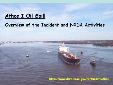
Title: Athos I Oil Spill
1
Athos I Oil Spill Overview of the Incident and
NRDA Activities
http//www.darp.noaa.gov/northeast/athos
2
- November 26, 2004, the 750-foot tanker Athos I
struck several submerged objects in the Delaware
River near Philadelphia.
3
Vessel hit submerged objects within a designated
anchorage area 18,000lb anchor concrete block
and pump casing
Anchor punctured 7 center cargo tank and port
ballast tanks. Bulkhead damaged allowing oil to
flow from ballast tank into river
4
Initial estimate 30,000 gallons 30 Nov estimate
473,500 gallons January 2005 estimate 265,000
gallons
Clean-up ended 22 April 2005 221,910 gallons of
oil and oil/water mix collected 17,761 tons of
oily solids collected
5
Responsible Party Information
- Athos I single-bottom, double-sided vessel
- Registered under the flag of Cyprus
- Owned by Frescati Shipping Company
- Operated by Tsakos Shipping Trading
- Designated as the RP
6
Oil Characteristics
Bachaquero Venezuelan crude oil
- Slightly buoyant (floats in fresh water density
0.98 g/mL) - Very viscous (cold honey gt50,000 cSt at ambient
water temp) - Very sticky
7
Initial Oil Behavior Pooled Oil
Initial high pressure oil release cut a trench
which held the cohesive, pooled oil
8
Initial Oil Behavior Floating Oil
- Floating oil spread to PA then NJ shores
- Heavy shoreline oiling, oiled debris
- Tarballs throughout lower river/upper bay
9
(No Transcript)
10
Floating Oil, Two scenarios . . .
(1) Submerged - Oil on sandy substrates picked
up enough sand to become negatively buoyant but
still transported by currents just above the
bottom and (2) Stranded Oil that stranded
on gravel beaches penetrates and binds to gravel
11
Trustees State of New Jersey Commonwealth of
Pennsylvania State of Delaware Federal NOAA
U.S. FWS
12
Joint Assessment Team (Trustee Council and RP
Reps)
Trustee Council
RP Team
Legal
Legal
Shorelines
Shorelines
Birds and Wildlife
Birds and Wildlife
Aquatic
Aquatic
Lost Use
Lost Use
13
Shoreline Oiling
- Surveyed 420 miles of shoreline, noting shoreline
type and degree of oiling (SCAT) - About 280 miles of oiled shoreline from
Tacony-Palmyra Bridge to Smyrna River
14
(No Transcript)
15
Miles of Oiled Shoreline
16
Birds and Wildlife - Response
- 187 dead birds 389 rehabilitated and released.
- 6 mammals 23 fish 5 reptiles
- Aerial and ground surveys (counts of birds by
species by degree of oiling)
- Through Jan. 05, dataset includes observation of
over 500,000 birds (representing over 100
different species)
17
(No Transcript)
18
Aquatic Resources
Surface and near bottom water samples in river
and tributaries (total and individual
PAHs) Striped bass, shad, perch, catfish and
oysters collected for tissue analysis (total and
individual PAHs) Monitoring horseshoe and blue
crabs
19
Aquatic Resources - Benthic Habitat
Oil snares and V-SORS
Intertidal and tidal sediment cores (total and
individual PAHs) Sediment Toxicity Triad
20
Recreation Losses Compiled historical data on
recreational use and values
Conducted interviews with boating, fishing, and
hunting interests
Monitored potential reduced beach use associated
with remobilization of oil
21
Summary of Injury Estimates
- Shoreline (including tidal flats) (SCAT)
- Over 1,000 acres were very lightly, lightly,
moderately, or heavily oiled - Tributaries six tributaries, with a total area
of more than 1,000 acres were exposed to very
light to moderate oiling - Aquatic (Field Assessments and Modeling)
- Subtidal habitat Over 400 acres were exposed to
Athos oil - Birds (Field Assessments and Modeling)
- Dead (includes direct and indirect losses)
22
Summary of injury estimates cont
- Recreational trips on the river either were lost
or had diminished value as a result of the spill - Recreational fishing
- Waterfowl Hunting
- Pleasure Boating
23
(No Transcript)
24
NRDA Claim
- NRDA claim to be presented to NPFC estimated to
be 20 million (restoration) - Trustees NRDA assessment costs ????
- NOAA currently serving as LAT
- States of PA, NJ, and MD to assume role of Lead
Implementing Trustees (LIT) for restoration
projects
25
NRDA Overview
NRDA initiated 11/27/04 Started out as a
cooperative process between Trustees and RP, but
RP exceeded liability and became Trustee only
NRDA Preassessment data collection efforts and
findings in Trustee Preassessment Data Report
(NOAA 2006) Athos Draft DARP/EA being finalized
(Spring 08) Describes exposure, injuries,
potential range of restoration alternatives,
preferred restoration alternatives, including
costs
http//www.darp.noaa.gov/northeast/athos
Recommended
