
Glaciers and Ice Sheet Interferometric Radar PowerPoint PPT Presentation
Title: Glaciers and Ice Sheet Interferometric Radar
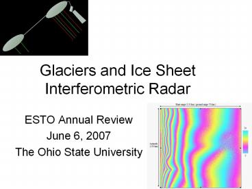
1
Glaciers and Ice Sheet Interferometric Radar
- ESTO Annual Review
- June 6, 2007
- The Ohio State University
2
GISIR/GISMO Team
- The Ohio State University (K. Jezek, J. Johnson)
- The Jet Propulsion Laboratory (E. Rodriguez, A.
Freeman) - The University of Kansas (S. Gogineni)
- Vexcel Corporation (X. Wu, J. Curlander)
- E.G.G Corporation (J. Sonntag)
- Collaborative with Wallops Flight Facility (W.
Krabill) - Science team members
- University of Utah (R. Forster)
- University of New Hampshire (M. Fahnestock)
3
Briefing Overview
- 0900 Welcome 0910 Project Status (Jezek) 0920
Radar System (Gogineni) 0940 Interferogram
Processing and tomography (Wu) 1000 InSAR
Clutter Rejection, Filtering, Refraction and - motion corrections (Rodriguez) 1020
Aircraft Navigation and Motion (Sonntag) - 1035 Break
- 1045 Topography estimation (Forster)
- 1100 GISMO modeling (Johnson) 1115 April
Deployment Summary, Recovery Plan, Plan - for September (Jezek) 1135
Project Schedule, Plans for Year 3 and Budgets - (Jezek, Telecon to Carl
Wagenfuehrer at ESTO) 1200 End - Tour of BPRC and ESL
4
GISMO Project Status
Kenneth Jezek
5
SAR Science Milestones Imaging the Ice Sheet
Surface
RADARSAT-1 AMM 1997
RADARSAT-1 MAMM 2000
6
GISMO Create new 3-D mosaics of Greenland and
Antarctica stripped of their icy cover
7
- The GISMO Heritage
NASA PARCA (initial radar Developments)
NSF Seed Study (SAR Feasibility and Algorithms)
NSF PRISM Ice Sounding SAR Demonstration
1992
NASA ESTO and NSF STC Ice Sounding InSAR Radar
Tomography Multiaperture Beam Formation
1996
2001
2006
GISMO
2010
8
Global Ice Sheet Interferometric Radar (GISIR)
PI Prof. Kenneth C. Jezek, The Ohio State
University
Objective
Filtered basal inferogram
InSAR Concept
- Develop and test radars and algorithms for
imaging the base of the polar ice sheets - Investigate interferometric and tomographic
clutter rejection and basal imaging methods - 3-d topography of the glacial bed
- Images of subglacial conditions
- Develop multiphase center P-band and VHF radars
- Capable of sounding 5 km of ice
- Single and repeat pass interferometric operation
- Assess the requirements for extension to
continental scale campaigns
Repeat pass tomography
Approach
Key Milestones
- Use available topography data to simulate
interferograms for testing the InSAR and
tomographic concepts. - Modify the SAR simulator to include operating
characteristics of several aircraft and several
radar designs - Develop UHF and VHF radars and antenna systems
- Test methodology by collecting data over the
Greenland and Antarctic ice sheets - Algorithm validation and sensitivity assessment.
1/ 06 Phase History Simulations and Algorithm
Testing 5/06 First flight test in Greenland
(Twin Otter 150 MHz) 7/06 InSAR algorithm
refinement 3/07 Radar and Antenna
Development 7/07 Tomography algorithm
refinement 9/07 Greenland Field Campaign (NASA
P-3) 5/08 Second Greenland Campaign (NASA
P-3) 6/08 Algorithm and methodology assessment
7/08 Requirements doc. for continental scale
imaging
Co-Is E. Rodriguez, JPL P. Gogineni, U. Kansas
J. Curlander, Vexcel Corp. John Sonntag, EGG
C. Allen, U. Kansas P. Kanagaratnam, U. Kansas
TRLin 3
http//esto.nasa.gov
9
GISIR IIP Concept Evaluation Objectives
- Ice sounding performance at P-band and VHF
- SAR imaging of basal ice from aircraft for swath
topography and reflectivity maps - Clutter rejection (Interferogram filtering
tomography multi-aperture beam steering) - Evaluation of ionospheric effects
10
Project Accomplishments
- Theoretical concept well defined
- Phase history simulations confirm theoretical
predictions - Radar design trade completed
- Scaling study completed
- 150 MHz radar system deployed for May 06 test
flight in Greenland - Tomography algorithm implemented and tested
11
Project Accomplishments cont.
- For the first time, SAR data acquired from
aircraft and successfully processed to SAR images
and interferograms of glacier bed - For the first time, left right clutter separation
verified - For the first time, 3-d basal topography
estimated along a swath from aircraft - For the first time, multiaperture beam formation
tested down Jacobshavn Glacier for clutter
rejection
12
GISMO Radar S. Gogineni, C. Allen, F.
Rodriguez, J. Ledford, K. Marathe, V. Jara
and S. Raghunandan
13
Outline
- Introduction
- Tasks
- Experiments and Results
- Multiple-aperture processing
- Radar Design
- Sub-system assembly and tests
- Integration and tests
- Antenna
- Installation
- Failure
- Analysis
- Problem and solution
- Reassembly and tests
- Plans
- Schedule
14
Clutter Problem and Solution
15
Data Over Antarctic from P-3 aircraft
16
Clutter Reduction MVDR
17
Radar and Algorithm
- MCRDS
- 150 MHz radar
- Chirped over 140 MHz -160 MHz
- Transmit Peak Power 800 W
- Alternating 3 and 10 msec pulses
- 5 Transmit and Receiver elements on a Twin Otter
- 4 Transmit and 4 Receive elements on P-3B
aircraft
18
Results from Greenland Geometric
19
Radar specs
20 MHz40 MHz
20
Radar Block Diagram
21
Radar hardware
- Radar is fully integrated and tested
22
Antennas
- Dipole antennas (dual-band) were designed and
constructed. - Baluns were tuned to achieve best performance
trade-off between 150 MHz and 450 MHz.
450 MHz assembly
150 MHz assembly
23
Antenna Measurements
24
Cabling for P-3
25
Delay-line tests (pre-deployment)
450 MHz test data
150 MHz test data
26
Radar Failure
- DMA and time out errors
- This persisted for more than 15 minutes
- DAQs are brought up first and Transmitter later
- worked and collected data over the ocean with /-
60 deg roll.
27
Radar Failure
- We concluded there is a digital system problem
- We could not duplicate the errors and suspected
an operator error April 20th - Took off and started the system with DAQs first
and transmitter later. - Collected delay line data for about 10-15 minutes
- Tested with transmitter started first and errors
appeared. - April 21st
- They removed and reseated all boards in the
front. - The system worked properly for about 1.5 hours
28
Radar Failure
- April 24th
- Informed that there is a fuel leak on the plane
- We wanted to take advantage of the downtime to
calibrate the radar - System would not start
- Backplane was removed and board reseated.
- Power supply would not come up
- Five boards failed simultaneously and could not
recover from this failure
29
Troubleshooting
- Duplicated DMA errors in the lab
- Caused by PCI controller (PLX chip)
- PCI controller chip replaced on defective
carrier boards - Boards are fully functional
- System has been working in the lab for almost a
month
Controller chip
30
Sample Test Data at 450 MHz
5-45 MHz BW
5-45 MHz BW
15-45 MHz BW
31
Procedure
- Back-up each board with one spare
- A back-up data system
- UAV system
- A commercial-unit with less capability
- Experimental system
- Need time to troubleshoot at WFF or in the
field, if necessary - More experienced personnel
32
Plans
- Improve waveform characteristics
- Pre-distort waveform to obtain 50-60 dB range
sidelobes - Perform antenna return loss and mutual coupling
measurements - Design and incorporate antenna matching network
- Readiness review First week of August 07
- Installation August 15-17, 07
- Test flights August 22-24, 07
- Departure September 3-6, 07
33
Side-lobe Level Improvement
- Currently analyzing phase and amplitude errors to
implement appropriate waveform pre-distortion and
maximize bandwidth.
15-45 MHz BW
Typical phase Response
Misaridis and Jensen use of modulated excitation
signals in medical ultrasound. part II
34
Improvements
35
Summary
- Radar is ready for data collection
- Understood what caused the failure and developed
back-up as well as trouble-shooting procedures - Some system improvements will be made (e.g.
side-lobe reduction, antenna matching network)
36
(No Transcript)
37
Digital System and Clock Generation
38
Transmitter
39
Antennas
40
Receiver
41
Clutter Rejection
Clutter Reduction MVDR
42
GISMO Annual Review 2007
- June 6, 2007
43
Contents
- Data processing
- Range compression
- Azimuth compression back projection algorithm
- Auto focus motion compensation
- Interferometric processing
- Tomography Processing
- Left/right side interferogram seperation
- On-site processor
- Future work
44
Interference
- Data corrupted by interference
- Only 4 data sets out of about 100 are clean data
sets !! These data sets are file no. 31 to 34.
range spectrum with interference
range spectrum without interference
45
Range compression
Range (5840 m)
- Ideal chirp is used for range compression
Azimuth 6500m)
Range compressed image of a clean data set (left,
file no. 33). Range compressed image of a data
set corrupted by interference (right, file no.
67).
46
Azimuth compression
Z (5840 m in free air)
- Imaging plane
- Back-projection algorithm
aircraft
X (5840m)
x
y
z
47
Consider two-layer Refraction
- Effective range r r1 r2 n2
48
Azimuth compression consider refraction
Z (3200 m true depth)
X (5840m)
49
Auto focus motion compensation
Z (5840 m)
X (5840m)
Original
After auto focus phase correction
50
Interferometry
- -Interferogram from the same transmit channel T0
range 5840 m
azimuth 5840 m
created from T0/R0 and T0/R3 with equivalent
baseline of 6.43m.
51
Interferometry
- -Interferogram from the same receive channel R0
range 5840 m
azimuth 5840 m
created from T0/R0 and T1/R0 with equivalent
baseline of 3.91m.
52
Return pass interferometry
- Flight tracks
Out-bounce
x
y
In-bounce
- Using the same reference and coordinate system
aircraft
aircraft
x
x
y
y
z
z
53
Return pass interferometry
- Return pass interferogram example
54
Tomography
- Antenna element time delay calibration
55
Tomography
- Direct back-projection to reconstruct 3D
back-scattering profile for single pass data
(surface) - 3 receive element from 1 transmitter
- 6 receive elements from 1 transmitter
ground range (875m)
depth (875m)
56
Tomography
- Direct back-projection for single pass data of 12
receive elements from 2 transmitters
ground rang 875 m
depth (875 m)
57
Improving interferogram by channel combinations
- Combination two -
- 6 interferograms with baseline of 7.38 meters
- (T0/R0, T0/R5)
- (T0/R1, T0/R4)
- (T0/R2, T0/R3)
- (T1/R0, T1/R5)
- (T1/R1, T1/R4)
- (T1/R2, T1/R5)
Left side
Right side
-7.38
6.43
8.33
T0
T1
-8.33
-3.91
3.91
7.38
-6.43
58
Interferogram of combination 1 with 7.38 m
baseline
59
Interferogram of combination 1 with 3.91 m
baseline
60
Improving interferogram by channel combinations
- Combination one -
- 6 interferograms with baseline of 3.91 meters
- (T0/R0, T1/R0)
- (T0/R1, T1/R1)
- (T0/R2, T1/R2)
- (T0/R3, T1/R3)
- (T0/R4, T1/R4)
- (T0/R5, T1/R5)
Left side
Right side
-7.38
6.43
8.33
T0
T1
-8.33
-3.91
3.91
7.38
-6.43
61
Interferogram of combination 1 with 3.91 m
baseline
62
Interferogram of combination 1 with 3.91 m
baseline
63
Left/right side interferogram separation
- Interferogram decomposition
- Base interferometric phase
- (left side contribution) Aleft expj4?
B/? sqrt(2(rs H n D)/(H D/n)) - (right side contribution) Aright exp-4? B/?
sqrt(2(rs H n D)/(H D/n))
rs r1 r2 n2
H
r1
?1
?2
D
r2
64
Left/right side interferogram separation - example
right side spectrum
Left side spectrum
65
Left/right side interferogram separation - example
Left side interferogram
Right side interferogram
66
On-site processor
- Data validation processor
- - for data ingest and data analysis
- Raw data display
- Raw data spectrum
- Range compressed data display
- SAR processor
- Using raw GPS and quick look GPS data to do
azimuth compression - Interferometric processor
- Create interferogram using azimuth compressed
data - Display tools provided for viewing raw data
67
Future work plan
- Processor integration with JPL
- Data processing of new data of September 2007
- Return and repeat pass interferometry using
September 2007 data - Tomography research and data processing
- Clutter cancellation verification using 2007 data
68
GISMO Progress in Clutter Rejection and
Processing Algorithms
- E. Rodríguez
- Jet Propulsion Laboratory
- California Institute of Technology
69
Talk Summary
- Improved clutter rejection algorithm
- Inerferogram subtraction shown to be superior to
interferogram filtering allowing clutter
rejection for smaller ice depths - Ray tracing compression using back-propagation
- Showed that full ray tracing solution is required
for high altitude flights - Processor development
- Developed real-time processor for aborted
Greenland deployment campaign
70
Kidnapped by Martians!
- Since March 2006, E. Rodríguez has led the radar
tiger team fixing the Mars Phoenix radar. Task
mandated by C. Elachi, JPL director - Since May 2006, E. Rodríguez has been the
QuikSCAT satellite project scientist - GISMO tasks could not be fully staffed due to
lack of available appropriate workforce at JPL - Phoenix work has been completed (launch in
summer 07) and recent hires have been identified
at JPL to support GISMO task.
71
UHF Fringe SpectrumNo Antenna Pattern
Interferogram spectra for signal to clutter ratio
of 1, radar frequency of 430MHz, bandwidth of
6MHz, for the first 50 km of xb. The basal
spectrum is colored orange. The remaining curves
show the surface spectra for D 1 km (black),
D 2 km (red), D 3 km (green), D 4 km
(blue). Notice that the basal fringe spectrum
depends very weakly on depth
72
Interferogram Spectrum and Angular Variations of
Brightness
Complex interferogram
Surface interferometric phase difference
Basal interferometric phase difference
The effect of long wavelength variations (due to
the antenna pattern or sigma0) is to convolve the
interferogram spectrum with the envelope
spectrum. This can lead to significant spectral
overlap.
73
Signal Spatial Variability
Due to antenna pattern sidelobes and sigma0
decay, the surface clutter can vary significantly
over the swath. This may be even more significant
for the airborne case.
74
Observed Surface Sigma0 Angular Dependence at 120
MHz
- Data obtained with the JPL Europa Testbed Sounder
in deployment with the Kansas U. sounder over
Greenland - Angular decay near nadir (gt15 dB in 5 degrees)
consistent with very smooth ice surface - Change in behavior at P-band is still unknown,
but probably bounded by 1-3 degree slope models
75
Proposed Solution
- Rather than do blind Fourier filtering, treat
surface signal as known up to a multiplicative
constant times a low order polynomial in
cross-track distance, which is estimated by
fitting and the interferogram real and imaginary
components known up to a constant phase shift
slope terms. The fitted signal is removed by
subtraction. - Known parameters antenna gain, flat surface
interferogram rate. - Unknown parameters surface slope, precise sigma0
variation. First sigma0 estimate from azimuth
averaged intensity data or near nadir returns. - Subtraction can be done iteratively, as the basal
and surface returns are better resolved.
76
Filter vs Fit Results
- Number of looks 80
- Surface/Base ratio 1.0
- Depth 3 km
- Surface slope 3 deg
77
Filter vs Fit Results
- Number of looks 80
- Surface/Base ratio 10
- Depth 3 km
- Surface slope 3 deg
78
Filter vs Fit Results
- Number of looks 80
- Surface/Base ratio 1
- Depth 1 km
- Surface slope 3 deg
79
Filter vs Fit Results
- Number of looks 80
- Surface/Base ratio 10
- Depth 1 km
- Surface slope 3 deg
80
Fit Sensitivity to Surface s0 Model
Model slope 3 deg
Model slope 5 deg
Model slope 7 deg
81
Clutter Rejection Conclusions
- Interferogram subtraction is a significant
improvement over Interferogram filtering - Interferogram filtering appropriate for large ice
depths, but cannot accommodate shallow ice - Interferogram subtraction can accommodate shallow
ice - Interferogram filtering is robust relative to the
model assumptions for the surface interferogram
82
Ray Bending Geometry
Given the cross-track distance, xb, and the
depth, it is possible to calculate the equivalent
range, req, by solving numerically these
nonlinear equations. req is then used to
calculate the back-propagation phase and
delay. Question1 can this computationally
costly computation be replaced by a straight-line
estimate of the equivalent range (which is
analytic)? Question 2 how sensitive is azimuth
compression to (unknown) topography?
83
Ray-Bending vs Straight Azimuth Compression
- Platform height 8 km
- Ice depth 2 km
- Cross-track distance 1 km
- Wavelength 70 cm
- -- Ray-bending point target response
- -- Straight-line point target response
84
Ray-Bending vs Straight Azimuth Compression
- Platform height 8 km
- Ice depth 2 km
- Cross-track distance 5 km
- Wavelength 70 cm
- -- Ray-bending point target response
- -- Straight-line point target response
85
Ray-Bending vs Straight Azimuth Compression
- Platform height 4 km
- Ice depth 2 km
- Cross-track distance 1 km
- Wavelength 70 cm
- -- Ray-bending point target response
- -- Straight-line point target response
86
Ray-Bending Sensitivity to Depth
- Platform height 8 km
- Reference Ice depth 2 km
- Cross-track distance 1 km
- Wavelength 70 cm
- Processing angle 10 deg
- -- Ray-bending point target response
87
Ray-Bending Sensitivity to Depth
- Platform height 8 km
- Reference Ice depth 2 km
- Cross-track distance 1 km
- Wavelength 70 cm
- Processing angle 10 deg
- -- Ray-bending point target response
88
Ray-Bending Sensitivity to Depth
- Platform height 8 km
- Reference Ice depth 2 km
- Cross-track distance 1 km
- Wavelength 70 cm
- Processing angle 5 deg
- -- Ray-bending point target response
89
Ray-Bending Conclusions
- For high altitude flights, one must use the exact
ray-bending equations to achieve correct azimuth
compression - Azimuth compression is a strong function of basal
topography, which is unknown - Iterative processing must be implemented
- Ray-bending solutions are slow, but are being
tabularized for speedier azimuth compression - Ray-bending and iterative topography will be
integrated into the GISMO back-propagation
processor
90
Processor Block Diagram Status
Prototyped Cal data to be collected in
deployment
91
Conclusions
- JPL activities have been delayed due to
unforeseen circumstances - Nevertheless, significant progress has been made
- Improved clutter rejection
- Ray bending processor (to be merged with Vexcel
processor) - Real time processor
- The task is now staffed and, due to the delay of
the Greenland deployment, can be made to catch up
with expected data collection date
92
- GISMO Navigation and
- Motion Detection
- John Sonntag
- EGG Technical Services, Inc.
93
Navigation Techniques
- Two navigation tools available
- Soxmap
- Used for May 2006 GISMO
- Standard Twin Otter tool
- Visual aid for flight crew
- Best for following curved path
- Course Deviation Indicator (CDI)
- Will be used for 2007 GISMO
- Can couple to aircraft steering
- Good repeatability for long straight lines
94
23 May 2006 Mission Plan
- Flight plan was out-and-back
- Thule to Camp Century, then southeast along 18
May 1999 ATM/KU flight track - Inbound leg offset 25 m to south of outbound
- Constant 10,000' pressure altitude
95
060523 Steering Performance (3)
96
97
24 March 2006P-3 Steering Error with CDI
98
7 May 2007 Steering
- High-altitude P-3
- 16,000' outbound
- 26,000' inbound
- Similar to GISMO ops
- Aircraft steering almost entirely CDI-based,
automated - Steady-state cross-track error lt50 m almost 100
- Larger deadband at high altitude
99
070507 Cross-Track Error
100
070507 XTD Geographically
- Error exceeds 100 m at inflection points
discrete course changes - because aircraft cannot
turn instantaneously - Steady-state error always better than 100 m
- Usually better than 25m, but not always
- Aircraft wingspan 30m
101
Topography Estimation
- R. Forster
- U. Utah
102
Processing steps for bottom topography from
interferogram
Single-look
Phase
Coherence
103
Multi-look (20 Az x 1 Rg)
Coherence
Phase
104
Minimum Cost Flow (MCF) Unwrapping
Adaptive filter
Subsetting
Phase
Coherence
Filtered
Unwrapped
Multi-look (20 Az x 1 Rg)
Alpha 0.9
Correlation threshold 0.3
-
Unwrapped simulated baseline
Flattened
Unwrapped
Void filling
Wrapped simulated baseline
105
Preliminary 3-D view of bottom topography
Transect shown on next slide
106
Study Area
107
Topography Comparison
108
Modeling Studies of Sub-Glacial NRCS Returns
- N. Niamsuwan, J. T. Johnson, and K. Jezek
- Department of Electrical and Computer Engineering
- ElectroScience Laboratory
- Byrd Polar Research Center
- The Ohio State University
- GISMO Project Annual Review
- 6th June 2007
109
Overview
- FOCUS Interpretation of sub-glacial NRCS returns
- Key questions
- Presence/absence of water between ice and ground
layers - Depth, salinity (i.e. loss tangent) of water if
present - Thin layer of water not resolvable in range, can
be thought of as a modified impedance of ground
surface - Possible to see through relatively thick pure
water layers - Surface profile properties
- Water if present could potentially be a flat or
rough surface - Sub-glacial ground profile properties not well
known - Is a water layer unambiguously detectable?
- This effort Extend models of rough surface
scattering to 2 layer case in an attempt to
address these questions
110
Model Development
- Using standard high (physical/geometrical optics,
PO/GO) and low (small perturbation method, SPM)
frequency limits of surface scattering - Includes influence of antenna patterns near
field coupling - Considering both deterministic and stochastic
surfaces - Multi-layer SPM available up to arbitrary order
in 3-D (from other efforts) - Assumes very small roughness compared to the
wavelength - Includes all multiple-reverberations between
layers - PO/GO extension has been the primary effort of
this project - Including only a single reverberation between
interfaces - Currently completed only in 2-D, 3-D case is
similar (in progress) - Complexity of model grows rapidly with of
layers - Applicable for larger height (but smooth)
surfaces, esp. for near normal incidence
backscatter backscattering enhancement issue - A two-layer, 2-D numerically exact scattering
model (MOM) was also - implemented for testing
SPM/PO/GO accuracy
111
Current Status
Approach 2-D 3-D Properties Comp. Requirements
SPM v v Valid for small roughness only, includes all reverberations First order solution analytical requires 2-D integration for antenna pattern effects (in 2-D)
PO (deterministic surface) v Large height but smooth Only one reverberation Use w/Monte Carlo study Product of 3 matrices, every matrix element requires numerical integration over the surface
Averaged PO v Same properties with no Monte Carlo needs 14 fold integral (including antenna pattern effects) impractical (easier for flat upper surface)
Double GO v Neglects correlation effects cannot capture backscattering enhancement (B-E) With antenna pattern requires a 5 fold integration.
Single GO O Attempts to keep GO-like form while including B-E With antenna pattern requires a 6 fold integration and 2 summations
MOM (deterministic) v Numerically exact Use w/Monte Carlo study Much more computationally expensive than analytical models
112
Seeing through Sub-Glacial Water?
- Penetration depth as a function of salinity
(Klein and Swift model, 0 C) - _at_ 150 MHz, penetration depth in pure water is 4
m! - (permittivity 87.72i1.38)
- Decreases rapidly with only a small salinity
however
113
A Previous Monte Carlo PO/MOM Comparison
- Simulation of time domain responses from
deterministic sub-glacial surface (pure water) - Deterministic PO matches MOM (no multi-scale
roughness however) - Presented at AGU Fall Meeting 2006
114
What do current models say about sensing
sub-glacial water?
- Normal incidence (plane wave), pure water, double
GO model - RCS as a function of depth (meters) and rms slope
(s) of water surface (rms slope of rock surface
is fixed at 0.05) - Lower layer RCS decreases as depth or upper
roughness increase. - Total RCS dominated by scattering from upper
interface water depth not important if layers
cannot be resolved in time
115
What do current models say about sensing
sub-glacial water?
- 0 10 degrees backscattering (plane wave), pure
water, one layer GO - Presence of water generally makes cross sections
much larger due to strong dielectric contrast - However very smooth ice/rock interface can be
confused with very rough ice/water interface
seems unlikely however
116
What do current models say about sensing
sub-glacial water?
- Very thin layers use single GO with two-layer
reflection coefficient - 450 MHz more sensitive to thin layers 150 MHz
needs gt2mm to detect (assuming water and ground
have identical rms slopes)
117
Backscattering Enhancement Effect
- Bottom layer only bistatic RCS for 20 degrees
incidence angle - Both layers have rms slope 0.2, test case
w/permittivities 1/2/8 - PO (Monte Carlo) shows B-E effect not captured
by Double GO currently developing a single GO
approach to include
118
Conclusions
- SPM and PO/GO models extended to multi-layer
configuration for interpreting sub-glacial NRCS
returns - Currently attempting to capture B-E with GO-like
form - Future work will extend PO/GO results to 3-D
- Comparisons with MOM to date suggest that PO/GO
should provide reasonable accuracy - Implications of modeling results
- Pure sub-glacial water will have a penetration
depth gt 0.5 m, possible to see through it, less
likely if slightly saline - Some scenarios exist where water layer detection
can be ambiguous requires near flat ground
layer/very rough water layer - Models can be applied to assist in interpreting
existing and future data
119
April Experiment Summary andSeptember Experiment
Plan
- Ken Jezek
- Ohio State University
120
Recovery Strategy
- Isolate, identify and fix failure points
- Build redundant systems
- Schedule radar hardware specific reviews
- Prepare for a September deployment
121
September 07 Airborne Experiment
122
September 07 Experiment
- P-3 flights from Thule and Kangerdlussuaq
- 150 MHz and 450 MHz Radars
- Maximum altitude allowable
- Experiment Plan Posted at
- http//www-bprc.mps.ohio-state.edu/rsl/gismo/docum
ents/GISMO_07.pdf
123
Technical Objectives for September 07 Experiment
- 1) Acquire data over the May 2006 flight line to
compare high and low altitude observations and to
compare interferometry acquired with different
baselines. Are results consistent with theory? - 2) Acquire data at 150 MHz and 450 MHz along
every flight line and compare backscatter and
interferometric frequency response? Are the
results consistent with theory? - 3) Acquire data over areas where we expect to
find subglacial water. Is water detectable
either from backscatter maps or from topography? - 4) Acquire data over regions of increasing
surface roughness. This may require observations
over heavily crevassed shear margins such as
those found around Jacobshavn Glacier. Can we
successfully implement interferogram phase
filtering? - 5) Acquire data for tomographic analysis
- 6) Investigate repeat pass interferometry over
repeat periods of days. - 7) Verify volume clutter is weak (all snow zones)
- 8) Collect data over thick and thin ice to test
for absorption effects
124
Update to May 06 Experiment Plan
Parameter Value
Frequency 150 Mhz, 450 MHz
Band width 20 MHz, 40 MHz
Range window Start 4 us to 44 us with pulse 1 (lo-gain) Then 15 us to 55 us pulse 2 (hi-gain)
Pulse width 3 us
PRF 10 KHz (5 Khz for each pulse)
Baseline offset Return flight 25 m south of outbound flight
Calibration Rough ocean observations at these specs
Aircraft elevation above ellipsoid (geoid) 26000 ft (install additional external attunuators into the receiver
Antennas configured for two frequencies Redesigned
At least one flight with multiple repeats for tomography Racetrack design
High elevation flights on any flights of opportunity 26,000 ft
Early evaluation of Greenland data VECO assisted DVD or electronic file transfer to KU after first GISMO flight Process to depth sounder mode Process to SAR image
125
Constraints on Flight Operations
- Fly at maximum allowable altitude
- Limit flight duration to allow for daily data Q/A
and experiment modifications (about 6 hours
assuming 150 Gb/hour and 3, 300 Gb disks) - Allow enough field time to repeat flight lines
- Fly over high and low clutter areas
- Fly over areas where some information on basal
properties is known - VHF and UHF radars cannot operate simultaneously
repeat P-band and VHF along same track to
within 30 m - Schedule 2 to 4 repeat flights at 30 m
horizontal offsets for tomography
126
Planned Flight Lines
127
Proposed Flight Lines
- Ice Streams
- Outlet Glaciers
- Jacobshavn
128
Jacobshavn
- Open Ocean Segment down Sondrestrom Fjord
- Several passes over Jacobshavn glacier with
tomography racetrack - Flight over GRIP GISP drill sites
- Outbound at 26000 ft, Return flight at 500 feet
- Flights at 150 MHz and 450 MHz
129
Thule 2
- Flight of NEMES drilling site location
- Flights across crevassed areas of outlet glaciers
and across grounding lines - Tomography racetrack over Mt. Gogineni
- Segment over open ocean
- Flight at 150 and 450 MHz
130
Thule Flight 1
- Flight 1
- Segment over open ocean
- Repeat segment flown at 150 MHz in May 2006
- Flights at 150 and 450 MHz
- Overflight of NGRIP and North East Ice Stream
131
Summary, Plans Budget
- Kenneth Jezek
132
IIP TRL Objectives
Item Entry TRL Justification Exit TRL Success Criterion
IFSAR processing under ice 3 IFSAR processing has only been demonstrated for land surfaces. Imaging under ice requires new techniques to account for ray bending and ice surface. 5 Successfully image basal layer from data collected in deployments (low altitude flights)
IFSAR clutter rejection 3 Extends angle of arrival techniques to develop a new technique for clutter rejection. 5 Successfully reject clutter from high altitude flights results agree with sounder low altitude flights
Ionospheric effects 3 Calibration techniques exist for data far from nadir. They will be extended to near-nadir polar data. 5 Simulation and theoretical results to validate calibration technique
Our goal is to advance the technique to a TRL
level 5 or 6, so that our instrument could be
ready to go to a phase A/B after completion of
the IIP. We estimate that the schedule and
resources required for this are compatible with a
NASA ESSP class mission.
133
2006 TRL Assessment
Item Current TRL Progress Exit TRL Success Criterion
IFSAR processing under ice 5 Demonstrated ability to acquire SAR SLC image data from basal ice (estimate TRL 5 by end of year 2) 5 Successfully image basal layer from data collected in deployments (low altitude flights)
IFSAR clutter rejection 3 Simulations demonstrate that IFSAR filtering technique is feasible (estimate TRL 5 by year 2/3) 5 Successfully reject clutter from high altitude flights results agree with sounder low altitude flights
Ionospheric effects 3 Calibration techniques exist for data far from nadir. They will be extended to near-nadir polar data. 5 Simulation and theoretical results to validate calibration technique
134
Project Tasks(gray change green complete
orange in progress)
- Year 1
- Science and Management (OSU) Convene Science
Team conduct initial design review refine
project plan compile information on ice
dielectric properties and ice sheet physical
properties such as surface roughness and slope.
Prepare reports as required by NASA - Radar Development (University of Kansas a)
Design of new set of optimized antennas We will
build a model structure and measure its
electrical performance. We will identify and work
with a contractor to build the antenna
installation mounted under the wings and flight
test it in collaboration with engineers at NASA
Wallops at 150 MHz. Flight test at 450 MHz b)
End-to-end simulation of the system including
antennas. - Algorithm Development Develop a motion
compensation processor and a time-domain
(back-propagation) IFSAR processor. Use legacy
code from the GeoSAR and MOSS IIP projects. (JPL
planned for April 07) b) Prototype first
version of the interferogram filtering code
(JPL) c) Modify simulation software and
generate simulated IFSAR returns from basal and
surface layers (Vexcel) and evaluate the filter
performance on the simulated data.
135
Project Tasks
- Year 2
- Radar Development Build sub-system and assemble
the complete system.(150 MHz complete, 450 MHz)
Perform laboratory tests using delay lines to
document loop sensitivity,radar waveforms and
impulse response. - System Integration (KU, WFF, Aircraft Operator)
a) Install the radar and navigational equipment
on P-3 or similar aircraft and conduct flight
tests over the ocean. (completed at 150 MHz
September 07 at 450 MHz - Algorithm Development. Develop a strip IFSAR
processor and compare against the results of the
exact time-domain processor. Iterate the clutter
removal algorithm based on experimental results
(JPL). Develop software and apply software to
process multiple 2-D complex SAR images
coherently (Vexcel). - Data acquistion and Analysis Field experiments
over the ice sheet (Sept. 07) Finalize
interferometric SAR processor and pre-processor
and process data from first campaign (JPL).
Extract basal topography from result. Iterate
interferometric filter design based on assessment
of the results. - Science and Management Participate in field
measurements Conduct design and performance
review assess quality of results in context of
science requirements. (Completed for Twin Otter
In progress for P-3)
136
Project Tasks
- Year 3
- Data Acquisition and analysis Conduct second
airborne campaign Reduce and analyze data.
Develop software and apply software to process
multiple raw data acquisitions tomographically.
Apply linear beam forming techniques
(Demonstrated with twin otter). Extract basal
topography from result. (Vexcel) - Mission Design Spaceborne mission design based
on the experimental results. - Science and Management Participate in final
field experiment convene final review develop
mission concept in terms of science requirements
and experimental results prepare final reports.
137
(No Transcript)
138
(No Transcript)
139
Task Modifications
- Vexcel
- 450 MHz motion compensation
- Refraction included in processor
- Data processing through topography
- JPL
- Concentrate on clutter rejection and refraction
algoritms - KU
- Participation in year 3 extended airborne
campaigns - Accelerometer installation design
- OSU
- Participation in year 3 extended airborne
campaigns - Field data processing
- EGG and Wallops Flight Facility
- Prepare for a September Deployment
Recommended
