
GIS in Forest Planning in Metshallitus PowerPoint PPT Presentation
1 / 21
Title: GIS in Forest Planning in Metshallitus
1
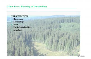
GIS in Forest Planning in Metsähallitus
- PRESENTATION
- Backround
- Technology
- Data
- Use in Metsähallitus
- Interfaces
2
History of Metsähallitus GIS-system
- Developement began 1989
- Building began 1991
- Pilot use in two districts (Karstula and
Suomussalmi) since 1993 - Forestry maplayer ready 1999
- New project 1999-2001
- Implementation of new system 2001
- Now
- One database
- over 7 milj. ha
- over 1 milj. forestry sub-compartments
3
A general description of the GIS system
GIS-data Base maps, measurements, coordinates,
vector data
Clients Terminal Clients
Clients MapInfo Professional
Analysis
Server
Database server
Citrix Metaframe
Oracle 8i Spatial
SutiGis KihtiGis TieGis R3
Data files
4
GIS interfaces to operational systems
5
Layers in Metsähallitus GIS-system
- Commercial
- Index map
- Airphotos
- Terraine map
- Updated by Metsähallitus
- Roads (TieGis)
- Real estates (KihtiGis)
- Landuse (KihtiGis)
- Areas divided by landuse purposes
- Forestry (SutiGis)
- Landscape ecological areas
- Forestry compartments
- Treatment maps
6
Attribute information for compartments
- Attribute information in
- 13
- different blocks
- For one sub-compartment possible
- about
- 150
- different variable
7
Real-time GIS
- Maintenance of attribute and geographic
information by operational staff in the
districts - about 500 persons - Annual growth by models
002
008 010 011
004
006 007
005
009
8
Vaatimukset paikkatiedolle
- Strateginen suunnittelu
- Riittävän luotettavat hakkuulaskelmat
(maankäyttö-, luonto- ja puustotiedot) - Taktinen ja operatiivinen suunnittelu
- Toimenpidetarpeen tunnistaminen
- Hakkuumahdollisuuksien löytäminen
- Toiminnan rajoitteiden hallinta
- Riittävä kertymäennuste
9
Toimintakierto vs. päivityskierto,
päivitysperiaate nyt
10
Toimintakierto vs. päivityskierto, kuviotieto ja
kasvumallit
11
Toimintakierto vs. päivityskierto, kuviotieto
operatiiviseen tarpeeseen
12
Landscape ecological plans are recorded in the GIS
- By GIS the plans are
- updated
- controlled
- output as reports and thematical maps
13
Forest treatment planning
- Planning is based on updated information
- Reports easy to draw
- Treatment maps
- Treatment map -files for wireless communication
with harvesters - Stand information updated after cutting
14
Harvesters cabin
15
Analyse Database
- Database for analyse purposes
- Producing versions of plan
- Interfaces to analyse programs (MapInfo and
MELA-system) - Managing versions of plan
16
MapInfo Analyses
Forest development classification
Tetrao Urogallus game areas
17
MELA connections to GIS
GIS database
Information of Site and Trees
Growth and treatment proposals to the
compartments
MELA simulator
18
(No Transcript)
19
MELA functions
GIS database
Simulation of treatment shedules
Treatment possibilities to the compartment
Optimation with restrictions
Optimal treatment shedule
20
Simulation of treatment shedules
Kasvatus
1
Harvennus
Kasvatus
Kasvatus
Harvennus
Harvennus
Taimikonhoito
Kasvatus
2
Kasvatus
3
Avohakkuu
Kasvatus
Kasvatus
Avohakkuu
4
Harvennus
Siemenpuuhakkuu
5
Aika, vuodet
1
11
21
21
TieGis - tietiedon hallintaan
Recommended
