
History of Remote Sensing PowerPoint PPT Presentation
1 / 56
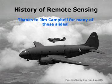
Title: History of Remote Sensing
1
History of Remote Sensing
- Thanks to Jim Campbell for many of these slides!
Photo from Flickr by Steve Reno (hawks914)
2
Value of historical perspective
- Place events in proper context
- Understand connections between events
- Understand origins of the science
- Recognize value of remote sensing
- Recognize trends and patterns
3
(No Transcript)
4
Camera Obscura (conceived by Aristotle 300 BC
Used by Roger Bacon 1300)
5
(No Transcript)
6
Joseph-Nicéphore Niépce, September, 1824 Louis
Daguerre, 1830s
1850
Daguerre, 1839
Eadweard Muybridge, 1872
7
Early aerial photographs
- Gaspard Tournachon (aka Nadar) 1859 Balloon
photos for land surveys - These early photos mainly served as novelties and
curiosities - Inability to control altitude and flight path
presented obstacles.
NARA
8
Bavarian Pigeon Corps (1903)
9
San Francisco, 1906
George Lawrence developed a system to use
multiple kites to fly a panoramic camera
CHICACO HISTORICAL SOCETY
NARA
LIBRARY OF CONGRESS
10
Roll Film
- George Eastman (1854-1932), transformed
photography from an expensive hobby to an
inexpensive and immensely popular pastime. - 1884 Eastman patented the first practical roll
film. - 1888 He perfected the Kodak camera, designed
specifically for roll film. - 1892 He established the Eastman Kodak Company,
one of the first firms to mass-produce
standardized photography equipment.
11
Early airplane photography (1909)
- The camera and the airplane were not designed
to be used with each other an uneasy partnership
for a long time.
12
Hand-held cameras/aerial observation
- propeller blast
- lens fogged by oil thrown by the engine
- difficulty in aiming and framing
- struts and wires block vision
- observers distracted by multiple duties,
including observation, navigation, and defense
against enemy pursuit aircraft - vertical photography difficult
- changing plates in flight difficult
13
World War IIncubator of aerial photography
- First conflict to focus upon mechanized
weaponry - Fixed lines across the western front-
conventional reconnaissance blinded - Artillery became the principal combat arm
- Aviation in its infancy
- Photography still in its youth
- Aviation and photography not integrated.
". . . aviation is a good sport, but for the army
it is useless"General Ferdinand Foch, Professor
of Strategy, Ecole Superiure de Guerre, 1911
14
balloon observation
15
Aerial observation missions
1. Infantry liaison 2. Artillery rélage 3.
Aerial observation and photography.
Aerial observation and photography soon became
the primary foci, with increasing significance
assigned to the photographic mission.
16
Aerial observers were trained to report against a
detailed checklist photography was ancillary to
the observation mission.
17
The photographer stood in the rear cockpit
belted in by a leather strap hooked to the inside
cowl. In taking pictures, he looked through a
viewfinder with cross-hairs and fired away at the
prescribed area. Optimum altitude ranged from
12,000 to 15,000 feet and of course there was no
such thing as an oxygen mask should it be
necessary to go higher. When the picture had
been taken and the aircraft was back on the
ground, the men in the laboratory field units
raced against time to get the pictures developed.
Ten minutes was considered fast work. Goddard
(1969) (pp 10-11)
18
(No Transcript)
19
Fuselage-mounted cameras
20
supplymagazine
early innovations in aerial camera design
handle advancesunexposed plates
exposed plates
21
Experiments with camera mounts
22
(No Transcript)
23
(No Transcript)
24
(No Transcript)
25
(No Transcript)
26
At the conclusion of World War I
- Rapid evolution of aviation and photographic
technology - Rapid development of techniques and tactics
- Organizational structures did not respond in a
timely or effective manner - Lack of vision by senior aviation leadership.
- Rapid progress and innovation not sustained
during the post-war era
27
Contributions of aerial reconnaissance not valued
by senior leadership
Aside from a few visionaries, . . . no one in
the Air Service gave a tin nickel for the
advancement of aerial photography.
Furthermore, neither the infantry nor the
cavalry understood the value of photography. . .
. In fact, its safe to say that while the U.S.
Army cared about reconnaissance, it cared very
little about reconnaissance from the air . . .
Goddard, 1969, p. 21).
28
The Face of the Earth as Seen From the Air
- W.T. Lee, 1922
- Lee envisioned a broad range of civil
applications of aerial photography - His book can been seen as a blueprint for the
development of aerial photography for the next 50
years.
29
1919-1939
- The economic crisis of the 1930s was also an
environmental crisis - Aerial photography was applied as a tool to
address economic and environmental issues.
30
- Pioneers in civil applications of aerial
photography - Tennessee Valley Authority land use mapping,
topographic mapping engineering applications - U.S. Geological Survey topographic mapping,
geologic mapping
31
1919-1939
- Early applications attempted to use aerial
photography to supplement or replace methods
based solely on direct observation from the
ground - Improvements in quality and efficiency
- Slow acceptance.
32
Agricultural economy
- Agriculture was a key component of the economic
and social structure of the nation. Economic
recovery depended upon developing an
understanding of commodity markets - Aerial photography was used to derive timely
information about the function of the
agricultural economy.
33
Aerial photography, historical coverage, USDA
Historical legacy we now have an achieve of 70
years of coverage
34
Technology, 1919-1939
- Development of equipment specifically tailored
for aerial photography - Precursors to todays designs
- Specialization to meet more specific tasks.
- Based upon mechanical designs
35
Werner von Fritsch 1935-38, commander in chief of
the German armed forces Killed in action during
the invasion of Poland, 1939
The military organization with the best aerial
reconnaissance will win the next war.
36
World War II
- Use of non-visible spectrum
- Training of a broad population as
photointerpreters and photo specialists - Formalization of photointerpretation
- Recognition of photointerpretation as a source
of strategic intelligence.
37
During World War II, aerial photointerpretation
was formalized as a specialized skill, requiring
specific training, experience, procedures and
organizations.
38
U.S. Army Aerial Reconnaissance-Related Military
Occupational Specialties (MOSs),
1942 _____________________________________________
___ Officer 8500 Photographic Unit
Commander8502 Aerial Photography Officer8503
Aerial Photo-Interpreter9300 Military
Intelligence Officer9301 Intelligence Staff
Officer9311 Intelligence and Security
Officer Enlisted 939 Aerial PhotographerGunner9
40 Aerial Photographer941 Camera Technician945
Photography Laboratory Technician 631
Intelligence NCO636 Intelligence Observer152
Photographer154 Photographic Darkroom
Man Source http//kelleys_kobras.home.att.net/r
eference/mos.htm
39
WORLD WAR II
- Specialized equipment specifically tailored for
specific aerial applications - Advances to develop new films, optical systems.
40
Photointerpretation for strategic intelligence
Success of photointerpretation in detecting
German V-weapons earned it a status as a source
of reliable strategic significance.
41
Babington-Smith, Constance. AIR SPY. The Story of
Photo Intelligence in World War II.1957 An
inside account of the instrumental role played by
aerial reconnaissance and photographic
intelligence during World War II, including in
the preparations for D-Day, the pursuit of the
Bismarck, and the battle against the German
V-weapons. Babington-Smith was in charge of the
Central Interpretation Unit at Medmenham Air Base
until 1945
42
Korean Conflict and the Cold War Era
43
Strategic reconnaissance,cold war era
44
Colwells research
- R.N. Colwell, experienced as a US Naval
photointerpreter during WWII, developed specific
procedures for applying color infrared aerial
photography to monitoring of crops and forests.
45
Colwell designed experiments to evaluate the
effectiveness of aerial photography for
applications in forestry and agriculture.
46
STRATEGIC RECONNAISSANCE
Cuban Missile Crisis, 1962
47
STRATEGIC RECONNAISSANCE
CORONA
48
CORONA
49
STRATEGIC RECONNAISSANCE
50
(No Transcript)
51
CIVIL APPLICATIONS
52
CIVIL APPLICATIONS
53
TELEVISION INFRARED OBSERVATION SATELLITE, 1960
TIROS, 1960
NIMBUS 5, 1972
TIROS was an experimental program to investigate
the feasibility of observing cloud cover and
weather patterns from space.
54
EARTH OBSERVATION SATELLITES, 1972
NASA
Landsat 7, 1999
NASA
NASA
Landsat 4, 1982
Landsat 3, 1978
CNES
SPOT 5, 2002
55
HYPERSPECTRAL REMOTE SENSING, 1985
JPL
JPL
Instrumentation and processing innovations led to
images with extraordinarily fine spatial and
spectral resolution
JPL
56
Global remote sensing
Recommended
