
WEATHER OR NOT A Study of Hurricanes PowerPoint PPT Presentation
1 / 14
Title: WEATHER OR NOT A Study of Hurricanes
1
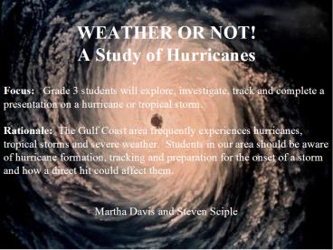
WEATHER OR NOT!A Study of Hurricanes
Focus Grade 3 students will explore,
investigate, track and complete a presentation on
a hurricane or tropical storm.
Rationale The Gulf Coast area frequently exper
iences hurricanes, tropical storms and severe
weather. Students in our area should be aware of
hurricane formation, tracking and preparation for
the onset of a storm and how a direct hit could
affect them.
Martha Davis and Steven Sciple
2
WEATHER OR NOT!A Study of Hurricanes
- Science
- 33 - Describe the water cycle.
- 34 - Recognize the positive and negative aspects
of weather. - 35 - Recognize geographic weather patterns.
- 36 - Recognize the effects of weather.
- 37 - Use weather instruments and other resources
to record and predict weather.
- Social Studies
- 1 - Extend and develop map and globe skills.
- 2 - Interpret and display information and data.
- 20 - Assess a situation concerning public safety.
- Technology
- 3 - Use communication input and output devices
efficiently and effectively. - 9 - Identify areas in which technology has
impacted human lives and communication. - 14 - Use the Internet to locate information
- 15 - Determine appropriate keywords for finding
information using a web search. - 17 - Relate search results to class or
individual assignments.
3
Learning Activities
- Students will
- listen to daily weather reports and the weather
channel. - use internet sites to gather information on
current storms, precautionary measure and storm
preparation. - research the Saffir-Simpson scale on storm
intensity, categories and projected damage of
each. - use longitude and latitude skills to track the
storm on an official tracking chart. - research and list items needed for preparation
before, during and after a direct or close hit. - know the evacuation route.
- use computers to word process their final project
4
Performance Task
- Students will
- partner with a buddy for research, sharing,
support and reporting. - locate and print a hurricane tracking chart for
plotting their storms path. - produce a booklet and poster that include the
following a title page, the tracking chart,
history of the storm, information on the
Saffir-Simpson scale, and a storm preparation
list. - present the project in class.
5
Passive Resources
- textbooks
- videos
- encyclopedia
6
Dynamic Resources
- Curriculum Support Software
- Internet Sites
- Content Software
- CD ROMS
- Tool Software
- Student Writing and Publishing
- Graphics
- Multimedia
- Music and sound
- Peripherals
- Printer
- Digital camera
- Computer projector
- Television
7
Web Sites
- www.wkrg.com
- www.weather.com
- www.disastercenter.com/hurricanes/tracking.htm
- www.wunderground.com/tropical
- www.brainpop.com/science/ecology/watercycle
- www.nhc.noaa.gov/aboutsshs.shtml
8
(No Transcript)
9
(No Transcript)
10
Tracking a Hurricane
- Get a tracking map.
- Get the longitude and
- latitude of the hurricane.
- Mark where the
- longitude and latitude
- intersect.
Longitude 66 Degrees Latitude 21 Degrees
Longitude 68 Degrees Latitude 22 Degrees
Longitude 64 Degrees Latitude 20 Degrees
- Repeat with each
- advisory.
11
Hurricane Formation
- Hurricanes start over the oceans as a collection
of storms in the tropics. - The deepening low-pressure center takes in moist
air and thermal energy from the ocean surface,
convection lifts the air, and high pressure
higher in the atmosphere pushes it outward. - Rotation of the wind currents tend to spin the
clouds into a tight curl as the winds reach gale
force, the depression becomes a tropical storm. - As the wind speed increases to 74 miles per hour,
the tropical storm becomes a hurricane.
12
Strength of Storm
- Based on the Saffir Simpson Scale
Category 1 Winds 74-95 mph (64-82 kt or 119-153
km/hr). Storm surge generally 4-5 ft above
normal. No real damage to building structures.
Damage primarily to unanchored mobile homes,
shrubbery, and trees. Some damage to poorly
constructed signs. Also, some coastal road
flooding and minor pier damage. Hurricanes
Allison of 1995 and Danny of 1997 were Category
One hurricanes at peak intensity.
Category 4 Winds 131-155 mph (114-135 kt or 2
10-249 km/hr). Storm surge generally 13-18 ft
above normal. More extensive curtainwall failures
with some complete roof structure failures on
small residences. Shrubs, trees, and all signs
are blown down. Complete destruction of mobile
homes. Extensive damage to doors and windows.
Low-lying escape routes may be cut by rising
water 3-5 hours before arrival of the center of
the hurricane. Major damage to lower floors of
structures near the shore. Terrain lower than 10
ft above sea level may be flooded requiring
massive evacuation of residential areas as far
inland as 6 miles (10 km). Hurricane Luis of 1995
was a Category Four hurricane while moving over
the Leeward Islands. Hurricanes Felix and Opal of
1995 also reached Category Four status at peak
intensity.
Category 5 Winds greater than 155 mph (135 kt
or 249 km/hr). Storm surge generally greater
than 18 ft above normal. Complete roof failure on
many residences and industrial buildings. Some
complete building failures with small utility
buildings blown over or away. All shrubs, trees,
and signs blown down. Complete destruction of
mobile homes. Severe and extensive window and
door damage. Low-lying escape routes are cut by
rising water 3-5 hours before arrival of the
center of the hurricane. Major damage to lower
floors of all structures located less than 15 ft
above sea level and within 500 yards of the
shoreline. Massive evacuation of residential
areas on low ground within 5-10 miles (8-16 km)
of the shoreline may be required. Hurricane Mitch
of 1998 was a Category Five hurricane at peak
intensity over the western Caribbean. Hurricane
Gilbert of 1988 was a Category Five hurricane at
peak intensity and is one of the strongest
Atlantic tropical cyclones of record.
Category 3 Winds 111-130 mph (96-113 kt or 17
8-209 km/hr). Storm surge generally 9-12 ft above
normal. Some structural damage to small
residences and utility buildings with a minor
amount of curtainwall failures. Damage to
shrubbery and trees with foliage blown off trees
and large trees blown down. Mobile homes and
poorly constructed signs are destroyed. Low-lying
escape routes are cut by rising water 3-5 hours
before arrival of the center of the hurricane.
Flooding near the coast destroys smaller
structures with larger structures damaged by
battering from floating debris. Terrain
continuously lower than 5 ft above mean sea level
may be flooded inland 8 miles (13 km) or more.
Evacuation of low-lying residences with several
blocks of the shoreline may be required.
Hurricanes Roxanne of 1995 and Fran of 1996 were
Category Three hurricanes at landfall on the
Yucatan Peninsula of Mexico and in North
Carolina, respectively.
Category 2 Winds 96-110 mph (83-95 kt or 154-17
7 km/hr). Storm surge generally 6-8 feet above
normal. Some roofing material, door, and window
damage of buildings. Considerable damage to
shrubbery and trees with some trees blown down.
Considerable damage to mobile homes, poorly
constructed signs, and piers. Coastal and
low-lying escape routes flood 2-4 hours before
arrival of the hurricane center. Small craft in
unprotected anchorages break moorings. Hurricane
Bonnie of 1998 was a Category Two hurricane when
it hit the North Carolina coast, while Hurricane
Georges of 1998 was a Category Two Hurricane when
it hit the Florida Keys and the Mississippi Gulf
Coast.
http//www.nhc.noaa.gov/aboutsshs.shtml
13
Preparation
- Safety Kit
- Wind Damage
- Storm Surge
- Disaster Planning
14
(No Transcript)
Recommended
