
Geologic Controls of Basin Denudation from Debris Flows in Rockbridge County, VA - PowerPoint PPT Presentation
1 / 16
Title:
Geologic Controls of Basin Denudation from Debris Flows in Rockbridge County, VA
Description:
... is primarily Virginia Pine, others include grasses and ... Tom Collins, USFS Local Geologist. Gary Kappesser, USFS GIS Expert. Chris Holland. Bubba Beasley ... – PowerPoint PPT presentation
Number of Views:107
Avg rating:3.0/5.0
Title: Geologic Controls of Basin Denudation from Debris Flows in Rockbridge County, VA
1
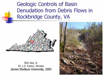
Geologic Controls of Basin Denudation from Debris
Flows in Rockbridge County, VA
Bob Sas, Jr. Dr. L.S. Eaton, Advisor James
Madison University, 2005
2
Purpose of Research
- Mapping
- Aerial photo
- Field
- GIS
- Bedrock controls
- Quartzite lithology
- Failure type
- Structural deformation
- Denudation volumes
3
What Is a Debris Flow?
- Mass wasting process
- Slope failure
- Soil, rock, woody debris
- Consistency of wet cement
- Churning mass of debris moved by water and gravity
4
Antietam Quartzite
- Cambrian
- Metamorphosed quartz arenite
- Orthogonal jointing
- Flanks most of western Blue Ridge
5
Mapping
- ArcGIS
- Data layers
- Aerial photo
- Polygon shapefile
- DEM
- Spatial analysis
6
Failure Types
- Initiation site
- Slump in regolith
- Minor bedrock exposure
- Lateral escarpments
- Bedrock control wide and shallow
- Regolith deeply incised
7
Pure Bedrock Failure
Photo by Bob Sas, 2/04
Plate 1 This debris flow was initiated by heavy
rainfall saturating the bedrock between joints.
The rocks are heavily weathered sandstones of the
Chilhowee group.
8
Regolith Failure
N
X
X1
Photo by Bob Sas, 2/04
Plate 2 From the main scarp to the bottom of the
photograph is approximately 250 ft. There are
multiple exposures of bedrock under the main
scarp and top slump areas. The new vegetation
growing in the flow path is primarily Virginia
Pine, others include grasses and thorny brush.
9
Basin Denudation
- Painstaking process of measurement
Cross-sectional area x Length of thalweg
Volume of Material
Volume of Material (m3) Area of Drainage Basin
(m2)
Basin Denudation (m)
10
Denudations Compared
11
Denudations Compared
12
Denudations Compared
13
Reasons for Greater Basin Denudation
- Heavy rainfall of June 27, 1995
- Steep slopes 30? ? 4?
- Orthogonal jointing
- Fissile planes and clay aquitards
14
Conclusions
- High-relief quartzite basins yielded highest
recorded denudations in VA - Structural deformation plays a role in failure
initiation and sediment yield (Gryta and
Bartholomew, 1989) - Fissile planes and clay aquitards contributed to
debris flow activity
15
Future Research
- Complete mapping of each flow
- Additional denudation measurements
- Statistical analysis of flow geometry
16
Acknowledgements
- Drs. Baedke, Eaton, Fichter, Frangos, Kearns,
Pyle, Sherwood, Ulanski - Gerry Wieczorek, USGS Grantor
- Tom Collins, USFS Local Geologist
- Gary Kappesser, USFS GIS Expert
- Chris Holland
- Bubba Beasley
Recommended
CrystalGraphics Presentations


