
Project Status Template PowerPoint PPT Presentation
1 / 23
Title: Project Status Template
1
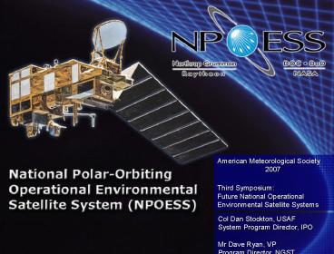
American Meteorological Society
2007Third Symposium Future National
Operational Environmental Satellite Systems
Col Dan Stockton, USAFSystem Program Director,
IPOMr Dave Ryan, VPProgram Director, NGST
2
- NPOESS Integrated Program Office System Program
Director - Development and production of the 11.5B NPOESS
Program - 22 Years of Acquisition Experience in satellites,
space launch and aircraft as well as staff and
Headquarters experience - Program Manager, Atlas V launch vehicle
- GPS User Equipment Manager later, Chief,
Integrated Systems Test later GPS Program
Element Monitor at the Air Staff - B-2 Operational Capabilities and Avionics Program
Manager - Staff tours at Headquarters Air Force Materiel
Command, National Reconnaissance Office, and the
Air Staff - B.S. Mechanical Engineering, Georgia Institute of
Technology - Masters of Systems Management, University of
Southern California
Colonel Dan Stockton NPOESS IPO System Program
Director
3
- 29 years of satellite design, development, and
operations experience - TRW
- Communications systems engineering
- Satellite payload systems engineering
- Satellite system integration and test
- President, Boeing Satellite Systems International
- Northrop GrummanV.P. Payloads and Sensors
- B.S. and M.E.E ., Electrical Engineering, Rice
University
Dave Ryan VP NPOESS Program Director Northrop
Grumman
4
American Meteorological Society
2007Third Symposium Future National
Operational Environmental Satellite Systems
Col Dan Stockton, USAFSystem Program Director,
IPOMr Dave Ryan, VPProgram Director, NGST
5
NPOESSEnvironmental Regimes
Weather, Oceanography Clouds, temperature, wind,
precipitation, currents, tides, land use
Space Weather Energetic Particles and Auroral
Energy Deposition
Climate, Environment Chemistry, water, pollution,
etc
- Solar Event Forecast
- Communication, navigation, anomaly resolution
- Energetic particle sensors (protons and electrons)
- Nowcasting, Forecasting
- Routine weather, disasters, military ops
- Imagers, sounders, active and passive
- Long Term Monitoring
- Planetary implications
- Radiometers, spectrometers, sounders active and
passive
6
Operational Needs
- Top requirements
Air Force
Navy / NOAA
Army
NOAA
Atmospheric vertical temperature and moisture
soundings
Soil moisture
Sea surface winds and temperature
Imagery
Six Key Performance Parameters
7
Current Polar Orbiting Systems
8
NPOESS Certified Program
- 2 EMD Satellites plus 2 Optional (2010 decision)
- Bus sized to carry all sensors
- VIIRS, CrIS, ATMS, CERES, OMPS-N, SEM,
ADCS,SARSAT remain - APS, TSIS, OMPS-L, ERBS, Alt, SuS,
SESSde-manifested from C1 C2
accommodationremains - CMIS deleted from C1 C2 MIS planned for C2
- Ground architectureessentially unchanged
Continuity, Flexibility, Affordable Advanced
Capability
9
Orbit Priorities
- Afternoon 1330 LTAN
- NOAA top priority
- Critical input gt90 for worldwide weather
forecast models - Product Examples
- Northern coverage Alaska for cloud, fire, and
volcano detection - Tactical air, sea, and ground operations
- IR and Micro-wave temperature and moisture
profiles - Tracks size and location of Ozone hole
- Measures radiation threat to airline passengers
and astronauts - Impact on space-based communications and GPS
operations - Early Morning 1730 LTAN
- AF priority
- Critical input for global cloud forecast models
- Product Examples
- Supports short term forecast models
- Traditional support to Intelligence Community
mission - Tactical support to air, sea, and ground
operations - Hurricane intensity and accuracy at landfall
- Mid Morning 2130 LTAN
Continuity of Operational Data Sources is the Top
Priority
10
Concept of Operations Unchanged
2. Downlink raw data
1. Sense phenomena
3. Transport data to Centrals for processing
X and L bands
Ka-band
Global fiber network connects 15 receptors to
Centrals
Field Terminals
SafetyNetTM Receptors
4. Process raw data into EDRs and deliver to
Centrals
Monitor and control Satellites and Ground Elements
MMC (Suitland)
Schriever MMC
Full IDP Capability at each Central NESDIS, AFWA,
FNMOC, NAVO
11
NOAA Satellite Operations Facility
NPP C3 Integrated Hardware and Software delivered
to and tested at NSOF and other operational sites
2 months early and on cost!
12
Provides Advanced WeatherForecasting Capability
Improvements
- 1330 VIIRS, CrIS, ATMS, SARSAT, ADCS, CERES,
OMPS-N, SEM - Advanced imager sounders
- Conical microwave imager/sounder on C3
- 1730 VIIRS, MIS, SARSAT, ADCS
- Advanced cloud imagery
- DMSP SSMI/S available for sea surface wind speed
- 0930 assigned to MetOp
- Cloud imagery capability with AVHRR
- DMSP available for additional cloud imagery, sea
surface wind speed - Potential for latency improvement
- Advanced atmospheric sounders
- Scatterometer for ocean winds and waves
13
Provides Climate Data Continuity
- 1330 VIIRS, CrIS, CERES, OMPS-N, ATMS, SARSAT,
ADCS, SEM - Column ozone, Earth radiation and cloud
observations - 1730 VIIRS, MIS, SARSAT, ADCS
- Advanced cloud imagery
- 2130 orbit provided by MetOp AVHRR, IASI, GOME
- Cloud imagery, column ozone and trace gases
- Orbits maintained with no drift in local time
- Data base timing continuity
- Full capacity satellite bus and ground segments
to accommodate future - sensors including MIS, APS, TSIS, OMPS-L,
ERBS, Alt, and SESS
14
Global Earth Observation System of Systems
GEOSS
- A top National Priority
- An Emerging International Priority
- Provides Political Legitimacy
- Enhances International Collaboration
NPOESS will be a major U.S. contributor to GEOSS
15
NPOESS Supports All GEOSS Societal Benefit Areas
Water Resources
Natural Human Induced Disasters
Ecosystems
Sustainable Agriculture Desertification
Energy Resources
Human Health Well-Being
Oceans
Climate Variability Change
16
Advanced Cloud ImageryImproves Interpretation
Tough Problems Solved
NRL Process
True Color
Contrails
Dust Fronts
Microwave Precip
Winds
Smoke Plume
17
NPOESS Provides Higher Spatial Resolution
Tenerife IslandCanary IslandsFebruary 19,
2004 POES 1122 GMT (NOAA 17) NPOESS 1405
GMT (Simulated from Aqua MODIS)
18
Advanced Soundings Result in Better Forecasts
Produces Global Forecast
Where is Isabel headed?
Natl Hurricane Center
Temperature and moisture profiles
All forecasts start with a global model
19
NPOESS Flight Schedule
CALENDAR YEAR
F13
C4
F19
F20
AM
F17
C2
M
F18
F16
MidAM
MetOp D
MetOp A
MetOp C
MetOp B
C3
N
N
C1
PM
NPP
AQUA
NPOESS and METOP team up to replace Heritage
Systems
20
NPOESS Preparatory Project IPO-NASA Cooperative
Program
- Data continuity for NASAs EOS Terra/Aqua/Aura
missions - Instrument risk reduction
- Early delivery / instrument-level test /
system-level integration and test - Provides lessons learned and allows time for any
required modifications before NPOESS first
launch - VIIRS - Vis/IR Imager Radiometer Suite (IPO)
- CrIS - Cross-track IR Sounder (IPO)
- ATMS - Advanced Technology Microwave Sounder
(NASA) - OMPS Ozone Mapping and Profile Suite (IPO)
- Ground System risk reduction
- Early delivery and test of a subset of
NPOESS-like ground system elements - Early User Evaluation of NPOESS data products
- Provides algorithms / instrument verification and
opportunities for instrument calibration /
validation prior to first NPOESS launch - Allows for algorithm modification prior to first
NPOESS launch
21
NPOESS Status
- VIIRS EDU
- Being Integrated on NPP S/C
- Completed Vibration Testing
- TVAC testing anomaly resolution underway
- VIIRS Flight Unit
- Completed Characterization Tests
- Ambient EMI tests begin 2Q CY07
- TVAC to begin by end of CY07
CrIS Instrument (ITT)
- CrIS EDU
- Completed
- Verified performance
- CrIS Flight Unit
- Vibe test failure under investigation
- Unit Disassembled
- Subsystem Testing Underway
- Rework anticipated
- One Year Slack to NPP Need Date
OMPS Instrument (BATC)
- OMPS Flight Nadir Instrument
- Sensor Integrated
- Ambient Testing Completed
- Vibration Testing Completed
- Vibe test anomaly resolved
- TVAC re-test considered
- Re-start ATP imminent
VIIRS EDU in Thermal Vac Chamber (SBRS)
Significant Progress Retiring Sensor Development
Risks
22
NPOESS Status
- Ground Segments (Raytheon IIS)
- Command and Control facilities installed
passed acceptance test - Central facility (NSOF) occupancy
- Significant processing latency risk reduction
achieved
Complex Common Modulator
- Spacecraft Bus (NGST)
- Risk Reduction achieved--Healthy mass and power
margins - Preliminary Design Audit Updates Completed Nov 06
- Unit designs progressing
Input/output Brass board
NSOF Operations Facility Completed
Spacecraft and GroundMeeting Cost Schedule
Objectives
23
The Way Ahead
- Certification re-validated the national security
need for NPOESS - Stakeholders unanimous No operational data
gap is top priority - Flying NPOESS Preparatory Project on schedule is
key - Program plan for the future
- Technical baseline understood
- Detailed planning complete
- Baseline in place Spring 07
- FY 2010 Program decision point for C3 and C4
We are developing a detailed and executable plan
for the future
Recommended
