
FEMA PowerPoint PPT Presentation
1 / 7
Title: FEMA
1
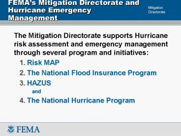
FEMAs Mitigation Directorate and Hurricane
Emergency Management
- The Mitigation Directorate supports Hurricane
risk assessment and emergency management through
several program and initiatives - Risk MAP
- The National Flood Insurance Program
- HAZUS
- and
- The National Hurricane Program
2
Risk MAP Vision
- To reduce losses of life and property through
effective local mitigation activities enabled by
quality flood hazard data, risk assessments, and
mitigation planning.
3
Risk MAP Key Program Goals
- Address Gaps in Flood Hazard Data
- Coastal, Levees, Other Engineering Needs
- Support Development of Hazard Mitigation Plans
- Provide an Enhanced Digital Platform
- Align Mapping, Assessment, and Hazard Mitigation
Planning - Develop Synergies
- Ensure Increase in Public Awareness
- Measurable reduction in risk over time
HAZUS
Dam Safety
Mapping
National Hurricane Program
MT Planning
4
Risk MAP - Coastal Hazard Mapping
- Goal Update 100 of the Nations populated
shoreline - Scope
- Modeling
- Updated Guidelines and Specifications for Coastal
Analyses and Mapping for all US Coasts (Pacific,
Atlantic, Gulf of Mexico, and Great Lakes) - Calculate storm surge, wave setup, erosion,
overland waves, wave run up and overtopping - Large-scale (State-wide, Region-wide) modeling
efforts where effective - Mapping
- Build on modernized maps
- Identify the Primary Frontal Dune and Limit of
Moderate Wave Action (1.5-foot wave heights) - State and local outreach and communication plans
- Schedule
- 5-year plan for funding updates (FY09 FY14)
- FY09 Funding used to initiate updates for approx.
20 of the populated shoreline - 2-year timeframe from study start to issuance of
preliminary FIRM - Cost
- Approx. 300M FY09
- FY10 and Beyond - TBD
5
Proposed NFIP Reform Legislation
- Includes provisions for expanded mapping
authorities considering - Coastal/hurricane inundation areas
- Sea level rise, increased precipitation, and
increased intensity of hurricanes due to global
warming - Future development
- 500-year floodplain areas of residual risk
- Areas previously not identified and protected by
or inundation areas as a result of the failure of
levees, dams, and other man-made structures
6
HAZUS-MH Surge Module to be added in FY10
- HAZUS-MH is FEMAs Program for Estimating
Potential Losses from Natural Disasters - Will be adding a coastal surge module in FY2010,
as provided by the National Hurricane Center
(SLOSH)
7
National Hurricane Program Renewed w/Expanded
Focus
- Directed to programmatically expand in 2007
- Engaging in broader FEMA-supported hurricane
emergency management initiatives, including mass
evacuation planning and risk-based capability
assessments - Launched Comprehensive Hurricane Emergency
Management Strategy (CHEMS) initiative in 2008
preliminary Summary Report and Recommendations
to be available prior to National Hurricane
Conference (April 7, 2009) - Strengthening partnership with NWS and NHC s
- supporting new surge governance proposal
- Endorsed new surge forecast product
development.
Recommended
