
A Regional HF Radar Testbed: PowerPoint PPT Presentation
1 / 45
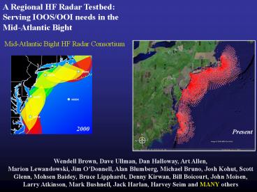
Title: A Regional HF Radar Testbed:
1
A Regional HF Radar Testbed Serving IOOS/OOI
needs in the Mid-Atlantic Bight
Mid-Atlantic Bight HF Radar Consortium
2000
Present
Wendell Brown, Dave Ullman, Dan Halloway, Art
Allen, Marion Lewandowski, Jim ODonnell, Alan
Blumberg, Michael Bruno, Josh Kohut, Scott Glenn,
Mohsen Baidey, Bruce Lipphardt, Denny Kirwan,
Bill Boicourt, John Moisen, Larry Atkinson, Mark
Bushnell, Jack Harlan, Harvey Seim and MANY others
2
Mid-Atlantic HF Radar Consortium
- University of Massachusetts, Dartmouth
- University of Rhode Island
- United States Coast Guard RD Center
- University of Connecticut
- Stevens Institute of Technology
- Rutgers University
- University of Delaware
- University of Maryland
- NASA, Wallops Island
- Old Dominion University
- WeatherFlow
- NOAA, Chesapeake Bay
- University of North Carolina, Chapel Hill
Over 50 Years of HF Radar experience site
selection to product delivery
3
Systems Deployed Now
- Systems Deployed (20)
- - 11 Standard Range Systems (25 MHz)
- - 8 Long Range Systems (5 MHz)
- - 1 Medium Range System (13 MHz)
4
New Sites to be deployed 2006
5
Systems Deployed by 2006
- Systems Deployed (27)
- - 15 Standard Range Systems (25 MHz)
- - 11 Long Range Systems (5 MHz)
- - 1 Medium Range System (13 MHz)
6
Systems Deployed by 2007
- Systems Deployed (30)
- - 15 Standard Range Systems (25 MHz)
- - 13 Long Range Systems (5 MHz)
- - 2 Medium Range System (13 MHz)
7
Ensuring public health Surf Zone Forecasts, NOAA
National Weather Service
NWS Mount Holly uses CODAR wave data in a linear
regression wave model. This model is part of a
Surf Zone Forecast including rip current
probability along the New Jersey and Delaware
Coasts
Marine/Aviation Desk
8
Present Status of the Standard Range Systems
Nested Coverage of 5 major estuaries and sounds
9
Present Status of the Mid-Atlantic Long-Range
Mid-Range Systems
Covering over 1000 km of coastline from the
shore to beyond the shelf break
10
National Data Management Network of Real-Time
Surface Currents
- Archive Centers
- East Coast Rutgers
- MA Regional Backup NASA/Wallops
- West Coast Scripps
Currently Archiving 53 Radar Systems
Data Integration into DODs/OPeNDAP
11
Many Applications (More than one for each
societal goal!) Fisheries
12
Adaptive Sampling Strategies, NOAA Fisheries
NOAA Fisheries ServiceNortheast Fisheries
Science Center Conserving Our Nation's Living
Oceans For Over 125 Years
James J. HowardMarine Sciences Laboratory John
Manderson et al.,
Ship-to-shore Communication
13
Applications Coast Guard Search and Rescue
14
Ensuring public health Search and Rescue, United
States Coast Guard, Office of Search and
Rescue Point measurement vs. Field of
measurements Hurricane Floyd Simulation
O(4)
O(gt10)
Search area reduced by factor of 4 (gt10)
Courtesy Art Allen, USCG Office of SAR
15
Lost Glider Recovery Rutgers, USCG, Civil Air
Patrol
Civil Air Patrol
Glider ru02 as seen from Search Plane
Communication Plane
Search Plane
16
Ensuring public health Search and Rescue, United
States Coast Guard, Office of Search and Rescue
Mid-Atlantic SAROPS Testbed
Coverage Jul 27, 2004 Aug 31, 2004
32773
Climatology SLDMB 32773 CODAR
17
Short Term Prediction System (STPS)
- Need to cover the time from availability of CODAR
- (-2 hours) to end of search time (25
hours) - A Statistical Data-based Algorithm Is
Transferable and relatively Inexpensive - Currents Can Be Separated into Tidal and Residual
(Low Frequency) Parts - Tides Are Easy to Predict (Harmonic Analysis)
- The Residuals Are Difficult
- Gauss-Markov Estimation
18
Ensuring public health Search and Rescue, United
States Coast Guard, Office of Search and Rescue
- Real-Time surface currents
- Forecasted surface currents
- (STPS)
1) User selects desired data product from
interactive menu 2) User specifies time window of
interest
19
US Coast Guard SAROPS Testbed
Drifter Deployment July-September 2006
20
Using Drifters to Quantify Uncertainty for
Integration into SAROPS
21
Applications Tropical Storm Ernesto The
regional 3-D response
22
The Big Picture
23
(No Transcript)
24
Tropical Storm Ernesto September 1, 2006 1300
GMT
WRF Forecast Surface Winds
CODAR Observations Surface Currents
25
Tropical Storm Ernesto September 1, 2006 1600
GMT
WRF Forecast Surface Winds
CODAR Observations Surface Currents
26
Tropical Storm Ernesto September 1, 2006 1900
GMT
WRF Forecast Surface Winds
CODAR Observations Surface Currents
27
Tropical Storm Ernesto September 1, 2006 2200
GMT
WRF Forecast Surface Winds
CODAR Observations Surface Currents
28
Tropical Storm Ernesto September 2, 2006 0100
GMT
WRF Forecast Surface Winds
CODAR Observations Surface Currents
29
Tropical Storm Ernesto September 2, 2006 0400
GMT
WRF Forecast Surface Winds
CODAR Observations Surface Currents
30
Tropical Storm Ernesto September 2, 2006 0700
GMT
WRF Forecast Surface Winds
CODAR Observations Surface Currents
31
Tropical Storm Ernesto September 2, 2006 1000
GMT
WRF Forecast Surface Winds
CODAR Observations Surface Currents
32
Tropical Storm Ernesto September 2, 2006 1300
GMT
WRF Forecast Surface Winds
CODAR Observations Surface Currents
33
Tropical Storm Ernesto September 2, 2006 1300
GMT
WRF Forecast Surface Winds
CODAR Observations Surface Currents
34
Tropical Storm Ernesto September 2, 2006 1600
GMT
WRF Forecast Surface Winds
CODAR Observations Surface Currents
35
Tropical Storm Ernesto September 2, 2006 1900
GMT
WRF Forecast Surface Winds
CODAR Observations Surface Currents
36
Tropical Storm Ernesto September 2, 2006 2200
GMT
WRF Forecast Surface Winds
CODAR Observations Surface Currents
37
Tropical Storm Ernesto September 3, 2006 0100
GMT
WRF Forecast Surface Winds
CODAR Observations Surface Currents
38
Tropical Storm Ernesto September 3, 2006 0400
GMT
WRF Forecast Surface Winds
CODAR Observations Surface Currents
39
Tropical Storm Ernesto September 3, 2006 0700
GMT
WRF Forecast Surface Winds
CODAR Observations Surface Currents
40
Tropical Storm Ernesto Surface Impacts
After
Before
41
Tropical Storm Ernesto Sub-Surface Impacts
Before
June 14, 2006 - Present
42
Tropical Storm Ernesto Sub-Surface Impacts
During
June 14, 2006 - Present
43
Tropical Storm Ernesto Sub-Surface Impacts
After
44
Conclusions
- A regional scale HF radar network is critical to
the IOOS/OOI mission within the coastal ocean. - The Mid-Atlantic Bight has shelf-wide HF radar
coverage along 1000 km of coastline with higher
resolution near the estuaries and sounds. - A phased implementation plan exists for a
region-wide demonstration project. - Knowledge base is here in the MAB for all
components of the network (HF Radar Consortium
with over 50 years combined experience). - The network continues to support science and
education activities in the region. - Immediate impacts on NOAA, US Navy, USCG, DoD,
and DHS operations including the MANY users these
groups serve.
45
NOAA PORTS Enhancements Data Assimilation
- Real-time current observations
- (ADCPs, CODAR) for nowcasting
- and forecasting
- 1) Water Level
- 2) Currents
- 3) Salinity
Evaluation - Codar based tidal prediction
- Surface current and salinity
prediction
Recommended
