
Chapter 10 Early Paleozoic Earth History Cambrian Silurian Periods PowerPoint PPT Presentation
1 / 18
Title: Chapter 10 Early Paleozoic Earth History Cambrian Silurian Periods
1
Chapter 10 - Early Paleozoic Earth
History(Cambrian Silurian Periods)
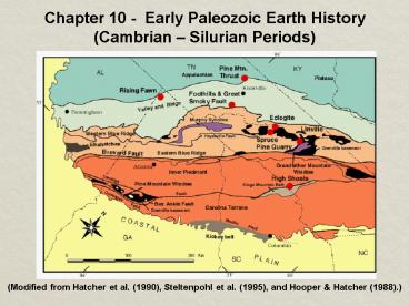
(Modified from Hatcher et al. (1990), Steltenpohl
et al. (1995), and Hooper Hatcher (1988).)
2
2
- The Paleozoic history of most continents involves
major mountain-building activity along their
margins (mobile belts) numerous shallow-water
marine transgressions and regressions over their
interiors. - These transgressions and regressions were caused
by global changes in sea level, most likely
related to plate activity and glaciation. - Most of the geologic time scale was developed in
Europe, sedimentary record in North America was a
little different, so we will be looking at the
major Transgressive-Regressive sequences of the
Paleozoic Era and how they affected life.
3
3
- With the Late Proterozoic breakup of Rodinia and
Pannotia 6 continents existed in early
Paleozoic. Each continent composed of craton and
one or more mobile belts. - Craton composed of shield and platform upon which
the Paleozoic sediments were deposited. Cratons
were built by tectonic activity during the
Precambrian, but remained stable during the
Paleozoic. - The transgressing and regressing shallow seas
(epeiric seas) were a common feature of most
Paleozoic cratonic histories. Flooding occurred
during times of higher activity at rift zones,
shrinkage of global ice sheets, and/or
continental sinkage following rifting.
4
4
Canadian shield not covered during
Paleozoic, re-mainder of craton (light brown) was
periodically cover-ed by epeiric (shallow,
inland) seas. Green (basins) yellow (domes)
local areas of gentle warpage of platform
sedimentary rocks.
Appalachian Basin
5
5
- Some of the (yellow) topographic highs were
exposed as islands during the Paleozoic and
supplied clastic sediments to the surrounding
areas. - Mobile belts elongated areas of mountain
building activity along the margins of
conti-nents. Shallow continental shelf and
deeper continental slope sediments were deformed
(and intruded by magmas) during times of
continental compression and collision. - 4 North American mobile belts
- Franklin mobile belt
- Cordilleran mobile belt
- Ouachita mobile belt (Ark./Okla.)
- Appalachian mobile belt (SE E North America)
6
6
- Historical Geology seeks to present snapshots
of Earth history by way of Paleogeographic maps
that show - - 1) The distribution of land and sea
- 2) Possible climate regimes, and
- 3) Geographic features, e.g., mountain ranges,
swamps, deltas, glaciers, etc.. - 4) Plate tectonic-related features distribution
of volcanoes, shape of coastlines, sedimentation
patterns, etc.. - Paleozoic paleogeographic reconstructions are
based primarily on 1) Structural relationships 2)
Climate-sensitive sediments such as red beds,
evaporates, and coals, and 3) Distribution of
plants and animals.
7
7
- 1963 Laurence Sloss divided North American
sedimentary rocks into 6 Cratonic sequences, 4 of
which include the Paleozoic Era (slide 8 p.
180). - Sauk Sequence (Late Proterozoic Early
Ordovician) marked by a steady rise in sea
level and rapid weathering and erosion of exposed
Precambrian due to tropical environment (slide 9)
with no vegetative cover. Resulted in
transgressive sand sequences being deposited on
both sides of the continent. - Tapeats SS Coronado SS (S. AZ) Bliss SS (TX)
- Arizona (Early Cambrian) eastward into West Texas
(Early Ordovician) (slide 10).
8
Sloss Sequences N. America
8
9
9
- Cambrian
- Paleogeo-
- Graphic Map
- of Laurentia.
- Shows Equa-
- tor, Epeiric
- seas, Conti-
- nental
- Shelves,
- Exposed
- areas.
Counter-clockwise rotation to reach present
orientation.
10
10
Cambrian transgressive sequence Grand Canyon
local source of shale. El Paso area shale is
missing no local source.
Bright Angel Shale Early Cambrian California
Middle Cambrian Grand Canyon. Muav Limestone
marks the top of the Sauk Sequence in the Grand
Canyon.
11
11
East Coast Sauk Trans-gressive Sequence was
deposited over Grenville-age continental
crust. The end-of-Sauk regression exposed
Cambrian/Early Ordovician carbonates and
sandstones to erosion.
By the end of Middle Cambrian source of shale
deposition is drowned.
12
12
- After regression of the
- Sauk Sea erosion,
- Tippecanoe Trans-
- gression began with
- the deposition of
- clean sandstones. St.
- Peter Sandstone
- best known of the
- Tippecanoe basal
- sandstones.
Tippecanoe (Ordovician) paleogeographic map.
Note rise of Taconic Highlands (discussed later).
13
13
Central Kentucky/ Tennessee eastern craton
transition from carbonate to shale deposition.
- Tippecanoe deposition marked by widespread
deposition of limestones in epeiric seas, due to
lack of clastics from eroded landmasses. Shales
in eastern portion of craton were derived from
the rising eroding Taconic Highlands. Gray/
light brown shales shallow marine. Red shales
tidal flats alluvial plain.
14
14
- By Tippecanoe time reef forming organisms
(corals, calcareous algae, bryozoa, sponges,
stomatoporoids) were more developed and
colonized suitable areas of epeiric sea bottom. - Most favorable conditions shallow, warm, clear
water of normal salinity. Locations determined
by bottom topography, seafloor subsidence, wind
and wave action, interactions by different
organisms. Barrier reefs form at the outer edge
of continental shelves. Ex Great Barrier Reef - As reefs are in tropical/sub-tropical regions, if
reef inhibits water circulation in the backreef
area, evaporation may produce layers of
evaporites (salts) or carbonate/evaporite
sequences.
15
15
Typical Barrier Reef Complex
16
16
During Silurian Period peak of Tippecanoe
Trans-gression covered all of craton, ex-cept
Taconic High-lands. Silurian alluvial
plain/tidal flat deposits include Red Mountain
Fm., Ringgold Roadcut Birmingham, AL.
Barrier reefs surround basin, Pinnacle reefs grow
w/in basin, p. 186.
Reef development surrounding Michigan Basin
17
17
- The Taconic Orogeny
- The first Phanerozoic orogeny began during the
Middle Ordovician Period, influenced the climate
and sedimentation of the craton. - During the Sauk Sequence, eastern margin was a
passive margin, with a continental shelf east of
the flooded craton. - Debates exist over nature of event, thought to be
a collision between an island arc or small
con-tinent. Resulting in uplift of Taconic
Highlands and downwarping and drowning of
existing carbonate shelf. Carbonate deposition
ceased during Middle Ordovician, replaced by
orogeny-related deepwater shales, graywackes.
18
18
Clastic wedge developed NW of Taconic
High-lands, tidal flat and alluvial/delta
sediments in-clude Red Mountain Fm. in NW Ga. and
Birmingham, AL.
Recommended
