
Research PowerPoint PPT Presentation
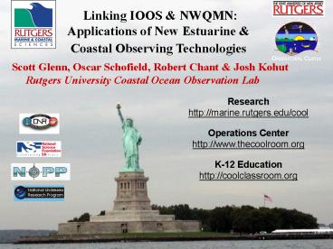
Title: Research
1
Linking IOOS NWQMN Applications of New
Estuarine Coastal Observing Technologies
Scott Glenn, Oscar Schofield, Robert Chant Josh
Kohut Rutgers University Coastal Ocean
Observation Lab
Research http//marine.rutgers.edu/cool
Operations Center http//www.thecoolroom.org
K-12 Education http//coolclassroom.org
2
IOOS Coastal Component Federal
Backbone Regional Associations
National Federation of Regional Associations
To Learn More www.ocean.us
3
5 Subregional Estuary/Bays Linked by the Middle
Atlantic Bight www.macoora.org
Carolyn Thoroughgood (PI), Dave Chapman (CEO)
4
5 Subregional Estuaries/Bays Linked by the Middle
Atlantic Bight www.macoora.org
Carolyn Thoroughgood (PI), Dave Chapman (CEO)
Observational Challenge for the
Region Cascading effect of multiple
large estuaries on the southward flow of shelf
water from Arctic to Cape Hatteras
5
Are continental shelves experiencing dramatic
changes?
6
The challenge Survival of humans on Earth is
linked to the oceans. Assessing the state of the
ocean requires us to see the global system.
John Delaney
The problem If I were to choose a single phrase
to characterize the first century of modern
oceanography, it would be a century of
under-sampling. Walter Munk
The potential Ocean sciences are now on the
threshold of a major technological advance as the
scientific community begins to establish a
global, long-term presence in the ocean. Robert
Detrick
Courtesy of the Neptune program
7
Processes Operate of Time and Space
8
A Look Back
By Tommy Dickey UCSB
If I were to choose a single phrase to
characterize the first century of modern
oceanography, it would be a century of
under-sampling.
Walter Munk, 2000
9
A Global View from Space Imagers and Altimeters
Passive Imagers for SST Ocean Color
Active Radars for Altimetry
10
A Global Array of 3,000 Argo Profiling Floats
11
National Initiatives For Ocean Observing
Technologies
The ocean sciences are now on the threshold of
another major technological advance as the
scientific community begins to establish a
global, long term presence in the ocean
Robert Detrich National Research Council
Enabling Ocean research in the 21st Century
12
U.S. Commission on Ocean Policy Final Report
September, 2004
Chapter 27 Enhancing Ocean Infrastructure and
Technology Development
- A robust infrastructure with cutting-edge
- technology forms the backbone of modern
- ocean and coastal science and effective
- resource management and enforcement.
- 3 Major Components for Oceans Coasts
- Facilities land based structures
- (labs, monitoring stations)
- and remote platforms
- (ships, aircraft, satellites,
submersibles). - Hardware research equipment, sensors
- instrumentation, information technology.
- Technical Support expert human resources
- to operate, maintain and use for
- monitoring, research, modeling, resource
- assessments, education enforcement.
13
U.S. Commission on Ocean Policy Final Report
September, 2004
Recommends Creating Virtual Marine Technology
Centers
Link existing capabilities, researchers and
students. Scientists and engineers work
collaboratively to solve fundamental
oceanographic questions. Large numbers of
platforms and sensors coordinated for
interdisciplinary research. Individuals not
required to acquire and master increasingly
complex instrumentation. Incubators for
innovation and new technologies, multi-purpose
focus enhances education. Located at existing
universities, science centers, etc. Recommendatio
n 27-6 NOAA should establish 4-6 national
virtual marine technology centers at existing
institutions to provide coordinated access,
through electronic means, to cutting-edge,
large-scale research technologies.
14
Rutgers Coastal Observatory Provide a
Long-term Shelf-Wide Context for High
Resolution Nested Process Studies
SW06
LaTTE
LEO
15
Self-sustaining NOPP-style Academic - Industry
Partnerships
- SeaSpace Corporation
- - Satellite remote sensing - 1992
- CODAR Ocean Sensors
- - HF radar current mapping -1997
- Webb Research Corporation
- - Autonomous gliders -1998
- WetSat
- - Cabled observatories -2004
16
New Enabling Technologies Coastal Satellites
Water mass classification (Blooms vs Rivers)
Objective Gradient and Frontal Boundaries
17
New Enabling Technologies CODAR HF Radar
Hudson Plume April, 2005 Summer Storm July,
2005
Each Radar Measures Radial Component of the
Surface Current
18
New Enabling Technologies - Seafloor Cabled
Observatories
SEAFLOOR CABLES LEO-15
SUSTAINED PRESENCE TO CAPTURE EVENTS
Hudson River
19
New Enabling Technologies GLIDER IN THE STORM
16-Sep-2004 150053 - 23-Sep-2004 115727
Depth-Averaged Currents Surface Currents
Temperature
bb532
bb(532)/c(532)
7410
7400
7350
7340
7330
7320
7310
20
A defining characteristic is the remote
interactivity
Coastal Ocean Observation Lab Center for Advanced
and Sustained Technologies (CAST)
CODAR Network
Cable
Glider Fleet
X-Band
L-Band
21
Ship-to-Shore Communications Guide Shipboard
Sampling
- AirNet Communications Wireless Broadband (1.5
Mbps, coverage 7 miles offshore from Sandy Hook) - Verizon National Access (100 kbps, coverage up
to 20 miles off Long Island, less for New
Jersey) - Freewave Radio Modems (80 kbps, coverage for a
18 mile radius centered at Sea Bright Fire
Department) - Verizon Quick2Net (14.4 kbps, coverage up to 20
miles off both New Jersey and Long Island) - Iridium Satellite (2,400 bps, global coverage,
data and voice)
22
The Same Real-Time Datasets Serve Multiple
Applied Needs
Contaminant Transport NOAA Hazmat
Vessel Tracking Dept. Homeland Security
Search and Rescue U.S. Coast Guard
23
Evolving National HF Radar Network
20 Radars Operating, 5 Funded
10 Radars Operating, 20 Funded
24
Technology Testbed Operations Center for
Global Glider Deployments
International Consortium of Ocean Observation
Labs I-COOL Formed in Paris, June
2005
25
International Partnerships in Operational
Oceanography Education
3-Year Vetlesen Fellowship in Rutgers Masters
Program. Priority given to a Norwegian Student
starting July, 2006.
26
Hypoxia/Anoxia Bottom Bathymetry
Warsh NOAA 1989
?
Summer late fall upwelling
27
(No Transcript)
28
(No Transcript)
29
The dynamics of a Buoyant Plume
30
The buoyant pulse front looks like a tidal bore
as it flows past the R/V Cape Hatteras (2005)
Salinity
31
Wind data from NOAA NDBC station at Ambrose Light
32
Wind data from NOAA NDBC station at Ambrose Light
33
Wind data from NOAA NDBC station at Ambrose Light
34
Wind data from NOAA NDBC station at Ambrose Light
35
Wind data from NOAA NDBC station at Ambrose Light
36
Wind data from NOAA NDBC station at Ambrose Light
37
(No Transcript)
38
Wind data from NOAA NDBC station at Ambrose Light
39
Wind data from NOAA NDBC station at Ambrose Light
40
Wind data from NOAA NDBC station at Ambrose Light
41
Wind data from NOAA NDBC station at Ambrose Light
42
Wind data from NOAA NDBC station at Ambrose Light
43
The dynamics of a Buoyant Plume
44
The Nearshore Recirculation A Potential
Incubator (known to locals as the Frazer eddy)
A Biological Incubator Abundant Nutrients
Large Phytoplankton Plunging DO
45
(No Transcript)
46
New Plume
Old Plume
5
14
12
4
10
3
8
Productivity (mgC/m3/hr)
6
2
4
1
2
0
0
4/17/2005
4/18/2005
4/19/2005
4/10/2005
4/11/2005
4/12/2005
4/13/2005
Date
Date
Skeletonema
Lauderia
47
Primary production is actually enhanced by the
larger grazers !
48
Hudson Bay
superstaurated
Ocean
Percent Oxygen Saturation
undersaturated
LATTE April 2005
Salinity
49
gt20 ?m particulate trace metals and phosphorus -
Ag, Al, Cr, Cu, Fe, P, Pb
salinity
50 ng L-1 (Al, Fe, P ?g L-1 Ag x 10, Al x 5, P x
10)
50
Freshwater Plume Moves Out Across the Shelf
Hudson Shelf Valley
51
LaTTE 2005 -After luring the Cape Hatteras
offshore.
The survey began on the Highway. We were near
the glider when it surfaced. We saw currents
ripping southward in a 10 m thick layer of
freshwater along the highway -- perhaps the most
significant freshwater transport we saw all
week. Perhaps the most perplexing to me
is the Highway and why there has been a lack of
a strong coastally trapped flow this week.
--- Bob Chant aboard the Cape Hatteras, April
21, 2005
52
Freshwater Plume Moves Out Across the Shelf
Water Mass Boundaries (Oliver et al.,
2004) April 13, 2005
-NJ highway transports carbon, fish larvae, etc.
53
I walk into our control room, with its panoply
of views of the sea. There are the updated global
pictures from the remote sensors on satellites,
there the evolving maps of subsurface variables,
there the charts that show the position and
status of all our Slocum scientific platforms,
and I am satisfied that we are looking at the
ocean more intensely and more deeply than anyone
anywhere else. - Henry Stommel, The SLOCUM
Mission, 1989
Some Conclusions - -It is the dawn of a new way
to be AT sea. -Fueled by new technologies that
enable continuous access to spatial datasets.
-Many big science questions are
interdisciplinary and long-term. -Facilitated by
global collaborative teams. -The same data can
have immediate societal impact Save Lives, Save
Money. -Education of a skilled workforce trained
in the installation, operation and use of
advanced oceanographic sampling technologies is
required now!
Red Sky at Night
54
R.U. COOL Hands-On Oceanography
Warning You Will Get Wet!
Oceanographic Technology Degree Partner
Institutions Rutgers University - New Jersey
Stevens Institute of Technology New
Jersey Mote Marine Laboratory
Florida California Polytechnic State
University University of Bergen Norway
Liz Creed, Emmeline Romana, and Barbara Berg
deploy Slocum Gliders off the west coast of
Florida
Recommended
