
Puerto Rico Gap Analysis Project PowerPoint PPT Presentation
1 / 34
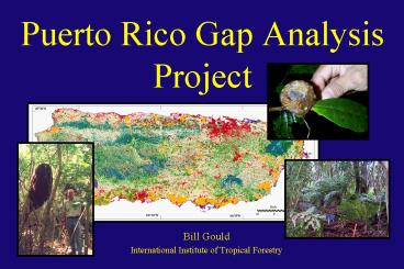
Title: Puerto Rico Gap Analysis Project
1
Puerto Rico Gap Analysis Project
- Bill Gould
- International Institute of Tropical Forestry
2
Outline
Goals
Personnel and collaboration
IITF resources
PR-GAP timeline and work plan
3
National Gap Analysis Program
Sponsored by the Biological Resources Division of
the United States Geological Survey (USGS-BRD)
Mission Regional assessments of the
conservation status of native terrestrial
vertebrate species and natural land cover types.
The intent of the Gap Analysis is to provide
proactive. land management activities at the
community and landscape levels (J. Michael
Scott, 1995).
4
Puerto Rico Gap Analysis Program (PR-GAP)
The state level representative of the National
Gap Analysis Program
Project goals Map land cover distribution
patterns for Puerto Rico. Map predicted
distributions of selected elements of
biodiversity. Analyze the representation of
vertebrate species and land cover types in
areas managed for biodiversity conservation.
Provide this information to the public. Build
institutional cooperation to further Puerto
Ricos conservation efforts.
5
Mapping
Land cover 1991
Forest fragments
Dry and moist lowland forests
Vegetation and landcover
Vertebrate distributions
Land management strategies
6
Conservation Gaps
Areas of high diversity or critical species
habitat that are unprotected under current
management strategies
7
Collaboration
The North Carolina Cooperative Research
Unit, US Geological Survey, NCSU Jaime
Collazo
International Institute of Tropical Forestry,
USDA Forest Service
The Puerto Rico Department of Natural and
Environmental Resources
8
International Institute of Tropical Forestry
(IITF)
Research work unit within the USDA Forest Service
PR-GAP personnel
Bill Gould Research Ecologist.
Betzaida Reyes GIS specialist.
Gloryvee Carrero Forestry technician.
9
IITF Resources
GIS laboratory and database PC and Unix
workstations with ArcInfo, ArcView, Erdas
software Digitizer, Scanners, Plotter
Air photos and remote sensing imagery (Landsat 7,
IKONOS) Historical land cover maps and
airphotos (1936, 1951, 1978, 1991)
Forest inventory and other ongoing studies
Experienced forestry technicians
History of collaboration with DNRA
Mandate to protect forest resources and
wildlife
10
Vegetation
Natural Vegetation and Land Cover, 1991
11
Geology
12
Rainfall
13
Elevation
14
Geoclimatic classification zones
15
Holdridge Lifezones
16
1950s landcover
17
1978 landcover
18
1999 Landsat
Puerto Rico - November 27, 1999 Landsat TM7 -
bands 4,2,1
19
DNRA lands
Public Lands of Puerto Rico
20
Karst Region
21
IITF work plan
22
Timeline Year 1
Develop legend. Develop biodiversity and
GIS databases. Initiate field and remote
sensing studies needed to compliment and
verify existing data. Develop PR-GAP web pages.
23
Timeline Year 2
Completion of field data collection and
incorporation into GIS Revision of existing
landcover maps with more detailed vegetation
descriptions (to alliance or association level).
Develop vertebrate models.
24
Timeline Year 3
Initiate accuracy assessment of revised map.
Make revisions based on this assessment. Model
species habitat relationships in order to
predict vertebrate diversity based on spatial
pattern of landcover types.
25
Timeline Year 4
Analyze diversity in terms of long-term
management strategies. Develop final products
including maps of species richness and
diversity of selected elements of the biota and
reports on the state of biodiversity and
conservation in Puerto Rico.
26
Vegetation mapping
Linking species distributions to mapped
landscape patterns
Field and published data Formation
Alliance Association
27
Vegetation description
Develop legend.
Determine extent of available literature.
Develop priorities for field descriptions.
Initiate field sampling through IITF, DNRA,
and additional collaborators (UPR).
28
Remote sensing
Create cloud-free composite of current
Landsat 7 imagery.
Stratify image by geoclimatic zones. Using
geology, rainfall, topography data layers
(modified Holdridge life zones)
Airborne videography or airphotos.
Supervised classification of Landsat imagery.
Photo interpret image to create landscape
unit polygons.
29
GIS database
Polygon attribute tables containing information
on
Ancillary data
Dominant vegetation (alliance or
association level)
Develop lookup tables linking map units to
vegetation descriptions and species
distributions.
30
Forested fragments
31
Dry and Lowland MoistForests
32
Vertebrate distributions
Develop species database
Determine species ranges and landcover
associations
Model and map distributions
33
Land management
Map land management strategies protected
vs. unprotected
Map predicted diversity patterns
Identify critical areas
34
Conclusions
Puerto Rico Gap will benefit from the
experience gained by the North Carolina Gap
Analysis (and National Program) and the
resources of the International Institute of
Tropical Forestry.
Puerto Rico is unique among the other GAP
participating units in terms of its species
composition and biodiversity and can make a
unique contribution to the Gap program.
Puerto Rico is undergoing rapid land use
conversion and urban development, putting
unpredictable stresses on species and
habitats. The PR-GAP program has an opportunity
to impact landuse and management decisions to
conserve biodiversity .
Recommended
