
2005 Hurricane Season PowerPoint PPT Presentation
1 / 15
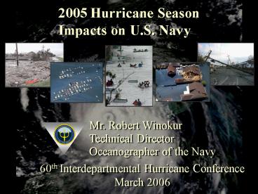
Title: 2005 Hurricane Season
1
2005 Hurricane Season Impacts on U.S. Navy
Mr. Robert Winokur Technical Director Oceanographe
r of the Navy
60th Interdepartmental Hurricane Conference March
2006
2
(No Transcript)
3
(No Transcript)
4
(No Transcript)
5
KATRINA Impacts on NAVO
- Katrina resulted in significant loss of
communications, server outages - and widely dispersed personnel (NAVO)
- MSRC remained operational
- Loss of communications and integral
- personnel resulted in the following product
- disruption
- Ocean Models
- Ice Models
- Tide Models
- Wave Models
- Unique Navy Classified Support
- Most model support returned to operational
- status within two weeks
6
NAVO Receives Backup from FNMOC and NOAA during
KATRINA
- MCSST backup from NOAA NESDIS
- FNMOC assumed CNMOC central
- communication and command control functions
and backed up NAVO high priority Ocean products
until - normal operations were restored
- WW3 substituted for WAM
- Navy Coupled Ocean Data Assimilation (NCODA)
provided a limited replacement for MODAS
7
Impact of Removing Navy Models from the
Hurricane Katrina Consensus Forecast
The Navy NOGAPS and GFDN models correctly
predicted the track and timing of Hurricane
Katrina prior to other major models used in the
5-member consensus forecast
CONU NGPS, GFDN, GFS, GFDL, UKMO CON3 GFS,
GFDL, UKMO
8
Overall 2005 North AtlanticTropical Cyclone
Model Performance
9
Navys Research and Development Efforts Enabling
Factor for Tropical Meteorology
- Automated Tropical Cyclone Forecast (ATCF) )
system developed by Naval Research Laboratory
(NRL), Monterey to optimize the forecasting
process.
- Operational Users include
- Joint Typhoon Warning Center
- National Hurricane Center
- Central Pacific Hurricane Center
- Navy sponsored RD includes
- Tropical Cyclone Genesis
- Probabilistic Prediction of High Impact Weather
- Multi-Scale Tropical Dynamics
- Developmental efforts in Ocean Coupling and Data
Assimilation directly - enable TC track and intensity forecasts
10
Navys Partnerships Enable Tropical Met
Capabilities
- Ongoing commitment to Joint Typhoon Warning
Center - Naval Officer assigned to TPC/NHC
- Naval Research Laboratory modeling initiatives
- Tri-Agency community modeling
- initiative
- Committee for Operational
- Processing Centers (COPC)
- NPOESS satellite
11
Value of Remote SensingNavy Commitment to NPOESS
NPOESS
Multispectral Imagery
combined with Microwaves
Improves Tropical Cyclone Forecasts Reduced
Impact on Maritime Forces
12
Lessons Learned
- Operational / Production Centers must ensure
back-up capability and capacity - - computer processing
- - communications
- - personnel
- Comprehensive personnel accountability plan
- Maintenance of agency mission unique requirements
- Partnerships are key to meeting todays and
tomorrows requirements in Tropical Meteorology
and specifically Tropical Cyclone forecasting.
13
Questions?
14
Backup Slides
15
Overall 2005 Western PacificTropical Cyclone
Model Performance
Recommended
