
Hurricane Rita 2005 PowerPoint PPT Presentation
1 / 22
Title: Hurricane Rita 2005
1
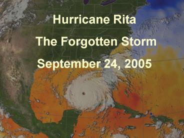
Hurricane Rita The Forgotten Storm September
24, 2005
2
The Great Mississippi River Flood of 1927
- .it penetrated to the core of the nation,
washed away the surface, and revealed the
nations character. Then it tested that character
and changed it. It marked the end of a way of
seeing the world and possibly the end of that
world as well. - Rising Tide John M. Barry
3
(No Transcript)
4
Calcasieu ParishPopulation 185,862
DeQuincy
Westlake
Sulphur
Iowa
Vinton
Lake Charles
5
Southwest Louisiana Economy
- Petrochemical
- Oil Gas
- Aviation
- Tourism/Gaming
- Agriculture/timber
- Manufacturing
- Shipbuilding
- Seafood Harvesting
- Food Processing
- Telecommunications
- Transportation and distribution
- Telecommunications
- Technology based industries
6
Rita Third Most Powerful Hurricane in Atlantic
History
- National Geographic News
- September 22, 2005 --
- Fueled by the warm late-summer waters of the
Gulf of Mexico, Hurricane Rita exploded overnight
into the third-most powerful hurricane on record
for the Atlantic Basin. - As of 5 a.m. today the hurricane's strongest
winds were blowing at 175 miles an hour (280
kilometers an hour) and the barometric pressure
at the storm's center had fallen to 26.51 inches,
or 897 millibars.
7
Hurricane Katrina Impact
15,000-20,000 Katrina evacuees parishwide 5,000
evacuees in Calcasieu shelters
8
(No Transcript)
9
Katrina Sheltering Operation
- Today, there are more than 3,000 evacuees staying
at the Civic Center - with 1,800 others at Burton Coliseum. More are
expected. - We have fed, clothed and cared for the evacuees.
We also have tried to - Make them feel welcome here, because they will be
here for a while. - All of this is being done on a local level.
- FEMA officials, who showed up last Saturday,
described the Civic Center - Shelter as top notch. Lake Charles and
surrounding communities have - given thousands of dollars in donations and even
more in supplies. - Years from now, people will look back at this
event and say it was one of - Lake Charles finest hours.
- -- American Press Editorial September 9,
2005
10
Wednesday Night -- 10 am Forecast Map
11
Wednesday Night Briefing -9/218 hours before
Mandatory Evacuation
- HURRICANE RITA PROBABILITIES NUMBER 18
...NATIONAL HURRICANE CENTER MIAMI FL 10 PM CDT
WED SEP 21 2005 - PROBABILITIES FOR GUIDANCE IN HURRICANE
PROTECTION PLANNING BY GOVERNMENT AND DISASTER
OFFICIALS AT 10 PM CDT...0300Z...THE CENTER OF
RITA WAS LOCATED NEAR LATITUDE 24.6
NORTH...LONGITUDE 87.2 WEST - CHANCES OF.. HURRICANE PASSING WITHIN 65 NAUTICAL
MILES OF LISTED LOCATIONS THROUGH 7PM CDT SAT SEP
24 2005 - LOCATION
LOCATION - 25.5N 90.5W 43
FREEPORT, TX - 26.3N 92.4W 30
PORT O CONNOR, TX - 27.5N 94.2W 24
CORPUS CHRISTI, TX
12
Thursday Morning -- 9/224a.m. Advisory
- RITA HAS TURNED A LITTLE TO THE RIGHT DURING THE
PAST SEVERAL HOURS AND THE INITIAL MOTION IS NOW
285/8. ...DATA SHOWS A STRONG MID-LEVEL RIDGE
CENTERED OVER TEXAS.. MODELS FORECAST THIS RIDGE
TO SHIFT EASTWARD INTO..THE EASTERN GULF OF
MEXICO DURING THE NEXT 48 HR. THIS SHOULD ALLOW
RITA TO TURN MORE NORTHWARD WITH TIME. THE TRACK
GUIDANCE IS NOW CLUSTERED AROUND A LANDFALL
BETWEEN THE SABINE RIVER AND MATAGORDA TEXAS IN
48-60 HR... THE NEW FORECAST TRACK IS ALSO
SHIFTED EASTWARD ABOUT 30 N MI...CALLING FOR
LANDFALL NEAR THE BOLIVAR PENINSULA AND GALVESTON
BAY. HOWEVER...IT SHOULD BE NOTED THAT THE NEW
TRACK IS ALONG THE LEFT OR WEST SIDE OF THE
ENVELOPE OF GUIDANCE.
13
Thursday Morning -- 4 a.m.Forecast Map
14
Thursday Morning Headlines
- SW La. Readies for Hurricane
- With a surging Hurricane Rita headed for the
Texas coast, Southwest Louisiana officials began
preparing for at least a glancing blow from the
powerful Category 5 storm, which could bring
tropical storm-strength winds and a substantial
storm surge to the area. - People in Cameron Parish and low-lying areas of
Calcasieu Parish were urged to evacuate due to an
expected storm surge of up to 8 feet. Residents
in mobile homes or other unsecured dwellings were
urged to move to stronger structures because wind
gusts here could reach 50 mph. - Power outages were likely, officials said, and
local Entergy crews were recalled Wednesday from
Texas and southeastern Louisiana and placed on
standby. - Calcasieu and Cameron schools were closed for
the rest of the week, and classes at McNeese
State University were canceled. - Local officials began transporting Hurricane
Katrina evacuees sheltered at the Lake Charles
Civic Center and Burton Coliseum to shelters in
Alexandria and Shreveport. Evacuees at the
special-needs shelter on the McNeese campus were
also moved.
15
The Aftermath
- 650,000 homes in Louisiana without electricity
- Half a million people with no drinking water
(three weeks) - 403 million in housing assistance to homeowners
and renters
16
200,000 acres of fresh water and intermediate
marsh inundated with salt water.
In Cameron Parish, . . . the damage that was
inflicted was beyond comprehension to the coastal
communities of Cameron, Grand Chenier, Creole,
Holly Beach, Pecan Island and Vermilion
Parish David Richard Stream Property
Management
17
The Response
- All emergency responders police, sheriff,
firefighters, public works and medical personnel
remained on the job. - Public officials coordinated relief efforts.
- Residents who remained assisted in cleanup.
- Within 48 hours, FEMA and National Guard were
distributing food, water and ice. - FEMA and Red Cross began distributing emergency
payments to evacuees. - 20,000 electrical utility workers deployed to
restore power.
18
Role of Charitable and Non-profit Organizations
- American Red Cross 500,000 meals, 660,000
snacks - Salvation Army 223,000 hot meals and 131,000
snacks 60,000 appliances and pieces of
furniture 18,000 food boxes 4,300 personal
comfort items 8,500 Wal-Mart gift cards 4,800
Kroger gift cards 1,267 phone cards - Fat Boys from the Civic Center 993,000 meals
for Katrina/Rita - Area churches, the synagogue and mosque also fed
and sheltered victims and volunteers from all
over the country.
19
Restoration
- The petrochemical industry escaped serious
damage, so most major employers in the area were
able to continue operations and employees
continued receiving paychecks. - Notable exception Harrahs Riverboat Casino
Complex (1,500 employees)
20
Labor Shortage
- FEMA and other relief agencies hired workers for
cleanup and reconstruction efforts at artificial
salaries. - Refineries and petrochemical plants had to
increase wage scales by 4.00 per hour and offer
sign-on bonuses. - Many small businesses could not afford to pay
higher wages and had to cut back on operations. - For example, the local McDonalds chain brought
in 60 workers from Romania
21
Debris Removal
- By September 2006, FEMA had collected 8,523,181
cubic yards of debris - 2,050,000 trash trucks, placed end to end and
side to side, would fill a 4-lane highway from
New York to California - Total cost - 232 million (as of June 2006)
22
(No Transcript)
Recommended
