
Physical Oceanography An Introduction PowerPoint PPT Presentation
1 / 95
Title: Physical Oceanography An Introduction
1
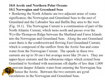
10.0 Arctic and Northern Polar Oceans
10.1 Norwegian and Greenland Seas
Bordering the North Atlantic are two adjacent
areas of some significance the Norwegian and
Greenland Seas to the east of Greenland and the
Labrador Sea and Baffin Bay area to the west
(Fig. 10.1). The Norwegian Current is a
continuation of part of the North Atlantic
Current, which turns north and passes over the
Wyville-Thompson Ridge between the Shetland and
Faroe Islands into the Norwegian and Greenland
Seas. Along the east Greenland coast there is
the southwestward flowing East Greenland Current,
which is composed of the outflow from the Arctic
Sea and some water from the Norwegian Current.
The speeds in these two currents are up to 30
cm/s but average more like 20 cm/s. They are
upper-layer currents and the submarine ridges
which extend from Greenland to Scotland with
maximum sill depths of less than 1,000 m prevent
deeper Atlantic water from entering the Norwegian
Sea and hence the Arctic. Between the two
currents are gyral circulations in the Norwegian
and Greenland Seas.
2
A rather curious feature is that apparently the
subsurface water which enters the Arctic Sea from
this area comes from the gyre of the Norwegian
Sea to the south rather than from the Greenland
Sea which is farther north and closer to the
Arctic. Metcalf (1960) showed this from data
obtained in the winters of 1951 to 1955.
Characteristically, the water of the Greenland
Gyre above 1,500 m has properties of T from -1.1
to -1.7 C, and S from 34.86 to 34.90 psu, while
below this depth the water is almost isohaline at
34.92 psu with a temperature of -1.1 C or
colder. The deep water of the Norwegian Gyre has
the same salinity but its temperature is -0.95 C
or warmer, properties, which are similar to those
of the Bottom Water of the Arctic Basin. This
Norwegian Sea water is also found to the east and
north of the Greenland Sea and apparently in some
way forms a barrier to the passage of the colder
Greenland Gyre water into the Arctic.
3
(No Transcript)
4
oxygen contents of 6 to 7.5 mL/L indicating
frequent formation. It had been assumed that
winter cooling at the surface resulted in
overturning which mixed the water from the
surface to the bottom. However, Carmack and
Aagaard (1973) have pointed out that although
there is considerable evidence that the formation
of Greenland Sea Deep Water (GSDW) is afforded by
the severity of the particular winter, when good
winter measurements in this area became available
there was no evidence of a homogeneous water
column. Therefore, unless the formation takes
place in a very small area, some other mechanism
must be responsible for the formation of
Greenland Sea Deep Water. They suggest that the
deeper Atlantic water (relatively warm and
saline) loses heat by conduction to the Greenland
Gyre Water above it (cool and less saline) at a
greater rate than it loses salt. The result is
that the bottom of the Gyre Water, being heated
from below, becomes unstable and convects upward
carrying heat to the surface and discharging it
to the atmosphere.
5
The Atlantic Water which is cooled by this
process at its contact with the Gyre Water,
without losing salt, becomes more dense and sinks
to form the GSDW. The exchange across the
interface between the Atlantic Water and the Gyre
Water is identified as a double diffusion
process. However, there is some question about
this since a typical double diffusion process is
a short-range one (decimeters to meters) whereas
the proposed Greenland Sea process requires heat
transfer over 50 to 200 m. Note that if it is an
example of double diffusion, it is of the second
variety described in Section 7.14 in which there
is no mixing between layers-there is simply
convection within each layer.
6
10.2 Labrador Sea, Baffin Bay and Hudson Bay
The East Greenland Current (Fig. 10.1) carries
a lot of sea ice from the Arctic down the coast
of Greenland, maintaining the low temperatures
and rendering access to the east coast of
Greenland difficult. The Current flows round the
southern tip of Greenland into the Labrador Sea,
having picked up some Atlantic water southwest of
Iceland. It continues north up the West Coast as
the West Greenland Current from which water
branches off to the west until the Current
eventually peters out in Baffin Bay. The inflow
to this area is balanced by the southward flow,
along the west side of Baffin Bay, of the Baffin
Land Current which continues south as the
Labrador Current down the west side of the
Labrador Sea back into the Atlantic.
7
In this region the differences between the
properties of the in- and outflowing currents are
not as great as to the east of Greenland. The
West Greenland Current has temperatures around 2
C and salinities of 31 to 34 psu, while the
Labrador Current water is at 0 C or less and 30
to 34 psu in salinity. The frequently quoted
calculations of Smith et al. (1937) for the
Labrador Sea indicate that above 1,500 m depth
the total inflow is 7.5 Sv, comprised of the East
Greenland Current from the south (5 Sv), the
Baffin Land Current from the north (2 Sv) and the
inflow from Hudson Bay (0.5 Sv).
The outflow totaling 5.6 Sv consists of 1 Sv
northward along the west Greenland coast to
Baffin Bay and 4.6 Sv south in the Labrador
Current. They concluded that the balance of 1.9
Sv must flow out as deep water from the Labrador
Sea into the Atlantic. Other estimates have
indicated that considerable variations in the net
flow may occur but the consensus is that in the
long-term average there is a net inflow in the
upper layers and an outflow of deep water.
8
The Labrador Sea is another region where it
has been assumed that deep, convective overturn
as a result of winter cooling was the mechanism
for deepwater formation. As some winter cruises
did not show the vertically homogeneous water
mass which would be expected in this process, a
winter cruise in C.S.S. Hudson in 1966 (Lazier,
1973) was designed to study the region with
closely spaced stations in case the formation
area was very small in horizontal extent.
No evidence of large-scale convective overturn
was obtained and a more plausible explanation of
the data was that surface cooling resulted in a
flow downward along moderately sloping surfaces
rather than vertically. However, in 1967 data
from Weather Station BRAVO in the center of the
Labrador Sea did show evidence of deep convective
overturn to 1,500 m and it is possible that both
vertical overturn and flow along isopycnal
surfaces may at different times play their part
in the formation of deep water there.
9
Some contribution to the Labrador Current
comes from Hudson Bay (Fig. 10.1). This is an
extensive body of water averaging only about 90 m
in depth with maximum values of about 200 m. The
Bay is usually covered with ice in the winter but
free for a time in summer. As a result, most of
the oceanographic data is for the summer, mainly
from cruises in 1930, 1960 and 1961. There is
considerable seasonal river runoff into the Bay
from the south and east sides, giving rise to a
marked horizontal stratification and an
estuarine-type circulation. In summer, the
upper water properties range from 1 to 9 C
and S 25 to 32 psu while the deeper water is
from - 1.6 to 0 C and 32 to 33.4 psu. The low
salinities are generally in the south and east,
near the main sources of runoff and consistent
with a general anticlockwise circulation in the
upper layer. A few observations taken in winter
through the ice indicate upper salinities from 28
psu in the southeast to 33 psu in the north, with
temperatures everywhere at the freezing point
appropriate to the salinity. The implication is
that the waters are vertically mixed each year
the high dissolved oxygen values of 4.5 to 8 mL/L
in the deep water are consistent with this
condition.
10
The Labrador Sea is open to the Atlantic to
depths of over 4,000 m but Baffin Bay, with a
maximum depth of 2,200 m, is separated from the
Labrador Sea, and hence from the Atlantic, by the
sill in the Davis Strait having a depth of only
about 600 m. The deep waters in Baffin Bay below
sill depth are markedly different from those at
the same depths outside. The temperature is
between 0 and -0.5 C with a salinity 34.5 psu
and relatively low oxygen values of 4 mL/L.
Sverdrup interpreted the Baffin Bay Deep Water as
Labrador Sea water which had moved north below
the surface, mixed with cool, low salinity
surface water, and then had its density increased
by freezing to sink to fill the basin.
Since Baffin Bay is ice-covered during the wi
nter there is little information for this season
but there are indications that water having the
properties of the Deep Baffin Bay Water does not
occur at the surface. An alternative suggestion
by Bailey (1957) is that the source of the Baffin
Bay Deep Water is probably inflow from the Arctic
through Nares Strait, the passage between
Greenland and Ellesmere Island. Water of the
same salinity and temperature as the Baffin Bay
Deep Water certainly occurs at the appropriate
depth in the Arctic Sea. The annual inflow to
Baffin Bay is presumably relatively small so that
the water in the basin has a long residence time
there and the oxygen content gets depleted.
11
10.3 Arctic Sea Our knowledge of the Arctic Se
a has developed considerably since the mid-1950s.
Numerous soundings and oceanographic stations
have been taken from ships, as well as through
the ice from semi-permanent camps on ice islands
or ice floes or from temporary camps established
by aircraft transportation. In particular it has
been demonstrated that the Arctic Sea is divided
into two basins by the Lomonosov Ridge, which
extends from Greenland past the North Pole to
Siberia (Fig. 10.1). These two basins have
been named the Canadian Basin (depth about 3,800
m) and the Eurasian Basin (depth about 4,200 m
Fig. 10.1). Soundings along the Lomonosov Ridge
are not numerous enough to determine its sill
depth with any certainty but comparisons of water
properties on either side suggest that it is at
1,200 to 1,400 m below sea level. A feature of
the bottom topography is the broad continental
shelf off Siberia, 200 to 800 km wide and
occupying about 36 of the area of the Arctic
Sea but containing only 2 of the total volume
of water in the Sea.
12
The main connection of the Arctic Ocean with
the other oceans is to the Atlantic through the
gap between Greenland and Spitsbergen with a main
sill depth there of 2,600 m while the sill depth
between Spitsbergen, Franz Josef Land and Novaya
Zemlaya is only about 200 m (Coachman and
Aagaard, 1974). The Bering Strait connection to
the Bering Sea and the Pacific Ocean has a sill
depth of about 45 m and is narrow, but the water
flow into the Arctic is not insignificant.
There are also connections from the Arctic th
rough the Canadian Archipelago by several
channels, principally Nares Strait (sill depth
250 m) and Lancaster Sound (sill depth 130 m)
which lead to Baffin Bay and thence to the
Atlantic. These passages are difficult to access
because of ice and are not fully charted.
13
10.4 Arctic Sea upper-layer circulation
Information on the circulation of the upper
layers has been obtained from the records of the
movements of ships held in the ice, such as the
Fram and the Sedov, and from movements of camps
on the ice. In addition, geostrophic
calculations have been made from the
water-density distribution. These various
sources yield a consistent picture of the
surface-layer movement which is best described as
a clockwise circulation in the Canadian Basin
leading out to the East Greenland Current and, in
the Eurasian Basin, a movement by the most direct
path toward Greenland and out in the East
Greenland Current. The speeds are of the o
rder of 1 to 4 cm/s or, perhaps, more
meaningfully stated as 300 to 1,200 km/year when
considered in relation to the size of the Arctic
Sea which is about 4,000 km across. The speed
and distance may be compared to the 3 years taken
by the Fram to drift from north of the Bering
Strait to Spitsbergen, and the 2.5 years for the
Sedov to drift about 3,000 km. The movement is
not by any means steady but has frequent
variations of speed and direction, which average
out to the figures quoted.
14
Recently it has been possible to compute sea
ice motion from passive microwave satellite
imagery. A 22-year mean ice motion pattern for
the entire Arctic is shown here in Fig. 10.2 that
is computed from daily maps of satellite tracked
sea ice motion (Emery et al., 1998). There are
dramatic daily, seasonal and interannual changes
in this ice motion pattern. The mean seaso
nal pattern 12 mean monthly maps are presented
here in Fig. 10.3. There is a definite seasonal
change in the ice movements. There are even
dramatic variations in ice motion on a daily
basis, which represent the response of the ice to
short-term variations in wind driving. In Fram
Strait Emery et al. (1996) found that the
geostrophic ocean currents contributed
significantly to the southward movement of sea
ice in this area.
15
Fig. 10.2 Mean annual Arctic sea ice motion from
1979-2003 from Special Sensor Microwave Imager
(SSM/I) passive microwave satellite data.
16
(No Transcript)
17
(No Transcript)
18
(No Transcript)
19
10.5 Arctic Seawater masses
20
Three main water masses are recognized in the
Arctic Ocean (Coachman and Aagaard, 1974). These
are (Table 10.1 and Fig. 10.4a) the surface or
Arctic Water from the sea surface to 200 m depth,
the Atlantic Water from 200 to 900 m, and the
Deep or Bottom Water from 900 m to the bottom.
One of the features of the water structure is
that its density is determined largely by the
salinity (which is why the marked temperature
maximum of the Atlantic Water can exist).
21
10.5.1 Arctic Water The Arctic Water (0 to 200
m) can be divided into three layers which will
be called the Surface Arctic, the Sub-surface
Arctic and the Lower Arctic Waters. Surface
Water (Table 10.1) is much the same across the
whole Arctic and extends from the surface to
between 25 and 50 m depth. The salinity is s
trongly influenced by the freezing or melting of
ice and has a wide range from 28 to 33.5 psu.
The temperature is also controlled by melting and
freezing, which involves considerable heat
transfer at constant temperature (the freezing
point).
As a consequence the temperature remains close
to the freezing point of sea-water which varies
only from -1.5 C at a salinity of 28 psu, to -
l.8 C at a salinity of 33.5 psu. Seasonal
variations in water properties are limited to
this layer and range up to 2 psu in salinity and
0.2 K in temperature.
22
Fig. 10.4. Arctic Sea (a) typical temperature
and salinity profiles for the two basins, (b) T-S
diagram for the Eurasian Basin waters.
23
The Subsurface layer (25/50 m to 100 m) in the
Eurasian Basin is isothermal to 100 m (Fig.
10.4b) and then increases but there is a strong
halocline between 25 and 100 m (Fig. 10.4a).
Below 100 m the temperature increases markedly
but the salinity only increases slowly. The fact
that the Subsurface water is isothermal (limited
to the freezing point) but not isohaline
indicates that its structure cannot be due to
vertical mixing between the Surface layer and the
deeper layers. It is probable that the Subsu
rface Water is maintained by horizontal advection
(flow) from the Eurasian Shelf. The mechanism
suggested by Coachman and Aagaard (1974) is that
the saline Atlantic Water, which enters near
Spitsbergen, continues below the surface along
the Eurasian continental slope which is indented
by several deep submarine canyons.
24
At the same time the considerable river runoff
from northern Asia flows north over the shelf as
a cold, low-salinity surface layer. It mixes at
its subsurface contact with the warmer, more
saline Atlantic Water to form the Subsurface
Water, which is close to its freezing point. The
Subsurface Water continues out into the Arctic
Sea to maintain the layer there between 25 and
100 m. The canyons are necessary to feed the
saline Atlantic Water into the shelf area, and
the vertical mixing process is similar to that
which occurs in an estuary where fresh river
water flows over saline sea-water as described in
Section ???.
25
The Subsurface Water in the Canadian Basin
also shows a halocline from 25 m to 100 m but its
temperature structure is different from that in
the Eurasian Basin. There is a characteristic
temperature maximum at 75 to 100 m depth (Fig.
10.4c) with a consequent temperature minimum of
-1.5 C at about 150 m and then an increase to
the deeper water values. The temperature maximum
is attributed to Bering Sea water coming into the
Arctic through the Bering Strait. This water is
warmer than the Arctic Surface layer but slightly
denser because of its salinity.
It presents one of the relatively few exampl
es of a subsurface temperature maximum occurring
in the open ocean. The reason that it occurs
here is because the water is close to its
freezing point and the effect of salinity
preponderates over that of temperature in
determining density. The temperature maximum is
found to be most prominent in the Chukchi Sea
north of the Bering Strait, and it diminishes
around the clockwise circulation of the Canadian
Basin. The Arctic Lower Water is essentially a
mixing layer with properties intermediate between
the Subsurface Arctic Water above and the
Atlantic Water below.
26
Fig. 10.5. Salinity and temperature profiles for
the Arctic Water Masses
27
10.5.2 Atlantic Water The second water mass, t
he Atlantic Water (vertical profiles in Fig.
10.4a and T-S diagrams in Fig. 10.4b), is
recognized chiefly by its having a higher
temperature than the water above or below it.
This takes place where it enters as the West
Spitsbergen Current, on the east side of the
Greenland-Spitsbergen gap its temperature is up
to 3 C and its salinity 34.8 to 35.1 psu.
In the Arctic Sea its temperature decreases g
radually to 0.4 C and its salinity is within the
limiting range from 34.85 to 35 psu. Its
movement has been traced by the core method along
the Eurasian continental slope, with some water
branching off to the north and out as part of the
East Greenland Current. The remainder flows
across the Lomonosov Ridge into the Canadian
Basin.
28
The application of the core method is as
follows. Fig. 10.6a shows a T-S diagram for the
water column in the Eurasian Basin with the
marked temperature maximum of the Atlantic Water
near the salinity of 35 psu. (Note that the
temperature maximum is emphasized by the
magnified temperature scale in this diagram, 2 K
equivalent on paper to 1 psu in salinity,
compared with the other T-S diagrams shown
previously, (e.g. Fig10.4 where 10 K was
equivalent to 1 psu.) Then Fig. 10.6a shows the
temperature maximum part of the T-S diagram, the
core of the Atlantic Water, for a selection of
stations from the Greenland Sea and around the
Arctic basins (Fig. 10.6b) to show how the core
is gradually eroded away by mixing during its
circuit. The water mass itself appears to
remain in the depth range from 200 to 900 m, but
the depth of the temperature maximum increases
from about 150 m at the top of the Atlantic Water
just before entry into the Arctic near
Spitsbergen to nearly 500 m in the Canadian
Basin. The reason is that the temperature
gradient in the upward direction is greater than
in the downward direction (Fig. 10.5a) with the
result that more heat is lost upward from the
layer than downward and the temperature maximum
increases in depth. (There may also be some
descent of the Atlantic Water.) The circulation
of the Atlantic Water is then basically
counter-clockwise around the Arctic Sea, the
opposite direction to that of the Arctic Water
above it.
29
10.5.3 Deep or Bottom Water The Arctic Deep or
Bottom Water (Fig. 10.4 Table 10.1) extends
from the lower 0 C isotherm, at about 800 m
depth, to the bottom and comprises about 60 of
the total water volume of the Arctic Sea. Its
salinity range through the whole volume is very
small, from 34.90 to 34.99 psu, and in any
particular area the change in the vertical
direction is generally smaller than this.
There is a tendency for the salinity to incr
ease very slightly with depth. The in situ
temperature varies over a range of 0.2 K in the
vertical column. In the Eurasian Basin the
temperature reaches a minimum of -0.8 C at 2,500
m while in the Canadian Basin the minimum is 0.4
C at 2,000 m (Fig. 10.5a). Below the minimum
the temperature rises by about 0.2 K to the
bottom, the rate of increase being equal to the
adiabatic rate, i.e. it can be attributed
entirely to compression of the water as it
sinks.
30
Aagaard et al. (1985) distinguished four
components of the Deep Water as cold,
relatively fresh Greenland Sea Deep Water (GSDW),
warmer and more saline Norwegian Sea Deep Water
(NSDW), (both named from their sources), still
warmer and more saline Eurasian Basin Deep Water
(EBDW) and, the most saline and warmest, Canadian
Basin Deep Water (CBDW), (these two named for
their locations). Through Fram Strait (between
Greenland and Spitsbergen) there is inflow of
GSDW below the strong surface outflow from the
Arctic. The authors also suggested that a source
for the higher salinity of the CBDW than of the
EBDW is brine formed during freezing on the
continental shelf and flowing down the slope to
increase the salinity of the deep water, i.e. a
nearshore boundary process. (Note that this will
also contribute to ventilation of the deep water
in the basin.) It was pointed out that the
brine formation must also occur along the
extensive Eurasian shelf and Aagaard et
al.,(1985) suggested that the lower salinity and
silicate content of the EBDW than those of the
CBDW may be accounted for by the inflow through
Fram Strait into the Eurasian Basin of low
salinity, low silicate GSDW which does not pass
into the Canadian Basin below the level of the
Lomonsov Ridge sill.
31
10.6 Arctic Sea budgets The Arctic Sea has alw
ays attracted the attention of oceanographers
wishing to exercise their talents by
investigating the water budget, and many sets of
calculations have been made. The results
obtained vary somewhat in detail but the main
features are substantially the same. A
calculation by Aagaard and Greisman (1975) has
been chosen for demonstration because it includes
both heat and salt budgets (Table 10.2).
This does not represent an absolute budget in
the sense that all the flow terms and water
properties are known exactly in fact,
information on most of the quantities is sparse
and, in any cases, variations with time are
likely to occur. Nevertheless, it is worth
making even trial budgets in order to determine
which terms appear to be important and where
ones observational efforts should be directed in
order to improve the budget.
32
From the budget in Table 10.2, it can be seen
clearly that the main volume fluxes are through
the GreenlandSpitsbergen gap but that the Bering
Strait and Arctic Archipelago flows are not
negligible. The West Spitsbergen Current carries
the main heat flux (larger than in previous
budgets) and overall there is a net advective
inflow (Qv positive) to the Arctic this must be
lost through the sea surface. (Note that because
of its high latent heat of fusion an outflow of
ice is equivalent to an inflow of heat and vice
versa.)
33
(No Transcript)
34
Calculations of heat budgets are done for
other reasons than for displaying virtuosity in
deduction and calculation. From the water
budget, in relation to the volume of the basin
itself, one can obtain an idea of the rate at
which the water in the basin is exchanged. This
may be important for determining the rate of
replenishment of nutrients in an area important
for fisheries or for the rate of removal of
sewage or industrial effluent. For the Arctic it
is estimated that the surface water is
substantially all replaced in a period (residence
time) of 3 to 10 years, the deep water in 20 to
25 years (from the above budget) and the bottom
water in about 150 years.
35
10.7 Ice in the sea Ice in the sea has two ori
gins, the freezing of sea-water and the breaking
off of ice from glaciers. The majority of ice
comes from the first of these sources and will be
referred to as sea-ice the glaciers supply
pinnacle icebergs in the Northern Hemisphere
and flat "tabular" icebergs in the Southern
Hemisphere.. The importance of sea-ice is that
it drastically alters the heat and momentum
transfers between the atmosphere and the ocean,
increases the surface albedo, is a thermal
insulator, damps surface waves, changes the
temperature and salinity structure in the upper
layer by melting and freezing and is a major
hindrance to navigation. Sea ice plays a dis
proportionately large role in the Earths climate
not only because of its direct air-sea heat
exchange but also because this ice covered
location may be somewhere that long-term climate
change is easiest to detect due to changes in the
ice cover in response to global warming. For
this reason the polar regions are of importance
for our study but at the same time the polar
conditions particularly in winter make it very
difficult to collect important measurements. In
spite of this the poles have received
considerable attention since the early days of
exploration when there was a global interest in
being the first to reach the north or south
poles.
36
10.7.1 Ice physics When water loses sufficient
heat (by radiation, conduction to the
atmosphere, convection or evaporation) it freezes
to ice, i.e. changes to the solid state. Initial
freezing occurs at the surface and then the ice
thickens by freezing at its lower surface as heat
is conducted away from the underlying water
through the ice to the air. The initial freezing
process is different for fresh and low-salinity
water than for more saline water because the
temperature at which water reaches its maximum
density varies with salinity. Table 10.3 gives
the values of the freezing point and temperature
of maximum density for water of various
salinities. (Note that the above values are for
freezing, etc. at atmospheric pressure.
Increased pressure lowers the freezing point,
which decreases by about 0.08 K per 100 m
increase in depth in the sea.).
37
(No Transcript)
38
To contrast the freezing process for fresh-
and sea-water, first imagine a fresh-water lake
where the temperature initially decreases from
about 10 C at the surface to about 5 C at about
30 m depth. As heat is lost through the surface,
the density of the water increases and vertical
convective mixing (overturn) occurs with the
temperature of the surface water-layer gradually
decreasing. This continues until the upper
mixed-layer cools to 3.98 C and then further
cooling of the surface water causes its density
to decrease and it stays near the top.
A result is the rapid loss of heat from a thin
surface layer, which soon freezes. For a
sea-water of salinity 35 psu of the same
initial temperature distribution, surface cooling
first results in a density increase and vertical
mixing by convention currents occurs through a
gradually increasing depth, but it is not until
the whole column reaches -1.91 C that freezing
commences.
39
As a much greater volume of water has to be
cooled through a greater temperature range than
in the fresh water case, it takes longer for
freezing to start in salt water than in fresh
water. A simple calculation for a column of
fresh water of 100 cm depth and 1 cm2
cross-section initially at 10 C shows that it
takes a heat loss of l63 joules to freeze the top
1 cm layer, whereas for a similar column of
sea-water of S 35 psu it takes a loss of 305
joules to freeze the top 1 cm because the whole
column has to be cooled to - l.91 C, rather than
just the top 1 cm to 0 C for the fresh water.
40
Note that as sea-water of salinity less than
24.7 psu has a higher temperature of maximum
density than its freezing point, it will behave
in a similar manner to fresh water, although with
a lower freezing point. For sea-water of
salinity 24.7 psu, in high latitudes the
salinity generally increases with depth and the
stability of the water column usually limits to
30-50 m the depth to which the convection
currents will sink. Therefore ice starts to form
at the surface before the deep water reaches the
freezing point.
41
Generally, sea-ice forms first in shallow
water near the coast, particularly where the
salinity is reduced by river runoff and where
currents are minimal. The first process is the
formation of needle-like crystals of pure ice,
which impart an oily appearance to the sea
surface (grease or frazil ice). The crystals
increase in number and form a slush, which then
thickens and breaks up into pancakes of a meter
or so across. With continued cooling, these
pancakes grow in thickness and lateral extent,
eventually forming a continuous sheet of floe or
sheet ice. Once ice has formed at the sea su
rface, when the air is colder than the water
below, freezing continues at the lower surface of
the ice and the rate of increase of ice thickness
depends on the rate of heat loss upward through
the ice (and any snow cover). This loss is
directly proportional to the temperature
difference between top and bottom surfaces and
inversely proportional to the thickness of the
ice and snow cover.
42
With very cold air, a sheet of sea-ice of up
to 10 cm in thickness can form in 24 h, the rate
of growth then decreasing with increasing ice
thickness. Snow on the top surface insulates it
and reduces the heat loss markedly, depending on
its degree of compaction. For instance, 5 cm of
new powder snow may have an insulation equivalent
to 250-350 cm of ice, 5 cm of settled snow can be
equivalent to only 60-100 cm of ice while 5 cm of
hard-packed snow can be equivalent to only 20-30
cm of ice. As an example of the annual cyc
le of the development of an ice sheet at a
location in the Canadian Arctic, the ice was
observed to start to form in September, was about
0.5 m thick in October, 1 m in December, 1.5 m in
February and reached its maximum thickness of 2 m
in May, after which it started to melt.
43
In the initial stage of ice-crystal formation,
salt is rejected and increases the density of the
neighboring sea-water, some of which then tends
to sink and some of which is trapped among the
ice crystals, forming pockets called brine
cells. The faster the freezing, the more brine
is trapped. Sea-ice in bulk is therefore not
pure water-ice but has a salinity of as much as
15 psu for new ice (and less for old ice as
gravity causes the brine cells to migrate
downward in time). With continued freezing, more
ice freezes out within the brine cells leaving
the brine more saline. Some of the salts may
even crystallize out. The salinity of firs
t-year ice is generally 4 to 10 psu, for
second-year ice (ice which has remained frozen
beyond the first year) salinity decreases to 1-3
psu and for multi-year ice may be less than 1
psu. If sea-ice is lifted above sea-level, as
happens when ice becomes thicker or rafting
occurs, the brine gradually trickles down through
it and eventually leaves almost saltless, clear
old ice. Such ice may be melted and used for
drinking whereas melted new ice is not potable.
Sea-ice must therefore be considered to be a
material of variable composition and properties,
which depend very much on its previous history.
(For more detail see Doronin and Kheisin, 1975.)
44
The density of pure water at 0 C is 999.9
kg/m3 and that of pure ice is 916.8 kg/m3.
However the density of sea-ice may be greater
than this last figure (if brine is trapped among
the ice crystals) or less (if the brine has
escaped and gas bubbles are present.) Values
from 924 to 857 kg/m3 were recorded on the
Norwegian Maud Expedition (Malingren, 1927).
Malmgren gave values for the specific heat of
sea-ice of as much as 67 kJ/kg K at -2 C and S
15 psu. This surprisingly high figure arises
because the measurement of specific heat
requires heating through a finite range of
temperature and while so doing there will be some
melting of ice crystals into the brine. The 67
kJ/kg K then includes some latent heat of melting
and the high values are not true specific heats
in the sense that the term is used for pure
substances. The latent heat of melting decreases
from 335 kJ/kg (80 cal/g) at 0 C and S 0 psu
to only 63 kJ/kg at -1 C and S 15 psu.
45
The amount of heat required to melt sea-ice
varies considerably with its salinity. For S 0
psu (fresh water ice) it requires 19.3 kJ/kg from
-2 C and 21.4 kJ/kg from -20 C, while for
sea-ice of S 15 psu, it requires only 11.2
kJ/kg from -2 C but 20.0 kJ/kg from -20 C.
The small difference of heat (2.1 kJ/kg) needed
to raise the temperature of fresh-water ice from
-20 C to -2 C is because no melting takes
place, i.e. it is a true measure of the specific
heat of pure ice. However, for sea-ice of
S 15 psu, it requires more heat (8.8 kJ/kg) to
raise its temperature through the same range
because some ice near brine cells melts and thus
requires latent heat of melting as well as heat
to raise its temperature. Note also that less
heat is needed to melt new ice (S 15 psu) than
old ice which has a lower salinity.
46
Because of the spongy nature of first year
sea-ice (crystals brine cells) it has much less
strength than fresh-water ice. Also, as fast
freezing results in more brine cells, the
strength of ice so formed is less than when
freezing occurs slowly, i.e. sea-ice formed in
very cold weather is initially weaker than ice
formed in less cold weather.
As the temperature of ice decreases, its hard
ness and strength increase, and ice becomes
stronger with age as the brine cells migrate
downward. When ice forms in calm water, the
crystals tend to line up in a pattern and such
ice tends to fracture along cleavage planes more
easily than ice formed in rough water where the
crystals are more randomly arranged and cleavage
planes are not formed.
47
The mechanical behavior of sea-ice when
temperature changes is complex. As the ice
temperature decreases below its freezing point,
the ice expands initially, reaches a maximum
expansion and then contracts. For instance, an
ice floe of S 4 psu will expand by 1 m per 1 km
length between -2 C and -3 C, reaches its
maximum expansion at -10 C and thereafter
contracts slightly. Ice of S 10 psu expands 4
m per 1 km length from -2 C to -3 C, and
reaches its maximum expansion at -18 C.
The expansion on cooling can cause an ice she
et to buckle and pressure ridges to form, while
contraction on further cooling after maximum
expansion results in cracks, sometimes wide, in
the ice sheet.
48
Pressure ridges can also develop as a result
of wind stress on the surface driving ice sheets
together. The ridges on top are accompanied by a
thickening of the lower surface of the ice by
four to five times the height of the surface
ridges. Sea-ice generally floats with about
five-sixths of its thickness below the surface
and one-sixth above and so relatively small
surface ridges can be accompanied by deep ridges
underneath-depths of 25 to 50 m below the sea
surface have been recorded. Thickening of
an ice sheet may also result from rafting when
wind or tide forces one ice sheet on top of
another or when two sheets, in compression,
crumble and pile up ice at their contact. Old
ridges, including piled up snow, are referred to
as hummocks. As they are less saline than newer
pressure ridges, they are stronger and more of an
impediment to surface travels than the younger
ridges.
49
Several forces determine the motion of pack ice
(a) Wind stress at the top surface, the
magnitude depending on the wind speed and the
roughness of the ice surface, so that ridges,
etc. increase the wind stress. Typical ice
speeds are 1 to 2 of the wind speed.
(b) Frictional drag on the bottom of an ice
sheet moving over still water will tend to slow
it down, while water currents (ocean and tidal)
will exert a force on the bottom of the ice in
the direction of the current. Because current
speeds generally decrease with increase in depth,
the net force on deep ice and icebergs will be
less than on thin ice, and pack ice will move
past icebergs when there is significant wind
stress.
50
(c) In both of the above cases, the effect of the
Coriolis force will be to divert the ice motion
by 15 to 20 to the right of the wind or
current stress in the Northern Hemisphere (to the
left in the southern). (It was the observation
of the relation between wind direction and ice
movement by Nansen, and communicated by him to
Ekman, which caused the latter to develop his
well known theory of wind-driven currents.) It
is convenient to note that as surface friction
causes the surface wind to blow at about 15 to
the left of the surface isobars, the direction of
the latter is approximately that in which the ice
is likely to drift (northern hemisphere).
51
(d) If the ice sheet is not continuous,
collisions between individual floes may occur
with a transfer of momentum (i.e. decrease of
speed of the faster floe and increase of speed of
the slower). Energy may go into ice deformation
and building up of ridges at impact, this is
referred to as internal ice resistance. This
will increase with ice concentration, i.e.
proportion of area covered by ice. The effect of
upper surface roughness (R on a scale of 1 to 9)
and ice concentration (C on a scale of 1 to 9) on
the speed of the ice V (expressed as a percentage
of the wind speed) is given by V R(l-0.08 C)
(to be taken to only one place of decimals), so
that the speed of the ice increases with
roughness but decreases with increased ice
concentration. It should be noted that for very
close pack ice, stresses of wind or current will
be integrated over quite large areas and the
local motion may not relate well to the local
wind.
52
Ice break-up is caused by wave action, tidal
currents and melting. Melting of ice occurs when
it gains enough heat by absorption of solar
radiation and by conduction from the air and from
sea-water nearby to raise its temperature above
the melting point. The absorption of radiation
depends very much on the albedo of the surface
(proportion of radiation reflected) which varies
considerably, e.g. for sea-water the albedo is
from 0.05 to 0.10 (i.e. it is a very good
absorber of radiation), for snow-free sea-ice it
is from 0.3 to 0.4, while for fresh snow it is
0.8 to 0.9. Dark materials, like dirt and dust,
have a low albedo of 0.1 to 0.25 and so absorb
radiation well, and such material on ice can form
a center for the absorption of radiation and
consequent melting of ice around it, so that
puddles can form. These can absorb heat because
of the low albedo of water and may even melt
right through an ice sheet. When any open water
forms, this absorbs heat and causes rapid melting
of ice floating in it.
53
10.7.2 Distribution of sea-ice
In the Arctic Sea, the sea-ice may be divided
into three categories. The most extensive is the
Polar Cap Ice which is always present and covers
about 70 (thought to be declining in recent
years as discussed in section 10.7.?) of the
Arctic Sea, extending from the pole approximately
to the 1,000 m isobath. It is very hummocky and,
on the average, is several years old. Some of
this Cap Ice melts in the summer and the average
thickness decreases to about 2.5 m. Open water
spaces, polynyas may form. In the autumn t
hese freeze over and the ice in them gets
squeezed into ridges (two ice floes meet and
deform vertically to form a ridge with 1/3 of the
ridge going up and 2/3 of the ridge going down),
or rafted (again two ice floes meet but in this
case on floe rises up and over the other). In
the winter, the average ice thickness is 3 to 3.5
m but hummocks increase the height locally up to
10 m above sea level. The occasional ice
islands, which have fairly uniform ice thickness
considerably greater than the regular Cap Ice,
originate from glaciers in northern Ellesmere
Island.
54
Although this Polar Cap Ice is always present
it is not always the same Ice. Up to one-third
of the total Cap and Pack Ice is carried away in
the East Greenland Current each year while other
ice is added from the Pack Ice described below.
The Polar Cap Ice is only penetrable by the
heaviest icebreakers. This ice has been replaced
in areal coverage by first-year ice, which is
considerably thinner than the old ice that it
replaces. This is evidence of a persistent
warming which has provided the total thermal
energy required to melt or transport the oldest
ice to be replaced by first-year ice.
55
The Pack Ice lies outside the Polar Cap and
covers about 25 of the Arctic area. It is
lighter than the Cap Ice and its area varies
somewhat from year to year but extends inshore of
the 1000 m isobath. It penetrates farther south
in the East Greenland and the Baffin
Land/Labrador Currents by which it is carried.
Its areal extent is least in September and
greatest in May. Some of it melts in summer and
some gets added to the Cap by rafting.
The ice which impedes navigation in the north
ern parts of the Canadian Archipelago, along the
east coast of Greenland, in Baffin Bay and the
Labrador Sea area and in the Bering Sea is the
Pack Ice which is a few meters thick.
Icebreakers can penetrate it.
56
The general circulation of the Cap and Pack
Ice is similar to that of the upper water-layer
in the Arctic. In the Beaufort Sea (Canadian
Basin) there is a clockwise circulation and, in
the Eurasian basin, a direct flow at about 3
km/day toward Fram Strait (between Greenland and
Spitsbergen) and down the East Coast of
Greenland. It has been estimated that the volume
of fresh water, as ice, exported there is
approximately equal to the total continental
runoff into the Arctic basin. Earlier estimates
of the general circulation were based on the
drifts of ice islands and later buoys. Daily ice
motion maps can be computed from passive
microwave satellite data (Emery et al., 1997)
which view the ice through the cloud cover giving
us an excellent visualization of the Arctic
general circulation (Fig. 9.3). Here the vectors
represent the ice motion averaged over a 7-year
period computed from daily ice motion inferred
from Special Sensor Microwave Imager (SSM/I)
data. These vectors clearly show the Trans Polar
Drift (TPD) across the central Arctic feeding
into the strong southward flow in Fram Strait.
57
The anticyclonic circulation in Beaufort Sea
is a well known feature but the amount of ice
flowing from the Laptev Sea into the TPD and
subsequently Fram Strait has not been reported
earlier. The fact that a substantial amount of
ice flows from the Kara Sea around the northern
tip of Nova Semlya and into the Barents Sea is
not a well known phenomenon. In this map the
overlying contours are of the 7-year mean
atmospheric pressure distribution.
Note the excellent agreement between the geos
trophic wind in the Fram Strait and the strong
flow of sea ice through the Strait. This
pressure distribution is also very consistent
with the ice movement out of the Laptev Sea and
into the TPD. The pressure gradients do not
justify the currents in the Beaufort Sea, which
must be more related to strong oceanic
geostrophic currents.
58
In recent years, much attention has been
directed to studies near the edge of the Pack Ice
(Marginal Ice Zone Experiments). In MIZEX,
(MIZEX Group, 1986) along the Greenland Sea ice
edge, and in MIZEX WEST in the Bering Sea, it has
been shown that the break-up of the Pack is
partly due to surface wave energy arriving.
MIZEX results also showed that upwelling, eddies
and jets are features in the sea along the ice
edge, and that higher levels of biological
productivity than in surrounding waters are found
in the MIZ. LIMEX (Labrador Ice Margin
Experiment) started in 1987 and was expected to
be repeated at two-year intervals with particular
reference to oil exploration and exploitation off
Newfoundlandmuch of this study is being carried
out by remote sensing from aircraft. In reality
it was a one-year experiment.
59
Lastly, Fast Ice is that which forms from the
shore out to the Pack. This ice is fast or
anchored to the shore and extends to about the 20
m isobath. In the winter it develops to a
thickness of 1-2 m but breaks up and melts
completely in summer. When it breaks away from
the shore it may have beach material frozen into
it and this may be carried some distance before
being dropped as the ice melts, giving rise to
erratic material in the bottom deposits.
60
10.7.3 Build-up and break-up of sea-ice in
several regions To give some idea of the varia
tion in ice conditions with latitude, we present
brief accounts of the build-up and break-up of
sea-ice from about 48 N to about 80 N in the
Canadian north. In the Gulf of St. Lawrence (46
- 51 N), there is only first-year ice. Ice
forms first in the inner area (river), then along
the north shore, becomes a hazard to shipping in
the main Gulf by January, covering most of the
area by the end of February with ice to 0.6 m
thickness. Break-up starts in mid-March an
d ships can move freely by mid-April along
mid-Gulf over the deep Laurentian Channel and all
the ice melts by the summer. In severe winters,
build-up and break-up can be two months
earlier/later respectively.
61
In Baffin Bay/Davis Strait (63 - 78 N),
there is mostly first-year ice of 1.5-2 m
thickness with some older ice up to 3 m thick
entering at the north through Smith Sound from
the Arctic. This is a region where ice cover is
more common than open water. Baffin Bay and the
west side of Davis Strait are largely covered by
ice until mid-May, mostly clear by mid-August
except off Baffin Island and ice then starts to
develop from the north by late October.
Interannual variations are considerable with
some areas clearing by mid-June in a good year
but freeze-up starting as early as the end of
August in a bad year. A feature of the north end
of Baffin Bay is the North Water, a large
recurrent polynya which is generally clear of
persistent ice throughout the winter.
62
In the Canadian Archipelago (north of 75 N,
from Baffin Bay to about 120 W) ice cover may
break up but floes remain present throughout the
year and icebreakers are needed for surface
supply to northern outposts there. First-year
ice develops to 2.4 m thickness and multi-year
ice to 4.5 m. Some clearing does take place in
Lancaster Sound (74 N, leading west from Baffin
Bay) and in passages further west by July, but
floes continue to be present. The Western Arct
ic (120 W to the Bering Strait) is largely an
open sea area north from the Canada/Alaska coast,
which is at about 70 N, with only a small tidal
range to 0.7 m and a slow current to the east in
the open. Multi-year ice (Arctic Pack) of up to
4.5 m thickness is general over the open sea
south to 72 N while fast ice develops to 2 m
thickness along the coast. Open water is usually
found near the coast from mid-August to
mid-September and can even extend to 73 N but in
extreme years the Arctic Pack may extend to the
coast in August. Ship movements along the coast
are generally limited to September.
63
10.7.4 Recent loss of oldest ice
There is considerable interest in Arctic ice
cover as an indicator of long-term climate
change, particularly in response to global
warming. This potential for significant change
in the fundamental nature of the perennial ice
pack is pointed out by Martinson and Steele
(2000), who suggest that the Arctic near-surface
ocean layer evolved in the mid-1990s (coincident
with years of strongly positive North
Atlantic/Arctic Oscillation mode) to be more
similar to conditions in the Southern Ocean
through a loss of the cold halocline layer, with
a subsequent increase in ocean heat flux and a
decrease in ice growth. Other work by
Proshutinsky and Johnson (1997) demonstrate the
existence in the Arctic of two wind-forced
circulation patterns. These cyclonic or
anti-cyclonic atmospheric patterns can persist
for 5-7 years and contribute to the large
variations in ice conditions.
64
Studies by Maslanik et al., (1996, 1999), and
Johannessen and Miles (1999) analyzed passive
microwave satellite and in-situ data to estimate
changes in end-of-summer ice extent. Maslanik et
al. (1996) found that the extent of the perennial
ice pack (i.e., old ice, defined as ice that has
survived at least one melt season) was reduced by
9 during 1990-1995 compared to the period from
1979-1989, with the greatest rate of decrease
occurring in summer (i.e., reduction in the
extent of the old ice pack). Record reducti
ons in ice cover in the Beaufort and Chukchi seas
in 1998, with portions of the Arctic usually
covered by the perennial pack becoming ice free
(Maslanik, 1999). They found that ice cover was
25 less than the previous minimum for the years
1953-1997.
65
Using passive microwave satellite imagery,
Johannessen and Miles (1999) restricted their
study to ice cover in summer and winter periods.
They found that while there was about a 3 ice
cover decrease over a decade, there was a
preferential decrease in old ice (7 per decade)
much of which was replaced by new first-year sea
ice. Their methods used the temporal character
and locations of the sea ice concentrations to
estimate these parameters. They compared their
results with coincident estimates of Arctic ice
thickness (6) and concluded that most of the ice
cover change may have been due to a long-term
change in ice thickness consistent with the loss
of the thicker old ice.
66
In an effort to quantify the behavior of old
ice and first-year ice in the Arctic, we have
carried out an initial study of the potential of
combining remotely sensed ice motion and ice
extent to provide an alternative approach to
estimating temporal ice age evolution for late
1978 through the present. As part of the
NASA/NOAA Pathfinder program, we used a
combination of data from the Scanning
Multichannel Microwave Radiometer (SMMR), the
Special Sensor Microwave/Imager (SSM/I), and the
optical and thermal channels of the Advanced Very
High Resolution Radiometer (AVHRR) to first
compute the daily movement of Arctic sea ice from
sequential satellite images using the Maximum
Cross Correlation (MCC) method. From these ice
motion vectors and the International Arctic Buoy
Program (IABP) buoy motions, gridded daily ice
motion velocity fields were generated using
optimal interpolation techniques for the period
from 1978 to 2003. These daily fields are
available at the National Snow and Ice Data
Center (NSIDC) (www-nsidc.colorado.edu).
67
Sea ice extent was estimated from the passive
microwave satellite imagery using the NASA Team
algorithm. Treating areas with more than 40 ice
concentration as ice covered, we estimated the
residence time of a segment of sea ice by
advecting ice between each approximately 12 km
square grid cell with the appropriate daily sea
ice vectors. The 40 ice concentration threshold
is a conservative value chosen to minimize the
introduction of errors associated with use of the
ice concentration algorithm.
68
The procedure operates as follows. The Arctic
region is divided into a 12 km grid. Each grid
cell that contains ice is advected at each time
step in a Lagrangian fashion using weekly mean
velocity fields. Ice is lost whenever an ice
cell is advected outside the Arctic Basin domain
or when ice is outside the ice extent maps. The
process was initialized using the ice extent from
November 1978 (the start of the SMMR data
record). Therefore, any ice present at that
time that may have been older than second-year
ice was nevertheless assigned to the second-year
ice category. New ice is "formed" when ice is
diverging or when no multi-year ice is present in
that step's ice extent map.
69
Ice of any age that flowed out primarily via
Fram Strait was considered to be lost from the
Arctic Basin. Convergence of ice will also
appear as lost ice area. To simplify the
visualization, any ice older than 4 years was
placed in a " 4-year ice" class. Using ice
extent instead of concentration to define
ice-covered area will tend to overestimate the
amount of old ice at the beginning of autumn.
This occurs since divergence within the ice
pack during the summer months will yield areas of
new ice at the beginning of September, whereas we
treat such areas as one-year old ice. The use of
the 40 percent concentration threshold for the
ice extent will thus slightly overestimate the
amount of first-year ice present at the beginning
of September. The overall trends in the ice ages
will not be affected.
70
With this approach, we were able to infer the
residence times of the sea ice and to estimate
the areal coverage of each age class. While
relatively straightforward to implement, the
procedure is somewhat difficult to visualize.
The approach is not an ice model in the
conventional sense, but in concept can be
considered a heavily data-driven model that uses
observed ice motion to describe ice dynamics,
with observed ice extent representing some of the
thermodynamical processes.
71
Previous studies that have examined trends in
sea ice cover based on passive microwave data
relied on microwave emission at multiple
frequencies to estimate total ice concentration
and fraction of old ice (typically referred to as
"multiyear" ice by the remote sensing community).
While these algorithms are fairly robust, they
nevertheless are affected by secondary factors
that modify microwave emission in ways that
affect ice concentration and type estimation.
For example, an increase in melt pond fraction
yields apparent decreases in ice concentration,
while changes in snow cover affect estimates of
old ice fraction due to effects on the spectral
gradient between the 37 GHz and 18 or 19 GHz
microwave channels used to estimate old ice
concentration.
72
Furthermore, changes in atmospheric conditions
such as an increase in atmospheric water content,
such as might be expected with the warming of the
Arctic troposphere yields a false decrease in old
ice fraction using typical algorithms. While
none of these sources of error are likely to be
sufficient individually to account for the
observed magnitude of the microwave-derived
changes in ice cover seen in the studies noted
above, the degree to which multiple error sources
combine to affect traditional calculation methods
has not been determined.
73
Given the importance of possible trends in ice
characteristics, an alternative method of
estimating ice age such as that proposed here is
needed. In contrast to algorithm-based studies,
this approach differs in that ice ages are
determined primarily based on transport
calculated from ice velocities that are not
affected by the types of error sources noted
above that are present in satellite-derived ice
concentration estimates. Where ice concent
ration is used, a conservative threshold is
chosen to define ice extent. Thus, this method
can be considered essentially independent of the
factors affecting other studies such as those
cited earlier that rely entirely on
satellite-derived estimates of ice concentration
or ice age.
74
The time series of ice evolution as calculated
using this method is presented in Fig. 10.7. To
illustrate these changes, we take a cross section
of ice age class across the central Arctic from
Banks Island to the Kara Sea (Fig. 10.7). The
colors indicate the age classes, shown by the
color scale. Here the age classes are designated
by six colors. White indicates ice less than 1
year old while blue indicates the first year ice
and so on through the 4-year ice indicated by
red. Events such as the large decrease in old
ice in 2002 are consistent with other
observations and warrant further examination that
can provide insights into the physical processes
at work.
75
Fig. 10.7 Cross section of ice age classes
(right) extending along a transect across the
Arctic from the Canadian Archipelago to the Kara
Sea (left). Color indicates ice year class.
76
Related work by Thomas and Rothrock use Kalman
smoothing techniques to combine SMMR data with
buoy motion information for a period from 1979 to
1985. The Arctic is divided into 7 regions and
the changes to the ice were studied including the
amounts of first-year and multi-year ice. Using
this method they found that there was little
change in the Arctic ice balance during these
years. Figure 10.8 also shows little overall
change in the multi-year ice in the transect
across the Arctic during these same years.
77
10.7.5 Icebergs Icebergs differ from sea-ice i
n that they originate on land, have no salt
content, have a density of about 900 kg/m3 (which
is less than that for pure ice because of gas
bubbles in bergs) and have much greater vertical
dimensions and are a more serious hazard to
shipping because of their large mass. In the
North Atlantic, the chief source of icebergs is
calving from the glaciers of West Greenland with
a much smaller number from the west coast of
Baffin Bay, the total number formed each year
being estimated at as many as 40,000. Icebergs
vary considerably in dimensions (height above sea
level/length) from 1.5 m/5 m for growlers, 5-15
m/l5-60 m for small bergs, 50-100 m/120-220 m for
large bergs, while bigger ones are called very
large bergs. The ratio of volume below sea
level to that above is close to 7 to 1 but the
ratio of maximum depth below sea level to height
above it is less than this, depending on the
shape of the iceberg. It varies from 5 to 1 for
blocky bergs to only 1 to 1 for very irregular
bergs (horned or winged). North Atlantic bergs
are generally in the pinnacled bergs category
with ratio 2 to 1.
78
Chiefly water currents because of their
greater draft th
Recommended
