
etrex or summit PowerPoint PPT Presentation
1 / 18
Title: etrex or summit
1
(No Transcript)
2
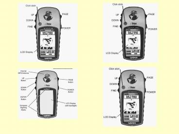
OR
etrex or summit
legend, venture, OR vista
How does it get a lock?
The usual search strategy is to start at an
oscillator frequency predicted on the basis of
(a) what is my approximate position? (based on
either the last known position or the guess you
"typed in"), (b) where are the satellites now and
what is their apparent velocity (based on the
almanac data downlinked from the satellite and
stored in the receiver's memory), and (c) what is
the best guess for the receiver's crystal
oscillator error (based on the last known error
and the current temperature). At this frequency,
the receiver tries all 1023 possible code phases
and if it sees some power, it will initiate a
finer search. If none of the 1023 states "smells"
a satellite, it offsets the oscillator to the
next test value and repeats the process until
something "smells promising". When you start
"blinded", the receiver goes thru its initial
search, finds nothing and steps outwards. After a
long while it may decide to start all over again
at the "zero" predicted value, or it may continue
into oblivion and initiate an "all sky" search on
its own. After the receiver "smells" a signal,
it establishes two tracking loops -- one is a
phase-locked loop in the frequency domain and the
other is a time-locked loop in the 1023 bit code
space domain with the goal of tracking both the
code and carrier phases for that signal.
3
Use the PAGE button to get to MAP View
Map View
- ENTER button open OPTIONS menu
- ORIENT MAP AHEAD/NORTHWARD
- AUTO ZOOM ON/OFF
- HIDE/SHOW WAYPOINTS
- SHOW BEARING/COURSE LINE
- STOP NAVIGATION
- UP and DOWN buttons
- Zoom IN and OUT
- Adjusts scale in the lower left
- Scrolls through OPTIONS menu
4
Compass View
Use the UP and DOWN buttons to scroll through
these options. The BEARING and HEADING screens
are not shown here.
5
Main Menu with has 5 options and displays time
and date. Scroll up or down to highlight MARK
and then press ENTER.
Use the UP and DOWN buttons to select the letter
or number you want to change then press
ENTER. Now scroll up and down the until you find
the number you want and press ENTER to
select. When you are done scroll down
to Highlight OK and press ENTER. To change the
elevation, Lat, And/or Lon. Highlight what
you want to change, press ENTER, and repeat the
process.
If you press ENTER with OK highlighted you will
store a way point named 001 Elev 302m Lat
31º5315.9 Lon -116º4705.8 Use the UP or
DOWN button to highlight the name of the waypoint
and press the ENTER button.
6
Go back to the Main MENU by selecting OK or
push the PAGE button. Scroll down to
WAYPOINTS And press ENTER.
Scroll UP or Down to highlight the tab which has
the WAYPOINT you want and press ENTER. Highlight
the WAYPOINT You want and press ENTER.
7
DELETE This Deletes the waypoint
displayed MAP Plots WAYPOINT on the MAP
screen And tells you how far away it is at the
top. GOTO Takes you to a COMPASS screen.
The compass points in the direction of
the WAYPOINT. The top window tells you how far
away the WAYPOINT is and how long it will take
you to get there at your current speed and
direction of travel. PROJECT This function
allows you to project a straight line track to
follow from you current position by entering this
information Course Direction - ???º Number of
miles long - ?.? mi Select GOTO from the PROJECT
screen.
8
Push the PAGE button until You get back to the
Main MENU then select ROUTE.
Highlight the first entry spot and press
ENTER This takes you to the waypoints list from
which you can select the start of the first leg
of your route. Select the second entry spot and
select a waypoint to end the first leg and start
the second. Continue this process until you have
created your entire route. When done select
FOLLOW and a compass screen appears pointing in
the direction of the start of the second
leg. The window at the top tells you how far you
have left to travel on your route and how long it
will take you to get there based on your current
speed and direction of travel.
9
- This screen shows how much memory is used. This
screen also show what tracks have been saved. - You also have three options to choose from
- CLEAR
- This option clears the track log stored in
memory. - Note This does not clear your saved track logs.
- SAVE
- This option saves the track log stored in memory.
- You have three ways to save track logs
- Save back through to a given time option.
- Save back through Midnight.
- Save back through entire track log.
- DELETE ALL
- This option deletes all saved files.
- Note This will not clear the track log being
create in the memory.
Select TRACKS from the Main MENU
10
This screen appears and shows you which track You
have selected. From this screen you can
delete This track, select OK which takes you back
to the Track log, or select TRACBACK. TRACBACK
gives you two options TO BEGIN and TOEND, select
one of these options and it takes you to a
COMPASS screen pointing you in the direction of
the track. This screen also tells you how far
away you are from the END or BEGINNING and how
long it will take you.
Scroll down and select A saved track.
11
From the SETUP screen select TIME. There are 3
options to set in this screen TIME
FORMAT Under this option you can select a 12 OR
24 hour clock. TIME ZONE This
option allows you to select you current time
zone. Note If you select OTHER as your time
zone you will have to set your UTC
(Universal Time Clock) OFFSET. DAYLIGHT
SAVING You can chose 3 settings YES, NO, and
AUTO
Once back at the Main MENU screen, scroll down
and select SETUP.
12
- There are 2 settings on the DISPLAY
- Screen
- LIGHT TIMEOUT
- STAYS ON
- 15 SECONDS
- 30 SECONDS
- 1 MINUTE
- 2 MINUTES
- CONTRAST
- Select the slider bar and adjust with
- UP and DOWN buttons.
Scroll down and select display.
13
- Scroll to and select POSITION FRMT.
- This brings up multiple settings.
- Common settings are
- hddd.dddddº - decimal degrees
- hdddºmm.mm - degrees decimal minutes
- hdddºmmss.s - degrees minutes seconds
- UTM/UPS Universal Transverse Mercator/
- Universal Polar Stereographic
- Scroll down, and select.
- MAP DATUM.
- This brings up many DATUM settings.
- I use WGS 84, NAD 27 CONUS, OR NAD 83.
- Scroll down and select.
- UNITS.
- This brings up 3 settings
- Statute mile, feet
- Nautical nautical mile
Scroll down and select UNITS
14
Scroll down and select INTERFACE. The most
Common setting for uploading and Downloading
information is GARMIN. NOTE Consult your USER
MANUAL for other options.
Push PAGE button to get back to SETUP screen.
Scroll down and select SYSTEM This gives you 3
options for you GPS to work under NORMAL
normal mode of operations BATTERY SAVER Updates
your position every 5 seconds, normal mode is
every second. DEMO Designed to show features
and functions while indoors. Navigation is not
possible in this mode!
15
etrex summit
- Save current location as waypoint
- Manage waypoints
- Manage route
- Manage traveled paths (Tracks)
- Calibrate compass and altimeter
- Setup
- Name of next waypoint
- Distance to next waypoint
- Estimated remaining time until arrival at next
waypoint - Direction to next waypoint
- Current speed
- Bearing
- Waypoints
- Route
- Traveled path (Track)
- Current scale
- Elevation above sea level
- Ascend/descend speed
- Elevation profile
- Length of profile
- Current air pressure
- Accuracy of current position information
- Strength of satellites' signals
16
etrex venture
- Save current location as waypoint and manage
waypoints - Find waypoints, favorites and cities
- Manage routes
- Manage traveled paths (Tracks)
- System setup
- Constellation Earth/Sun/Moon Calendar Time
information for hunting and fishing
- Status
- Accuracy of current position information
- Constellation of the satellites
- Strength of satellites' signals
- Current position
- Current elevation
- Destination
- Estimated remaining travel time
- Distance to destination (direct line)
- Waypoints
- Route
- Traveled path (track)
- Current scale
- Traveled distance
- Current time
- Travelled trip distance
- Moving time
- Stopped time
- Accumulated travelled distance (Odometer)
- Current speed
- Maximum speed
- Average speed (moving time only)
- Average speed
- Waypoint
- Estimated remaining travel time
- Distance to destination (direct line)
- Compass ring with bearing to waypoint
- Current elevation
- Current time
17
etrex legend
- Save current location as waypoint and manage
waypoints - Find waypoints, favorites, cities and exits
(extended search functions with MapSource) - Manage routes
- Manage travelled pathes (Tracks)
- System setup
- Constellation Earth/Sun/Moon Calendar Time
information for hunting and fishing
- Status
- Accuracy of current position information
- Constellation of the satellites
- Strength of satellites' signals
- Current position
- Current elevation
- Destination
- Estimated remaining travel time
- Distance to destination (direct line)
- Map
- Route
- Travelled path (track)
- Current scale
- Current elevation
- Current heading
- Waypoint
- Estimated remaining travel time
- Distance to destination (direct line)
- Compass ring with bearing to waypoint
- Current elevation
- Current time
- Travelled trip distance
- Moving time
- Stopped time
- Accumulated travelled distance (Odometer)
- Current speed
- Maximum speed
- Average speed (moving time only)Average speed
(total time)
18
etrex vista
- Save current location as waypoint and manage
waypoints - Find waypoints, favorites, cities and exits
(extended search functions with Map Source) - Manage routes
- Manage traveled paths (Tracks)
- System setup
- Constellation Earth/Sun/Moon Calendar Time
information for hunting and fishing
- Traveled trip distance
- Moving time
- Stopped time
- Accumulated traveled distance (Odometer)
- Current speed
- Maximum speed
- Average speed (moving time only)
- Average speed (total time)
- Status
- Accuracy of current position information
- Constellation of the satellites
- Strength of satellites' signals
- Current position
- Current elevation
- Status
- Accuracy of current position information
- Current elevation
- Current position
- Current Heading
- Distance to destination (direct line)
- Map
- Route
- Traveled path (track)
- Current scale
- Waypoint
- Estimated remaining travel time
- Distance to destination (direct line)
- Compass ring with bearing to waypoint
- Current elevation
- Current time
- Current ascend / descend speed
- Current elevation
- Elevation profile
- Maximum elevation
- Current air pressure
Recommended
